Category:Thornhill, Dumfries and Galloway
Zur Navigation springen
Zur Suche springen
| Objektposition | | Karte mit allen Koordinaten: OpenStreetMap |
|---|
English: Thornhill is a town in the District Council Region of Dumfries and Galloway, Scotland, south of Sanquhar and north of Dumfries.
Gàidhlig: 'S e baile ann an Dùn Phris is Gall-Ghaidhealaibh a tha ann am Bàrr na Dris (Beurla: Thornhill). Tha e suidhichte deas air An t-Seann Chathair agus gu tuath air Dùn Phrìs. 'S e seo na co-chomharran aige: 55° 14′ 20.4″ Tuath agus 3° 46′ 1.2″ Iar.
Kleinstadt im Vereinigten Königreich  | |||||
| Medium hochladen | |||||
| Ist ein(e) | |||||
|---|---|---|---|---|---|
| Ort |
| ||||
| Einwohnerzahl |
| ||||
 | |||||
Unterkategorien
Es werden 5 von insgesamt 5 Unterkategorien in dieser Kategorie angezeigt:
In Klammern die Anzahl der enthaltenen Kategorien (K), Seiten (S), Dateien (D)
D
- Dalgarnock, Thornhill (24 D)
E
- Enterkinfoot Mill (12 D)
- Ewe Hill, Thornhill (2 D)
G
- Gallows Hill, Thornhill (3 D)
T
Medien in der Kategorie „Thornhill, Dumfries and Galloway“
Folgende 50 Dateien sind in dieser Kategorie, von 50 insgesamt.
-
 A country road - geograph.org.uk - 376731.jpg 640 × 523; 124 KB
-
 Ancient Cross detail.jpg 3.080 × 6.194; 5,21 MB
-
 Ancient Cross.jpg 2.316 × 3.088; 1,82 MB
-
 Buccleuch Hotel - geograph.org.uk - 1474734.jpg 640 × 480; 96 KB
-
 Buchan Hall, New Cample, Dumfries and Galloway.jpg 4.896 × 2.752; 3,47 MB
-
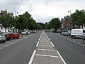
 Drumlanrig Street - geograph.org.uk - 1474770.jpg 640 × 480; 119 KB
-
 Drumlanrig Street, Thornhill - geograph.org.uk - 1048802.jpg 640 × 436; 73 KB
-
 Drumlanrig Street, Thornhill - geograph.org.uk - 1048812.jpg 640 × 480; 81 KB
-
 Freemasons Hall, Thornhill - geograph.org.uk - 1423330.jpg 640 × 480; 67 KB
-
 Joseph Morton, African Explorer's. Memorial. Thornhill. Dumfries and Galloway.jpg 3.126 × 3.005; 1,93 MB
-
 Joseph Morton, African Explorer. Memorial. Thornhill. Dumfries and Galloway.jpg 3.126 × 3.672; 1,86 MB
-
 Main street Thornhill - geograph.org.uk - 1423830.jpg 640 × 480; 68 KB
-
 Mapa dg bàrr na dris.jpg 2.004 × 1.363; 599 KB
-
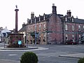
 Market Cross, Thornhill (geograph 5996277).jpg 2.448 × 3.264; 3,58 MB
-

-
-
 Road to Dollard - geograph.org.uk - 728089.jpg 480 × 640; 92 KB
-
 Roadworks, Drumlanrig Street - geograph.org.uk - 1770436.jpg 640 × 359; 74 KB
-
 Samuel Wallace VC Memorial, Thornhill, Nithsdale.jpg 2.505 × 2.033; 1,31 MB
-
 The Joseph Morton, African Explorer's. Memorial. Thornhill. Dumfries and Galloway.jpg 3.966 × 3.672; 3,64 MB
-

-
 Thornhill - geograph.org.uk - 1474760.jpg 640 × 480; 67 KB
-
 Thornhill - geograph.org.uk - 376817.jpg 640 × 470; 102 KB
-
 Thornhill Auction Mart - geograph.org.uk - 768815.jpg 640 × 480; 66 KB
-
 Thornhill Inn - geograph.org.uk - 925328.jpg 640 × 480; 56 KB
-
 Thornhill main street. View south. Dumfries and Galloway.jpg 3.472 × 2.088; 1,41 MB
-
 Thornhill Mercat cross 1 - geograph.org.uk - 925320.jpg 480 × 640; 54 KB
-
 Thornhill Mercat cross 2 - geograph.org.uk - 925323.jpg 640 × 480; 65 KB
-
 Thornhill Mercat cross 3 - geograph.org.uk - 925325.jpg 480 × 640; 44 KB
-
 Thornhill Parish Church and tower. Dumfries and Galloway, Scotland.jpg 4.896 × 3.672; 7,82 MB
-
 Thornhill Parish Church and tower. Dumfries and Galloway.jpg 4.896 × 3.672; 3,27 MB
-
 Thornhill Parish Church, Entrance. Dumfries and Galloway.jpg 4.637 × 3.477; 2,81 MB
-
 Thornhill Post Office - geograph.org.uk - 1503839.jpg 640 × 480; 96 KB
-
 Thornhill, Dumfries and Galloway. Spring Fling Festival.jpg 3.501 × 2.768; 1,79 MB
-
 Townhead Street, Thornhill - geograph.org.uk - 1474742.jpg 640 × 480; 91 KB
-
 Trigony Bridge, G&SWR line, Thornhill, Dumfries and Galloway. View north.jpg 4.896 × 2.752; 5,5 MB
-
 Trigony Bridge, G&SWR line, Thornhill, Dumfries and Galloway. View towards Dumfries.jpg 4.896 × 2.752; 5,33 MB
-
 View towards Thornhill from Barjarg, Dumfries & Galloway.jpg 1.920 × 1.080; 674 KB
-
 War Memorial, Thornhill, Nithsdale.jpg 3.966 × 2.446; 2,65 MB
-
 Welcome to Bridge Pool - geograph.org.uk - 728115.jpg 640 × 480; 134 KB
-
 West Morton Street - geograph.org.uk - 1474750.jpg 640 × 480; 96 KB
-
 A74 at Thornhill - geograph.org.uk - 1503836.jpg 640 × 480; 78 KB
-
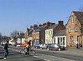
 Drumlanrig Street, Thornhill (A76) - geograph.org.uk - 1402927.jpg 640 × 480; 71 KB
-
 Road bridge - geograph.org.uk - 376839.jpg 628 × 461; 119 KB
-
 Shops on Drumlanrig Street, Thornhill - geograph.org.uk - 682719.jpg 640 × 480; 51 KB
-
 The Thornhill Inn, Thornhill - geograph.org.uk - 151900.jpg 640 × 480; 294 KB
-
 Thornhill - geograph.org.uk - 151897.jpg 640 × 480; 271 KB
-
 Thornhill Golf Course - geograph.org.uk - 376751.jpg 640 × 480; 100 KB
-
 Thornhill Parish Church - geograph.org.uk - 376927.jpg 640 × 476; 140 KB
-
 Wallace Hall Academy - geograph.org.uk - 376745.jpg 640 × 481; 122 KB


.jpg)


_-_geograph.org.uk_-_1402927.jpg)


