Category:Thropton
Vai alla navigazione
Vai alla ricerca
Villaggio nella contea del Northumberland  | |||||
| Carica un file multimediale | |||||
| Istanza di | |||||
|---|---|---|---|---|---|
| Luogo | Northumberland, Nord Est dell'Inghilterra, Inghilterra | ||||
 | |||||
Sottocategorie
Questa categoria contiene un'unica sottocategoria, indicata di seguito.
C
File nella categoria "Thropton"
Questa categoria contiene 159 file, indicati di seguito, su un totale di 159.
-
 A boundary stone - geograph.org.uk - 3582515.jpg 1 600 × 1 760; 766 KB
-
 A Plough under a pair of trees - geograph.org.uk - 2371967.jpg 4 000 × 3 000; 4,11 MB
-
 A winter wonderland in Simonside forest - geograph.org.uk - 1125724.jpg 480 × 640; 130 KB
-
 Above Bracken Wood - geograph.org.uk - 4143968.jpg 3 648 × 2 736; 4,77 MB
-
 Approach to Thropton Bridge - geograph.org.uk - 3644726.jpg 1 691 × 1 073; 692 KB
-
 Arable field with sheep and cattle beyond - geograph.org.uk - 4176283.jpg 1 600 × 1 296; 366 KB
-
 Arable land, Coquetdale - geograph.org.uk - 3505987.jpg 640 × 360; 209 KB
-
 Beech trees near Chapel Hill - geograph.org.uk - 3840541.jpg 1 024 × 768; 321 KB
-
 Beer garden of the Three Wheat Heads Inn - geograph.org.uk - 3582347.jpg 1 600 × 1 200; 318 KB
-
 Boulder in deep heather - geograph.org.uk - 4176509.jpg 1 600 × 1 200; 425 KB
-
 Boundary stone built into wall - geograph.org.uk - 4176513.jpg 1 200 × 1 600; 453 KB
-
 Bridge crossing the Wreigh Burn, Thropton - geograph.org.uk - 5826143.jpg 2 000 × 1 500; 398 KB
-
 Bridge over Spout Burn - geograph.org.uk - 3582478.jpg 4 320 × 3 240; 5,61 MB
-
 Bridge over the Coquet - geograph.org.uk - 3506020.jpg 640 × 480; 301 KB
-
 Bridge over the Wreigh Burn - geograph.org.uk - 3644687.jpg 1 465 × 1 032; 346 KB
-
 Bus shelter, Thropton - geograph.org.uk - 3506007.jpg 640 × 480; 276 KB
-
 Bus stop and phone box, Thropton - geograph.org.uk - 5826134.jpg 2 000 × 1 500; 435 KB
-
 Cairn of some antiquity on Cartington Hill - geograph.org.uk - 3307752.jpg 1 500 × 1 125; 1,55 MB
-
 Cairn on Cartington Hill - geograph.org.uk - 4176286.jpg 1 600 × 1 200; 423 KB
-
 Carriageway south of Crocky's Heugh - geograph.org.uk - 3840548.jpg 1 024 × 768; 295 KB
-
 Cartington Castle Remains - geograph.org.uk - 6202338.jpg 4 000 × 3 000; 2,41 MB
-
 Cartington waterfall - geograph.org.uk - 2449089.jpg 604 × 453; 96 KB
-

-
 Chapel Hill - geograph.org.uk - 4143995.jpg 3 648 × 2 736; 5,08 MB
-
 Chapel Well Wood - geograph.org.uk - 4758435.jpg 2 816 × 2 112; 742 KB
-
 Charming pant-drinking fountain in Physic Lane - geograph.org.uk - 6202529.jpg 2 448 × 3 264; 3,17 MB
-
 Chirnells on the road heading south to Thropton - geograph.org.uk - 3582389.jpg 1 600 × 1 200; 380 KB
-
 Circular straw bales - geograph.org.uk - 4176273.jpg 1 600 × 1 203; 349 KB
-
 Confluence of the Wreigh Burn and the River Coquet - geograph.org.uk - 3582314.jpg 1 600 × 1 063; 335 KB
-
 Coquetdale - geograph.org.uk - 3506012.jpg 640 × 480; 248 KB
-
 Coquetdale from Wreighburn House - geograph.org.uk - 928026.jpg 640 × 428; 105 KB
-
 Cottages in Thropton - geograph.org.uk - 932853.jpg 640 × 428; 140 KB
-
 Country road near Snitter (1) - geograph.org.uk - 2183354.jpg 640 × 320; 140 KB
-
 Country road near Snitter (2) - geograph.org.uk - 2183365.jpg 640 × 384; 140 KB
-
 Cross Keys - geograph.org.uk - 3506003.jpg 640 × 480; 259 KB
-
 Cross Keys Pub, Thorpton - geograph.org.uk - 5705569.jpg 1 800 × 1 013; 1,82 MB
-
 Cross Keys, Thropton - geograph.org.uk - 3644717.jpg 1 824 × 1 368; 674 KB
-
 Cyclists crossing Thropton Bridge - geograph.org.uk - 3582374.jpg 1 600 × 1 124; 554 KB
-
 Dry stone wall - geograph.org.uk - 3582428.jpg 1 600 × 1 271; 413 KB
-
 Dry stone wall heading up Cartington Hill - geograph.org.uk - 3582482.jpg 1 600 × 1 263; 432 KB
-

-

-
 Erosion on the banks of the River Coquet - geograph.org.uk - 3582305.jpg 1 600 × 1 200; 388 KB
-
 Farmland near Cartington - geograph.org.uk - 2183379.jpg 640 × 309; 134 KB
-
 Felled rotten oak - geograph.org.uk - 3836141.jpg 1 600 × 1 200; 520 KB
-
 Fence with gate on bridleway - geograph.org.uk - 3307876.jpg 1 500 × 1 125; 1,72 MB
-

-

-

-

-

-

-
 First World War practice trenches north of Rothbury - geograph.org.uk - 4730359.jpg 1 600 × 1 200; 377 KB
-

-

-
 Footbridge over the River Coquet - geograph.org.uk - 3582336.jpg 1 600 × 1 200; 325 KB
-
 Footbridge over the River Coquet - geograph.org.uk - 4758418.jpg 1 066 × 800; 271 KB
-
 Footbridge over the River Coquet - geograph.org.uk - 4758419.jpg 1 066 × 800; 263 KB
-
 Footpath at Crocky's Heugh - geograph.org.uk - 3840556.jpg 1 024 × 768; 287 KB
-
 Footpath beside the Back Burn - geograph.org.uk - 3867316.jpg 1 600 × 1 200; 661 KB
-
 Footpath on Rothbury Terraces - geograph.org.uk - 4758427.jpg 1 066 × 800; 176 KB
-
 Footpath on the north bank of the River Coquet - geograph.org.uk - 3582335.jpg 1 600 × 1 018; 442 KB
-
 Footpath towards Chapel Well Wood - geograph.org.uk - 4758432.jpg 2 816 × 2 112; 503 KB
-
 Footpath towards Crocky's Heugh - geograph.org.uk - 4758428.jpg 2 816 × 2 112; 482 KB
-
 From Glitteringstone to the Cheviots - geograph.org.uk - 4143984.jpg 3 648 × 2 736; 4,62 MB
-
 From Ship Crag to Thropton - geograph.org.uk - 4143956.jpg 3 648 × 2 736; 4,84 MB
-
 Gate and fields near Warton - geograph.org.uk - 2466619.jpg 640 × 480; 151 KB
-
 Gate on Physic Lane, Thropton - geograph.org.uk - 1150863.jpg 640 × 480; 102 KB
-
 Gateway for footpath to Crocky's Heugh - geograph.org.uk - 4730374.jpg 1 600 × 1 200; 400 KB
-
 Gateway through an old dry stone wall - geograph.org.uk - 3582471.jpg 1 600 × 1 219; 485 KB
-
 Glitteringstone - geograph.org.uk - 3550195.jpg 3 648 × 2 736; 4,14 MB
-
 Grazing and forest on Chapel Hill - geograph.org.uk - 3582414.jpg 1 600 × 1 200; 394 KB
-
 Heather moorland between Cartington Hill and Hard Heugh - geograph.org.uk - 3307792.jpg 1 500 × 1 125; 1,65 MB
-
 Hedge, Coquetdale - geograph.org.uk - 3505980.jpg 640 × 360; 239 KB
-
 Hollow-ways on moorland above Cartington - geograph.org.uk - 3840443.jpg 1 024 × 768; 233 KB
-
 Housing development, Thropton - geograph.org.uk - 5826164.jpg 2 000 × 1 500; 360 KB
-
 In the woods - geograph.org.uk - 3582456.jpg 1 600 × 1 200; 610 KB
-
 Inscribed stone, Snitter Bridge - geograph.org.uk - 5826183.jpg 2 000 × 1 500; 644 KB
-
 Island in the River Coquet - geograph.org.uk - 3582320.jpg 1 600 × 1 165; 394 KB
-
 Looking across Coquetdale - geograph.org.uk - 3353917.jpg 1 600 × 1 207; 531 KB
-
 Looking down the River Coquet from Thropton Footbridge - geograph.org.uk - 5602615.jpg 3 872 × 2 592; 1,17 MB
-
 Looking downstream from Snitter Bridge - geograph.org.uk - 5826187.jpg 2 000 × 1 500; 713 KB
-
 Looking west from Crocky's Heugh - geograph.org.uk - 3582509.jpg 1 600 × 1 200; 280 KB
-
 Main Street, Thropton - geograph.org.uk - 5826138.jpg 2 000 × 1 500; 346 KB
-

-
 Moorland south-west of Debdon - geograph.org.uk - 3840565.jpg 1 024 × 768; 245 KB
-
 Moorland track on Rothbury Common - geograph.org.uk - 3840482.jpg 1 024 × 768; 253 KB
-
 Mowed heather on Cartington Hill - geograph.org.uk - 4176288.jpg 1 600 × 1 200; 295 KB
-
 Mystery fenced area in field - geograph.org.uk - 6201712.jpg 4 000 × 3 000; 2,48 MB
-

-
 Pasture off Physic Lane - geograph.org.uk - 1513457.jpg 640 × 427; 202 KB
-
 Physic Lane, Thropton - geograph.org.uk - 1151089.jpg 640 × 480; 88 KB
-
 Public access route by Chapel Hill - geograph.org.uk - 3582459.jpg 1 600 × 1 200; 591 KB
-
 Public bridleway to Whittle - geograph.org.uk - 4176276.jpg 1 600 × 989; 317 KB
-
 Public footpath beside the Back Burn - geograph.org.uk - 3867325.jpg 900 × 1 200; 372 KB
-
 Public Footpath through Blue Mill woodland - geograph.org.uk - 6138928.jpg 1 200 × 1 600; 743 KB
-

-
 River Coquet - geograph.org.uk - 2101151.jpg 640 × 480; 79 KB
-
 River Coquet near Thropton - geograph.org.uk - 304123.jpg 640 × 480; 90 KB
-
 River Coquet near Thropton - geograph.org.uk - 3582325.jpg 1 600 × 1 200; 429 KB
-
 River Coquet, Thropton - geograph.org.uk - 4758416.jpg 1 066 × 800; 359 KB
-
 Road Bridge over the Wreigh Burn - geograph.org.uk - 4758422.jpg 2 816 × 2 112; 1,13 MB
-

-
 Road junction north of Thropton - geograph.org.uk - 5826176.jpg 2 000 × 1 500; 373 KB
-
 Road out of Thorpton - geograph.org.uk - 5706308.jpg 1 800 × 1 013; 1,48 MB
-
 Roadside houses in Thropton - geograph.org.uk - 3644702.jpg 1 759 × 1 169; 778 KB
-
 Sewage treatment works, Snitter - geograph.org.uk - 5826205.jpg 2 000 × 1 500; 446 KB
-
 Site yard near Thropton - geograph.org.uk - 2100027.jpg 640 × 480; 80 KB
-
 Site yard near Thropton - geograph.org.uk - 2100028.jpg 640 × 480; 72 KB
-
 Smith's Garage, Thropton - geograph.org.uk - 927873.jpg 640 × 428; 81 KB
-
 Snitter Bridge - geograph.org.uk - 5826193.jpg 2 000 × 1 500; 359 KB
-
 Snitter Bridge widened 1972 - geograph.org.uk - 3867322.jpg 1 600 × 1 079; 374 KB
-
 Snowy rough pasture above Thropton - geograph.org.uk - 1151101.jpg 640 × 360; 63 KB
-
 St Andrew's Church, Thropton - geograph.org.uk - 5826172.jpg 2 000 × 1 500; 415 KB
-
 Temperature inversion at sunrise - geograph.org.uk - 5184059.jpg 1 600 × 1 067; 151 KB
-
 The Cross Keys, Thropton - geograph.org.uk - 2101152.jpg 640 × 480; 80 KB
-
 The Cross Keys, Thropton - geograph.org.uk - 4396509.jpg 1 600 × 2 044; 427 KB
-
 The Cross Keys, Thropton - geograph.org.uk - 5826166.jpg 2 000 × 1 500; 504 KB
-
 The Cross Keys, Thropton - geograph.org.uk - 5929170.jpg 1 600 × 1 200; 497 KB
-
 The road from South Cartington - geograph.org.uk - 3582416.jpg 1 600 × 1 200; 507 KB
-
 The road to South Cartington - geograph.org.uk - 3582408.jpg 1 600 × 1 200; 440 KB
-

-
 The Three Wheat Heads at Thropton - geograph.org.uk - 5929178.jpg 1 600 × 1 200; 390 KB
-
 The Three Wheat Heads Inn - geograph.org.uk - 3582357.jpg 1 600 × 1 136; 294 KB
-
 The Three Wheat Heads, Thropton - geograph.org.uk - 927857.jpg 432 × 640; 98 KB
-
 The Three Wheat Heads, Thropton - geograph.org.uk - 927864.jpg 429 × 640; 120 KB
-
 The Wreigh Burn - geograph.org.uk - 3582381.jpg 1 600 × 1 200; 610 KB
-
 Three Wheat Heads - geograph.org.uk - 4720568.jpg 640 × 480; 53 KB
-
 Three Wheat Heads inn - geograph.org.uk - 3644675.jpg 1 824 × 1 368; 857 KB
-
 Thropton - geograph.org.uk - 3505995.jpg 640 × 480; 263 KB
-
 Thropton - geograph.org.uk - 780400.jpg 480 × 640; 63 KB
-
 Thropton - geograph.org.uk - 927849.jpg 640 × 428; 105 KB
-
 Thropton - geograph.org.uk - 932850.jpg 640 × 428; 81 KB
-
 Thropton Bridge - geograph.org.uk - 927958.jpg 640 × 429; 137 KB
-
 Thropton Bridge - geograph.org.uk - 932856.jpg 640 × 428; 102 KB
-
 Thropton from Physic Lane - geograph.org.uk - 4758423.jpg 1 066 × 800; 248 KB
-
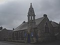 Thropton United Reformed Church - geograph.org.uk - 3644660.jpg 1 824 × 1 368; 425 KB
-
 Thropton, from Tosson Lime Kiln - geograph.org.uk - 1529882.jpg 640 × 426; 107 KB
-
 Topiary at Cartington - geograph.org.uk - 3582421.jpg 1 600 × 1 115; 278 KB
-
 Towards Thropton - geograph.org.uk - 3550120.jpg 3 648 × 2 736; 3,45 MB
-
 Tree and road above Bankhead - geograph.org.uk - 5704901.jpg 1 800 × 1 013; 1,05 MB
-
 Trees near Cartington - geograph.org.uk - 2183441.jpg 576 × 640; 335 KB
-
 Two trees by the B6341 west of Thorpton - geograph.org.uk - 5705568.jpg 1 800 × 1 013; 1,31 MB
-
 Unusual stile into woodland on Chapel Hill - geograph.org.uk - 6138913.jpg 1 600 × 1 200; 667 KB
-
 View from Cartington - geograph.org.uk - 3582426.jpg 1 600 × 1 057; 245 KB
-

-
 View towards Rothbury and Rothbury Terraces - geograph.org.uk - 4758414.jpg 3 492 × 1 802; 1,08 MB
-
 View towards Rothbury, Rothbury Terraces and Gragside - geograph.org.uk - 4393049.jpg 4 180 × 1 838; 1,44 MB
-
 View towards Thropton and Rothbury Terraces - geograph.org.uk - 4393045.jpg 1 854 × 800; 256 KB
-
 Village Garage - geograph.org.uk - 2468149.jpg 4 288 × 3 216; 1,73 MB
-
 W and J Smith Garage, Thropton - geograph.org.uk - 2466713.jpg 640 × 480; 79 KB
-
 Westhills Farm - geograph.org.uk - 1150799.jpg 640 × 360; 80 KB
-
 Westhills House to Simonside - geograph.org.uk - 4480739.jpg 3 648 × 2 736; 4,58 MB
-
 Wheat in the foreground - geograph.org.uk - 3582433.jpg 1 600 × 1 192; 515 KB
-
 Wood at West Hills - geograph.org.uk - 1150809.jpg 640 × 360; 65 KB
-
 Wreigh Burn, Thropton - geograph.org.uk - 780410.jpg 480 × 640; 147 KB
-
 Footpath northeast of Thropton - geograph.org.uk - 350177.jpg 640 × 480; 132 KB
-
 The Cross Keys, Thropton - geograph.org.uk - 81941.jpg 462 × 640; 121 KB
-
 The United Reformed Church, Thropton - geograph.org.uk - 561015.jpg 640 × 480; 54 KB


_-_geograph.org.uk_-_2183354.jpg)
_-_geograph.org.uk_-_2183365.jpg)


_-_geograph.org.uk_-_4696531.jpg)


