Category:Thur
Aller à la navigation
Aller à la recherche
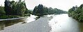
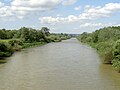
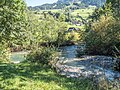
English: Thur river is a 131 km long river in north-eastern Switzerland. Its source is near the mountain Säntis in the south-east of the canton of St. Gallen. In this canton it flows through the Toggenburg region and passes close to the town Wil. After Wil it flows through the canton of Thurgau and its capital Frauenfeld. The final 19 km of the river Thur are in the canton of Zürich. It flows into the Rhine river on the border with Germany, south of Schaffhausen, near Flach and Marthalen.
rivière suisse  .png) | |||||
| Téléverser des médias | |||||
| Nature de l’élément | |||||
|---|---|---|---|---|---|
| Lieu | |||||
| Longueur |
| ||||
| Altitude |
| ||||
| Se jette dans | |||||
| Bassin versant | |||||
| Affluent |
| ||||
| À ne pas confondre avec | |||||
 | |||||
Sous-catégories
Cette catégorie comprend 21 sous-catégories, dont les 21 ci-dessous.
A
B
G
- Giessenfälle (Thur) (11 F)
- Gonzenbach (2 F)
K
M
N
O
S
T
- Thur flooding in Altikon (14 F)
- Thurweg (21 F)
U
- Uze (4 F)
W
- Wildhauser Thur (10 F)
Média dans la catégorie « Thur »
Cette catégorie comprend 97 fichiers, dont les 97 ci-dessous.
-
 "Ganggelisteg" als Schatten auf der Thur, Bussnang.jpg 1 920 × 1 440 ; 2,53 Mio
-
 "Inselikapelle" auf der Thurinsel "Helgoland" (Nesslau-Neu St. Johann 2018).jpg 4 480 × 5 120 ; 21,89 Mio
-
 "Inselikapelle" auf der Thurinsel "Helgoland" (Nesslau-Neu St. Johann, 2018).jpg 4 500 × 3 000 ; 10,72 Mio
-
 2007-06-16 Thurbrücke Andelfingen.jpg 5 417 × 1 410 ; 2,34 Mio
-
 20090503-01 Uze Mündung.JPG 2 304 × 1 728 ; 1,42 Mio
-
 20090503-05 Mündung Glatt Uze.JPG 2 304 × 1 728 ; 1,42 Mio
-
 2010-08-08 07-33-57 Switzerland St. Gallen Nesslau Nesslau.jpg 2 848 × 4 288 ; 5,15 Mio
-
 2010-08-08 07-40-53 Switzerland St. Gallen Nesslau Nesslau.jpg 4 043 × 2 685 ; 4,51 Mio
-
 2010-08-08 07-47-26 Switzerland St. Gallen Nesslau Nesslau.jpg 4 288 × 2 848 ; 6,09 Mio
-
 2010-08-08 07-48-04 Switzerland St. Gallen Nesslau Nesslau.jpg 2 848 × 4 288 ; 6,54 Mio
-
 2010-08-08 07-48-16 Switzerland St. Gallen Nesslau Nesslau.jpg 4 288 × 2 848 ; 6,3 Mio
-
 2010-08-08 08-04-39 Switzerland St. Gallen Nesslau Nesslau.jpg 2 848 × 4 288 ; 6,49 Mio
-
 2011-08-04 10-58-51 Switzerland Starkenbach.jpg 3 795 × 2 530 ; 2,99 Mio
-
 2011-09-10-Vinlando (Foto Dietrich Michael Weidmann) 098.JPG 3 872 × 2 592 ; 4,86 Mio
-
 2017-06-21 10-19-04 901.0 Switzerland Kanton St. Gallen Unterwasser Unterwasser.jpg 4 172 × 2 771 ; 9,3 Mio
-
 2017-06-21 10-23-22 897.0 Switzerland Kanton St. Gallen Unterwasser.jpg 4 288 × 2 848 ; 9,73 Mio
-
 2017-06-21 10-26-48 895.0 Switzerland Kanton St. Gallen Unterwasser Alt St. Johann.jpg 4 288 × 2 848 ; 11,15 Mio
-
 2018-04-04 10-23-07 Panoramic view near Oberneunforn.jpg 25 709 × 2 445 ; 31,67 Mio
-
 2019-04-22 10-32-03 Schweiz Ossingen Bei der Thurbrücke 450.8-Pano.jpg 10 400 × 2 267 ; 14,01 Mio
-
 Auengebiet Eggrank-Thurspitz, Rüdlingen SH 20230321-jag9889.jpg 4 608 × 3 456 ; 13,92 Mio
-
 Auengebiet Gillhof-Glattburg an der Thur, Niederuzwil SG– Sonnental SG 20190726-jag9889.jpg 4 581 × 2 577 ; 7,19 Mio
-
 Auengebiet Hau-Äuli, Frauenfeld TG – Warth-Weiningen TG 20190801-jag9889.jpg 4 420 × 2 763 ; 10,73 Mio
-
 Auengebiet Hau-Äuli, Frauenfeld TG – Weiningen TG 20190801-jag9889.jpg 4 463 × 3 347 ; 8,48 Mio
-
 Auengebiet Schäffäuli, Neunforn TG 20190805-jag9889.jpg 3 964 × 2 230 ; 6,15 Mio
-
 Auengebiet Thur und Necker bei Lütisburg, Lütisburg SG 20190726-jag9889.jpg 4 608 × 3 456 ; 13,38 Mio
-
 Auengebiet Thurauen Wil-Weieren, Züberwangen SG – Henau SG 20190726-jag9889.jpg 4 608 × 2 592 ; 9,43 Mio
-
 Auengebiet Wuer, Frauenfeld TG– Weiningen TG 20190801-jag9889.jpg 4 608 × 3 456 ; 13,33 Mio
-
 BT Thurviadukt I.jpg 683 × 504 ; 102 kio
-
 CH-NB - Ebnat-Kappel von Südwesten, Panoramaansicht - Collection Gugelmann - GS-GUGE-FEHRENBACH-B-1.tif 5 700 × 3 689, 2 pages ; 60,18 Mio
-
 ETH-BIB-Bürglen (Thurgau) v. S. O. aus 600 m-Inlandflüge-LBS MH01-000642.tif 6 349 × 4 380 ; 79,69 Mio
-
 ETH-BIB-Henau (Felsegg, Gemeinde Uzwil), Zweifel AG, Weberei-Inlandflüge-LBS MH03-0433.tif 6 771 × 4 825 ; 47,24 Mio
-
 ETH-BIB-Henau (Felsegg, Gemeinde Uzwil), Zweifel AG, Weberei-Inlandflüge-LBS MH03-1498.tif 6 390 × 4 475 ; 81,92 Mio
-
 ETH-BIB-Henau (Felsegg, Gemeinde Uzwil), Zweifel AG, Weberei-Inlandflüge-LBS MH03-1500.tif 6 389 × 4 450 ; 81,42 Mio
-
 ETH-BIB-Henau (Felsegg, Gemeinde Uzwil), Zweifel AG, Weberei-Inlandflüge-LBS MH03-1687.tif 6 082 × 4 284 ; 74,66 Mio
-
 ETH-BIB-Henau (Felsegg, Gemeinde Uzwil), Zweifel AG, Weberei-Inlandflüge-LBS MH03-1763.tif 6 089 × 4 225 ; 73,7 Mio
-
 ETH-BIB-Rhein-Thur-Zusammenfluss-LBS H1-015738.tif 5 918 × 4 081 ; 69,21 Mio
-
 ETH-BIB-Rhein-Thur-Zusammenfluss-LBS H1-015739.tif 5 922 × 4 084 ; 69,4 Mio
-
 ETH-BIB-Rhein-Thur-Zusammenfluss-LBS H1-017247.tif 6 453 × 4 529 ; 83,77 Mio
-
 ETH-BIB-Rhein-Thurmündung, Waldhof-LBS H1-012781.tif 6 733 × 4 653 ; 89,73 Mio
-
 ETH-BIB-Thur aufwärts von der Eisenbahnbrücke Süden, Ossingen-Dia 247-13352.tif 3 644 × 2 778 ; 29,07 Mio
-
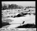
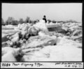
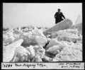
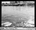
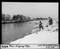
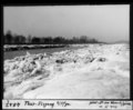 ETH-BIB-Thur, Eisgang bei Pfyn-Dia 247-04847.tif 3 627 × 2 997 ; 10,37 Mio
-
 ETH-BIB-Thur, Eisgang bei Pfyn-Dia 247-04848.tif 3 643 × 3 054 ; 10,62 Mio
-
 ETH-BIB-Thur, Eisgang bei Pfyn-Dia 247-04849.tif 3 584 × 2 973 ; 10,17 Mio
-
 ETH-BIB-Thur, Eisgang bei Pfyn-Dia 247-04850.tif 3 584 × 2 955 ; 10,11 Mio
-
 ETH-BIB-Thur, Eisgang bei Pfyn-Dia 247-04851.tif 3 615 × 2 991 ; 10,32 Mio
-
 ETH-BIB-Thur, Eisgang bei Pfyn-Dia 247-04853.tif 3 591 × 3 002 ; 10,29 Mio
-
 ETH-BIB-Thur, Eisgang bei Pfyn-Dia 247-04854.tif 3 594 × 2 973 ; 10,2 Mio
-
 ETH-BIB-Thur-Mündung vom Rhein Weidling-Dia 247-13490.tif 3 693 × 2 781 ; 29,49 Mio
-
 ETH-BIB-Thurlauf bei Ossingen, Eisenbahnbrücke-LBS H1-014569.tif 6 890 × 4 743 ; 93,66 Mio
-
 IMAGE 632-Turo sub Nov-Sankt-Johano.jpg 1 200 × 1 600 ; 224 kio
-
 Inseli-Kapelle bei Neu St. Johann.jpg 4 200 × 2 800 ; 9,07 Mio
-
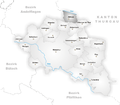 Karte Gemeinde Altikon.png 944 × 826 ; 220 kio
-
 Mühlau (Foto Dietrich Michael Weidmann) 163.JPG 3 872 × 2 592 ; 3,75 Mio
-
 Mühlau (Foto Dietrich Michael Weidmann) 164.JPG 3 872 × 2 592 ; 3,61 Mio
-
 Mühlau (Foto Dietrich Michael Weidmann) 165.JPG 3 872 × 2 592 ; 3,8 Mio
-
 Mündung Murg Rohrerbrücke P1020730.jpg 4 000 × 3 000 ; 3,52 Mio
-
 Naturschutzgebiet Thurauen.jpg 5 184 × 3 888 ; 8,58 Mio
-
 Nesslau-NeuStJohann.jpg 1 000 × 664 ; 743 kio
-
 Schwarzenbach - Jonschwil 005.JPG 3 872 × 2 592 ; 4,41 Mio
-
 Schwarzenbach turfervojponto - komunumo Jonschwil 006.JPG 3 872 × 2 592 ; 3,92 Mio
-
 Schwarzenbach turponto - komunumo Jonschwil 007.JPG 3 872 × 2 592 ; 3,87 Mio
-
 StarkenbachSG Thur.JPG 1 600 × 1 200 ; 656 kio
-
 Steine in der Thur.JPG 4 608 × 3 072 ; 2,73 Mio
-
 The River Thur.jpg 4 000 × 3 000 ; 5,21 Mio
-
 Thur (Suisse).png 633 × 530 ; 400 kio
-
 Thur bei Alt St. Johann.JPG 5 184 × 3 456 ; 5,61 Mio
-
 Thur bei Flaach-2.jpg 1 458 × 1 944 ; 620 kio
-
 Thur bei Flaach.jpg 2 592 × 1 944 ; 1,57 Mio
-
 Thur Flussmündung in den Hochrhein, Flaach ZH 20170817-jag9889.jpg 4 608 × 3 456 ; 10,7 Mio
-
 Thur im Toggenburg.JPG 1 600 × 1 200 ; 492 kio
-
 Thur in Krummenau SG.jpg 4 200 × 2 800 ; 10,79 Mio
-
 Thur in Ossingen 2011-09-26 13-40-34.JPG 2 848 × 4 288 ; 4,06 Mio
-
 Thur in Ossingen 2011-09-26 13-40-46.JPG 4 288 × 2 848 ; 5,12 Mio
-
 Thur Mündung Murg.JPG 4 608 × 3 456 ; 6,12 Mio
-
 Thur Nesslau.JPG 4 546 × 3 054 ; 3,81 Mio
-
 Thur Schriftzug1.JPG 4 608 × 3 456 ; 6,27 Mio
-
 Thur Schriftzug2.JPG 4 608 × 3 456 ; 6,47 Mio
-
 Thur Uze Glatt Pano.jpg 4 103 × 1 601 ; 4,68 Mio
-
 Thur Warth.JPG 4 608 × 3 456 ; 3,32 Mio
-
 Thur zwischen Neu-St. Johann und Krummenau.jpg 4 200 × 2 800 ; 9,87 Mio
-
 Thur, Baujahr 2000, sign 2019.jpg 349 × 732 ; 240 kio
-
 Thurbrücke Schwarzenbach IR.jpg 4 000 × 2 248 ; 3,76 Mio
-
 Thurbrücke Schwarzenbach REX.jpg 4 000 × 2 248 ; 3,88 Mio
-
 Thurmündung.jpg 2 579 × 1 735 ; 1,37 Mio
-
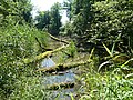
 Thurweg Beaver pond.jpg 480 × 640 ; 428 kio
-
 Thurwehr in Weinfelden.jpg 3 840 × 2 560 ; 5,84 Mio
-
 Thurwehr Weinfelden.jpg 3 000 × 2 000 ; 4,33 Mio
-
 Turo che Daetwil 094.jpg 3 872 × 2 592 ; 4,44 Mio
-
 Turo che Daetwil 098.jpg 3 872 × 2 592 ; 4,66 Mio
-
 Turo cxe Daetwil 095.jpg 3 872 × 2 592 ; 4,25 Mio
-
 Turo en Schwarzenbach (Foto Dietrich Michael Weidmann) 008.JPG 3 872 × 2 592 ; 3,91 Mio
-
 Turo Supre de Stein 665.jpg 1 200 × 1 600 ; 208 kio
-
 Umfahrungsstrasse Bütschwil Neudietfurt.jpg 5 184 × 3 456 ; 9,47 Mio
-

-
 Unterwässerli Brücke über die Wildhauser Thur, Unterwasser SG 20190722-jag9889.jpg 4 608 × 3 456 ; 14,57 Mio
-
 Wissthur Mündung in die Thur, Stein SG 20220921-jag9889.jpg 4 608 × 3 456 ; 15,69 Mio
-
 Zusammenfluss von Säntisthur und Wildhauser Thur zur Thur, Unterwasser SG 20190722-jag9889.jpg 4 608 × 3 456 ; 11,46 Mio

.jpg)
.jpg)


_098.JPG)


_163.JPG)
_164.JPG)
_165.JPG)


_008.JPG)


_und_Murg_M%C3%BCndung_(rechts)_in_die_Thur,_Frauenfeld_TG_20190623-jag9889.jpg)


