Category:Tillingham
Aller à la navigation
Aller à la recherche
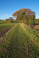
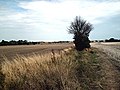
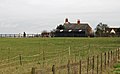
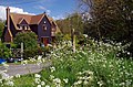
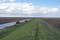
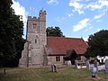
English: Tillingham is a small village with 959 inhabitants in 2006 located 8 miles from Burnham-on-Crouch and 3 miles from Bradwell-on-Sea. It is one of the villages that make up the ancient Dengie Hundred that is bounded by the River Blackwater and River Crouch.
village britannique  | |||||
| Téléverser des médias | |||||
| Nature de l’élément | |||||
|---|---|---|---|---|---|
| Lieu | Maldon, Essex, Angleterre de l'Est, Angleterre | ||||
 | |||||
Sous-catégories
Cette catégorie comprend 3 sous-catégories, dont les 3 ci-dessous.
T
- Tillingham War Memorial (2 F)
Média dans la catégorie « Tillingham »
Cette catégorie comprend 206 fichiers, dont les 200 ci-dessous.
(page précédente) (page suivante)-
 "Ghost sign", Tillingham - geograph.org.uk - 5092601.jpg 1 600 × 1 438 ; 506 kio
-
 'Footpath to nowhere in particular' - geograph.org.uk - 4994373.jpg 640 × 480 ; 88 kio
-
 18th century cottages - geograph.org.uk - 2685627.jpg 3 648 × 2 736 ; 2,49 Mio
-
 A Pond Near Tillingham - geograph.org.uk - 3967439.jpg 640 × 424 ; 84 kio
-

-
 Aerial view of the Dengie Coastline - geograph.org.uk - 2165462.jpg 1 024 × 699 ; 141 kio
-
 Agricultural building at Reddings Farm - geograph.org.uk - 2822386.jpg 3 648 × 2 736 ; 2,62 Mio
-
 Approaching Tillingham church from the west - geograph.org.uk - 4994651.jpg 932 × 1 024 ; 343 kio
-
 Arable Fields ^ Ross Revenge - geograph.org.uk - 5179446.jpg 640 × 424 ; 52 kio
-
 Asheldam Brook - geograph.org.uk - 3971094.jpg 640 × 424 ; 59 kio
-
 Avenue of Ash - geograph.org.uk - 3967448.jpg 424 × 640 ; 98 kio
-
 B1021 west of Tillingham - geograph.org.uk - 5164993.jpg 640 × 480 ; 230 kio
-
 Bend in St Peter's Way - geograph.org.uk - 3967450.jpg 640 × 424 ; 71 kio
-
 Bend in the Dike - geograph.org.uk - 3967564.jpg 640 × 424 ; 56 kio
-
 Bend on Grange Road, Tillingham - geograph.org.uk - 3012788.jpg 1 600 × 1 200 ; 508 kio
-
 Beside Asheldham brook - geograph.org.uk - 3971115.jpg 640 × 424 ; 65 kio
-
 Blossom On the St Peters Way - geograph.org.uk - 3967454.jpg 424 × 640 ; 90 kio
-
 Borrow Dike ^ "New" Sea Wall - geograph.org.uk - 3971184.jpg 640 × 424 ; 57 kio
-
 Borrow Dike ^ Flat Land - geograph.org.uk - 3970932.jpg 640 × 424 ; 71 kio
-
 Borrow Dike, Sea Wall ^ Wind Farm - geograph.org.uk - 3971206.jpg 640 × 424 ; 42 kio
-
 Borrow Dyke East of Round Barn - geograph.org.uk - 3971135.jpg 640 × 424 ; 47 kio
-
 Bounty of Brasicas - geograph.org.uk - 5204858.jpg 640 × 424 ; 70 kio
-
 Bradwell Brook Near Bradwell Hall - geograph.org.uk - 5205025.jpg 424 × 640 ; 92 kio
-
 Bridge Over Bradwell Brook - geograph.org.uk - 5204883.jpg 424 × 640 ; 111 kio
-
 Bridleway to St Lawrence Rd - geograph.org.uk - 5179657.jpg 424 × 640 ; 86 kio
-
 Church of St Nicholas, Tillingham - geograph.org.uk - 5092394.jpg 1 600 × 1 067 ; 452 kio
-
 Defunct Barn at Midlands - geograph.org.uk - 3970989.jpg 640 × 424 ; 70 kio
-
 Dengie poppies - geograph.org.uk - 4994361.jpg 768 × 1 024 ; 240 kio
-
 Dengie Wind Power - geograph.org.uk - 3970957.jpg 640 × 424 ; 46 kio
-
 Digenhope Too - geograph.org.uk - 5204799.jpg 640 × 430 ; 46 kio
-
 Dike ^ St Peter's Way - geograph.org.uk - 2296658.jpg 640 × 428 ; 58 kio
-
 Dots ^ Melons, Tillingham - geograph.org.uk - 2417358.jpg 640 × 492 ; 99 kio
-
 Double bend in St Peter's Way - geograph.org.uk - 3967511.jpg 640 × 424 ; 88 kio
-
 Double Rainbow Over Weatherewick - geograph.org.uk - 3971306.jpg 640 × 424 ; 40 kio
-
 Dried Up Pond at Stowes farm - geograph.org.uk - 5179601.jpg 640 × 424 ; 106 kio
-
 East Hyde Farm - geograph.org.uk - 5179573.jpg 640 × 424 ; 73 kio
-
 Edge of The crop - geograph.org.uk - 3967530.jpg 640 × 424 ; 62 kio
-
 Entrance to High House Farm - geograph.org.uk - 2822345.jpg 3 648 × 2 255 ; 2,31 Mio
-
 Farm track from Weatherwick - geograph.org.uk - 2698040.jpg 640 × 425 ; 50 kio
-
 Farm Track ^ Land Drain - geograph.org.uk - 3971052.jpg 640 × 199 ; 25 kio
-
 Farmhouse at Midlands - geograph.org.uk - 3970983.jpg 640 × 424 ; 72 kio
-
 Field boundary with trees - geograph.org.uk - 2685655.jpg 3 648 × 2 736 ; 2,97 Mio
-
 Field corner near Tillingham - geograph.org.uk - 5164966.jpg 640 × 480 ; 213 kio
-
 Field edge near Byhams - geograph.org.uk - 5165088.jpg 640 × 480 ; 185 kio
-
 Field near track at Stows Farm, Tillingham - geograph.org.uk - 3915770.jpg 1 024 × 577 ; 222 kio
-
 Field, sheep, farm buildings - geograph.org.uk - 2685611.jpg 3 648 × 2 255 ; 1,66 Mio
-
 Food Farm ^ Wind Farm - geograph.org.uk - 3971080.jpg 640 × 424 ; 62 kio
-
 Footbridge to Bradwell Rd - geograph.org.uk - 5205045.jpg 424 × 640 ; 94 kio
-
 Footbridge to Leggats Farm - geograph.org.uk - 5204802.jpg 424 × 640 ; 64 kio
-
 Footpath marker on edge of arable field - geograph.org.uk - 2685586.jpg 3 644 × 2 252 ; 2,5 Mio
-
 Footpath Near Byhams - geograph.org.uk - 5205060.jpg 424 × 640 ; 99 kio
-
 Footpath near hedgerow on field boundary - geograph.org.uk - 2854693.jpg 3 261 × 2 015 ; 2,36 Mio
-
 Footpath on farm track past cottage - geograph.org.uk - 2832671.jpg 3 648 × 2 736 ; 3,53 Mio
-
 Footpath on Grange Road - geograph.org.uk - 3970963.jpg 424 × 640 ; 82 kio
-
 Footpath sign and small bridge over ditch - geograph.org.uk - 2685643.jpg 3 648 × 2 736 ; 4,28 Mio
-
 Footpath sign at Dots and Melons - geograph.org.uk - 2698071.jpg 640 × 426 ; 125 kio
-
 Footpath through a spinney, Packards Grove - geograph.org.uk - 2698181.jpg 640 × 425 ; 127 kio
-
 Footpath to Bradwell Hall - geograph.org.uk - 5205070.jpg 424 × 640 ; 97 kio
-
 Footpath to Legatts Farm - geograph.org.uk - 5204789.jpg 424 × 640 ; 65 kio
-
 Footpath to Mark Farm - geograph.org.uk - 2698083.jpg 640 × 426 ; 119 kio
-
 Footpath to Mark Farm - geograph.org.uk - 3967442.jpg 640 × 424 ; 56 kio
-
 Footpath to nowhere in particular - geograph.org.uk - 220984.jpg 640 × 480 ; 86 kio
-
 Footpath to Sandbeach - geograph.org.uk - 3971176.jpg 640 × 424 ; 64 kio
-
 Footpath to Stows Farm - geograph.org.uk - 5179614.jpg 424 × 640 ; 59 kio
-
 Footpath to Thrashes - geograph.org.uk - 5179629.jpg 424 × 640 ; 86 kio
-
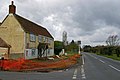
 Fox and Hounds, Tillingham, Essex - geograph.org.uk - 219551.jpg 640 × 427 ; 83 kio
-
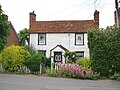
 Gambrel-roofed cottage at Tillingham - geograph.org.uk - 2211367.jpg 1 024 × 670 ; 130 kio
-
 Gambrel-roofed cottage, Tillingham - geograph.org.uk - 5001177.jpg 751 × 1 024 ; 121 kio
-
 Gate on St Peters Way - geograph.org.uk - 2296650.jpg 640 × 428 ; 63 kio
-
 Grange Outfall - geograph.org.uk - 3971091.jpg 640 × 424 ; 63 kio
-
 Grange Road - geograph.org.uk - 3970971.jpg 640 × 424 ; 72 kio
-
 Grange Road at the junction of South Street - geograph.org.uk - 3012791.jpg 1 600 × 1 200 ; 565 kio
-
 Grange Road between Dengie and Tillingham - geograph.org.uk - 3012584.jpg 1 600 × 1 200 ; 615 kio
-
 Grange Road near Midlands - geograph.org.uk - 5164955.jpg 640 × 480 ; 140 kio
-
 Grange Road north of Midlands - geograph.org.uk - 5164960.jpg 640 × 480 ; 203 kio
-
 Horses, paddock, farm buildings - geograph.org.uk - 2854891.jpg 2 673 × 1 652 ; 1,02 Mio
-
 Howe Farm - geograph.org.uk - 3971010.jpg 640 × 424 ; 66 kio
-
 Howe Outfall - Landward side - geograph.org.uk - 240750.jpg 510 × 640 ; 107 kio
-
 Howe Outfall Cut - geograph.org.uk - 3971067.jpg 640 × 424 ; 51 kio
-
 Kiddies' Play Area - geograph.org.uk - 3967427.jpg 424 × 640 ; 88 kio
-
 Land Drain - geograph.org.uk - 3967527.jpg 424 × 640 ; 61 kio
-
 Leggatts, Tillingham - geograph.org.uk - 2417354.jpg 640 × 431 ; 109 kio
-
 Little Savages - geograph.org.uk - 2865977.jpg 3 648 × 2 736 ; 3,42 Mio
-
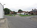
 Looking north over the village green - geograph.org.uk - 3959973.jpg 1 077 × 807 ; 169 kio
-
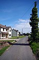
 Looking southeast along North Street - geograph.org.uk - 3959963.jpg 1 011 × 758 ; 173 kio
-
 Looking west along Tillingham Road - geograph.org.uk - 3960001.jpg 979 × 734 ; 180 kio
-
 Mark Road - geograph.org.uk - 2854779.jpg 3 648 × 2 736 ; 3,22 Mio
-
 Marsh House - geograph.org.uk - 5204813.jpg 640 × 424 ; 82 kio
-
 Marsh House Track - geograph.org.uk - 3971170.jpg 640 × 424 ; 72 kio
-
 Marsh Rd - geograph.org.uk - 5204838.jpg 424 × 640 ; 93 kio
-
 Middlewick Wind Farm - geograph.org.uk - 3970919.jpg 640 × 424 ; 39 kio
-
 Midlands farm buildings, Tillingham - geograph.org.uk - 3012784.jpg 1 600 × 1 200 ; 512 kio
-
 Midlands, Dengie - geograph.org.uk - 4994471.jpg 1 024 × 780 ; 175 kio
-
 North Street, Tillingham - geograph.org.uk - 5001153.jpg 1 024 × 768 ; 156 kio
-
 Not the Footpath to Howe Farm - geograph.org.uk - 3971003.jpg 640 × 424 ; 88 kio
-
 Oak on the corner - geograph.org.uk - 2865989.jpg 3 648 × 2 736 ; 3,22 Mio
-
 Off Piste - geograph.org.uk - 3967420.jpg 626 × 626 ; 87 kio
-
 Old Sluice in The Dengie Marshes - geograph.org.uk - 3967542.jpg 640 × 424 ; 63 kio
-

-

-
 Path to the Coast - geograph.org.uk - 3967522.jpg 640 × 424 ; 72 kio
-
 Path ^ Misnamed Cottage - geograph.org.uk - 3967471.jpg 640 × 424 ; 111 kio
-
 Peculiar People's Chapel Tillingham, Essex (2017).jpg 2 560 × 1 920 ; 2,86 Mio
-
 Pillbox ^ Old Timbers - geograph.org.uk - 3971156.jpg 640 × 424 ; 62 kio
-
 Playing Field ^ St Peters Way - geograph.org.uk - 3967397.jpg 640 × 424 ; 71 kio
-
 Pond at Midlands - geograph.org.uk - 3970996.jpg 640 × 424 ; 77 kio
-
 Postbox in Tillingham's main street. - geograph.org.uk - 396846.jpg 480 × 640 ; 118 kio
-
 Pump and Brook Rd - geograph.org.uk - 719062.jpg 426 × 640 ; 116 kio
-
 Pylon and Power - geograph.org.uk - 5179526.jpg 424 × 640 ; 51 kio
-
 Pylon at Thrashes - geograph.org.uk - 5179644.jpg 424 × 640 ; 51 kio
-
 Roadside poppies, Mark Rd, near Tillingham, Essex - geograph.org.uk - 4278602.jpg 1 024 × 768 ; 184 kio
-
 Salt Marsh Sea Wall ^ Dyke - geograph.org.uk - 3971161.jpg 640 × 424 ; 53 kio
-
 Saltmarsh ^ Sunken Barges - geograph.org.uk - 3971215.jpg 640 × 424 ; 49 kio
-
 Sandbeach Farm - geograph.org.uk - 3971281.jpg 640 × 424 ; 59 kio
-
 Sandbeach, Bradwell-on-Sea - geograph.org.uk - 2417378.jpg 640 × 440 ; 95 kio
-
 Science in the Saltmarsh - geograph.org.uk - 3971199.jpg 640 × 424 ; 46 kio
-
 Sea Wall Salt Marsh ^ Dyke - geograph.org.uk - 3971133.jpg 640 × 424 ; 50 kio
-
 Shingleford off Marsh lane - geograph.org.uk - 3967460.jpg 640 × 424 ; 90 kio
-
 Soaking Imminent - geograph.org.uk - 3971187.jpg 640 × 424 ; 62 kio
-
 South Street at the junction of Grange Road - geograph.org.uk - 3012798.jpg 1 600 × 1 200 ; 576 kio
-
 St Lawrence Road - geograph.org.uk - 5179559.jpg 424 × 640 ; 120 kio
-
 St Nicholas Church, Tillingham, Essex - geograph.org.uk - 2014947.jpg 640 × 480 ; 183 kio
-
 St Nicholas Church, Tillingham, Essex - geograph.org.uk - 4278558.jpg 1 024 × 768 ; 154 kio
-
 St Nicholas, Tillingham - geograph.org.uk - 2417491.jpg 640 × 434 ; 98 kio
-
 St Nicolas Church Tillingham.jpg 3 024 × 4 032 ; 6,32 Mio
-
 St Peter's Way by West Hyde - geograph.org.uk - 5179492.jpg 424 × 640 ; 61 kio
-
 St Peter's Way Footpath near East Hyde - geograph.org.uk - 1408364.jpg 640 × 425 ; 77 kio
-
 St Peter's Way West of Tillingham - geograph.org.uk - 3967413.jpg 424 × 640 ; 76 kio
-
 St Peter's Way ^ St Lawrence Rd - geograph.org.uk - 5179544.jpg 640 × 424 ; 68 kio
-
 St. Lawrence Road - geograph.org.uk - 2854714.jpg 3 648 × 2 736 ; 3,41 Mio
-
 Stowe's Lane - geograph.org.uk - 2822394.jpg 3 648 × 2 736 ; 3,07 Mio
-
 Stows Farm, Tillingham - geograph.org.uk - 2150008.jpg 1 024 × 709 ; 182 kio
-
 Thatched Cottage, Vicarage Lane - geograph.org.uk - 2832656.jpg 3 560 × 2 200 ; 2,12 Mio
-

-
 The entrance to Crosbie, Grange Road - geograph.org.uk - 3012482.jpg 1 600 × 1 200 ; 563 kio
-
 The Peculiar Peoples Chapel, South Street, Tillingham (geograph 4860376).jpg 2 720 × 3 880 ; 7,35 Mio
-
 The Square at Tillingham, Essex - geograph.org.uk - 4278556.jpg 1 024 × 768 ; 121 kio
-
 The Track From Howe farm - geograph.org.uk - 3971030.jpg 640 × 222 ; 28 kio
-
 The View from Dots ^ Melons - geograph.org.uk - 3967502.jpg 640 × 424 ; 50 kio
-
 The View to Weatherwick - geograph.org.uk - 3967519.jpg 640 × 424 ; 58 kio
-
 The Village Sign in Tillingham. - geograph.org.uk - 1417486.jpg 521 × 640 ; 94 kio
-
 The White Horse - geograph.org.uk - 719077.jpg 640 × 426 ; 62 kio
-
 Tillingham church, Norman north door - geograph.org.uk - 5001380.jpg 717 × 1 024 ; 296 kio
-
 Tillingham Essex - Village sign and St. Nicholas Church - geograph.org.uk - 3649309.jpg 1 315 × 889 ; 747 kio
-
 Tillingham fire station - geograph.org.uk - 1910318.jpg 640 × 427 ; 238 kio
-
 Tillingham Fire Station - geograph.org.uk - 2398718.jpg 640 × 480 ; 110 kio
-
 Tillingham Marshes - geograph.org.uk - 3971121.jpg 640 × 424 ; 62 kio
-
 Tillingham Post Office, Essex - geograph.org.uk - 219564.jpg 640 × 427 ; 100 kio
-
 Tillingham revisited - geograph.org.uk - 5000818.jpg 1 024 × 768 ; 149 kio
-
 Tillingham Salt Marsh - geograph.org.uk - 3971108.jpg 640 × 424 ; 58 kio
-
 Tillingham Village Green - geograph.org.uk - 3967433.jpg 640 × 424 ; 57 kio
-
 Tillingham, Essex - geograph.org.uk - 2134302.jpg 1 024 × 683 ; 180 kio
-
 Topiary in Tillingham - geograph.org.uk - 1601392.jpg 446 × 640 ; 172 kio
-
 Towards Dots ^ Melons - geograph.org.uk - 3967474.jpg 424 × 640 ; 63 kio
-
 Towards Howe Outfall - geograph.org.uk - 3971063.jpg 640 × 424 ; 44 kio
-
 Towards Reddings Lane - geograph.org.uk - 3967406.jpg 640 × 424 ; 96 kio
-
 Towards The Dengie Flat - geograph.org.uk - 3971153.jpg 640 × 424 ; 53 kio
-
 Towards Weatherwick - geograph.org.uk - 2698007.jpg 640 × 425 ; 75 kio
-
 Towards West Hyde on St Peter's Way - geograph.org.uk - 5179466.jpg 424 × 640 ; 74 kio
-
 Track to Byhams - geograph.org.uk - 2866001.jpg 3 648 × 2 736 ; 3,51 Mio
-
 Track to Packards - geograph.org.uk - 2855656.jpg 3 648 × 2 255 ; 2,62 Mio
-
 Turning Turbine - geograph.org.uk - 3971293.jpg 424 × 640 ; 35 kio
-
 Up The Creek^ - geograph.org.uk - 3971126.jpg 640 × 430 ; 60 kio
-
 Varied trees near Tillingham - geograph.org.uk - 5164986.jpg 640 × 480 ; 217 kio
-
 View from St Peter's Way footpath, Tillingham - geograph.org.uk - 275825.jpg 640 × 404 ; 49 kio
-
 View towards Tillingham - geograph.org.uk - 5164963.jpg 640 × 480 ; 162 kio
-
 Village Pump, North Street - geograph.org.uk - 2832601.jpg 3 297 × 2 038 ; 1,94 Mio
-
 War Memorial, Tillingham - geograph.org.uk - 2698173.jpg 640 × 426 ; 109 kio
-
 Water pump on village green - geograph.org.uk - 2685520.jpg 3 648 × 2 736 ; 2,56 Mio
-
 Water Pump, Vicarage Lane - geograph.org.uk - 2832624.jpg 2 736 × 2 736 ; 2 Mio
-
 Water pump, Willow, Cottage - geograph.org.uk - 2822409.jpg 3 648 × 2 736 ; 5,33 Mio
-
 WD40 Anyone^ - geograph.org.uk - 3967551.jpg 424 × 640 ; 68 kio
-
 Weather-boarded cottage at Tillingham - geograph.org.uk - 4994565.jpg 1 024 × 768 ; 220 kio
-
 Weather-boarded cottage at Tillingham - geograph.org.uk - 4994639.jpg 1 024 × 755 ; 212 kio
-
 Weather-boarded cottages, Tillingham - geograph.org.uk - 5001361.jpg 1 024 × 771 ; 171 kio
-
 Weather-boarded house at Brick House Farm - geograph.org.uk - 4994618.jpg 1 024 × 777 ; 163 kio
-
 Weatherboarded Residence - geograph.org.uk - 5204824.jpg 640 × 424 ; 84 kio
-
 Weatherwick - geograph.org.uk - 2698033.jpg 640 × 425 ; 82 kio
-
 Weatherwick Barns - geograph.org.uk - 3971299.jpg 640 × 424 ; 59 kio
-
 Weatherwick Rainbow - geograph.org.uk - 3972101.jpg 640 × 273 ; 26 kio
-
 Weatherwick, Bradwell-on-Sea - geograph.org.uk - 2417487.jpg 640 × 420 ; 87 kio
-
 West Hyde Farm Drive - geograph.org.uk - 5179487.jpg 430 × 640 ; 58 kio
-
 Wind turbine between Howe and Orange Farms - geograph.org.uk - 5164941.jpg 480 × 640 ; 102 kio
-
 Approaching Stows Farm, Tillingham - geograph.org.uk - 1408344.jpg 640 × 425 ; 52 kio
-
 Asheldham Brook from Grange Outfall - geograph.org.uk - 240730.jpg 545 × 640 ; 67 kio
-
 Bridge on the saltings - geograph.org.uk - 240692.jpg 640 × 461 ; 85 kio
-
 Creek and saltings - geograph.org.uk - 240777.jpg 480 × 640 ; 90 kio
-
 Duckpond in Shingleford Farm - geograph.org.uk - 74612.jpg 640 × 480 ; 107 kio
-
 Farmland near Bradwell Hall, Tillingham - geograph.org.uk - 275841.jpg 640 × 417 ; 61 kio
-
 Farmtrack to Marsh House - geograph.org.uk - 240780.jpg 640 × 483 ; 81 kio
-
 Fields - geograph.org.uk - 74601.jpg 640 × 382 ; 64 kio
-
 Footbridge over brook - geograph.org.uk - 74615.jpg 640 × 480 ; 109 kio
-

-
 Grange Farm - geograph.org.uk - 221041.jpg 640 × 480 ; 73 kio
-
 Grange Outfall - Seaward side - geograph.org.uk - 415055.jpg 485 × 640 ; 98 kio
-
 Howe outfall - Seaward side - geograph.org.uk - 415025.jpg 640 × 449 ; 68 kio
-
 Life on the Dengie Peninsula - geograph.org.uk - 220999.jpg 480 × 640 ; 77 kio
-
 Pond beside Reddings Lane - geograph.org.uk - 221057.jpg 480 × 640 ; 134 kio
-
 Reclaimed Salt Marsh Land - geograph.org.uk - 74605.jpg 640 × 480 ; 42 kio
-
 Semi-detached style contrasts - geograph.org.uk - 396852.jpg 640 × 480 ; 121 kio


.jpg)


.jpg)


