Category:Toft, Lincolnshire
Jump to navigation
Jump to search
village in Lincolnshire  | |||||
| Upload media | |||||
| Instance of | |||||
|---|---|---|---|---|---|
| Location | Toft with Lound and Manthorpe, South Kesteven, Lincolnshire, East Midlands, England | ||||
 | |||||
English: Toft is a small village in Lincolnshire, England situated about three miles south-west of Bourne on the A6121. It is part of the Parish of Toft with Lound and Manthorpe.
Media in category "Toft, Lincolnshire"
The following 13 files are in this category, out of 13 total.
-
 A6121 south of Toft - geograph.org.uk - 2285432.jpg 2,396 × 1,797; 1.38 MB
-
 A6121 South of Toft - geograph.org.uk - 4210812.jpg 640 × 480; 220 KB
-
 A6121 Toft - geograph.org.uk - 4210789.jpg 640 × 480; 303 KB
-
 A6121 towards Toft - geograph.org.uk - 4210785.jpg 640 × 480; 295 KB
-
 Approaching Toft through its golf course - geograph.org.uk - 5600896.jpg 3,776 × 2,520; 3.73 MB
-
 Bus Stop at Toft - geograph.org.uk - 4210795.jpg 640 × 480; 326 KB
-
 Field with poppies, Toft, Lincolnshire.jpg 640 × 339; 61 KB
-

-
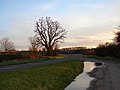
 The road through Toft, near Bourne Lincolnshire - geograph.org.uk - 4546017.jpg 1,738 × 1,162; 811 KB
-
 Toft - geograph.org.uk - 4210800.jpg 640 × 480; 295 KB
-
 Toft Tunnel Nature Reserve - geograph.org.uk - 1226434.jpg 640 × 480; 99 KB
-
 Site of Shillingthorpe Park - geograph.org.uk - 487316.jpg 640 × 477; 91 KB
-
 Straw bales and rape - geograph.org.uk - 487307.jpg 640 × 477; 94 KB


