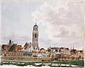
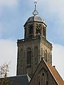
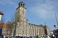
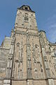
Category:Toren Grote of Lebuïnuskerk
Jump to navigation
Jump to search
| Object location | | View all coordinates using: OpenStreetMap |
|---|
Church tower in Deventer  | |||||
| Upload media | |||||
| Instance of |
| ||||
|---|---|---|---|---|---|
| Location | Deventer, Overijssel, Netherlands | ||||
| Street address |
| ||||
| Located on street | |||||
| Heritage designation |
| ||||
 | |||||
|
This is a category about rijksmonument number 12573
|
| Address |
|
Subcategories
This category has the following 2 subcategories, out of 2 total.
I
V
Media in category "Toren Grote of Lebuïnuskerk"
The following 134 files are in this category, out of 134 total.
-
 11 - Deventer - 20054233 - RCE.jpg 1,192 × 1,200; 235 KB
-
 2007-01-23 12.59 Deventer, Lebuinis Kerk foto3.JPG 1,704 × 2,272; 2.15 MB
-
 20150617 Zicht op Deventer met Wilhelminabrug.jpg 4,896 × 3,672; 1,009 KB
-
 20150617 Zicht op Deventer met-Grote of Lebuinuskerk.jpg 4,896 × 3,672; 1.31 MB
-
 20150624 Zicht op Deventer1 met Grote of Lebuinuskerk.jpg 4,713 × 3,535; 1.02 MB
-
 20150624 Zicht op Deventer2 met Grote of Lebuinuskerk.jpg 4,675 × 3,506; 1.01 MB
-
 20150630 Stadsmuur met toren en Lebuinuskerk Deventer.jpg 4,575 × 3,431; 1.91 MB
-
 20150630 Toren Grote of Lebuinuskerk Deventer.jpg 3,672 × 4,896; 1.3 MB
-
 20150630 Zicht op Deventer in de ochtend.jpg 4,862 × 1,491; 448 KB
-
 20150630 Zicht op Deventer1.jpg 4,896 × 3,672; 1.36 MB
-
 20150630 Zicht op Deventer2.jpg 4,912 × 1,080; 441 KB
-
 20150630 Zicht op Deventer3.jpg 4,912 × 1,080; 436 KB
-
 20150630 Zicht op Deventer4.jpg 4,896 × 3,672; 1.2 MB
-
 20150630 Zicht op Deventer5.jpg 4,896 × 3,672; 1.37 MB
-
 Baldakijn west geveltoren - Deventer - 20054841 - RCE.jpg 1,200 × 850; 190 KB
-
 Baldakijn west geveltoren - Deventer - 20054842 - RCE.jpg 1,200 × 1,064; 299 KB
-
 Beiaard Lebuïnuskerk.JPG 480 × 640; 287 KB
-
 Beschadigd panden aan de IJsselkade, Bestanddeelnr 900-2466.jpg 2,897 × 2,878; 1.71 MB
-
 Breman Gezicht op Deventer 1922.jpg 680 × 479; 57 KB
-
 Detail, toren vanuit het oosten - Deventer - 20420554 - RCE.jpg 800 × 1,200; 218 KB
-
 Devanter, Netherlands, 2003 (117139513).jpg 1,032 × 1,563; 255 KB
-
-
 Deventer IJsselboulevard with the Lebuinuschurch at the background - panoramio.jpg 4,288 × 2,848; 3.41 MB
-
 Deventer IJsselkade 2009.jpg 3,072 × 2,304; 1.48 MB
-
 Deventer kerk.jpg 480 × 640; 312 KB
-
 Deventer MP banner Lebuïnuskerk.jpg 4,161 × 1,389; 393 KB
-
 Deventer, de Lebuiniskerk positie2 foto3 RM12572 2012-02-05 14.21.JPG 2,592 × 3,456; 5.76 MB
-
 Deventer, Netherlands - panoramio (12).jpg 1,148 × 2,048; 496 KB
-
 Deventer, Netherlands - panoramio (20).jpg 2,048 × 1,148; 305 KB
-
 Deventer, Netherlands - panoramio (27).jpg 2,048 × 1,148; 364 KB
-
 Deventer, stadszicht foto7 RM12572 2012-02-05 12.07.jpg 4,416 × 3,312; 5.69 MB
-
 Deventer.jpg 360 × 270; 14 KB
-
 DevIJss.jpg 4,288 × 2,848; 4.32 MB
-
 Exterieur - Deventer - 20054697 - RCE.jpg 958 × 1,200; 157 KB
-
 Exterieur - Deventer - 20054704 - RCE.jpg 958 × 1,200; 171 KB
-
 Exterieur naar het noord-oosten - Deventer - 20054537 - RCE.jpg 1,200 × 950; 186 KB
-
 Exterieur naar het noord-westen - Deventer - 20054627 - RCE.jpg 962 × 1,200; 229 KB
-
 Exterieur OVERZICHT - Deventer - 20286216 - RCE.jpg 1,200 × 955; 235 KB
-
 Exterieur OVERZICHT - Deventer - 20286217 - RCE.jpg 1,200 × 960; 208 KB
-
 Exterieur OVERZICHT - Deventer - 20286218 - RCE.jpg 1,200 × 949; 268 KB
-
 Exterieur OVERZICHT - Deventer - 20286219 - RCE.jpg 1,200 × 953; 208 KB
-
 Exterieur OVERZICHT - Deventer - 20297812 - RCE.jpg 1,172 × 1,200; 306 KB
-
 Exterieur OVERZICHT VOORGEVELS - Deventer - 20261238 - RCE.jpg 1,200 × 776; 148 KB
-
 Exterieur OVERZICHT VOORGEVELS - Deventer - 20277848 - RCE.jpg 965 × 1,200; 230 KB
-
 Exterieur TIJDENS RESTAURATIE - Deventer - 20267053 - RCE.jpg 1,191 × 1,200; 302 KB
-
 Exterieur TOREN, NOORDGEVEL, GEDEELTE - Deventer - 20289230 - RCE.jpg 1,200 × 1,200; 341 KB
-
 Exterieur TOREN, TORENVOET, ZUIDGEVEL - Deventer - 20261390 - RCE.jpg 766 × 1,200; 201 KB
-
 Gevel - Deventer - 20056423 - RCE.jpg 802 × 1,200; 160 KB
-
 Gevel west. - Deventer - 20054855 - RCE.jpg 1,200 × 879; 180 KB
-
 Gevels naar prent - Deventer - 20054857 - RCE.jpg 870 × 1,200; 272 KB
-
 Gezicht op de kerk over het water - Deventer - 20054689 - RCE.jpg 1,200 × 869; 233 KB
-
 Gezicht op de kerk over het water - Deventer - 20054690 - RCE.jpg 1,200 × 874; 234 KB
-
 Gezicht op de stad met IJsselkade - Deventer - 20053888 - RCE.jpg 1,200 × 911; 202 KB
-

-

-
 Grote of Lebuinuskerk Deventer (4278063663).jpg 1,024 × 681; 178 KB
-
 Grote of Lebuinuskerk--2020.jpg 2,752 × 5,664; 961 KB
-
 Icefun south of Deventer with lots of sunshine 8 Februari 2012 - panoramio.jpg 4,928 × 3,264; 7.12 MB
-
 IJsselkade Deventer 2011.jpg 4,147 × 2,438; 1.54 MB
-
 IJsselkade Deventer.jpg 3,978 × 3,075; 1.94 MB
-
 Interieur kapiteel west gevel toren - Deventer - 20054837 - RCE.jpg 866 × 1,200; 189 KB
-

-
 J.A. Knip - Gezicht op Deventer.jpg 1,000 × 803; 193 KB
-
 Lebuinus church tower.jpg 960 × 1,280; 258 KB
-
 Lebuinuskerk.gif 587 × 423; 259 KB
-
 Lebuinuskerk1.jpg 600 × 800; 118 KB
-
 Lebuinuskerk2.jpg 600 × 800; 97 KB
-
 Lebuinuskerk2011a.JPG 3,776 × 2,520; 4.83 MB
-
 Lebuinuskerk2011c.jpg 2,520 × 3,776; 3.98 MB
-
 Lebuinuskerk3.jpg 600 × 800; 112 KB
-
 Lebuïnuskerk Deventer.JPG 1,952 × 2,576; 1.37 MB
-
 Nieuwe Markt met Lebuïnuskerk Deventer.JPG 1,952 × 2,576; 1.19 MB
-
 Onderbouw Toren - Deventer - 20054538 - RCE.jpg 952 × 1,200; 324 KB
-

-
 Overzicht - Deventer - 20056107 - RCE.jpg 954 × 1,200; 221 KB
-
 Overzicht - Deventer - 20056722 - RCE.jpg 1,200 × 802; 151 KB
-
 Overzicht - Deventer - 20056723 - RCE.jpg 1,200 × 809; 155 KB
-
 Overzicht - Deventer - 20056737 - RCE.jpg 1,200 × 804; 162 KB
-
 Overzicht - Deventer - 20056738 - RCE.jpg 873 × 1,200; 212 KB
-
 Overzicht dubbele stadsmuur met muurtoren - Deventer - 20350873 - RCE.jpg 1,190 × 1,200; 363 KB
-
 Overzicht dubbele stadsmuur met muurtoren - Deventer - 20351065 - RCE.jpg 1,190 × 1,200; 394 KB
-

-
 Overzicht overzijde IJssel - Deventer - 20053908 - RCE.jpg 1,200 × 1,195; 337 KB
-

-
 Overzicht van de toren - Deventer - 20384288 - RCE.jpg 1,200 × 1,195; 216 KB
-
 Overzicht vanuit het oosten - Deventer - 20420553 - RCE.jpg 800 × 1,200; 179 KB
-
 Overzicht vanuit het zuiden - Deventer - 20420550 - RCE.jpg 800 × 1,200; 224 KB
-
 Overzicht vanuit het zuiden - Deventer - 20420551 - RCE.jpg 1,200 × 800; 161 KB
-
 Overzicht vanuit het zuiden - Deventer - 20420552 - RCE.jpg 800 × 1,200; 168 KB
-

-
 Overzicht zuidwestgevel met kerktoren - Deventer - 20351049 - RCE.jpg 951 × 1,200; 216 KB
-
 Polstraat - Deventer - 20054092 - RCE.jpg 1,200 × 1,200; 346 KB
-

-
 Restauratie Lebuïnuskerk.jpg 2,100 × 2,800; 1.1 MB
-
 Rising water of river IJssel in Deventer (Netherlands 2011) (5736975064).jpg 1,434 × 671; 94 KB
-
 Stadsaanzicht vanaf de overkant van de IJssel - Deventer - 20351736 - RCE.jpg 1,200 × 1,181; 204 KB
-
 Toren - Deventer - 20054759 - RCE.jpg 1,200 × 1,005; 166 KB
-
 Toren - Deventer - 20054771 - RCE.jpg 804 × 1,200; 155 KB
-
 Toren detail onder de ingang - Deventer - 20054553 - RCE.jpg 1,193 × 1,200; 373 KB
-
 Toren detail onder de ingang - Deventer - 20054554 - RCE.jpg 1,200 × 1,193; 403 KB
-
 Toren detail onder de ingang - Deventer - 20054555 - RCE.jpg 1,195 × 1,200; 292 KB
-
 Toren detail onder de ingang - Deventer - 20054556 - RCE.jpg 1,200 × 1,193; 401 KB
-
 Toren detail onder de ingang - Deventer - 20054557 - RCE.jpg 1,197 × 1,200; 399 KB
-
 Toren detail onder de ingang - Deventer - 20054558 - RCE.jpg 964 × 1,200; 275 KB
-
 Toren detail onder de ingang - Deventer - 20054559 - RCE.jpg 965 × 1,200; 322 KB
-
 Toren detail onder de ingang - Deventer - 20054560 - RCE.jpg 1,186 × 1,200; 388 KB
-
 Toren detail onder de ingang - Deventer - 20054561 - RCE.jpg 1,200 × 1,193; 433 KB
-
 Toren detail onder de ingang - Deventer - 20054562 - RCE.jpg 1,200 × 1,197; 429 KB
-
 Toren detail onder de ingang - Deventer - 20054563 - RCE.jpg 1,193 × 1,200; 372 KB
-
 Toren detail onder de ingang - Deventer - 20054564 - RCE.jpg 1,191 × 1,200; 375 KB
-
 Toren detail onder de ingang - Deventer - 20054565 - RCE.jpg 1,200 × 1,190; 409 KB
-
 Toren detail onder de ingang - Deventer - 20054566 - RCE.jpg 1,193 × 1,200; 299 KB
-
 Toren detail onder de ingang - Deventer - 20054567 - RCE.jpg 1,200 × 1,183; 376 KB
-
 Toren detail onder de ingang - Deventer - 20054568 - RCE.jpg 1,179 × 1,200; 423 KB
-
 Toren detail onder de ingang - Deventer - 20054569 - RCE.jpg 1,200 × 1,196; 333 KB
-
 Toren Grote of Lebuïnuskerk Deventer hnapel 001.jpg 4,661 × 7,075; 6.87 MB
-
 Toren Grote of Lebuïnuskerk Deventer hnapel 002.jpg 7,360 × 4,912; 6.27 MB
-
 Toren Grote of Lebuïnuskerk Deventer hnapel 003.jpg 4,912 × 7,092; 7.66 MB
-
 Toren Grote of Lebuïnuskerk Deventer hnapel 004.jpg 4,912 × 7,167; 7.3 MB
-
 Torenmodel Gemeente Museum - Deventer - 20055107 - RCE.jpg 953 × 1,200; 137 KB
-
 Tower Grote of Lebuïnuskerk Deventer 2019 2.jpg 3,264 × 4,928; 8.29 MB
-
 Tower Grote of Lebuïnuskerk Deventer 2019 3.jpg 3,264 × 4,928; 7.14 MB
-
 Tower Grote of Lebuïnuskerk Deventer 2019.jpg 3,264 × 4,928; 7.11 MB
-
 Tower of Lebuinus Church, Deventer, 2012.jpg 2,672 × 4,000; 3.5 MB
-
 Welle - Deventer - 20054159 - RCE.jpg 1,188 × 1,200; 237 KB
-
 Welle - Deventer - 20054161 - RCE.jpg 1,190 × 1,200; 285 KB
-
 Welle naar Nieuwe Markt - Deventer - 20054156 - RCE.jpg 1,195 × 1,200; 337 KB
-
 Wijzerplaat aan de zuid-zijde - Deventer - 20054552 - RCE.jpg 955 × 1,200; 325 KB
-
 Wilhelminabrug Deventer.jpg 4,022 × 2,367; 1.63 MB
-
 Zandpoort - Deventer - 20054163 - RCE.jpg 1,192 × 1,200; 270 KB
-
 Zicht op Deventer met de Lebuïnuskerk en de IJsselkade - Deventer - 20384287 - RCE.jpg 1,200 × 1,181; 394 KB
-
 Zicht op Deventer over de IJssel - Deventer - 20387606 - RCE.jpg 1,200 × 794; 138 KB
-
 Zicht op Deventer vanaf aanlegplaats - Deventer - 20429917 - RCE.jpg 800 × 1,200; 186 KB
-
 Zicht op Deventer vanaf recreatieplaats - Deventer - 20429935 - RCE.jpg 1,200 × 800; 193 KB


.jpg)
_Gezicht_op_Deventer_met_de_Grote_kerk,_waarvan_de_toren_boven_de_huizen,_SFA006012005.jpg)


.jpg)
.jpg)
.jpg)


.jpg)


_THANS_IN_MUSEUM_DE_WAAG_TE_DEVENTER_-_Deventer_-_20273729_-_RCE.jpg)


_(5736975064).jpg)


