Category:Trg Ante Starčevića (Osijek)
Jump to navigation
Jump to search
| Object location | | View all coordinates using: OpenStreetMap |
|---|
City square  .jpg) | |||||
| Upload media | |||||
| Instance of | |||||
|---|---|---|---|---|---|
| Named after | |||||
| Location | Gornji grad (Osijek), Osijek, Osijek-Baranja County, Croatia | ||||
| Has part(s) |
| ||||
| Inception |
| ||||
| Significant event |
| ||||
 | |||||
Subcategories
This category has the following 3 subcategories, out of 3 total.
A
N
- Normann Palace, Osijek (5 F)
Media in category "Trg Ante Starčevića (Osijek)"
The following 17 files are in this category, out of 17 total.
-
 Ante starcevic square.jpg 4,750 × 3,167; 9.77 MB
-
 Ante Starčević Square in Osijek during the winter.jpg 2,576 × 1,952; 1.32 MB
-
 Konkatedrala 5.jpg 2,048 × 1,536; 1.24 MB
-
 Osijek (29263092303).jpg 6,016 × 4,016; 14.18 MB
-
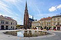
 Osijek centar.jpg 1,632 × 1,218; 538 KB
-
 Osijek Starcevicev trg.jpg 1,410 × 1,058; 340 KB
-
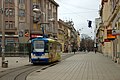 Osijek, Trg Ante Starčevića, tramvaj.jpg 4,770 × 3,178; 2.28 MB
-
 Osijek, Trg Ante Starčevića.jpg 4,770 × 3,178; 2.4 MB
-
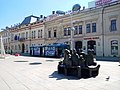
 Osjecka fontana.jpg 800 × 598; 124 KB
-
 Square in Osijek.jpg 800 × 573; 111 KB
-
 The west side of Ante Starčević square in winter.jpg 2,576 × 1,952; 1.19 MB
-
 Tram at Ante Starčević Square and Hotel Central.jpg 1,600 × 1,200; 276 KB
-
 Tram at the beginning of Josip Juraj Strossmayer street.jpg 2,576 × 1,952; 1.05 MB
-
 Trg Ante Starčevića - panoramio (1).jpg 4,288 × 3,216; 2.92 MB
-
 Trg Ante Starčevića - panoramio.jpg 4,288 × 3,216; 2.98 MB
-
 Trg Ante Starčevića.jpg 2,592 × 1,730; 932 KB
-
 Winter at Ante Starčević Square in Osijek.jpg 2,576 × 1,952; 1.3 MB


.jpg)


.jpg)


