Category:Tsubetsu, Hokkaido
Vai alla navigazione
Vai alla ricerca

town in Abashiri district, Hokkaidō, Japan     | |||||
| Carica un file multimediale | |||||
| Istanza di | |||||
|---|---|---|---|---|---|
| Luogo |
| ||||
| Forma giuridica |
| ||||
| Data di fondazione o creazione |
| ||||
| Popolazione |
| ||||
| Superficie |
| ||||
| Ha sostituito |
| ||||
| sito web ufficiale | |||||
 | |||||
Sottocategorie
Questa categoria contiene le 13 sottocategorie indicate di seguito, su un totale di 13.
H
- Honki Station (1 F)
K
- Kaitaku Station (1 F)
- Kakkumi Station (1 F)
- Kitami-Aioi Station (6 F)
- Kokomae Station (Hokkaido) (1 F)
M
- Michinoeki Aioi (2 F)
N
- Nunokawa Station (1 F)
O
- Onne Station (1 F)
T
- Taishō Station (Tsubetsu) (1 F)
- Tatsumi Station (Hokkaido) (1 F)
- Tsubetsu Pass (4 F)
- Tsubetsu Station (1 F)
- Tsubetsu Town Bus (8 F)
File nella categoria "Tsubetsu, Hokkaido"
Questa categoria contiene 23 file, indicati di seguito, su un totale di 23.
-
 Emblem of Tsubetsu, Hokkaido.svg 512 × 512; 3 KB
-
 Flag of Tsubetsu Hokkaido.png 367 × 219; 5 KB
-
 Flag of Tsubetsu, Hokkaido.svg 500 × 333; 4 KB
-
 Former Emblem of Tsubetsu, Hokkaido.png 184 × 183; 5 KB
-
 Former Flag of Tsubetsu, Hokkaido.png 424 × 287; 3 KB
-
 Hokkaido Tsubetsu-town.png 300 × 152; 14 KB
-
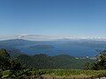 Lake Kussharo from Tsubetsu pass deck 2009.jpg 3 648 × 2 736; 1,99 MB
-
 Lake Kussharo01.JPG 2 048 × 1 536; 1,17 MB
-
 Location of Lake Chimikeppu, Japan.svg 1 024 × 1 024; 11 KB
-
 Population distribution of Tsubetsu, Hokkaido, Japan.svg 512 × 256; 22 KB
-
 Rokumei Fall.JPG 3 008 × 2 000; 3,83 MB
-
 Timikeppuko.jpg 400 × 400; 71 KB
-
 Tsubetsu Hokkaido chapter.png 173 × 174; 17 KB
-
 Tsubetsu in Abashiri Subprefecture.gif 600 × 300; 27 KB
-
 Tsubetsu in Hokkaido Prefecture Ja.svg 800 × 872; 44 KB
-
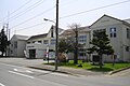 Tsubetsu town01.JPG 2 592 × 1 728; 2,15 MB
-
 Tsubetsu Tōge01.JPG 2 048 × 1 536; 1,39 MB
-
 Tsubetsu-town Abashiri.png 496 × 224; 39 KB
-
 Tsubetsu-Town see from airplane.JPG 2 400 × 1 800; 743 KB
-
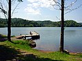 Timikeppuko2.jpg 640 × 480; 76 KB
-
 チミケップ湖 - panoramio.jpg 1 280 × 960; 412 KB
-
 北海道道682号二又北見線 DD682.jpg 3 252 × 1 924; 1,8 MB
-
 基礎自治体位置図 01544.svg 608 × 393; 8 KB


