Category:Tsuruga, Fukui
Jump to navigation
Jump to search
city in Fukui Prefecture, Japan   .jpg)      | |||||
| Upload media | |||||
| Instance of | |||||
|---|---|---|---|---|---|
| Location | Fukui Prefecture, Japan | ||||
| Located in or next to body of water | |||||
| Legal form |
| ||||
| Inception |
| ||||
| Population |
| ||||
| Area |
| ||||
| Replaces |
| ||||
| official website | |||||
 | |||||
日本語: 福井県敦賀市
Subcategories
This category has the following 10 subcategories, out of 10 total.
Media in category "Tsuruga, Fukui"
The following 76 files are in this category, out of 76 total.
-
 Fukui Tsuruga-city.png 249 × 174; 4 KB
-
 Map Tsuruga en.png 1,181 × 803; 47 KB
-
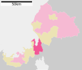 Tsuruga in Fukui prefecture Ja.svg 550 × 471; 13 KB
-
 32-6-1 Irohama, Tsuruga-shi, Fukui-ken 914-0844, Japan - panoramio (1).jpg 5,472 × 3,648; 4.46 MB
-
 Around the place where Tsuruga Shinko Station and the railway used to be.jpg 3,593 × 2,695; 4.85 MB
-
 Brick remains of railway.jpg 4,032 × 3,024; 2.57 MB
-
 CA320297.JPG 2,048 × 1,536; 744 KB
-
 Conservation forest for genetic resources of trees in Kurokoyama.jpg 4,032 × 3,024; 5.13 MB
-
 Danose-Matsuri Eburisashi.jpg 1,600 × 1,200; 1.18 MB
-
 Danose-Matsuri Tauchi.jpg 1,600 × 1,200; 1.14 MB
-
 Danose-Matsuri Taue.jpg 1,024 × 768; 465 KB
-
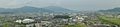
 East side of Tsuruga.JPG 2,048 × 1,536; 881 KB
-
 Ebisu Daikoku Tag of War - End.jpg 1,200 × 1,600; 1.36 MB
-
 Ebisu Daikoku Tag of War - Sagicho.jpg 1,200 × 1,600; 1.32 MB
-
 Ebisu Daikoku Tag of War - Start.jpg 1,600 × 1,200; 1.16 MB
-
 Ebisu Daikoku Tag of War - Straw Craft1.jpg 1,600 × 1,200; 1.6 MB
-
 Ebisu Daikoku Tag of War - Straw Craft2.jpg 1,600 × 1,200; 1.46 MB
-
 Ebisu Daikoku Tag of War - Walking Ceremony.jpg 1,200 × 1,600; 1.26 MB
-
 Emblem of Tsuruga, Fukui (1900–1952).gif 283 × 250; 10 KB
-
 Emblem of Tsuruga, Fukui (1900–1952).svg 227 × 208; 30 KB
-
 Emblem of Tsuruga, Fukui.jpg 104 × 92; 3 KB
-
 Emblem of Tsuruga, Fukui.svg 370 × 370; 1 KB
-
 Esplanade in Mongasaki.jpg 5,184 × 3,456; 6.28 MB
-
 Fan - panoramio.jpg 800 × 1,200; 643 KB
-
 Firefighters2.jpg 1,818 × 1,228; 747 KB
-
 Flag of Tsuruga, Fukui.png 900 × 600; 28 KB
-
 Flag of Tsuruga, Fukui.svg 323 × 215; 3 KB
-
 Ike-no-hara Wetlands.jpg 4,608 × 3,456; 4.18 MB
-
 Japan, Fukui-ken, Tsuruga-shi, 県道141号線 - panoramio (1).jpg 1,926 × 2,560; 2.4 MB
-
 Japan, Fukui-ken, Tsuruga-shi, 県道141号線 - panoramio (2).jpg 2,560 × 1,926; 2.87 MB
-
 Japan, Fukui-ken, Tsuruga-shi, 県道141号線 - panoramio.jpg 2,560 × 1,926; 2.72 MB
-
 Japan, 〒914-0831 Fukui-ken, Tsuruga-shi, Kutsu, 県道141号線 - panoramio.jpg 2,560 × 1,926; 2.74 MB
-
 Kaguracho, Tsuruga, Fukui Prefecture 914-0063, Japan - panoramio.jpg 3,356 × 2,264; 2.07 MB
-
 Kinome-touge.jpg 3,072 × 2,048; 2.64 MB
-
 Kuchinashi Valley.jpg 4,608 × 3,456; 4.19 MB
-
 Kuroko valley Tsuruga city Fukui prefecture 20080315 1535.jpg 2,048 × 1,536; 691 KB
-
 Kutsu, Tsuruga, Fukui Prefecture 914-0831, Japan - panoramio.jpg 1,926 × 2,560; 2.88 MB
-
 Map of Kuroko Valley.jpg 717 × 956; 317 KB
-
 Maruyama, Tsuruga 敦賀市鞠山 Aug 9, 2010.jpg 3,648 × 2,432; 2.23 MB
-
 Mito-hanshi-funbo-no-tokoro.jpg 3,024 × 4,032; 5.36 MB
-
 Mito-resshi-tsuito-no-hi.jpg 2,579 × 3,439; 5 MB
-
 Mito-resshi-yukyo-no-tera.jpg 3,024 × 4,032; 4.91 MB
-
 Miya-yama.jpg 4,032 × 3,024; 4.73 MB
-
 Moat of Tsuruga Castle.jpg 1,600 × 1,200; 1.77 MB
-
 Mongasaki.jpg 5,076 × 3,384; 4.05 MB
-
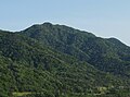 Mount Iwagomori.jpg 2,557 × 1,903; 3.03 MB
-
 Mukaideyama Kofun.jpg 4,032 × 3,024; 4.32 MB
-
 Namiyoke-jizou1.jpg 3,968 × 2,976; 2.59 MB
-
 Observatory in Mongasaki.jpg 5,184 × 3,456; 4.76 MB
-
 Population distribution of Tsuruga, Fukui, Japan.svg 512 × 256; 22 KB
-
 Ronin-sodo-ketsudan-shirasu-no-ato.jpg 4,032 × 3,024; 4.86 MB
-
 San-no-maru Jizou.jpg 3,024 × 4,032; 4.44 MB
-
 Sea - panoramio - ThisIsThe Kiwi.jpg 800 × 1,200; 762 KB
-
 Ships of Ofuna-asobi-kangensai Festival.jpg 4,608 × 3,456; 3.92 MB
-
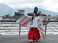 Shira-byoshi dance in Ofuna-asobi-kangensai Festival.jpg 4,608 × 3,456; 1.72 MB
-
 Shougetsu Yatai ac (1).jpg 1,345 × 1,009; 330 KB
-
 Sunrise - panoramio - ThisIsThe Kiwi.jpg 1,200 × 800; 547 KB
-
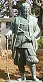 Takeda kounsai.jpg 320 × 612; 22 KB
-
 Tateishi Lighthouse distant view.jpg 5,184 × 3,456; 4.21 MB
-
 The ruins of a railway abutment bound for Tsuruga Shinko Station over the Koyano River.jpg 3,718 × 3,729; 8.02 MB
-
 Tombstones of Mariyama domain's Samurai 2.jpg 4,036 × 3,027; 7.57 MB
-
 Traces of a masonry canal at a hydropower station.jpg 4,032 × 3,024; 5.97 MB
-
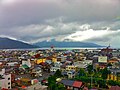
 Tsuruga center area back ground No,1.JPG 1,292 × 192; 98 KB
-
 Tsuruga center area back ground No,2.JPG 1,768 × 404; 181 KB
-
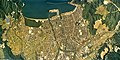 Tsuruga city center area Aerial photograph.1975.jpg 6,818 × 3,432; 17.11 MB
-
 Tsuruga city center area Aerial photograph.2013.jpg 6,383 × 6,327; 35.86 MB
-
 Tsuruga Fireworks Festival.jpg 144 × 176; 9 KB
-
 Tsuruga Regiment Sentry Post.JPG 4,000 × 3,000; 5.55 MB
-
 View of a town south of Tsuruga Station from Hokuriku Main Line 01.jpg 4,032 × 3,024; 2.84 MB
-
 View of a town south of Tsuruga Station from Hokuriku Main Line 02.jpg 4,032 × 3,024; 2.77 MB
-
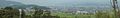
 View of Tsuruga city (6062574656).jpg 2,592 × 1,936; 1.78 MB
-
 Yuuki-cho.jpg 3,024 × 4,032; 5.05 MB
-
 沓 - panoramio (1).jpg 2,592 × 1,936; 1.51 MB
-
 沓 - panoramio.jpg 2,592 × 1,936; 1.29 MB
-
 船 - panoramio.jpg 5,472 × 3,648; 4.65 MB
-
 馬背峠 - panoramio - Yobito KAYANUMA.jpg 1,600 × 902; 163 KB


.jpg)


.gif)
.svg)


.jpg)
.jpg)


.jpg)


.jpg)

.jpg)


