Category:Tuinkoepel, Geertruidenberg
Jump to navigation
Jump to search
| Object location | | View all coordinates using: OpenStreetMap |
|---|
 | |||||
| Upload media | |||||
| Instance of | |||||
|---|---|---|---|---|---|
| Location | Geertruidenberg, North Brabant, Netherlands | ||||
| Street address |
| ||||
| Located on street |
| ||||
| Heritage designation |
| ||||
 | |||||
|
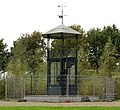
This is a category about rijksmonument number 16013
|
| Address |
|
Media in category "Tuinkoepel, Geertruidenberg"
The following 3 files are in this category, out of 3 total.
-
-
 Theehuisje - Geertruidenberg - 20076069 - RCE.jpg 1,195 × 1,200; 476 KB
-
 Uitzichttoren - Geertruidenberg - 20076070 - RCE.jpg 1,195 × 1,200; 301 KB

