Category:U.S. Route 97 in Washington (state)
Jump to navigation
Jump to search
| « First · 92 · 96 · 97 · 99 · 100 · 102 · 103 · 104 · 105 · 106 · 107 · Last » |
| I-5 · I-82 · I-90 · I-182 · I-205 · I-405 · I-605 · I-705 |
| US-2 · US-10 · US-12 · US-95 · US-97 · US-99 · US-101 · US-195 · US-197 · US-295 · US-395 · US-730 · US-830 |
English: This category should contain files related to U.S. Route 97 in Washington. (State route number 97 in Washington per RCW 47.17.155 and RCW 47.17.157)
highway in Washington   | |||||
| Upload media | |||||
| Instance of | |||||
|---|---|---|---|---|---|
| Location | Washington, Pacific Northwest, Washington, Pacific States Region | ||||
| Transport network | |||||
| Owned by | |||||
| Maintained by | |||||
| Inception |
| ||||
| Length |
| ||||
| |||||
Subcategories
This category has the following 6 subcategories, out of 6 total.
A
B
- Beebe Bridge (10 F)
F
- Fred G. Redmon Bridge (14 F)
R
- Richard Odabashian Bridge (4 F)
S
- Sam Hill Memorial Bridge (15 F)
Media in category "U.S. Route 97 in Washington (state)"
The following 36 files are in this category, out of 36 total.
-
 WA-US97.svg 601 × 585; 7 KB
-
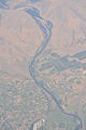
 Aerial - Selah, WA 01 (9794317743).jpg 2,848 × 4,288; 4.14 MB
-
 Aerial - Selah, WA 01 - white balanced (9794364093).jpg 2,848 × 4,288; 9.41 MB
-
 Aerial - Wenas Valley northwest of Selah, WA 01 (9793247586).jpg 2,848 × 4,288; 3.85 MB
-
 Aerial - Wenas Valley northwest of Selah, WA 01 - equalized (9793282574).jpg 2,848 × 4,288; 11.2 MB
-
 Aerial - Yakima River and east of Selah, WA 01 (9793043924).jpg 4,288 × 2,848; 4.45 MB
-
 Aerial - Yakima River and east of Selah, WA 01 - white balanced (9793184203).jpg 4,288 × 2,848; 10.23 MB
-
 Aerial - Yakima River and east of Selah, WA 02 (9792952204).jpg 4,288 × 2,848; 4.43 MB
-
 Aerial - Yakima River and east of Selah, WA 02 - white balanced (9793041026).jpg 4,288 × 2,848; 11.12 MB
-
 Aerial - Yakima River in Selah, WA 01 (9793141864).jpg 2,848 × 4,288; 4.32 MB
-
 Aerial - Yakima River in Selah, WA 01 - white balanced (9793225656).jpg 2,848 × 4,288; 9.53 MB
-
 Aerial - Yakima River northeast of Selah, WA 01 (9792947853).jpg 4,288 × 2,848; 4.45 MB
-
 Aerial - Yakima River northeast of Selah, WA 01 - white balanced (9793001623).jpg 4,288 × 2,848; 10.7 MB
-
 Aerial - Yakima River northeast of Selah, WA 02 (9792797715).jpg 2,848 × 4,288; 4.17 MB
-
 Aerial - Yakima River northeast of Selah, WA 02 - white balanced (9792877826).jpg 2,848 × 4,288; 8.97 MB
-
 Aerial - Yakima River northeast of Selah, WA 03 (9792722914).jpg 2,848 × 4,288; 4.09 MB
-
 Aerial - Yakima River northeast of Selah, WA 03 - white balanced (9792786584).jpg 2,848 × 4,288; 9.54 MB
-
 Aerial view of Goldendale, WA from the northeast.jpg 3,680 × 2,002; 6.73 MB
-
 Aerial view of the Columbia River and Lake Entiat.jpeg 3,504 × 2,336; 4.76 MB
-
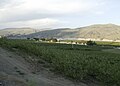 Azwell WA.jpg 2,651 × 1,894; 2.49 MB
-
 I-82, US 12, US 97 in Union Gap, WA.jpg 4,744 × 3,156; 2.8 MB
-
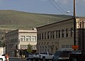
 Main Street, Oroville, Washington.jpg 2,048 × 1,536; 1.54 MB
-
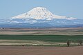
 Mount Adams 7956.JPG 4,272 × 2,848; 4.79 MB
-
 Mount Adams 7962.JPG 4,272 × 2,848; 4.29 MB
-
 Okanogan River at Riverside WA.jpg 2,443 × 1,745; 3.03 MB
-
 Outcrop near Riverside WA.jpg 2,216 × 1,583; 2.35 MB
-
 Outcropping near Riverside WA.jpg 1,478 × 1,055; 1.12 MB
-
 SR 215 northbound at Tyee Street in Omak, WA.jpg 4,840 × 3,152; 3.37 MB
-
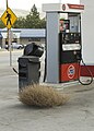 Tumbleweed in Chelan WA.jpg 1,107 × 1,550; 940 KB
-
 US 97 and SR 20 northbound near Okanogan, WA.jpg 3,426 × 2,256; 1.9 MB
-
 US 97 Business northbound in Okanogan, WA.jpg 3,386 × 2,192; 1.94 MB
-
 US 97 Washington 1926.svg 1,485 × 1,440; 33 KB
-
 View of Okanogan WA.jpg 2,139 × 1,528; 1.6 MB
-
 Washington U.S. Route 97.svg 1,152 × 640; 1.17 MB
-
 Wind farm 7966.JPG 4,272 × 2,848; 4.31 MB
-
 Wind farm 7967.JPG 4,272 × 2,848; 4.24 MB

.jpg)
.jpg)
.jpg)
.jpg)
.jpg)
.jpg)
.jpg)
.jpg)
.jpg)
.jpg)
.jpg)
.jpg)
.jpg)
.jpg)
.jpg)
.jpg)


