Category:Ulvenhoutse bos
Jump to navigation
Jump to search
| Camera location | | View all coordinates using: OpenStreetMap |
|---|
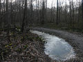
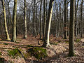
Nederlands: Afbeeldingen van het Ulvenhoutse onder meer nabij de Sint Annadreef in Ulvenhout behorende tot de gemeente Breda en een klein deel tot Alpen-Chaam in de provincie Noord-Brabant in het zuiden van Nederland. Het Ulvenhoutse bos is circa 729 ha en eigendom van Staatsbosbeheer. Tot het gebied behoren tevens het Sint-Annabos, het Voorbos, het Nieuwbos, het Prinsenbos en het Chaambos. Het Ulvenhoutse bos is een Natura 2000 gebied. (bron [1];[2];[3];[4];[5];[6];[7])
protected area in Kingdom of the Netherlands | |||||
| Upload media | |||||
| Instance of |
| ||||
|---|---|---|---|---|---|
| Location |
| ||||
| IUCN protected areas category | |||||
| Inception |
| ||||
| Area |
| ||||
 | |||||
Media in category "Ulvenhoutse bos"
The following 7 files are in this category, out of 7 total.
-
 Natura2000 - Ulvenhoutse Bos.png 2,016 × 2,267; 241 KB
-
 P1010672 copyUlvenhoutse bos.jpg 3,264 × 2,448; 2.59 MB
-
 P1010673 copyUlvenhoutse bos.jpg 2,448 × 3,264; 3.04 MB
-
 P1010675 copyUlvenhoutse bos.jpg 3,264 × 2,448; 3.29 MB
-
 P1010676 copyUlvenhoutse bos.jpg 3,264 × 2,448; 3.14 MB
-
 P1010677 copyUlvenhoutse bos.jpg 2,448 × 3,264; 2.97 MB
-
 P1010678 copyUlvenhoutse bos.jpg 3,264 × 2,448; 3.03 MB


