Category:Umatilla County, Oregon
Zur Navigation springen
Zur Suche springen
Counties of Oregon: Baker · Benton · Clackamas · Clatsop · Columbia · Coos · Crook · Curry · Deschutes · Douglas · Gilliam · Grant · Harney · Hood River · Jackson · Jefferson · Josephine · Klamath · Lake · Lane · Lincoln · Linn · Malheur · Marion · Morrow · Multnomah · Polk · Sherman · Tillamook · Umatilla · Union · Wallowa · Wasco · Washington · Wheeler · Yamhill
County im US-Bundesstaat Oregon   | |||||
| Medium hochladen | |||||
| Ist ein(e) | |||||
|---|---|---|---|---|---|
| Benannt nach | |||||
| Ort | Oregon | ||||
| Hauptstadt | |||||
| Datum der Gründung, Erstellung, Entstehung, Erbauung |
| ||||
| Einwohnerzahl |
| ||||
| Fläche |
| ||||
| offizielle Website | |||||
 | |||||
Unterkategorien
Es werden 45 von insgesamt 45 Unterkategorien in dieser Kategorie angezeigt:
In Klammern die Anzahl der enthaltenen Kategorien (K), Seiten (S), Dateien (D)
A
B
C
D
- Deadman Pass (Oregon) (13 D)
E
H
- Hat Rock State Park (22 D)
I
- Interstate 80N in Oregon (1 D)
M
- McNary Wildlife Nature Area (12 D)
- Meacham, Oregon (4 D)
N
- North Fork John Day River (8 D)
O
- Old Emigrant Road (Oregon) (21 D)
P
R
S
T
- Tollgate, Oregon (8 D)
U
- Ukiah, Oregon (10 D)
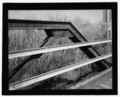
- Umatilla Bridge (3 D)
- Umatilla Chemical Depot (30 D)
W
Medien in der Kategorie „Umatilla County, Oregon“
Folgende 86 Dateien sind in dieser Kategorie, von 86 insgesamt.
-

-
 170113 WW odfw (37313616691).jpg 1.345 × 963; 898 KB
-
 170121 WallaWalla odfw (33132134884).jpg 1.220 × 976; 393 KB
-
 200630 Ruckel Ridge yrlng (51144475362).jpg 2.100 × 1.500; 2,44 MB
-
 20111110-OC-AMW-0034 - Flickr - USDAgov.jpg 4.744 × 3.576; 7,65 MB
-
 20170625 NEM odfw (37313617271).jpg 1.485 × 976; 1,18 MB
-
 2020 Hermiston flood damage.jpeg 4.032 × 3.024; 4,11 MB
-
 Alaska-Yukon-Pacific Exposition - Cover.jpg 3.645 × 5.356; 9,03 MB
-
 Bathers at Lehman Springs.jpg 992 × 572; 337 KB
-
 Battle Mountain Oregon (6027849713).jpg 4.948 × 1.573; 2,71 MB
-
 Battle Mountain Oregon forest (6027846325).jpg 3.648 × 2.736; 3,8 MB
-
 Battle Mountain Oregon forest (6028399842).jpg 3.648 × 2.736; 4,25 MB
-
 Battle Mountain Oregon forest (6028400836).jpg 3.648 × 2.736; 2,64 MB
-
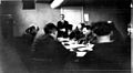
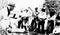 Beekeeping club meeting, Umatilla County, 1922 (5833609449).jpg 3.172 × 1.865; 552 KB
-
 Bingham Springs Resort ad.jpeg 800 × 1.042; 160 KB
-
 Bridge Creek Wildlife Area.jpg 675 × 481; 126 KB
-
 Field examination report. Birch Creek Watershed, Umatilla County, Oregon (IA CAT10681294).pdf 1.270 × 1.739, 50 Seiten; 2,24 MB
-
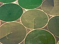 Crop circles north of Umatilla, Oregon, USA.jpg 2.552 × 1.912; 2,45 MB
-
 Cunningham Sheep Company buildings (3388156696).jpg 4.859 × 3.781; 1,48 MB
-
 Cunningham Sheep Company home ranch (3387349877).jpg 4.845 × 3.808; 1,37 MB
-
 Dale Ukiah Scenic Byway (10900087503).jpg 1.536 × 1.024; 403 KB
-
 Description of The Heppner Times in December 1875.png 1.924 × 664; 922 KB
-
 East of Milton Freewater, OR. (10488992384).jpg 2.048 × 1.536; 799 KB
-
 Elk graze on Cabbage Hill near I-84 (5662812972).jpg 2.048 × 1.536; 749 KB
-

-
-
 Harris-Park-South-Fork-WW-9.JPG 1.488 × 1.984; 701 KB
-
 Hermiston (Unsplash).jpg 5.616 × 3.744; 11,27 MB
-
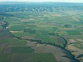
 Hermiston area aerial (34522051522).jpg 3.264 × 2.448; 1,58 MB
-
 Highway84Clouds.jpg 1.280 × 989; 227 KB
-
 Highway84Eve.jpg 1.471 × 1.037; 248 KB
-
 I-82 Umatilla.jpg 4.072 × 2.528; 1,72 MB
-
 Ice covers Oregon 11 near Weston (6728195813).jpg 1.920 × 2.560; 908 KB
-
 Installing grounding rings at Bosley Butte (14000190285).jpg 2.560 × 1.920; 1,08 MB
-
 Interstate 82, Umatilla, Oregon Approaching Columbia River (265620026).jpg 1.280 × 960; 96 KB
-
 Interstate 84 Between Blue Mountains and Pendleton, Oregon (265619268).jpg 1.280 × 960; 105 KB
-
 Interstate 84 Between Blue Mountains and Pendleton, Oregon (265619319).jpg 1.280 × 960; 108 KB
-
 Interstate 84 Between Blue Mountains and Pendleton, Oregon (265619373).jpg 1.280 × 960; 113 KB
-
 Irrigation in Umatilla County.png 1.192 × 692; 572 KB
-
 Junction I-84 and I-82.jpg 4.032 × 3.024; 1.012 KB
-
 Langdonlake.JPG 1.024 × 768; 420 KB
-
 Lonely (210480091).jpeg 2.048 × 1.365; 683 KB
-
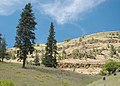
 Mt. Cabbage - panoramio.jpg 2.464 × 1.437; 2,68 MB
-
 Mt. Emily wolf (17086825637).jpg 920 × 612; 318 KB
-
 New hotel at Wildhorse Casino.jpg 1.215 × 911; 369 KB
-
 NRCSOR02016 - Oregon (5881)(NRCS Photo Gallery).jpg 2.100 × 1.500; 5,63 MB
-
 NRCSOR02016 - Oregon (5881)(NRCS Photo Gallery).tif 2.100 × 1.500; 12,02 MB
-

-

-
-

-
 OR I-84 near Pendleton.png 3.872 × 2.592; 13,94 MB
-
 OR-10 odfw (16671794354).jpg 1.665 × 1.189; 1,51 MB
-
 Ordnance, Oregon.jpg 4.608 × 3.072; 4,85 MB
-
 OSN advertisement.jpg 292 × 480; 43 KB
-
 Pikes Peak, United States (Unsplash eYwn81sPkJ8).jpg 6.000 × 4.000; 5,46 MB
-
 Pilot Rock High School - panoramio.jpg 11.438 × 3.465; 6,01 MB
-

-

-
-
 Range Soil Analysis - All States - DPLA - 3a6ab817e4a022a0d95458e2949dbfe2.jpg 5.112 × 3.988; 2,71 MB
-
 Red angus cows oregon (cropped).jpg 1.664 × 1.235; 365 KB
-
 Red angus cows oregon.jpg 2.080 × 1.544; 671 KB
-
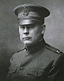 Roy W. Ritner, Oregon Legislator, 1918.jpg 553 × 703; 137 KB
-
 Sheep "plimsoll line" (3387354233).jpg 3.246 × 1.829; 608 KB
-
 South-Fork-WW.JPG 1.488 × 1.984; 710 KB
-
 Speed limit road signs EB I-82, Umatilla County, OR, Apr 17.jpg 2.592 × 1.944; 2,72 MB
-
 Sun peeking through the clouds (5229156623).jpg 2.560 × 1.920; 1,05 MB
-
 Andy Tillman, llama rancher, 2008.JPG 3.072 × 2.304; 2,25 MB
-

-
 Two Sisters rock formation in Wallula Gap area (1666867565).jpg 948 × 621; 284 KB
-
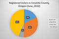 Umatilla County Registered Voters 2022.png 543 × 358; 69 KB
-
 Umatilla County, OR, USA - panoramio.jpg 2.592 × 1.936; 1,19 MB
-
 Umatilla Reservation (3229179631).jpg 4.027 × 2.375; 3,96 MB
-
 Umatilla River, Echo, Rieth Road - DPLA - 250a9ca714d78db4d6b7e713a94823e1.jpg 1.339 × 2.000; 1,19 MB
-
 UmatillaCountyCircuitCourt.jpg 3.721 × 1.976; 1,27 MB
-
 USA Umatilla, Oregon age pyramid.svg 520 × 600; 7 KB
-
 Valley-of-North-Fork-WallaWalla.JPG 1.984 × 1.488; 701 KB
-
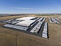 Wal-Mart DC.jpg 3.945 × 2.957; 2,91 MB
-
 Walla Walla wolf (17292447002).jpg 1.254 × 950; 665 KB
-
 Walla Walla wolf (17292447212).jpg 1.387 × 986; 583 KB
-
 WallaWalla 160116 (25770616481).jpg 1.243 × 894; 829 KB
-
 Welcome to Washington - The Evergreen State - Highway Sign (30765813677).jpg 3.999 × 2.554; 6,3 MB
-
 Weston and Athena, Oregon (2850661781).jpg 2.552 × 1.912; 1,84 MB
-
 Winter driving on I-84 at Meacham Hill Oregon (2646735439).jpg 1.704 × 2.272; 179 KB
-
 Wooden clothes pin.JPG 1.704 × 2.272; 1,7 MB

.jpg)
.jpg)
.jpg)

.jpg)


.jpg)
.jpg)
.jpg)
.jpg)


.jpg)
.jpg)
.jpg)
.jpg)
.jpg)

.jpg)
.jpg)


.jpg)
.jpg)
.jpg)
.jpg)
.jpg)
.jpg)


.jpeg)

.jpg)

(NRCS_Photo_Gallery).jpg)
.jpg)
.jpg)
.jpg)
.jpg)

.jpg)


.jpg)
.gif)
.gif)
.jpg)

.jpg)


.jpg)


.jpg)

.jpg)


.jpg)


.jpg)
.jpg)
.jpg)
.jpg)
.jpg)
.jpg)

.jpg)