Category:Umhlanga Lagoon Nature Reserve
Jump to navigation
Jump to search
| Object location | | View all coordinates using: OpenStreetMap |
|---|
Afrikaans: Die Umhlanga-strandmeer Natuurreservaat is aangrensend aan die Umhlanga-stadsgebied en omsluit die Ohlanga-strandmeer. Dit maak deel uit van die wyer Hawaanbos wat weerskante van die M4-snelweg en Ohlangarivier geleë is.
English: The Umhlanga Lagoon Nature Reserve is situated on the city perimeter of Umhlanga and encloses the Ohlanga lagoon. It forms part of the wider Hawaan forest that is situated on both sides of the M4 freeway and the Ohlanga river.
Nature reserve in South Africa  | |||||
| Upload media | |||||
| Instance of | |||||
|---|---|---|---|---|---|
| Location | uMhlanga, eThekwini Metropolitan Municipality, KwaZulu-Natal, RSA | ||||
 | |||||
Media in category "Umhlanga Lagoon Nature Reserve"
The following 22 files are in this category, out of 22 total.
-
 Allophylus natalensis, bas, Umhlanga-strandmeer NR.jpg 4,000 × 3,000; 3.69 MB
-
 Allophylus natalensis, loof, Umhlanga-strandmeer NR.jpg 2,030 × 1,588; 1.09 MB
-
 Allophylus natalensis, lower, Umhlanga-strandmeer NR.jpg 4,000 × 3,000; 5.19 MB
-
 Baphia racemosa, blaarkruin, Umhlanga-strandmeer NR.jpg 3,736 × 3,000; 3.69 MB
-
 Baphia racemosa, loof en bas, Umhlanga-strandmeer NR.jpg 3,625 × 3,000; 3.82 MB
-
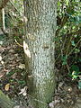
 Chaetacme aristata, stam, Umhlanga-strandmeer NR.jpg 4,000 × 3,000; 4.89 MB
-
 Dicrurus ludwigii, Umhlanga-strandmeer Natuurreservaat.jpg 1,805 × 2,057; 1.89 MB
-
 Erianthemum dregei, Umhlanga-strandmeer Natuurreservaat.jpg 1,967 × 1,794; 2.43 MB
-
 Hibiscus tiliaceus subsp tiliaceus, Umhlanga-strandmeer NR, a.jpg 4,000 × 3,000; 4.02 MB
-
 Hibiscus tiliaceus subsp tiliaceus, Umhlanga-strandmeer NR, b.jpg 3,656 × 3,000; 3.53 MB
-
 Hibiscus tiliaceus subsp tiliaceus, Umhlanga-strandmeer NR, c.jpg 4,000 × 3,000; 4.25 MB
-
 Mimusops caffra, loof, Umhlanga-strandmeer NR.jpg 4,000 × 3,000; 4.88 MB
-
 Mimusops caffra, op kusduin, Umhlanga-strandmeer NR.jpg 3,386 × 2,901; 3.28 MB
-
 Mimusops caffra, stam, Umhlanga-strandmeer NR.jpg 3,000 × 4,000; 4.85 MB
-
 Ohlanga-strandmeer, Umhlanga, a.jpg 4,000 × 3,000; 4.6 MB
-
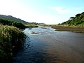 Ohlanga-strandmeer, Umhlanga, b.jpg 4,000 × 3,000; 3.8 MB
-
 Ohlanga-strandmeer, Umhlanga, c.jpg 4,000 × 3,000; 3.83 MB
-
 Ohlanga-strandmeer, Umhlanga, d.jpg 4,000 × 3,000; 4.31 MB
-
 Ohlanga-strandmeer, Umhlanga, e.jpg 4,000 × 3,000; 3.85 MB
-
 Ohlanga-strandmeer, Umhlanga, f.jpg 4,000 × 3,000; 4.13 MB
-
 Senecio tamoides & Hibiscus tiliaceus, Umhlanga-strandmeer NR, a.jpg 4,000 × 3,000; 5.13 MB
-
 Senecio tamoides, Umhlanga-strandmeer NR.jpg 4,000 × 3,000; 4.72 MB


