Category:United States Coast and Geodetic Survey
Jump to navigation
Jump to search
federal agency responsible for surveying and mapping the United States | |||||
| Upload media | |||||
| Instance of | |||||
|---|---|---|---|---|---|
| Location | Montgomery County, Maryland | ||||
| Applies to jurisdiction | |||||
| Headquarters location |
| ||||
| Inception |
| ||||
| official website | |||||
 | |||||
Subcategories
This category has the following 13 subcategories, out of 13 total.
Media in category "United States Coast and Geodetic Survey"
The following 93 files are in this category, out of 93 total.
-
The late attacks upon the Coast and Geodetic Survey (IA 101703576.nlm.nih.gov).pdf 779 × 1,258, 56 pages; 3 MB
-
1889 map of Nestuggah Bay (Nestucca Bay), Oregon.jpg 7,964 × 11,577; 7.78 MB
-
1889 map of the Columbia River.jpg 8,861 × 10,074; 8 MB
-
1891 map of Nehalem River, Oregon.jpg 13,171 × 13,568; 11.72 MB
-
Bixby Creek Bridge 1932..jpg 2,860 × 1,605; 2.07 MB
-
CastineME Observatory.jpg 1,024 × 680; 250 KB
-
Centennial celebration of the United States Coast and geodetic survey (IA centennialcelebr00unit).pdf 704 × 1,056, 216 pages; 9.98 MB
-
Coast & Geodetic Survey 3c 1957 issue U.S. stamp.jpg 1,325 × 848; 538 KB
-
Alaska coast pilot notes from Yakutat Bay to Cook Inlet and Shelikof Strait (IA coastpilotalaska00uscorich).pdf 1,162 × 1,756, 100 pages; 8.74 MB
-
CORS spicewood lcrh.jpg 1,000 × 1,333; 450 KB
-
List and catalogue of the publications issued by the U.S. Coast and geodetic survey, 1816-1902 (IA cu31924104019736).pdf 1,133 × 1,675, 252 pages; 11.17 MB
-
Datum Shift Between NAD27 and NAD83.png 1,115 × 581; 260 KB
-
Flag of the United States Coast and Geodetic Survey.svg 1,500 × 1,000; 558 bytes
-
Gaithersburg Observatory, 1940s.png 480 × 585; 275 KB
-
Geodetic Survey wants pure gold (IA geodeticsurveywantspuregold18931116).pdf 3,002 × 3,716, 3 pages; 1.64 MB
-
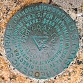
Goat Island - U.S. Coast & Geodetic Survey benchmark.jpg 2,196 × 2,187; 1.55 MB
-
Gulf of Alaska Nygren.jpg 2,442 × 1,531; 225 KB
-
Horizontal Control Network of the United States June 1931.jpg 1,365 × 844; 438 KB
-
Hypsometry. Use of mean sea level as the datum for elevations (IA hypsometryuseofm00unit).pdf 937 × 1,435, 30 pages; 2.27 MB
-
Instrument tent on hill w M29C weasel.jpg 2,000 × 1,394; 239 KB
-
KARO ST LOUIS 1944.jpg 700 × 454; 77 KB
-
The late attacks upon the Coast and geodetic survey .. (IA lateattacksuponc00philrich).pdf 745 × 1,210, 60 pages; 4.02 MB
-
List and catalogue of the publications issued by the U. S. Coast and geodetic survey, 1816-1902 (IA listcatalogueofp00unitrich).pdf 1,135 × 1,681, 252 pages; 22.57 MB
-
List and catalogue of the publications issued by the U S. Coast and Geodetic Survey 1816-1902 (IA listcatalogueofp00uscorich).pdf 981 × 1,610, 296 pages; 51.05 MB
-
Map-making Division of Coast & Geodetic Survey, Dept of Commerce LCCN2016877308.jpg 10,055 × 8,078; 8 MB
-
Map-making Division of Coast & Geodetic Survey, Dept of Commerce LCCN2016877309.jpg 10,063 × 8,112; 6.38 MB
-
Monographs of the United States Geological Survey (IA monographsofunit221893geol).pdf 935 × 1,281, 370 pages; 17.98 MB
-
Necker Island 1928.jpg 920 × 596; 338 KB
-
OrcaInlet.PNG 901 × 521; 1,009 KB
-
Pathfinder's whaleboat 1969 NOAA theb0527.jpg 904 × 588; 155 KB
-
PattersonsboatNOAAtheb0662.jpg 1,840 × 1,188; 1.57 MB
-
Photo-topographic methods and instruments - topography (IA phototopographic00flem).pdf 1,237 × 1,643, 128 pages; 9.64 MB
-
Post0103 - Flickr - NOAA Photo Library (cropped) (2).jpg 2,441 × 1,376; 1.57 MB
-
Post0103 - Flickr - NOAA Photo Library (cropped).jpg 2,464 × 574; 972 KB
-
Post0103 - Flickr - NOAA Photo Library.jpg 2,816 × 2,112; 2.65 MB
-
Puertogalera chart 4344 1917.jpeg 3,626 × 3,213; 1.69 MB
-
Regulations for the government of the United States Coast and Geodetic Survey (IA regulationsforgo00uscorich).pdf 702 × 1,160, 200 pages; 24.01 MB
-
RESEARCH rptintro 1903ar.jpg 837 × 839; 188 KB
-
Richards Building 1923 crop.jpg 433 × 325; 65 KB
-
Richards Building 1923.jpg 600 × 403; 112 KB
-
Securing launch Nygren.jpg 2,939 × 1,817; 425 KB
-
Sketch of John Ross Key.jpg 1,200 × 1,424; 1.53 MB
-
Summary of survey of oyster bars of Maryland, 1906-1912 (IA summaryofsurveyo00usco).pdf 979 × 1,543, 98 pages; 5.09 MB
-
Survey of oyster bars, Talbot County, Maryland; (IA surveyofoysterba01unit).pdf 791 × 1,262, 274 pages; 12.39 MB
-
Survey of oyster bars, Somerset County, Maryland; (IA surveyofoysterba05unit).pdf 960 × 1,250, 136 pages; 6.13 MB
-
Survey of oyster bars, Dorchester County, Maryland (IA surveyofoysterba06unit).pdf 1,072 × 1,702, 198 pages; 10.24 MB
-
T-Chart 368 - NARA - 55302726.jpg 15,075 × 8,312; 12.57 MB
-
T-Chart 402 Part 1 - NARA - 55302728.jpg 13,175 × 8,248; 15.37 MB
-
T-Chart 402 Part 2 - NARA - 55302730.jpg 12,579 × 8,576; 16.05 MB
-
T.W. McKinley, printing expert of the Coast & Geodetic Survey.jpg 1,024 × 793; 291 KB
-
The coast survey plate LCCN98504113.jpg 1,536 × 870; 216 KB
-
Theb1510 - Flickr - NOAA Photo Library.jpg 1,864 × 1,220; 546 KB
-
Theb1576 - Flickr - NOAA Photo Library.jpg 1,380 × 892; 237 KB
-
Theb1636 - Flickr - NOAA Photo Library.jpg 1,384 × 904; 253 KB
-
Theb1638 - Flickr - NOAA Photo Library.jpg 892 × 1,380; 205 KB
-
Theb1646 - Flickr - NOAA Photo Library.jpg 1,388 × 892; 1.07 MB
-
Theb1649 - Flickr - NOAA Photo Library.jpg 1,388 × 904; 912 KB
-
Theb1945 - Flickr - NOAA Photo Library.jpg 1,088 × 1,624; 484 KB
-
Theb2459 - Flickr - NOAA Photo Library.jpg 796 × 1,612; 155 KB
-
Theb2467 - Flickr - NOAA Photo Library.jpg 1,056 × 1,336; 269 KB
-
Theb2488 - Flickr - NOAA Photo Library.jpg 1,048 × 1,612; 247 KB
-
Theb2489 - Flickr - NOAA Photo Library.jpg 484 × 1,604; 360 KB
-
Theb2519 - Flickr - NOAA Photo Library.jpg 1,052 × 1,604; 274 KB
-
Theb2520 - Flickr - NOAA Photo Library.jpg 944 × 1,604; 199 KB
-
Theb2525 - Flickr - NOAA Photo Library.jpg 1,056 × 1,588; 173 KB
-
Theb2528 - Flickr - NOAA Photo Library.jpg 1,068 × 1,640; 457 KB
-
Theb2546 - Flickr - NOAA Photo Library.jpg 900 × 1,620; 147 KB
-
Theb2561 - Flickr - NOAA Photo Library.jpg 1,056 × 1,604; 437 KB
-
U.S. Coast and Geodetic Survey emblem.jpg 300 × 304; 33 KB
-
U.S. Coast and Geodetic Survey, AAF Aeronautical chart - Suez canal (FL155701943 3718092).jpg 17,525 × 13,327; 279.96 MB
-
U.S. Coast and Geodetic Survey, World Aeronautical chart - Cyprus 01 (FL155703602 3718094).jpg 17,525 × 13,293; 308.45 MB
-
U.S. Coast and Geodetic Survey, World Aeronautical chart - Cyprus 02 (FL155703607 3718094).jpg 17,528 × 13,242; 230.76 MB
-
US-NOAA-200thLogo.svg 720 × 283; 215 KB
-
USC&GS Pioneer.jpg 800 × 523; 60 KB
-
USCGSPatterson.jpg 700 × 446; 72 KB
-
U.S. Coast and Geodetic Survey. Historical compilation (IA uscoastgeodetics00uscorich).pdf 777 × 1,283, 20 pages; 1.22 MB
-
USCSRobertJWalker1852.jpg 1,600 × 1,069; 697 KB
-
USGS Idaho Montana 1900 Survey Spokane Courthouse Astronomic Piers.jpg 1,436 × 944; 353 KB
-
Alaska coast pilot notes from Yakutat Bay to Cook Inlet and Shelikof Strait (IA yakutatbay00uscorich).pdf 1,083 × 1,652, 92 pages; 8.34 MB


