Category:Up Nately
Jump to navigation
Jump to search
village in Hampshire, United Kingdom  | |||||
| Upload media | |||||
| Instance of | |||||
|---|---|---|---|---|---|
| Location | Mapledurwell and Up Nately, Basingstoke and Deane, Hampshire, South East England, England | ||||
 | |||||
English: Up Nately is a village and former civil parish southeast of Basingstoke in Hampshire, England.
Subcategories
This category has only the following subcategory.
S
Media in category "Up Nately"
The following 36 files are in this category, out of 36 total.
-
 A country house in Up Nately - geograph.org.uk - 1286961.jpg 640 × 471; 53 KB
-
 Arch from Up Nately brickworks.jpg 912 × 684; 541 KB
-
 Basingstoke Canal, Up Nately 01.jpg 4,128 × 3,096; 9.43 MB
-
 Basingstoke Canal, Up Nately 02.jpg 4,128 × 3,096; 8.24 MB
-
 Basingstoke Canal, Up Nately 03.jpg 4,128 × 3,096; 9.57 MB
-
 Basingstoke Canal, Up Nately 04.jpg 4,128 × 3,096; 6.43 MB
-
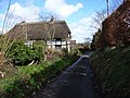 Cottage and lane, Up Nately - geograph.org.uk - 147190.jpg 640 × 480; 135 KB
-
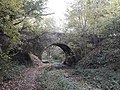 Eastrop Bridge, Up Nately 01.jpg 4,128 × 3,096; 9.22 MB
-
 Eastrop Bridge, Up Nately 02.jpg 3,096 × 4,128; 5.97 MB
-
 Eastrop Bridge, Up Nately 03.jpg 4,128 × 3,096; 6.56 MB
-
 Eastrop Bridge, Up Nately 04.jpg 4,128 × 3,096; 6.85 MB
-
 Eastrop Bridge, Up Nately 05.jpg 4,128 × 3,096; 6.98 MB
-
 Eastrop Bridge, Up Nately 06.jpg 4,128 × 3,096; 8.68 MB
-
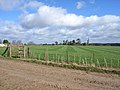 Farmland above Up Nately - geograph.org.uk - 146109.jpg 640 × 480; 109 KB
-
 Farmland above Up Nately - geograph.org.uk - 147187.jpg 640 × 480; 106 KB
-
 Farmland near Up Nately - geograph.org.uk - 2405822.jpg 640 × 480; 89 KB
-
 Footpath near Up Nately - geograph.org.uk - 2408301.jpg 640 × 480; 103 KB
-
-
 Footpath signpost near Up Nately, Hampshire.jpg 4,128 × 3,096; 6.17 MB
-
 Hampshire, Up Nately - geograph.org.uk - 2924639.jpg 4,288 × 3,216; 3.4 MB
-
 Hedge ^ footpath - Up Nately - geograph.org.uk - 2405848.jpg 640 × 480; 103 KB
-
 Kissing gate on footpath near Up Nately - geograph.org.uk - 3623079.jpg 640 × 427; 112 KB
-
 Phone box and pillar box at Up Nately - geograph.org.uk - 3623066.jpg 640 × 427; 103 KB
-
 Phone box and post box, Up Nately - geograph.org.uk - 1286935.jpg 480 × 640; 137 KB
-
 Rusting harrow - geograph.org.uk - 1671265.jpg 640 × 480; 130 KB
-
 Simple field gate - Up Nately - geograph.org.uk - 2405834.jpg 640 × 480; 112 KB
-
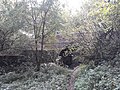
 Slade's Bridge - Basingstoke Canal - geograph.org.uk - 1670935.jpg 800 × 600; 186 KB
-
 Slade's Bridge - Basingstoke Canal - geograph.org.uk - 1670957.jpg 640 × 472; 113 KB
-
 Slade's Bridge, Basingstoke Canal - geograph.org.uk - 105979.jpg 640 × 480; 158 KB
-
 Slade's Bridge, Up Nately 01.jpg 4,128 × 3,096; 7.69 MB
-
 Slade's Bridge, Up Nately 02.jpg 4,128 × 3,096; 8.59 MB
-
 Slade's Bridge, Up Nately 03.jpg 3,096 × 4,128; 7.97 MB
-
 Up Nately - geograph.org.uk - 2923647.jpg 4,288 × 3,216; 3.58 MB
-
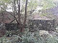
 Up Nately dock - geograph.org.uk - 3105492.jpg 640 × 480; 108 KB
-
 Up Nately Local Nature Reserve.jpg 912 × 684; 493 KB
-
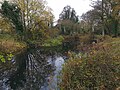
 Village Pond, Up Nately - geograph.org.uk - 2923446.jpg 4,288 × 3,216; 3.71 MB


