Category:Upper Stowe
Jump to navigation
Jump to search
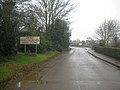
English: Upper Stowe is a village in the West Northamptonshire district of the county of Northamptonshire in England. It is in the civil parish of Stowe Nine Churches.
village in Northamptonshire, United Kingdom  | |||||
| Upload media | |||||
| Instance of | |||||
|---|---|---|---|---|---|
| Location | Stowe Nine Churches, West Northamptonshire, Northamptonshire, East Midlands, England | ||||
 | |||||
Subcategories
This category has only the following subcategory.
S
Media in category "Upper Stowe"
The following 19 files are in this category, out of 19 total.
-
 Farm field at Upper Stowe - geograph.org.uk - 101745.jpg 640 × 480; 79 KB
-
 Poppy - geograph.org.uk - 1355005.jpg 640 × 427; 66 KB
-
 Sheep near Upper Stowe - geograph.org.uk - 272551.jpg 640 × 480; 87 KB
-
-
 Upper Stowe Farmland - geograph.org.uk - 1333040.jpg 640 × 480; 104 KB
-
 Upper Stowe Farmland - geograph.org.uk - 1333042.jpg 640 × 480; 85 KB
-
 Upper Stowe Farmland - geograph.org.uk - 2150642.jpg 640 × 480; 105 KB
-
 Upper Stowe Farmland - geograph.org.uk - 2976900.jpg 640 × 480; 70 KB
-
 Upper Stowe, Birth of Radar Memorial - geograph.org.uk - 4365552.jpg 640 × 480; 76 KB
-
 Upper Stowe, Main Street (1) - geograph.org.uk - 4372167.jpg 640 × 480; 55 KB
-
 Upper Stowe, Main Street (2) - geograph.org.uk - 4372173.jpg 640 × 480; 69 KB
-
 Upper Stowe, Northampton Road - geograph.org.uk - 4365577.jpg 640 × 480; 64 KB
-
 Upper Stowe, Northampton Road - geograph.org.uk - 4365596.jpg 640 × 485; 83 KB
-
 Upper Stowe, Ramsden Corner SSSI - geograph.org.uk - 4372151.jpg 640 × 480; 87 KB
-
 Upper Stowe-The Old Dairy Farm - geograph.org.uk - 1333037.jpg 640 × 480; 92 KB
-
 Upper Stowe-The Old Dairy Farm - geograph.org.uk - 2977170.jpg 640 × 480; 94 KB
-
 Upper Stowe-The Old Dairy Farm - geograph.org.uk - 2977206.jpg 640 × 480; 115 KB
-

-
 Footpath, Upper Stowe to Church Stowe - geograph.org.uk - 101642.jpg 640 × 480; 108 KB


_-_geograph.org.uk_-_4372167.jpg)
_-_geograph.org.uk_-_4372173.jpg)


