Category:Upper Denton
Aller à la navigation
Aller à la recherche
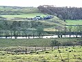
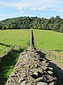
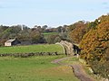
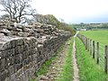
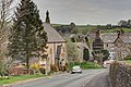
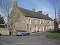
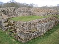
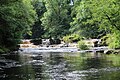
English: Upper Denton is a village and civil parish in the City of Carlisle in Cumbria, England, about 1 kilometre north of the A69 road linking Haltwhistle and Brampton. At the 2001 census it had a population of 92. The village is situated on the line of the Roman Stanegate which ran from Corbridge (Coria) to Carlisle (Luguvalium). Just 1 kilometre to the north across the river Irthing is Birdoswald fort on Hadrian's Wall. Nearby villages include Gilsland, Greenhead and Lanercost.

localité britannique du comté anglais de Cumbria  | |||||
| Téléverser des médias | |||||
| Nature de l’élément | |||||
|---|---|---|---|---|---|
| Lieu | cité de Carlisle, Cumbria, Angleterre du Nord-Ouest, Angleterre | ||||
| Population |
| ||||
 | |||||
Sous-catégories
Cette catégorie comprend 5 sous-catégories, dont les 5 ci-dessous.
Média dans la catégorie « Upper Denton »
Cette catégorie comprend 167 fichiers, dont les 167 ci-dessous.
-
 'This monument is in the care .... ' - geograph.org.uk - 4173400.jpg 640 × 480 ; 99 kio
-
 1-4, Hall Terrace upper.jpg 8 000 × 6 000 ; 11 Mio
-
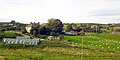
 156513 at Upper Denton level crossing - August 2016 - geograph.org.uk - 5095220.jpg 1 250 × 855 ; 764 kio
-
 66108 at Upper Denton crossing - September 2016 - geograph.org.uk - 5122917.jpg 1 250 × 811 ; 1 007 kio
-
 66302 at Upper Denton crossing - September 2016 - geograph.org.uk - 5122929.jpg 1 250 × 823 ; 853 kio
-
 A real life saver - geograph.org.uk - 2887091.jpg 800 × 600 ; 139 kio
-
 A69 enters Northumberland - geograph.org.uk - 3495118.jpg 640 × 462 ; 58 kio
-
 An Oxbow of the River Irthing - geograph.org.uk - 1271002.jpg 480 × 640 ; 53 kio
-
 Approaching the railway line at Gilsland - geograph.org.uk - 6435261.jpg 1 600 × 1 200 ; 514 kio
-
 Burn at Gilsland - geograph.org.uk - 3944164.jpg 640 × 427 ; 354 kio
-
 Bush Nook - geograph.org.uk - 2734645.jpg 3 700 × 2 592 ; 1,26 Mio
-
 Carlisle to Newcastle railway - geograph.org.uk - 2530377.jpg 800 × 531 ; 123 kio
-
 Carlisle to Newcastle railway - geograph.org.uk - 2530387.jpg 800 × 531 ; 119 kio
-
 Cattle in the Vallum - geograph.org.uk - 207967.jpg 640 × 480 ; 80 kio
-

-
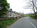
 Cottages in Gilsland - geograph.org.uk - 4588587.jpg 640 × 480 ; 86 kio
-
 Country west of Gisland - geograph.org.uk - 6279962.jpg 1 024 × 512 ; 161 kio
-
 Date stone on Gilsland Methodist Church - geograph.org.uk - 3203752.jpg 640 × 480 ; 92 kio
-
 Denton Mains - geograph.org.uk - 1822882.jpg 600 × 450 ; 268 kio
-
 Derelict house on Hadrian's Wall, Gisland - geograph.org.uk - 6279937.jpg 1 024 × 512 ; 166 kio
-
 Direction Sign – Signpost in Gilsland - geograph.org.uk - 6509754.jpg 528 × 960 ; 86 kio
-
 Direction Sign – Signpost in Gilsland - geograph.org.uk - 6565371.jpg 720 × 960 ; 257 kio
-
 Earthwork, Upper Denton (2) - geograph.org.uk - 1558659.jpg 640 × 480 ; 102 kio
-
 Earthwork, Upper Denton - geograph.org.uk - 1558638.jpg 640 × 480 ; 101 kio
-
 Entering Northumberland at Gilsland - geograph.org.uk - 3478315.jpg 640 × 455 ; 77 kio
-
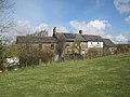 Farm at Upper Denton - geograph.org.uk - 1822848.jpg 600 × 450 ; 302 kio
-
 Farm at Upper Denton - geograph.org.uk - 1822858.jpg 600 × 450 ; 314 kio
-
 Farm at Upper Denton - geograph.org.uk - 1822860.jpg 600 × 450 ; 308 kio
-
 Farm road at Gilsland - geograph.org.uk - 2236565.jpg 640 × 480 ; 94 kio
-
 Farm Road End Cattle Grid - geograph.org.uk - 325018.jpg 640 × 480 ; 79 kio
-
 Farmland south west of Gilsland - geograph.org.uk - 3431007.jpg 640 × 637 ; 63 kio
-
 Farmland, Gilsland - geograph.org.uk - 3431024.jpg 640 × 570 ; 66 kio
-
 Follysyke Cottages - geograph.org.uk - 424039.jpg 640 × 480 ; 98 kio
-
 Freight train heading for Carlisle - geograph.org.uk - 3501456.jpg 2 592 × 1 944 ; 1,42 Mio
-
 Gilsland (2) - geograph.org.uk - 3203759.jpg 640 × 480 ; 83 kio
-
 Gilsland - geograph.org.uk - 3203756.jpg 640 × 480 ; 106 kio
-
 Gilsland - geograph.org.uk - 4205402.jpg 1 024 × 768 ; 163 kio
-
 Gilsland Church of England Primary school - geograph.org.uk - 3944167.jpg 640 × 427 ; 380 kio
-
 Gilsland Methodist Church - geograph.org.uk - 3203742.jpg 640 × 480 ; 76 kio
-
 Grazing, Lanerton - geograph.org.uk - 3430993.jpg 640 × 548 ; 52 kio
-
 Grazing, Upper Denton - geograph.org.uk - 3430999.jpg 640 × 632 ; 68 kio
-
 Hadrian's Wall - geograph.org.uk - 2530343.jpg 800 × 531 ; 124 kio
-
 Hadrian's Wall - geograph.org.uk - 2530359.jpg 800 × 531 ; 126 kio
-

-

-
 Hadrian's Wall at Birdoswald - geograph.org.uk - 552097.jpg 480 × 640 ; 135 kio
-
 Hadrian's Wall at Willowford - geograph.org.uk - 1836055.jpg 600 × 450 ; 259 kio
-
 Hadrian's Wall at Willowford - geograph.org.uk - 2236577.jpg 640 × 480 ; 105 kio
-
 Hadrian's Wall at Willowford, 1969 - geograph.org.uk - 3330098.jpg 640 × 401 ; 72 kio
-
 Hadrian's Wall at Willowford, 1969 - geograph.org.uk - 3330116.jpg 640 × 356 ; 54 kio
-

-
-

-
 Hadrian's Wall east of Willowford Farm - geograph.org.uk - 3203729.jpg 640 × 480 ; 88 kio
-
 Hadrian's Wall marches east - geograph.org.uk - 3490126.jpg 480 × 640 ; 135 kio
-
 Hadrian's Wall National Trail, near Birdoswald - geograph.org.uk - 552093.jpg 640 × 480 ; 120 kio
-
 Hadrian's Wall near Willowford - geograph.org.uk - 3501493.jpg 2 592 × 1 944 ; 1,46 Mio
-
 Haugh west of Willowford Farm - geograph.org.uk - 3157840.jpg 640 × 480 ; 65 kio
-
 House of Meg Tea Rooms - geograph.org.uk - 5091743.jpg 640 × 480 ; 113 kio
-
 House of Meg Tea Rooms - Gilsland - geograph.org.uk - 4115369.jpg 4 243 × 3 159 ; 5,21 Mio
-
 Irthing valley at Willowford, 1969 - geograph.org.uk - 3330015.jpg 640 × 347 ; 58 kio
-
 Level crossing at Upper Denton - geograph.org.uk - 1932562.jpg 640 × 480 ; 105 kio
-
 Level crossing at Upper Denton - geograph.org.uk - 1932563.jpg 640 × 480 ; 80 kio
-
 Level crossing east of Upper Denton - geograph.org.uk - 1558732.jpg 640 × 480 ; 94 kio
-
 Level Crossing near Upper Denton - geograph.org.uk - 1822250.jpg 600 × 450 ; 218 kio
-
 Level Crossing near Upper Denton - geograph.org.uk - 1822262.jpg 600 × 450 ; 237 kio
-
 Level crossing near Willowford - geograph.org.uk - 4574400.jpg 640 × 480 ; 74 kio
-
 Level crossing, Upper Denton (2) - geograph.org.uk - 1558690.jpg 640 × 480 ; 94 kio
-
 Level crossing, Upper Denton - geograph.org.uk - 1558667.jpg 640 × 479 ; 96 kio
-
 Lime Kilns and Disused Quarry near Tindale - geograph.org.uk - 479079.jpg 640 × 480 ; 70 kio
-
 Looking east at Upper Denton level crossing - geograph.org.uk - 3919516.jpg 1 800 × 1 197 ; 490 kio
-
 Looking west from level crossing - geograph.org.uk - 3919519.jpg 1 800 × 1 197 ; 486 kio
-
 Manned Level Crossing at Denton Village - geograph.org.uk - 1822865.jpg 600 × 450 ; 303 kio
-
 Meadow near Chapelburn - geograph.org.uk - 1932553.jpg 640 × 480 ; 67 kio
-
 Methodist Church, Gilsland - geograph.org.uk - 1822158.jpg 600 × 450 ; 281 kio
-
 Milecastle 48, Gilsland - geograph.org.uk - 2530409.jpg 800 × 531 ; 163 kio
-
 Milecastle 48, Gilsland - geograph.org.uk - 2530418.jpg 800 × 531 ; 164 kio
-
 Milecastle 48, Gilsland - geograph.org.uk - 2530420.jpg 800 × 531 ; 198 kio
-
 Newcastle to Carlisle Railway - geograph.org.uk - 1485269.jpg 640 × 427 ; 86 kio
-
 Newcastle to Carlisle Railway near Upper Denton - geograph.org.uk - 1822276.jpg 600 × 450 ; 323 kio
-

-
 Orchard House, Gilsland, Cumbria - geograph.org.uk - 5063788.jpg 640 × 427 ; 99 kio
-
 Pasture land south of Denton Mains - geograph.org.uk - 1558789.jpg 640 × 480 ; 74 kio
-
 Pasture land southwest of Denton Mains - geograph.org.uk - 1558801.jpg 640 × 480 ; 80 kio
-
 Plantation and poles - geograph.org.uk - 497037.jpg 640 × 480 ; 147 kio
-
 Plaque at Willowford Farm - geograph.org.uk - 3501515.jpg 2 592 × 1 944 ; 1,69 Mio
-
 Poltross Burn - Milecastle 48 - geograph.org.uk - 4587000.jpg 1 600 × 1 064 ; 643 kio
-
 Poltross Burn Milecastle - geograph.org.uk - 5368034.jpg 640 × 480 ; 110 kio
-
 Railway line at Gilsland, 1969 - geograph.org.uk - 3329958.jpg 640 × 347 ; 50 kio
-

-
 Railway tracks east of Upper Denton - geograph.org.uk - 1558674.jpg 640 × 480 ; 75 kio
-
 Railway tracks east of Upper Denton - geograph.org.uk - 1558768.jpg 640 × 480 ; 114 kio
-
 Railway viaduct over Poltross Burn - geograph.org.uk - 844509.jpg 480 × 640 ; 128 kio
-
 Remains of Milecastle 49 on Hadrian's Wall - geograph.org.uk - 4971764.jpg 1 600 × 1 424 ; 650 kio
-
 Roachburn Cottages - geograph.org.uk - 424041.jpg 640 × 480 ; 102 kio
-
 Road and railway at Upper Denton - geograph.org.uk - 1932557.jpg 640 × 480 ; 94 kio
-
 Road and railway east of Upper Denton - geograph.org.uk - 1932579.jpg 640 × 480 ; 73 kio
-
 Road to Upper Denton and the Methodist Church - geograph.org.uk - 3944143.jpg 640 × 427 ; 383 kio
-
 Rough grazing near Gilsland - geograph.org.uk - 3431014.jpg 640 × 525 ; 50 kio
-
 Rough pastures west of Gilsland - geograph.org.uk - 3203796.jpg 640 × 480 ; 91 kio
-
 Shallow lough west of Shawfield - geograph.org.uk - 1564413.jpg 640 × 480 ; 61 kio
-
 Sheep feeding near Palmer Hill - geograph.org.uk - 637132.jpg 640 × 480 ; 65 kio
-
 Straight as a die - geograph.org.uk - 2235967.jpg 640 × 480 ; 88 kio
-
 Tea Room and Terraced Houses, Gilsland - geograph.org.uk - 1822234.jpg 600 × 450 ; 312 kio
-

-
 The Eastern Abutment of Willowford Roman Bridge - geograph.org.uk - 4115391.jpg 4 470 × 3 282 ; 5,58 Mio
-
 The Old Vicarage - geograph.org.uk - 3944155.jpg 427 × 640 ; 396 kio
-
 The old Vicarage at Gilsland - geograph.org.uk - 3454638.jpg 800 × 643 ; 199 kio
-
 The old vicarage, Gilsland - geograph.org.uk - 1943016.jpg 640 × 480 ; 91 kio
-
 The Poltross burn - geograph.org.uk - 3706115.jpg 1 024 × 768 ; 231 kio
-

-

-

-

-

-

-

-
 Track to Willowford - geograph.org.uk - 3944129.jpg 427 × 640 ; 368 kio
-
 Train passing milecastle at Gilsland, 1969 - geograph.org.uk - 3329950.jpg 640 × 321 ; 37 kio
-
 Turret 48b (Willowford West) - geograph.org.uk - 4587041.jpg 1 600 × 1 064 ; 398 kio
-
 Turret 48B near Willowford - geograph.org.uk - 1836051.jpg 600 × 450 ; 345 kio
-
 Unnamed Burn near Denton Mains - geograph.org.uk - 1822878.jpg 600 × 450 ; 301 kio
-
 Upper Denton - geograph.org.uk - 1492779.jpg 640 × 419 ; 114 kio
-
 Upper Denton - geograph.org.uk - 1558698.jpg 640 × 480 ; 83 kio
-
 Upper Denton Level Crossing - geograph.org.uk - 1822870.jpg 600 × 450 ; 238 kio
-
 Upper Denton Level Crossing - geograph.org.uk - 6170073.jpg 1 600 × 1 200 ; 513 kio
-
 Upper Denton level crossing from south side July 2014.JPG 2 252 × 1 956 ; 656 kio
-
 Valley of River Irthing west of Gilsland - geograph.org.uk - 6120566.jpg 1 024 × 767 ; 325 kio
-
 Viaduct over Poltross Burn - geograph.org.uk - 954601.jpg 480 × 640 ; 127 kio
-
 View towards Willowford Farm and Hadrian's Wall - geograph.org.uk - 1847581.jpg 600 × 450 ; 312 kio
-
 VTEC diversions - 16 September 2016 (5) - geograph.org.uk - 5123002.jpg 1 250 × 905 ; 978 kio
-
 Walking uphill towards Gilsland - geograph.org.uk - 2887082.jpg 800 × 600 ; 96 kio
-
 Waterfall on the River Irthing - geograph.org.uk - 5063765.jpg 640 × 427 ; 125 kio
-
 Willowford - geograph.org.uk - 5395426.jpg 640 × 427 ; 94 kio
-
 Willowford Farm and B^B - geograph.org.uk - 1836053.jpg 600 × 450 ; 244 kio
-
 Willowford Farm from the North - geograph.org.uk - 6120575.jpg 1 024 × 768 ; 274 kio
-
 Willowford Hill - geograph.org.uk - 4574406.jpg 640 × 480 ; 59 kio
-
 Woodend Bridge - geograph.org.uk - 424048.jpg 640 × 480 ; 101 kio
-
 (Part of) Thirlwall Common (South Side) (2) - geograph.org.uk - 853799.jpg 640 × 480 ; 69 kio
-
 (Part of) Thirlwall Common (SouthSide) - geograph.org.uk - 853784.jpg 640 × 480 ; 58 kio
-
 Brampton to Lambley Railway - geograph.org.uk - 1485434.jpg 640 × 411 ; 148 kio
-
 Bridge over Carling Gill - geograph.org.uk - 749047.jpg 640 × 480 ; 95 kio
-
 Bull warning sign - geograph.org.uk - 749125.jpg 640 × 480 ; 76 kio
-
 Converted barn at Highstead Ash - geograph.org.uk - 637142.jpg 640 × 480 ; 60 kio
-
 Derelict Building - geograph.org.uk - 460651.jpg 640 × 427 ; 97 kio
-
 Disused quarry near Temon Bridge - geograph.org.uk - 749027.jpg 640 × 480 ; 66 kio
-
 Dusk Mole Hills - geograph.org.uk - 325085.jpg 640 × 480 ; 53 kio
-
 Farm land near Chapelburn - geograph.org.uk - 325042.jpg 640 × 480 ; 62 kio
-
 Fields near Cleugh Head - geograph.org.uk - 652404.jpg 640 × 480 ; 261 kio
-
 Footpath above Closegill - geograph.org.uk - 749061.jpg 640 × 480 ; 76 kio
-
 Footpath near Rob's Pike - geograph.org.uk - 749119.jpg 480 × 640 ; 121 kio
-
 Hadrian's Wall - geograph.org.uk - 723993.jpg 640 × 427 ; 71 kio
-
 Hadrian's Wall at Birdoswald - geograph.org.uk - 552099.jpg 640 × 480 ; 118 kio
-
 Hadrian's Wall Path - geograph.org.uk - 207960.jpg 640 × 480 ; 92 kio
-
 High House Farm - geograph.org.uk - 207969.jpg 640 × 480 ; 74 kio
-
 Junction A69 - geograph.org.uk - 325079.jpg 640 × 480 ; 50 kio
-
 Leahill Farm - geograph.org.uk - 207961.jpg 640 × 480 ; 80 kio
-
 Mobile phone masts near Roachburn Farm - geograph.org.uk - 479084.jpg 640 × 480 ; 57 kio
-
 Pipes in burn - geograph.org.uk - 325064.jpg 480 × 640 ; 88 kio
-
 Pond near Shawfield Farm - geograph.org.uk - 302275.jpg 640 × 426 ; 113 kio
-
 Shawfield Farm - geograph.org.uk - 296947.jpg 640 × 480 ; 83 kio
-
 Sheep enclosure and hut - geograph.org.uk - 653368.jpg 640 × 479 ; 262 kio
-
 Stream near Miller Hill - geograph.org.uk - 241286.jpg 640 × 480 ; 93 kio
-
 The road from Dumblar Rigg. - geograph.org.uk - 637145.jpg 640 × 480 ; 85 kio
-
 The Road to Tindale - geograph.org.uk - 424044.jpg 640 × 480 ; 102 kio
-
 Thirlwall Common - geograph.org.uk - 6651.jpg 640 × 480 ; 57 kio
-
 Upper Denton level crossing - geograph.org.uk - 445341.jpg 640 × 480 ; 76 kio


_-_geograph.org.uk_-_1558659.jpg)


_-_geograph.org.uk_-_3203759.jpg)


_-_geograph.org.uk_-_3203799.jpg)


_-_geograph.org.uk_-_1558690.jpg)


_-_geograph.org.uk_-_3157744.jpg)


_-_geograph.org.uk_-_4587041.jpg)


_-_geograph.org.uk_-_5123002.jpg)


_Thirlwall_Common_(South_Side)_(2)_-_geograph.org.uk_-_853799.jpg)
_Thirlwall_Common_(SouthSide)_-_geograph.org.uk_-_853784.jpg)


