Category:Denton Fell
Jump to navigation
Jump to search
Media in category "Denton Fell"
The following 92 files are in this category, out of 92 total.
-
 A gruesome tally of exterminated moles. - geograph.org.uk - 497052.jpg 640 × 436; 130 KB
-
-
-

-

-
-
-

-
-

-

-
-

-
-

-

-

-

-
 Denton Fell - geograph.org.uk - 755406.jpg 640 × 480; 55 KB
-
 Disused quarry - geograph.org.uk - 759791.jpg 640 × 480; 98 KB
-
 Edge of large plantation on Denton Fell - geograph.org.uk - 603283.jpg 640 × 480; 172 KB
-

-

-

-
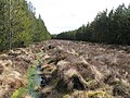
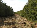
 Firebreak in the plantation on Black Rigg - geograph.org.uk - 759714.jpg 480 × 640; 111 KB
-

-

-

-

-

-

-

-

-
-
-
-

-

-

-

-
-

-

-
 Gate across a ditch - geograph.org.uk - 653361.jpg 640 × 480; 269 KB
-
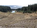
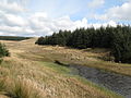
 Lake and valley on Denton Fell (2) - geograph.org.uk - 760873.jpg 640 × 480; 83 KB
-
 Lake and valley on Denton Fell - geograph.org.uk - 759821.jpg 640 × 480; 84 KB
-
 Lake below Whamoss Rigg (2) - geograph.org.uk - 760784.jpg 640 × 480; 82 KB
-
 Lake below Whamoss Rigg (3) - geograph.org.uk - 760792.jpg 640 × 480; 54 KB
-
 Lake below Whamoss Rigg - geograph.org.uk - 755409.jpg 640 × 480; 88 KB
-
 Lake below Whamoss Rigg - geograph.org.uk - 759823.jpg 640 × 480; 72 KB
-

-

-

-

-

-

-

-

-

-
-

-

-

-
 Old mine building on Denton Fell - geograph.org.uk - 759828.jpg 640 × 480; 97 KB
-
 Old mining area on Denton Fell - geograph.org.uk - 755413.jpg 640 × 480; 81 KB
-

-
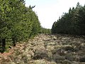
 Plantation on Denton Fell (2) - geograph.org.uk - 759802.jpg 640 × 480; 74 KB
-
 Plantation on Denton Fell - geograph.org.uk - 759799.jpg 640 × 480; 71 KB
-
 Plantation southwest of Whamoss Rigg - geograph.org.uk - 760848.jpg 640 × 480; 80 KB
-
 Remains of old mine on Denton Fell - geograph.org.uk - 759830.jpg 640 × 480; 125 KB
-

-
 Rough pastures west of Denton Fell - geograph.org.uk - 749049.jpg 640 × 480; 72 KB
-

-

-

-

-
 Tindale Tarn - geograph.org.uk - 1776879.jpg 1,024 × 768; 132 KB
-

-

-

-
-
-
-

-

-

-
-

-

-

-
 Valley and stream in Denton Fell - geograph.org.uk - 759811.jpg 640 × 480; 96 KB
-
 Valley in Denton Fell - geograph.org.uk - 759809.jpg 640 × 480; 73 KB


_-_geograph.org.uk_-_760855.jpg)


_-_geograph.org.uk_-_759757.jpg)
_-_geograph.org.uk_-_762266.jpg)

_-_geograph.org.uk_-_760884.jpg)
_-_geograph.org.uk_-_762098.jpg)
_-_geograph.org.uk_-_760891.jpg)
_-_geograph.org.uk_-_762105.jpg)
_-_geograph.org.uk_-_760900.jpg)
_-_geograph.org.uk_-_762125.jpg)
_-_geograph.org.uk_-_760901.jpg)
_-_geograph.org.uk_-_762168.jpg)
_-_geograph.org.uk_-_760903.jpg)
_-_geograph.org.uk_-_760904.jpg)
_-_geograph.org.uk_-_762092.jpg)
_-_geograph.org.uk_-_762173.jpg)


_-_geograph.org.uk_-_760873.jpg)

_-_geograph.org.uk_-_760784.jpg)
_-_geograph.org.uk_-_760792.jpg)


_firebreak_in_the_plantation_on_Glenwhistle_Hill_-_geograph.org.uk_-_762220.jpg)
_-_geograph.org.uk_-_762276.jpg)


_-_geograph.org.uk_-_762085.jpg)
_-_geograph.org.uk_-_762121.jpg)
_-_geograph.org.uk_-_762203.jpg)
_-_geograph.org.uk_-_762179.jpg)
_-_geograph.org.uk_-_762197.jpg)
_-_geograph.org.uk_-_762210.jpg)


_-_geograph.org.uk_-_759802.jpg)


_-_geograph.org.uk_-_759700.jpg)
_-_geograph.org.uk_-_759734.jpg)
_-_geograph.org.uk_-_759703.jpg)
_-_geograph.org.uk_-_759743.jpg)
_-_geograph.org.uk_-_759709.jpg)
_-_geograph.org.uk_-_759774.jpg)
_-_geograph.org.uk_-_759713.jpg)
_-_geograph.org.uk_-_759775.jpg)


_-_geograph.org.uk_-_759804.jpg)
_-_geograph.org.uk_-_759789.jpg)
_-_geograph.org.uk_-_759794.jpg)
_-_geograph.org.uk_-_759801.jpg)
_-_geograph.org.uk_-_759807.jpg)
_-_geograph.org.uk_-_759808.jpg)
_-_geograph.org.uk_-_760814.jpg)
_-_geograph.org.uk_-_760819.jpg)
_-_geograph.org.uk_-_760831.jpg)
_-_geograph.org.uk_-_762248.jpg)
_-_geograph.org.uk_-_762254.jpg)
_-_geograph.org.uk_-_759787.jpg)