Category:Utkinton
Aller à la navigation
Aller à la recherche
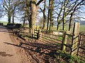
English: Utkinton is a small village and former civil parish in the unitary authority of Cheshire West and Chester and the ceremonial county of Cheshire, England. It is approximately 8 miles west of Winsford and north of Tarporley and 9 miles east of Chester. Utkinton is at the heart of the local farming community. The upper part of Utkinton is known as 'Quarry Bank'.
village britannique  | |||||
| Téléverser des médias | |||||
| Nature de l’élément | |||||
|---|---|---|---|---|---|
| Lieu | Utkinton and Cotebrook, Cheshire West and Chester, Cheshire, Angleterre du Nord-Ouest, Angleterre | ||||
 | |||||
Sous-catégories
Cette catégorie comprend 2 sous-catégories, dont les 2 ci-dessous.
U
- Utkinton Hall (7 F)
- Utkinton War Memorial (1 F)
Média dans la catégorie « Utkinton »
Cette catégorie comprend 11 fichiers, dont les 11 ci-dessous.
-
 16, Northgate, Utkinton.jpg 3 535 × 2 424 ; 625 kio
-
 Bailiff's House 335.jpg 1 600 × 1 200 ; 453 kio
-
 Footpath East from Utkinton Lane - geograph.org.uk - 332011.jpg 640 × 480 ; 272 kio
-
 Goat in Utkinton - geograph.org.uk - 332004.jpg 640 × 480 ; 241 kio
-
 Quarrybank Frost and snow in mid-Cheshire 1728550 33d13449.jpg 640 × 361 ; 105 kio
-
 Quarrybank Frost and snow in mid-Cheshire 1728555 3d2ceee6.jpg 640 × 442 ; 139 kio
-
 Sandstone Trail Signpost - geograph.org.uk - 331801.jpg 480 × 640 ; 261 kio
-
 Vr utkinton.png 591 × 443 ; 63 kio
-
 Utkinton from the South - geograph.org.uk - 331836.jpg 640 × 480 ; 175 kio
-
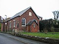 Utkinton Methodist Church - geograph.org.uk - 300947.jpg 640 × 480 ; 91 kio
-


