Category:Venice Boulevard
Jump to navigation
Jump to search
English: Venice Boulevard is an east-west street in the City of Los Angeles and Los Angeles County, Southern California.
- It is also designated from CA-1 (Lincoln Blvd.) to Interstate 10 (Santa Monica Freeway) as California State Route 187.
- Venice Boulevard begins at the Pacific Ocean in Venice Beach, and runs eastward and inland through various L.A. districts and Culver City, to its terminous in southeastern Downtown Los Angeles.
major east–west thoroughfare in Los Angeles, California, USA | |||||
| Upload media | |||||
| Instance of | |||||
|---|---|---|---|---|---|
| Location | Los Angeles County, California, Pacific States Region | ||||
| Has part(s) | |||||
| |||||
Subcategories
This category has the following 2 subcategories, out of 2 total.
H
V
Media in category "Venice Boulevard"
The following 17 files are in this category, out of 17 total.
-
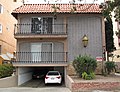
 11836 Venice Blvd, LA.jpg 3,813 × 2,375; 2.07 MB
-
 12628 Venice Blvd, LA.jpg 3,222 × 2,448; 2.1 MB
-
 12750 Venice Blvd, LA.jpg 2,484 × 1,836; 1.36 MB
-
 1410 Venice Blvd, Venice, Los Angeles.jpg 3,324 × 2,538; 2.47 MB
-
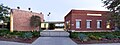
 Actors' Gang at Ivy Substation in Media Park, Culver City, California.JPG 3,264 × 2,448; 2.59 MB
-
 Ivy Substation Actors Gang Culver Boulevard Venice Boulevard.jpg 3,873 × 2,275; 2.79 MB
-
 L & M Arts, Venice, California.jpg 2,400 × 903; 1.72 MB
-
 Los Angeles Pacific Company Ivy Park Substation.JPG 2,549 × 1,515; 941 KB
-
 Los Angeles, CA, W North Venice Blvd, 2012 - panoramio.jpg 4,000 × 3,000; 4.64 MB
-
 Loyola High LA (cropped).jpg 703 × 563; 230 KB
-
 Loyola High LA.jpg 800 × 600; 200 KB
-
 Robinson Beautilities Venice Blvd LA.jpg 4,298 × 2,480; 2.75 MB
-
 Space Shuttle Endeavour in Los Angeles - 2012 (37919560104).jpg 3,811 × 2,858; 10.57 MB
-
 Traffic Jam,1953.jpg 4,479 × 5,645; 13.26 MB
-
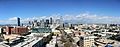 Ultimate Los Angeles - panoramio.jpg 6,000 × 2,336; 4.67 MB
-
 Venice City Hall.jpg 3,097 × 2,306; 2.09 MB
-
West Traffic Division Felony Hit & Run Traffic Collision.webm 32 s, 1,920 × 1,080; 5.87 MB


.jpg)


.jpg)

