Category:Verwersdijk 8
Jump to navigation
Jump to search
| Object location | | View all coordinates using: OpenStreetMap |
|---|
 | |||||
| Upload media | |||||
| Instance of | |||||
|---|---|---|---|---|---|
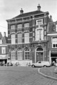
| Location | Delft, South Holland, Netherlands | ||||
| Street address |
| ||||
| Heritage designation |
| ||||
 | |||||
|
This is a category about rijksmonument number 525343
|
| Address |
|
Media in category "Verwersdijk 8"
The following 5 files are in this category, out of 5 total.
-
 Delft - Verwersdijk 8 (2).jpg 1,944 × 2,592; 1.63 MB
-
 Delft - Verwersdijk 8.jpg 2,592 × 1,944; 1.77 MB
-
 Delft building 9.JPG 1,944 × 2,592; 1.76 MB
-
 Gevel - Delft - 20053008 - RCE.jpg 803 × 1,200; 205 KB
-
 Overzicht voorgevel van de Openbare Lagere School - Delft - 20382167 - RCE.jpg 1,200 × 954; 294 KB
.jpg)


