Category:Victory Boulevard (Los Angeles)
Jump to navigation
Jump to search
English: Victory Boulevard is a major east-west arterial road that runs traversing the entire length of the San Fernando Valley in Los Angeles County, Southern California. Through much of the San Fernando Valley, Victory Boulevard divides the affluent communities on the southern side of the Valley (Woodland Hills, Tarzana, and Encino), from the less affluent communities of the central Valley (Canoga Park, Reseda, Lake Balboa, Van Nuys, and North Hollywood).
Polski: Victory Boulevard – ulica w Los Angeles, głównie w dzielnicy San Fernando Valley biegnąca ze wschodu na zachód. Rozciąga się od West Hills do Burbank. Długość – ok. 40 km (25 mil). Podczas wyznaczania dzielnicy Van Nuys w 1911 roku Victory Blvd. nosiła nazwę 7th Avenue (Siódma Aleja), w 1916 zmieniono nazwę na Leesdale Avenue. Obecna nazwę nosi od lat 20., na cześć żołnierzy wracających z frontów I wojny światowej.
street in the San Fernando Valley, mostly in Los Angeles, California USA  | |||||
| Upload media | |||||
| Instance of | |||||
|---|---|---|---|---|---|
| Location |
| ||||
| Maintained by | |||||
| |||||
Subcategories
This category has the following 2 subcategories, out of 2 total.
L
W
Media in category "Victory Boulevard (Los Angeles)"
The following 64 files are in this category, out of 64 total.
-
 7-11 Plaza on Victory-Reseda - panoramio.jpg 2,046 × 1,341; 966 KB
-
 Bull creek north from victory.jpg 2,400 × 1,715; 1,012 KB
-
 Canoga Ave.-Victory Blvd. - panoramio.jpg 2,014 × 1,490; 1.08 MB
-
 Canoga Park, California - panoramio.jpg 2,048 × 1,536; 932 KB
-
 Carl's Jr. - panoramio.jpg 2,048 × 1,534; 1.05 MB
-
 Carl's Jr., Loehmann's Plaza - panoramio.jpg 2,043 × 1,221; 880 KB
-
 Carls' Jr. Restaurant - panoramio.jpg 2,002 × 1,474; 1.29 MB
-
 Cottage Beef Bowl, Burbank.jpg 2,526 × 1,532; 862 KB
-
 Encino Farmer's Market - panoramio.jpg 2,474 × 1,766; 1.31 MB
-
 Encino, Los Angeles, CA, USA - panoramio (102).jpg 3,264 × 2,448; 2.29 MB
-
 Frederick's of Hollywood - panoramio.jpg 2,008 × 1,480; 1.04 MB
-
 Gyro Firehouse Restaurant - panoramio.jpg 2,008 × 1,480; 1.11 MB
-
 GYROS - panoramio.jpg 2,592 × 1,936; 1.65 MB
-
 Intersections in Van Nuys in 2002.jpg 583 × 363; 103 KB
-
 Jiffy Lube - panoramio.jpg 2,012 × 1,486; 1.13 MB
-
 LA FITNESS Signature Club - panoramio.jpg 2,048 × 1,536; 1.2 MB
-
 LAFD ambulance.jpg 1,000 × 750; 167 KB
-
 Lake Balboa, Los Angeles, CA, USA - panoramio (10).jpg 2,592 × 1,936; 1.55 MB
-
 Lake Balboa, Los Angeles, CA, USA - panoramio (11).jpg 2,592 × 1,936; 2.09 MB
-
 Lake Balboa, Los Angeles, CA, USA - panoramio (30).jpg 2,550 × 1,880; 751 KB
-
 Lake Balboa, Los Angeles, CA, USA - panoramio (34).jpg 3,264 × 2,448; 2.75 MB
-
 Lake Balboa, Los Angeles, CA, USA - panoramio (36).jpg 3,264 × 2,448; 2.81 MB
-
 Lake Balboa, Los Angeles, CA, USA - panoramio (37).jpg 3,264 × 2,448; 2.74 MB
-
 Lake Balboa, Los Angeles, CA, USA - panoramio (7).jpg 2,592 × 1,936; 2.47 MB
-
 Lake Balboa, Los Angeles, CA, USA - panoramio (8).jpg 2,592 × 1,936; 1.57 MB
-
 Lake Balboa, Los Angeles, CA, USA - panoramio (9).jpg 2,592 × 1,936; 2.5 MB
-
-
 Los Angeles River at Victory and White Oak.JPG 1,644 × 1,098; 290 KB
-
 Los Angeles, CA, USA - panoramio (23).jpg 3,264 × 2,448; 2.14 MB
-
 McDonald's - panoramio (4).jpg 1,994 × 1,462; 1,013 KB
-
 McDonald's - panoramio (6).jpg 2,592 × 1,936; 1.38 MB
-
 McDonald's on Reseda - panoramio.jpg 3,245 × 2,222; 1.65 MB
-
 Men's Wearhouse - panoramio.jpg 2,034 × 1,518; 938 KB
-
 Mobil Gas Station - panoramio (3).jpg 2,048 × 1,536; 949 KB
-
 Orange Line bike path Victory Blvd.jpg 1,600 × 1,280; 743 KB
-
 Pedlow Field Skate Park.JPG 3,053 × 1,847; 1.31 MB
-
 Pierce College - panoramio.jpg 2,004 × 1,476; 937 KB
-
 Pierce College Farm Center - panoramio.jpg 3,472 × 2,604; 2.07 MB
-
 Reseda, Los Angeles, CA, USA - panoramio (23).jpg 2,592 × 1,936; 1.97 MB
-
 Reseda, Los Angeles, CA, USA - panoramio (37).jpg 3,264 × 2,448; 1.99 MB
-
 Reseda, Los Angeles, CA, USA - panoramio (39).jpg 3,157 × 2,174; 895 KB
-
 Reseda, Los Angeles, CA, USA - panoramio (40).jpg 3,264 × 2,448; 2.48 MB
-
 Reseda-Victory Blvd. - panoramio (1).jpg 3,186 × 2,134; 1.58 MB
-
 Reseda-Victory Blvd. - panoramio.jpg 3,206 × 2,216; 1.69 MB
-
 Schaber's cafeteria North Hollywood matchbook cover.jpg 2,048 × 811; 1.11 MB
-
 Staples, Golfsmith, Nordstrom Rack - panoramio.jpg 2,022 × 1,502; 1,011 KB
-
 Street Scene on Victory Blvd. in Burbank.JPG 2,804 × 1,805; 991 KB
-
 Tampa-Victory Blvd. - panoramio.jpg 3,184 × 2,336; 2.03 MB
-
 Tonga Hut in North Hollywood.JPG 2,305 × 2,677; 1.45 MB
-
 Tujunga Wash.JPG 2,448 × 3,264; 1.69 MB
-
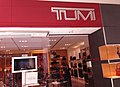 TUMI - panoramio.jpg 3,146 × 2,282; 1.59 MB
-
 Upper-las-virgenes-canyon-open-space-preserve-victory-trailhead.jpg 2,048 × 1,536; 964 KB
-
 Van Nuys, Los Angeles, CA, USA - panoramio (57).jpg 3,254 × 2,206; 1.05 MB
-
 Van Nuys, Los Angeles, CA, USA - panoramio (58).jpg 3,192 × 2,234; 918 KB
-
 Variel Ave.-Victory Blvd - panoramio.jpg 2,008 × 1,482; 1.05 MB
-
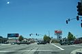
 Victory Blvd. @ Owensmouth - panoramio.jpg 2,048 × 1,536; 841 KB
-
 Victory Blvd. near 405 North - panoramio.jpg 4,288 × 3,216; 2.87 MB
-
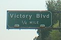 Victory Boulevard Exit from the 134.JPG 409 × 273; 37 KB
-
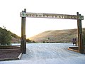
 Victory Gateway at Upper Los Virgenes.JPG 2,185 × 1,668; 840 KB
-
 Westfield Topanga Mall - panoramio (2).jpg 2,038 × 1,348; 1.56 MB
-
 Woodland Hills, Los Angeles, CA, USA - panoramio (1).jpg 3,174 × 2,322; 1.65 MB
-
 Woodland Hills, Los Angeles, CA, USA - panoramio (3).jpg 3,218 × 2,384; 1.17 MB
-
 Woodland Hills, Los Angeles, CA, USA - panoramio (4).jpg 3,264 × 2,448; 2.31 MB
-
 Woodland Hills, Los Angeles, CA, USA - panoramio.jpg 3,196 × 2,252; 1.72 MB


.jpg)


.jpg)
.jpg)
.jpg)
.jpg)
.jpg)
.jpg)
.jpg)
.jpg)
.jpg)
.jpg)

.jpg)
.jpg)
.jpg)


.jpg)


.jpg)
.jpg)
.jpg)
.jpg)
.jpg)


.jpg)
.jpg)


.jpg)
.jpg)
.jpg)
.jpg)
