Category:Virginia State Route 54
Jump to navigation
Jump to search
 | number: | (fifty-four) |
|---|---|---|
| State highways in Virginia: | 34 · 35 · 36 · 37 · 38 · 39 · 40 · 41 · 42 · 43 · 45 · 46 · 47 · 48 · 49 · 51 · 53 · 54 · 55 · 56 · 57 · 59 · 61 · 62 · 63 · 65 · 67 · 68 · 69 · 70 · 71 · 72 · 73 · 74 |
State highway in Hanover County, Virginia, US _at_U.S._Route_301_(Hanover_Courthouse_Road)_in_Hanover,_Hanover_County,_Virginia.jpg)  | |||||
| Upload media | |||||
| Instance of | |||||
|---|---|---|---|---|---|
| Location | Hanover County, Virginia | ||||
| Transport network | |||||
| Owned by | |||||
| Maintained by | |||||
| Inception |
| ||||
| Length |
| ||||
| |||||
English: Media related to Virginia State Route 54, a 18.67-mile (30.05 km) state highway in Hanover County, Virginia, United States.
Media in category "Virginia State Route 54"
The following 16 files are in this category, out of 16 total.
-
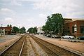
 19990205 22 CSX Ashland, Virginia (6620529727).jpg 1,800 × 1,178; 244 KB
-

-
 Ashland Station - NE Regional Train Coming.JPG 1,908 × 1,272; 767 KB
-
 Ashland, VA; US Bike Routes 1 and 76.jpg 3,648 × 2,736; 2.07 MB
-
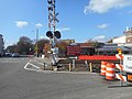
 Downtown Ashland (VA); Route 54 RR Xing Wayfinding Sign-1.jpg 3,648 × 2,736; 2.08 MB
-
 Downtown Ashland (VA); Route 54 RR Xing Wayfinding Sign-2.jpg 3,648 × 2,736; 2.05 MB
-
 Exit 92 on I-95.jpg 4,000 × 3,000; 2.11 MB
-
 Iron Horse Restaurant; Ashland, Virginia.jpg 3,648 × 2,736; 1.96 MB
-
 NB I-95 at Exit 92B (VA 54) in Ashland, VA (3845319010).jpg 1,600 × 1,200; 479 KB
-
 NB I-95 at Exits 92 A and B (VA 54) in Ashland, VA (3845318916).jpg 1,600 × 1,200; 474 KB
-
 NB I-95; One-and-a-half miles from Exits 92 A-B (VA 54); Ashland, VA (3844528159).jpg 1,600 × 1,200; 464 KB
-
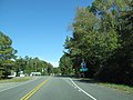
 NB US 301 at VA 54 Wye in Hanover Courthouse, VA.jpg 640 × 480; 77 KB
-
 NB US 301 south of VA 54 at Hanover Courthouse, VA.jpg 640 × 480; 52 KB
-
 US Route 301 - Virginia (8117283906).jpg 3,072 × 2,304; 989 KB
-
 VA 54 map.svg 1,205 × 709; 454 KB
-
 Virginia 54.svg 600 × 600; 3 KB
.jpg)


;_Route_54_RR_Xing_Wayfinding_Sign-1.jpg)
;_Route_54_RR_Xing_Wayfinding_Sign-2.jpg)


_in_Ashland,_VA_(3845319010).jpg)
_in_Ashland,_VA_(3845318916).jpg)
;_Ashland,_VA_(3844528159).jpg)


.jpg)