Category:Visbank (Geertruidenberg)
Jump to navigation
Jump to search
| Object location | | View all coordinates using: OpenStreetMap |
|---|
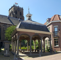
National monument at Vismarktstraat 17  | |||||
| Upload media | |||||
| Instance of | |||||
|---|---|---|---|---|---|
| Location | Geertruidenberg, North Brabant, Netherlands | ||||
| Street address |
| ||||
| Heritage designation |
| ||||
 | |||||
|
This is a category about rijksmonument number 16019
|
| Address |
|
Media in category "Visbank (Geertruidenberg)"
The following 11 files are in this category, out of 11 total.
-
 Aanzicht exterieur - Geertruidenberg - 20075859 - RCE.jpg 2,460 × 3,067; 1.51 MB
-
 Exterieur - Geertruidenberg - 20075857 - RCE.jpg 3,316 × 2,224; 1.9 MB
-
 Exterieur POMP EN HEK - Geertruidenberg - 20305667 - RCE.jpg 788 × 1,200; 267 KB
-

-
 Geertruidenberg - rijksmonument 16019 - Vismarktstraat 17 20111030.jpg 663 × 800; 238 KB
-
 Geertruidenberg - Vismarkt.jpg 1,944 × 2,592; 1.38 MB
-
 Geertruidenberg Vismarkt 1.png 907 × 840; 1.22 MB
-
 Geertruidenberg Vismarkt 2.png 1,633 × 1,600; 3.7 MB
-
 Geertruidenberg Vismarkt pomp.png 540 × 896; 956 KB
-
 Overzicht en pomp - Geertruidenberg - 20075858 - RCE.jpg 2,849 × 3,824; 1.81 MB
-
 Vismarkt - panoramio.jpg 1,944 × 2,592; 1.54 MB


