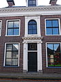
Category:Voorstraat 42, Kollum
Jump to navigation
Jump to search
| Object location | | View all coordinates using: OpenStreetMap |
|---|
building in Kollumerland en Nieuwkruisland, Netherlands  | |||||
| Upload media | |||||
| Instance of | |||||
|---|---|---|---|---|---|
| Location | Kollum, Noardeast-Fryslân, Friesland, Netherlands | ||||
| Street address |
| ||||
| Located on street |
| ||||
| Heritage designation |
| ||||
 | |||||
|
This is a category about rijksmonument number 23729
|
| Address |
|
Media in category "Voorstraat 42, Kollum"
The following 7 files are in this category, out of 7 total.
-
 Bethesda, Kollum.jpg 4,928 × 3,264; 4.5 MB
-
 Exterieur INGANGSPARTIJ - Kollum - 20292020 - RCE.jpg 777 × 1,200; 220 KB
-
 Exterieur OVERZICHT VOORGEVELS - Kollum - 20277039 - RCE.jpg 1,200 × 951; 244 KB
-
 Exterieur VOORGEVEL - Kollum - 20292021 - RCE.jpg 788 × 1,200; 230 KB
-
 Hoger, voorgevels - Kollum - 20126629 - RCE.jpg 1,200 × 823; 205 KB
-
 Oude Liedenhuis, Voorstraat 42, Kollum.JPG 3,061 × 4,081; 2.37 MB
-
 Voorgevel - Kollum - 20126628 - RCE.jpg 802 × 1,200; 189 KB


