Category:Walls, Shetland Islands
Jump to navigation
Jump to search
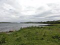
en:Walls, Shetland, known locally as Waas, ( Old Norse: Vagar = "Sheltered Bays" (voes) - the Ordnance Survey added the "ll" as they thought it was a corruption of "walls". Cf Vágar and Vágur in the Faroe Islands), is a settlement on the south side of West Mainland, Shetland Islands, at the head of Vaila Sound and sheltered even from southerly storms by the islands of Linga and Vaila.
village in Shetland Islands, Scotland, UK  | |||||
| Upload media | |||||
| Instance of | |||||
|---|---|---|---|---|---|
| Location |
| ||||
 | |||||
Media in category "Walls, Shetland Islands"
The following 60 files are in this category, out of 60 total.
-
 At Walls Show 2005 - geograph.org.uk - 85049.jpg 640 × 480; 100 KB
-
 Bayhall, Walls (geograph 1783650).jpg 1,516 × 1,151; 292 KB
-
 Bayhall, Walls (geograph 1783651).jpg 2,048 × 1,536; 581 KB
-
 Boats at Walls - geograph.org.uk - 102390.jpg 640 × 480; 87 KB
-
 Church at Walls - geograph.org.uk - 5318209.jpg 1,024 × 681; 105 KB
-
 Coastal Walk by the Voe at Walls - geograph.org.uk - 2046886.jpg 2,560 × 1,920; 1.8 MB
-
 Foula's shopping trolley - geograph.org.uk - 3798897.jpg 640 × 853; 386 KB
-
 Jetty at Walls - geograph.org.uk - 5041651.jpg 3,648 × 2,736; 3.84 MB
-
 Loading peats - geograph.org.uk - 3799751.jpg 640 × 480; 301 KB
-
 Loch of Kirkigarth - geograph.org.uk - 435574.jpg 640 × 480; 115 KB
-
 Looking across the harbour at Walls - geograph.org.uk - 972564.jpg 640 × 480; 84 KB
-
 Methodist Church, Walls - geograph.org.uk - 894459.jpg 640 × 467; 43 KB
-
 Mid Walls - Burrastow crossroads - geograph.org.uk - 533055.jpg 640 × 480; 60 KB
-
 New Advance, Walls - geograph.org.uk - 3798901.jpg 640 × 480; 281 KB
-
 New harbour facility for Walls - geograph.org.uk - 3931971.jpg 1,400 × 1,050; 338 KB
-
 New harbour, Walls - geograph.org.uk - 3798891.jpg 640 × 480; 242 KB
-
 New pier, Walls - geograph.org.uk - 3798884.jpg 640 × 480; 243 KB
-
 Old Bedford bus at Walls - geograph.org.uk - 972598.jpg 640 × 480; 74 KB
-

-
 Peat stacks near the Simli Field - geograph.org.uk - 93312.jpg 640 × 480; 177 KB
-
 Pier and houses at the end of Pier Road, Walls - geograph.org.uk - 5317994.jpg 1,024 × 681; 114 KB
-
 Pier, Walls - geograph.org.uk - 3798871.jpg 640 × 480; 259 KB
-
 Riskaness - geograph.org.uk - 148366.jpg 640 × 430; 74 KB
-
 Ruin on the waterfront - geograph.org.uk - 2035495.jpg 1,200 × 1,600; 424 KB
-
 Saltness - geograph.org.uk - 3798878.jpg 640 × 480; 252 KB
-
 Seals on the Jetty at Walls, Shetland - geograph.org.uk - 2605129.jpg 2,048 × 1,536; 802 KB
-
 Shore at Walls - geograph.org.uk - 972570.jpg 640 × 480; 75 KB
-
 Shoreline, Walls - geograph.org.uk - 3798864.jpg 640 × 480; 274 KB
-
 Slipway at Walls - geograph.org.uk - 5317987.jpg 1,024 × 681; 127 KB
-
 Smokeless Chimney IMG 2944 (19774085751).jpg 4,194 × 2,427; 3.59 MB
-
 Snaraness - geograph.org.uk - 145697.jpg 640 × 424; 102 KB
-
 St Paul's Kirk, Walls - geograph.org.uk - 894452.jpg 640 × 480; 53 KB
-
 Telephone box at Walls - geograph.org.uk - 971407.jpg 640 × 480; 79 KB
-
 The Cloka Burn in Walls - geograph.org.uk - 2047046.jpg 1,200 × 1,600; 616 KB
-
 Unloading ship at Walls pier - geograph.org.uk - 6183213.jpg 1,600 × 1,029; 203 KB
-
 Walls Bakery, Walls - geograph.org.uk - 971403.jpg 640 × 480; 65 KB
-
 Walls from South Voe - geograph.org.uk - 943742.jpg 640 × 427; 79 KB
-
 Walls from the Pier - geograph.org.uk - 2046969.jpg 2,560 × 1,920; 1.82 MB
-
 Walls Harbour - geograph.org.uk - 2046989.jpg 2,560 × 1,920; 1.68 MB
-
 Walls Harbour in the Evening - geograph.org.uk - 4625492.jpg 4,842 × 2,976; 1.92 MB
-
 Walls Health Centre (geograph 1783660).jpg 640 × 480; 60 KB
-
 Walls Marina View - geograph.org.uk - 3553657.jpg 2,546 × 1,902; 2.03 MB
-
 Walls Pier - geograph.org.uk - 2046979.jpg 2,560 × 1,920; 1.89 MB
-
 Walls Regatta club house - geograph.org.uk - 971417.jpg 640 × 480; 60 KB
-
 Walls Regatta club house sign - geograph.org.uk - 971421.jpg 640 × 480; 94 KB
-
 Walls sewerage pumping station - geograph.org.uk - 971413.jpg 640 × 480; 71 KB
-
 Walls Shetland banner Smokeless Chimney.jpg 4,194 × 599; 1.02 MB
-
 Walls Shetland banner.jpg 3,150 × 450; 444 KB
-
 Walls shop and Post Office - geograph.org.uk - 971398.jpg 640 × 480; 63 KB
-
 Walls slipway - geograph.org.uk - 971426.jpg 640 × 480; 83 KB
-
 Walls village centre - geograph.org.uk - 972615.jpg 640 × 480; 77 KB
-
 Walls War Memorial (geograph 1783666).jpg 480 × 640; 70 KB
-
 Walls, Shetland (7334176556).jpg 3,218 × 2,015; 2.15 MB
-
 Walls, Shetland Islands - geograph.org.uk - 3315371.jpg 567 × 378; 77 KB
-
 Bruntskerry - geograph.org.uk - 146731.jpg 640 × 425; 68 KB
-
 Da Leaans - geograph.org.uk - 145704.jpg 640 × 423; 88 KB
-
 Derelict Buildings - geograph.org.uk - 148926.jpg 640 × 480; 69 KB
-
 Littlure - geograph.org.uk - 148326.jpg 640 × 418; 56 KB
-

-
 The Gravens Garden - geograph.org.uk - 148764.jpg 640 × 361; 80 KB

.jpg)
.jpg)


.jpg)


.jpg)


.jpg)
.jpg)


