Category:Walpole Highway
Jump to navigation
Jump to search
village and civil parish in Norfolk, UK  .jpg) | |||||
| Upload media | |||||
| Instance of |
| ||||
|---|---|---|---|---|---|
| Location | King's Lynn and West Norfolk, Norfolk, East of England, England | ||||
| Area |
| ||||
 | |||||
Media in category "Walpole Highway"
The following 100 files are in this category, out of 100 total.
-
 A green house with three gable ends - geograph.org.uk - 2191605.jpg 2,848 × 2,136; 2.85 MB
-
 A thin blue line - geograph.org.uk - 1847078.jpg 2,848 × 2,136; 3.06 MB
-
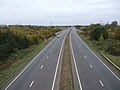
 A47 looking east from the flyover at Walpole Highway - geograph.org.uk - 6151889.jpg 3,456 × 2,592; 3.84 MB
-
 A47 looking south-west from the flyover at Walpole Highway - geograph.org.uk - 6151890.jpg 3,456 × 2,592; 3.91 MB
-
 A47 towards Peterborough - geograph.org.uk - 4716894.jpg 640 × 480; 59 KB
-
 Bridge over Smeeth Lode - geograph.org.uk - 946322.jpg 3,008 × 2,000; 3.57 MB
-
 Cobblers Lane - geograph.org.uk - 6234635.jpg 1,024 × 768; 196 KB
-
 Cottage in School Road, Walpole Highway - geograph.org.uk - 1823374.jpg 640 × 480; 130 KB
-
 Dovecot Lane - geograph.org.uk - 4716900.jpg 640 × 480; 74 KB
-
-
 Driveway to Willow Farm on Trinity Road, Walpole Highway - geograph.org.uk - 6199588.jpg 3,456 × 2,592; 3.97 MB
-
 Eastfield Farm - geograph.org.uk - 4716388.jpg 640 × 480; 43 KB
-
 Farm buildings, Mill Bank - geograph.org.uk - 4716878.jpg 640 × 480; 48 KB
-
 Farm track off Cobblers Lane - geograph.org.uk - 6234629.jpg 1,024 × 768; 170 KB
-
 Farmland off Walton Road - geograph.org.uk - 4716320.jpg 640 × 480; 49 KB
-
 Farmland on Mill Road, Walpole Highway - geograph.org.uk - 2191679.jpg 2,848 × 2,136; 2.89 MB
-
 Farmland towards Trinity Grange - geograph.org.uk - 4716877.jpg 640 × 480; 51 KB
-
 Faulkner House near Walton Highway, Norfolk - geograph.org.uk - 2182314.jpg 2,848 × 2,136; 2.94 MB
-
 Faulkner House, Walton Highway, Wisbech - geograph.org.uk - 2182300.jpg 2,848 × 2,136; 3.02 MB
-
 Fenland cereal fields - geograph.org.uk - 1963398.jpg 2,848 × 2,136; 3.04 MB
-
 Field off National Cycle Route 1 - geograph.org.uk - 4716903.jpg 640 × 480; 76 KB
-
 Flat farmland off Walton Road - geograph.org.uk - 4716316.jpg 640 × 480; 52 KB
-
 Gated entrance to Trinity Quay Farm - geograph.org.uk - 6199592.jpg 3,363 × 2,490; 3.58 MB
-
 Grazing off National Cycle Route 1 - geograph.org.uk - 4716879.jpg 640 × 480; 52 KB
-
 Green, yellow and blue - geograph.org.uk - 1846742.jpg 2,848 × 2,136; 3.07 MB
-
 Hog Holme Field - geograph.org.uk - 946257.jpg 3,008 × 2,000; 3.31 MB
-
 House off National Cycle Route 1 - geograph.org.uk - 4716887.jpg 640 × 480; 46 KB
-
 House on Mill Bank - geograph.org.uk - 4716881.jpg 640 × 480; 56 KB
-
 House on National Cycle Route 1 - geograph.org.uk - 4716889.jpg 640 × 480; 69 KB
-
 Ivy covered trees, Walpole Highway - geograph.org.uk - 2191626.jpg 2,848 × 2,136; 3.08 MB
-

-

-
 Long Swine Home Field - geograph.org.uk - 946194.jpg 3,008 × 2,000; 3.67 MB
-
 Lynn Road - geograph.org.uk - 4716904.jpg 640 × 480; 50 KB
-
 Main Road between St John's and Walpole Highway - geograph.org.uk - 6151894.jpg 3,456 × 2,592; 3.69 MB
-
 Main Road, Walpole Highway - geograph.org.uk - 5982868.jpg 1,600 × 800; 571 KB
-
 March Lane - geograph.org.uk - 946226.jpg 2,000 × 3,008; 3 MB
-
 March Lane is drying out - geograph.org.uk - 2299814.jpg 2,848 × 2,136; 3.08 MB
-
 Mill Bank - geograph.org.uk - 4716883.jpg 640 × 480; 49 KB
-

-
 Mill Bank leading off Trinity Road - geograph.org.uk - 5319648.jpg 3,648 × 2,736; 4.13 MB
-

-
 Mill Road, north of Walpole Highway - geograph.org.uk - 5982865.jpg 1,600 × 1,200; 853 KB
-
 National Cycle Route 1 - geograph.org.uk - 4716868.jpg 640 × 480; 51 KB
-
 National Cycle Route 1 - geograph.org.uk - 4716876.jpg 640 × 480; 55 KB
-
 National Cycle Route 1 - geograph.org.uk - 4716884.jpg 640 × 480; 51 KB
-
 National Cycle Route 1 - geograph.org.uk - 4716888.jpg 640 × 480; 91 KB
-
 National Cycle Route 1 - geograph.org.uk - 4716895.jpg 640 × 480; 57 KB
-
 National Cycle Route 1 - geograph.org.uk - 4716898.jpg 640 × 480; 69 KB
-
 New plantation alongside Mill Bank - geograph.org.uk - 5319645.jpg 3,648 × 2,736; 3.88 MB
-
 Old rolls - geograph.org.uk - 1963386.jpg 2,848 × 2,136; 3.15 MB
-
 Ordnance Survey Flush Bracket S8865 - geograph.org.uk - 4283255.jpg 4,000 × 3,000; 3.57 MB
-
 Paddock near Green Lane Farm - geograph.org.uk - 1963368.jpg 2,848 × 2,136; 3.01 MB
-
 Primary school at Ratten Row - geograph.org.uk - 283705.jpg 640 × 427; 85 KB
-
 Primitive Methodist chapel, Walpole Highway - geograph.org.uk - 6151442.jpg 3,456 × 2,592; 3.88 MB
-
 Puddles on March Lane - geograph.org.uk - 2299787.jpg 2,848 × 2,136; 3.01 MB
-
 Remains of the Tower Mill - geograph.org.uk - 6150881.jpg 2,592 × 3,456; 3.29 MB
-
 Remains of the Tower Mill - geograph.org.uk - 6150893.jpg 2,592 × 3,456; 3.11 MB
-
 Road near interchange with A47 - geograph.org.uk - 4248968.jpg 4,000 × 3,000; 3.05 MB
-
 Rusting fenland shed, West Drove (North) - geograph.org.uk - 2199504.jpg 2,848 × 2,136; 2.97 MB
-
 School Road, Walpole Highway - geograph.org.uk - 1570204.jpg 3,072 × 2,304; 1.27 MB
-
 School Road, Walpole Highway - geograph.org.uk - 1570208.jpg 3,072 × 2,304; 1.3 MB
-
 Smeeth Lode (drain) - geograph.org.uk - 4716336.jpg 640 × 480; 48 KB
-
 Smeeth Lode at Walpole Gate (bridge) - geograph.org.uk - 6199607.jpg 3,456 × 2,592; 3.77 MB
-
 Snow on Cobbler's Lane - geograph.org.uk - 2191688.jpg 2,848 × 2,136; 3.06 MB
-
 Stall waste off Mill Bank - geograph.org.uk - 5319634.jpg 3,648 × 2,736; 4.13 MB
-
 Stratton Farm from West Drove (North) - geograph.org.uk - 6151846.jpg 3,456 × 2,592; 3.8 MB
-
 Stud Moor Holme Field by Cobblers Lane - geograph.org.uk - 5982857.jpg 1,600 × 1,200; 709 KB
-
 Sugar beet near West Drove Farm - geograph.org.uk - 1963406.jpg 2,848 × 2,136; 3.14 MB
-
 The A47 heading towards Wisbech - geograph.org.uk - 2191827.jpg 2,848 × 2,136; 2.98 MB
-
 The A47 viewed from the Lynn Road bridge - geograph.org.uk - 5319531.jpg 3,648 × 2,736; 4.12 MB
-

-

-

-

-
-
 The old A47 in Walpole Highway, Norfolk - geograph.org.uk - 2191568.jpg 2,848 × 2,136; 2.89 MB
-
 Track and drain across Great West New Field - geograph.org.uk - 6199458.jpg 3,378 × 2,493; 1.83 MB
-
 Track to Trinity Lodge Farm - geograph.org.uk - 4716870.jpg 640 × 480; 72 KB
-
 Trinity Road - geograph.org.uk - 4716872.jpg 640 × 480; 52 KB
-
 Trinity Road, Marshland - geograph.org.uk - 6199596.jpg 3,456 × 2,592; 3.94 MB
-
 Tyre marks on March Lane - geograph.org.uk - 2299831.jpg 2,848 × 2,136; 3.05 MB
-
 UK WalpoleHighway (SideA).jpg 623 × 1,670; 218 KB
-
 UK WalpoleHighway (SideB).jpg 640 × 1,665; 253 KB
-
 Very basic bird scarers - geograph.org.uk - 2299855.jpg 2,848 × 2,136; 3.03 MB
-
 Walpole Community County Primary School - geograph.org.uk - 5982871.jpg 1,600 × 1,200; 735 KB
-
 Walpole Highway Community Primary School - geograph.org.uk - 946288.jpg 3,008 × 2,000; 2.33 MB
-

-
 West Drove (south) - geograph.org.uk - 4716890.jpg 640 × 480; 62 KB
-

-
 A47 heading west - geograph.org.uk - 279119.jpg 640 × 480; 78 KB
-

-
 Children's Playground - geograph.org.uk - 283614.jpg 640 × 427; 75 KB
-
 Cottages and barn on Mill Field - geograph.org.uk - 283616.jpg 640 × 427; 58 KB
-

-
 Road to nursery - geograph.org.uk - 283711.jpg 640 × 427; 54 KB
-
 The A 47 near Walpole Highway - geograph.org.uk - 283621.jpg 640 × 427; 71 KB
-
 Trinity Hall Farm - geograph.org.uk - 283606.jpg 640 × 427; 65 KB
-
 West Drove Farm - geograph.org.uk - 283618.jpg 640 × 427; 74 KB
-
 Willow Farm, Walpole Highway - geograph.org.uk - 283612.jpg 640 × 427; 70 KB


_-_geograph.org.uk_-_5319601.jpg)


_and_Mill_Lane_(right)_-_geograph.org.uk_-_5319623.jpg)


_-_geograph.org.uk_-_2199504.jpg)


_-_geograph.org.uk_-_4716336.jpg)
_-_geograph.org.uk_-_6199607.jpg)


_-_geograph.org.uk_-_6151846.jpg)


_-_geograph.org.uk_-_4716890.jpg)


.jpg)