Category:Walthamstow
Vai alla navigazione
Vai alla ricerca
quartiere di Londra  | |||||
| Carica un file multimediale | |||||
| Istanza di | |||||
|---|---|---|---|---|---|
| Luogo | Waltham Forest, Grande Londra, Londra, Inghilterra | ||||
 | |||||

Sottocategorie
Questa categoria contiene le 37 sottocategorie indicate di seguito, su un totale di 37.
A
- The Ancient House, Walthamstow (17 F)
B
- Blackhorse Lane, Walthamstow (20 F)
C
E
- Essex Close, Walthamstow (empty)
F
H
- Walthamstow House (5 F)
L
- Lakes in Walthamstow (3 F)
M
O
P
- Pretoria Avenue, Walthamstow (10 F)
S
- Street art in Walthamstow (37 F)
W
- Waltham Forest College (15 F)
- Walthamstow Assembly Hall (10 F)
- Walthamstow Cemetery (630 F)
- Walthamstow Old Town Hall (9 F)
- Walthamstow War Memorial (19 F)
Pagine nella categoria "Walthamstow"
Questa categoria contiene un'unica pagina, indicata di seguito.
File nella categoria "Walthamstow"
Questa categoria contiene 200 file, indicati di seguito, su un totale di 217.
(pagina precedente) (pagina successiva)-
 'Run' by Giacomo Bufarini, Wood Street Walls, Walthamstow.jpg 3 888 × 2 592; 5,77 MB
-
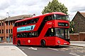
 (GBR-London) Arriva London HA007 LK65BZD SL1 2024-03-06 (Sludge G).jpg 3 072 × 2 304; 4,65 MB
-
 (GBR-London) Arriva London HA5 LK65BZB SL1 2024-03-02 (Sludge G).jpg 3 072 × 2 304; 1,26 MB
-
 1885-1918 Walthamstow - Essex.png 173 × 132; 3 KB
-
 74 St Mary Road, Walthamstow, E17 (8097424526).jpg 2 182 × 2 910; 2,73 MB
-
 Ainslie Wood Road - geograph.org.uk - 1185072.jpg 640 × 480; 78 KB
-

-
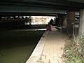 Anglers Under the North Circular - geograph.org.uk - 93390.jpg 640 × 480; 102 KB
-
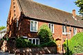
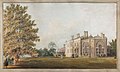 Anon - Grosvenor House, Walthamstow - 9615.jpg 2 048 × 1 228; 485 KB
-
 Ansar Gardens Walthamstow - geograph.org.uk - 2633389.jpg 1 024 × 768; 113 KB
-
 Arbutus Unedo (Waltham Forest) 2.jpg 1 500 × 2 000; 1,78 MB
-
 Arbutus Unedo (Waltham Forest).jpg 1 500 × 2 000; 2,42 MB
-
 Aubrey Rd and Byron Rd - geograph.org.uk - 5939466.jpg 1 024 × 681; 185 KB
-
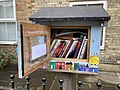 Aubrey Road bookswap.jpg 4 032 × 3 024; 3,21 MB
-

-
 Belle Vue House, Hale End, Walthamstow.jpg 1 024 × 707; 564 KB
-
 Birds on Cornish Coast (NBY 437774).jpg 3 600 × 2 335; 961 KB
-
 Bishop's Close, Walthamstow Village - geograph.org.uk - 3830125.jpg 4 000 × 3 000; 4,08 MB
-
 Black Path (sign) Walthamstow.jpg 4 320 × 2 880; 4,34 MB
-
 Blackhorse Road, Walthamstow - geograph.org.uk - 138305.jpg 640 × 480; 185 KB
-
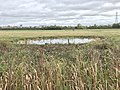 Bomb Crater Pond, Walthamstow, Greater London, UK.jpg 4 032 × 3 024; 3,99 MB
-
 Bungalows at 49-53 Roland Road, Walthamstow, London E17.jpg 7 096 × 2 573; 5,24 MB
-
 Business Park South Chingford - geograph.org.uk - 35912.jpg 640 × 480; 12 KB
-
 Carlton Road, Higham Hill - geograph.org.uk - 174710.jpg 640 × 503; 73 KB
-
 Cedars Avenue, Walthamstow, London E17 - geograph.org.uk - 2398582.jpg 2 576 × 1 932; 1,36 MB
-
 Chewton Road, Walthamstow - geograph.org.uk - 2774206.jpg 4 320 × 3 240; 4,41 MB
-
 Chingford Road (A112) Walthamstow - geograph.org.uk - 2638825.jpg 1 600 × 1 200; 464 KB
-
 Chingford Road, Walthamstow - geograph.org.uk - 5219840.jpg 2 304 × 1 728; 1,14 MB
-
 Chingford Road, Walthamstow - geograph.org.uk - 6206865.jpg 800 × 600; 139 KB
-
 Church Hill - geograph.org.uk - 5939531.jpg 1 024 × 681; 159 KB
-
 Church Hill Road, Walthamstow - geograph.org.uk - 3846968.jpg 2 560 × 1 920; 1,48 MB
-
 Clearing in Walthamstow Forest - geograph.org.uk - 5438865.jpg 424 × 640; 113 KB
-
 Clifford Road, Walthamstow - geograph.org.uk - 2609826.jpg 2 048 × 1 536; 791 KB
-
 Coleridge Road E17 - geograph.org.uk - 5463996.jpg 640 × 480; 70 KB
-

-
 Coppermill Lane towards Walthamstow - geograph.org.uk - 6206320.jpg 640 × 480; 89 KB
-
 Coppermill Lane, Walthamstow - geograph.org.uk - 2774168.jpg 4 320 × 3 240; 4,04 MB
-
 Coppermills.jpg 1 704 × 2 272; 742 KB
-
 Corbett Rd - geograph.org.uk - 5933023.jpg 1 024 × 681; 166 KB
-
 Dean Gardens - geograph.org.uk - 5928171.jpg 1 024 × 681; 153 KB
-
 Decorated Bollards, Corner of Wellington Road and Suffolk Park Road, Walthamstow.jpg 2 592 × 3 888; 5,27 MB
-

-
 Double rainbow over Walthamstow.jpg 5 344 × 3 006; 3,69 MB
-
 Dried pond - geograph.org.uk - 5924408.jpg 1 024 × 681; 295 KB
-
 E17 Type K Post office letter box - Flickr - sludgegulper.jpg 1 600 × 2 133; 554 KB
-
 Edward Road, Walthamstow - geograph.org.uk - 2774170.jpg 4 320 × 3 240; 4,29 MB
-
 Edward Road, Walthamstow - geograph.org.uk - 2774179.jpg 4 320 × 3 240; 4,18 MB
-
 Electrification, Gospel Oak to Barking line, Walthamstow (32373021890).jpg 3 026 × 2 266; 5,03 MB
-
 Elephani Sunt Personnae, Ringwood Road, Walthamstow.jpg 4 096 × 3 072; 5,73 MB
-

-
 Fallen Tree in Walthamstow Forest - geograph.org.uk - 5438860.jpg 424 × 640; 130 KB
-
 Falmer Rd - geograph.org.uk - 5939298.jpg 1 024 × 681; 201 KB
-
 Farnan Avenue - geograph.org.uk - 5939296.jpg 1 024 × 681; 161 KB
-
 Fernhill Court - geograph.org.uk - 4380909.jpg 4 000 × 3 000; 4,06 MB
-

-
 Forest path - geograph.org.uk - 5386287.jpg 800 × 600; 667 KB
-
 Frederick Bremer (Waltham Forest Heritage).jpg 2 000 × 1 500; 954 KB
-
 Frederick Bremer - 1 Connaught Road Walthamstow London E17 8QB.jpg 1 500 × 2 000; 602 KB
-
 Fyfield Rd - geograph.org.uk - 5928176.jpg 1 024 × 681; 170 KB
-
 Gaywood Rd - geograph.org.uk - 5939470.jpg 1 024 × 681; 121 KB
-
 George Monoux - 43 Billet Road Walthamstow London E17 5DH.jpg 1 500 × 2 000; 1,16 MB
-
 Glenthorne Road - geograph.org.uk - 4882125.jpg 1 064 × 1 600; 682 KB
-
 GOC Walthamstow to Stratford 013-014 EastEnders (25184377636).jpg 2 651 × 1 993; 1,14 MB
-
 GOC Walthamstow to Stratford 015 Coppermill Lane, Walthamstow (25184378186).jpg 4 080 × 3 065; 4,03 MB
-
 Greenleaf Rd - geograph.org.uk - 5939480.jpg 1 024 × 681; 201 KB
-
 Greenway Avenue - geograph.org.uk - 5928183.jpg 1 024 × 681; 169 KB
-
 Habitat Pile in Walthamstow Forest - geograph.org.uk - 5438888.jpg 424 × 640; 104 KB
-
 Hatherley Rd - geograph.org.uk - 5939488.jpg 1 024 × 681; 150 KB
-
 Hatherley Road - Hatherley Mews, E17 - geograph.org.uk - 5285731.jpg 640 × 480; 71 KB
-
 Havant Rd - geograph.org.uk - 5933020.jpg 1 024 × 681; 167 KB
-
 High Street Social, Walthamstow.jpg 4 096 × 3 072; 3,45 MB
-
 Higham Hill Road - geograph.org.uk - 3582097.jpg 1 200 × 1 600; 368 KB
-
 Higham Hill Road at the junction of Billet Road - geograph.org.uk - 3846760.jpg 2 446 × 1 756; 1,04 MB
-
 Higham Hill Road, Walthamstow - geograph.org.uk - 3846759.jpg 2 560 × 1 920; 1,98 MB
-
 Higham Hill Road, Walthamstow - geograph.org.uk - 3846981.jpg 2 560 × 1 920; 2 MB
-

-
 Houses on Brettenham Road, Walthamstow - geograph.org.uk - 5220070.jpg 2 238 × 1 636; 966 KB
-
-

-
 Howard Road at the junction of Church Road - geograph.org.uk - 3846630.jpg 2 560 × 1 920; 1,4 MB
-
 Hurst Rd - geograph.org.uk - 5939291.jpg 1 024 × 681; 161 KB
-
 Industrial Area, Edmonton - geograph.org.uk - 391232.jpg 640 × 480; 90 KB
-
 James Hilton (Waltham Forest Heritage).jpg 2 000 × 1 500; 1,06 MB
-
 James Hilton - 16 College Road Walthamstow E17 9DF.jpg 1 500 × 2 000; 756 KB
-
 Kenilworth Avenue - geograph.org.uk - 5939300.jpg 1 024 × 681; 160 KB
-
 Kingsley Rd - geograph.org.uk - 5933104.jpg 1 024 × 681; 147 KB
-
 Knitted graffiti.jpg 5 344 × 3 006; 5,26 MB
-
 Knitted poppies Walthamstow 2.jpg 4 000 × 3 000; 3,82 MB
-
 Knitted poppies Walthamstow 3.jpg 4 000 × 3 000; 3,92 MB
-
 Knitted poppies Walthamstow.jpg 4 000 × 3 000; 3,75 MB
-
 Latte and dark coffee.jpg 3 200 × 2 000; 2,12 MB
-
 Lindford Rd - geograph.org.uk - 5928233.jpg 1 024 × 681; 151 KB
-
 Lloyd Park, Walthamstow - geograph.org.uk - 174691.jpg 554 × 640; 65 KB
-
 Longitude Zero in Walthamstow - Close-Up - geograph.org.uk - 91456.jpg 640 × 413; 105 KB
-
 Longitude Zero in Walthamstow - geograph.org.uk - 90634.jpg 640 × 480; 176 KB
-
 Looking along Church Lane, Walthamstow Village - geograph.org.uk - 3815551.jpg 4 000 × 3 000; 3,96 MB
-

-
 Lord Roberts House Macdonald Road E17.jpg 1 500 × 2 000; 1,16 MB
-
 Lord Roberts of Macdonald (home made blue plaque).jpg 1 500 × 2 000; 1,42 MB
-
 Low density housing, Walthamstow, E17.jpg 2 133 × 1 600; 738 KB
-
 Low density inter-war housing E17 (3909876901).jpg 2 133 × 1 600; 636 KB
-
 Lowered track and masts, Walthamstow (33176919325).jpg 3 072 × 2 304; 1,43 MB
-
 Lowered track, Walthamstow (33049223931).jpg 3 072 × 2 304; 1,53 MB
-
 LT238 in Walthamstow.jpg 2 048 × 1 360; 566 KB
-
 Marlowe Rd - geograph.org.uk - 5928236.jpg 1 024 × 681; 164 KB
-
 Memorial at the Death of Queen Elizabeth II off Crooked Billet near Walthamstow.jpg 4 349 × 3 306; 10,78 MB
-
 Metropolitan Water Board Crest, Coppermills Advanced Water Treatment Works, Walthamstow.jpg 3 888 × 2 592; 5,65 MB
-
 Milton Rd - geograph.org.uk - 5939489.jpg 1 024 × 681; 199 KB
-
 Monoux Almshouses 1.jpg 4 893 × 3 241; 13,7 MB
-
 Monoux Almshouses 2.jpg 4 699 × 3 112; 14,33 MB
-
 Monoux Almshouses 3.jpg 4 472 × 2 962; 14,06 MB
-
 National Cycle Route 1, Lee Valley - geograph.org.uk - 93351.jpg 640 × 480; 155 KB
-
 National Spiritualist Church (Waltham Forest Heritage).jpg 2 000 × 1 500; 1,62 MB
-
 National Spiritualist Church - Vestry Rd London E17 9NH.jpg 2 000 × 1 500; 1,54 MB
-
 Needs Urgent Care, Greenleaf Road, Walthamstow.jpg 3 888 × 2 592; 4,52 MB
-
 New homes under construction.jpg 2 704 × 2 503; 1,76 MB
-

-
 Orford Road - geograph.org.uk - 4471803.jpg 480 × 640; 75 KB
-
 Orford Road, Walthamstow - geograph.org.uk - 4882264.jpg 1 600 × 1 064; 473 KB
-
 Pagoda Monoform by Jack Gardner.jpg 3 024 × 4 032; 4,59 MB
-
 Path in Walthamstow Forest - geograph.org.uk - 5438857.jpg 424 × 640; 125 KB
-
 Path through young woodland - geograph.org.uk - 3187266.jpg 640 × 480; 233 KB
-
 Path through young woodland - geograph.org.uk - 3188625.jpg 640 × 480; 188 KB
-
 Paths meet in Walthamstow Forest - geograph.org.uk - 2704256.jpg 3 648 × 2 736; 4,12 MB
-
 Peter Blake Ian Drury Peter Greenaway Ken Russell (Waltham Forest Heritage).jpg 2 000 × 1 500; 1,37 MB
-
 Piccolo at filter coffee at Wood St Coffee, Walthamstow.jpg 4 652 × 3 489; 5,07 MB
-
 Pillar box on corner of Church Lane and path to St Mary's Church.jpg 2 486 × 3 753; 7,61 MB
-
 Pollarded trees in Walthamstow Forest - geograph.org.uk - 2704271.jpg 3 648 × 2 255; 3,39 MB
-
 Post Box topper, walthamstow.jpg 4 096 × 3 072; 3 MB
-
 Prospect Hill at the junction of Church Hill - geograph.org.uk - 3846740.jpg 2 560 × 1 920; 1,96 MB
-
 Pylons in the Lea Valley - geograph.org.uk - 120845.jpg 640 × 480; 81 KB
-

-

-

-
 Railway Bridge Design by Stoneydown Park Primary School Children, Walthamstow.jpg 3 888 × 2 592; 5,55 MB
-

-
 Railway Bridge over Essex Road Walthamstow, 2023.jpg 4 096 × 3 072; 5,08 MB
-
 Richards Place - geograph.org.uk - 5939478.jpg 1 024 × 681; 175 KB
-
 Ringwood Road, Walthamstow - geograph.org.uk - 4947473.jpg 5 791 × 3 860; 3,07 MB
-
 Selborne Rd - geograph.org.uk - 5939553.jpg 1 024 × 681; 181 KB
-

-
 Shernhall Street - geograph.org.uk - 4882226.jpg 1 600 × 1 064; 441 KB
-
 Shernhall Street - geograph.org.uk - 5933444.jpg 1 024 × 681; 150 KB
-
 Shernhall Street at the junction of Vallentin Road - geograph.org.uk - 3846616.jpg 2 560 × 1 920; 2,07 MB
-

-
 Shops on Coppermill Lane - geograph.org.uk - 6206325.jpg 800 × 535; 95 KB
-
 Shops, Coppermill Lane, Walthamstow - geograph.org.uk - 2774169.jpg 4 320 × 3 240; 3,77 MB
-
 Simon King Hindu Tamil Walthamstow Rathayatra Bus.jpg 1 000 × 667; 754 KB
-
 Single graffiti art bollard.jpg 3 000 × 4 000; 3,43 MB
-
 Sir John Dankworth CBE (Waltham Forest Heritage).jpg 2 000 × 1 500; 1,47 MB
-
 Sir John Dankworth CBE - 16 Hollywood Way Woodford Green Greater London IG8 9LQ.jpg 1 500 × 2 000; 1,44 MB
-
 Site of “Moones” where lived George Monoux Mayor of London Local benefactor 1477-1543.jpg 1 500 × 2 000; 1,23 MB
-
 South end of Winsbeach, Upper Walthamstow - geograph.org.uk - 5162659.jpg 1 024 × 768; 144 KB
-
 Squirrel brickwork. Crooked Billet, E17. c 1914-20.jpg 1 600 × 2 133; 675 KB
-
 Sri Merupuram Maha Pathirakali Amman Thevasthanam Temple, Walthamstow - panoramio.jpg 4 218 × 7 930; 11,48 MB
-
 St James Street station entrance 2023.jpg 4 096 × 3 072; 4,53 MB
-
 Stagecoach 15001 (LX58CDV) Walthamstow 06.08.2023.jpg 2 048 × 1 360; 564 KB
-
 Station Approach - geograph.org.uk - 5939572.jpg 1 024 × 681; 142 KB
-
 Station Approach, Walthamstow - geograph.org.uk - 5157061.jpg 640 × 480; 86 KB
-
 Street Art by ATM, Coppermill Lane, Walthamstow.jpg 3 888 × 2 592; 5,63 MB
-
 Street Art by Hatch, Cassiobury Road, Walthamstow.jpg 3 888 × 2 592; 5,46 MB
-
 Street Art by Hunto, Elmfield Road, Walthamstow.jpg 3 888 × 2 592; 5,34 MB
-
 Street Art on Cassiobury Road.jpg 2 592 × 3 888; 4,68 MB
-
 Street art, Brighton Avenue, E17.jpg 4 096 × 3 072; 5,07 MB
-
 Street art, Ray Dudley Way, Walthamstow E17 (better light).jpg 4 096 × 3 072; 4,73 MB
-
 Street art, Ray Dudley Way, Walthamstow E17.jpg 4 096 × 3 072; 4,43 MB
-
 Street art, Walthamstow 2.jpg 10 772 × 3 810; 18,34 MB
-
 Street art, Walthamstow.jpg 12 007 × 4 092; 18,39 MB
-
 Sturge Avenue - geograph.org.uk - 5933435.jpg 1 024 × 681; 158 KB
-
 Sunken Track in Walthamstow Forest - geograph.org.uk - 5438846.jpg 424 × 640; 117 KB
-
 The Lighthouse Methodist Church.jpg 4 000 × 3 000; 5,69 MB
-
 The Lighthouse Methodist Church1.jpg 3 000 × 4 000; 4,27 MB
-
 The Lighthouse Methodist Church2.jpg 3 000 × 4 000; 3,27 MB
-
 The Marie Kondo of the 1800s, Ruby Road, Walthamstow.jpg 3 888 × 2 592; 4,85 MB
-
 The Old Sorting Office 7 Vestry Road Walthamstow London E17 9NH.jpg 2 000 × 1 500; 756 KB
-
 The Old Vicarage (Waltham Forest Heritage).jpg 2 000 × 1 500; 1,15 MB
-
 The Old Vicarage - 106 Grove Road Walthamstow E17 9BY.jpg 2 000 × 1 500; 903 KB
-
 The Playground opposite was part of Bury Field or Church Common enclosed 1850.jpg 1 500 × 2 000; 1,05 MB
-
 The Tottenham Outrage (Waltham Forest Heritage).jpg 2 000 × 1 500; 1,81 MB
-
 The Tottenham Outrage - 94-96 Oak Hill Woodford Green IG8 9PE.jpg 1 500 × 2 000; 1,78 MB
-
 The Tramworks, Hatherley Mews, E17 (2).jpg 640 × 480; 91 KB
-
 Thorpe Coombe Hospital, Walthamstow - geograph.org.uk - 5220075.jpg 2 304 × 1 728; 829 KB
-
 Thorpe Hall Primary School (Waltham Forest Heritage).jpg 2 000 × 1 500; 1,75 MB
-
 Track lowering, Gospel Oak to Barking line, Walthamstow (31938962123).jpg 2 304 × 3 072; 1,48 MB
-
 Track lowering, Gospel Oak to Barking line, Walthamstow (32599665422).jpg 3 072 × 2 304; 1,49 MB
-
 Track lowering, Gospel Oak to Barking line, Walthamstow (32712075846).jpg 3 072 × 2 304; 1,49 MB
-
 Track lowering, Gospel Oak to Barking line, Walthamstow (32753247935).jpg 2 304 × 3 072; 1,57 MB
-
 Track lowering, Gospel Oak to Barking line, Walthamstow (32753248225).jpg 3 072 × 2 304; 1,55 MB
-
 Leicester Tunks portrait.jpg 327 × 480; 9 KB
-
 Vallentin Road, Walthamstow - geograph.org.uk - 3846989.jpg 2 560 × 1 920; 1,28 MB
-
 View of the sunset sky over Hatherley Road from Hoe Street - geograph.org.uk - 5607342.jpg 3 872 × 2 592; 2,63 MB
-
 Village, Walthamstow, London (3211265654).jpg 2 848 × 2 136; 2,26 MB
-
 Vinegar Alley - geograph.org.uk - 2232995.jpg 640 × 480; 147 KB
-
 Vinegar Alley - geograph.org.uk - 3242439.jpg 640 × 480; 160 KB
-
 Walkway to the Market, Walthamstow - geograph.org.uk - 758028.jpg 640 × 427; 120 KB
-
 Waltham Forest Hebrew Synagogue - geograph.org.uk - 3375359.jpg 4 288 × 3 216; 3,9 MB
-
 Walthamstow bike sheds.jpg 4 032 × 3 024; 4,61 MB
-

-
 Walthamstow Delivery Office - geograph.org.uk - 1463210.jpg 640 × 480; 82 KB
-
 Walthamstow Fire Engine House (Waltham Forest Heritage).jpg 2 000 × 1 500; 1,43 MB

_Arriva_London_HA007_LK65BZD_SL1_2024-03-06_(Sludge_G).jpg)
_Arriva_London_HA5_LK65BZB_SL1_2024-03-02_(Sludge_G).jpg)

.jpg)


_2.jpg)
.jpg)


.jpg)

_Walthamstow.jpg)


_Walthamstow_-_geograph.org.uk_-_2638825.jpg)


_in_extensive_grounds_the_birthplace_of_William_Morris_24_March_1834.jpg)


.jpg)


.jpg)


.jpg)
.jpg)


.jpg)


.jpg)

.jpg)
.jpg)
.jpg)


.jpg)


.jpg)


_-_geograph.org.uk_-_2645083.jpg)


.jpg)


_Walthamstow_06.08.2023.jpg)


.jpg)


.jpg)


.jpg)

.jpg)

.jpg)
.jpg)
.jpg)
.jpg)
.jpg)
.jpg)


.jpg)


.jpg)