Category:London Borough of Waltham Forest
Jump to navigation
Jump to search
Boroughs of London: City of London · City of Westminster · Barking and Dagenham · Barnet · Bexley · Brent · Bromley · Camden · Croydon · Ealing · Enfield · Greenwich · Hackney · Hammersmith and Fulham · Haringey · Harrow · Havering · Hillingdon · Hounslow · Islington · Kensington and Chelsea · Kingston · Lambeth · Lewisham · Merton · Newham · Redbridge · Richmond · Southwark · Sutton · Tower Hamlets · Waltham Forest · Wandsworth
borough in the London Region in England    | |||||
| Upload media | |||||
| Instance of | |||||
|---|---|---|---|---|---|
| Named after |
| ||||
| Location | Greater London, London, England | ||||
| Capital | |||||
| Legislative body |
| ||||
| Executive body |
| ||||
| Head of government |
| ||||
| Inception |
| ||||
| Population |
| ||||
| Area |
| ||||
| official website | |||||
 | |||||
Subcategories
This category has the following 20 subcategories, out of 20 total.
A
E
F
H
M
P
S
T
Pages in category "London Borough of Waltham Forest"
This category contains only the following page.
Media in category "London Borough of Waltham Forest"
The following 200 files are in this category, out of 1,750 total.
(previous page) (next page)-
 "Butler's Retreat", Rangers Road - geograph.org.uk - 4816778.jpg 3,008 × 2,008; 1.19 MB
-
 "Electric House" Church Hill Walthamstow - geograph.org.uk - 2634865.jpg 1,600 × 1,162; 527 KB
-
 "Nature's Throne", Middlesex Filter Beds - geograph.org.uk - 2249050.jpg 2,794 × 1,871; 1.88 MB
-
-
 "The Wishing Well", South Chingford - geograph.org.uk - 4817171.jpg 2,426 × 3,239; 1.13 MB
-

-
 ...and welcome to the London Borough of Redbridge^ - geograph.org.uk - 3178168.jpg 3,456 × 2,592; 3.03 MB
-
 102 Diana Road E17 - geograph.org.uk - 4471748.jpg 480 × 640; 101 KB
-
 112-114 New Road - geograph.org.uk - 3187031.jpg 640 × 428; 75 KB
-
 A bit of infill, Brewster Road - geograph.org.uk - 2065716.jpg 1,024 × 768; 110 KB
-
 A distinctive house in Pevensey Road - geograph.org.uk - 4312490.jpg 3,804 × 2,999; 1.1 MB
-
 A Pond on Leyton Flats - geograph.org.uk - 5438301.jpg 640 × 424; 71 KB
-
 A rainy day on Walthamstow Marshes - geograph.org.uk - 5343829.jpg 1,600 × 1,067; 249 KB
-
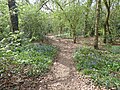
 A show of bluebells in Larks Wood - geograph.org.uk - 5339295.jpg 4,000 × 3,000; 4.85 MB
-
 A very narrow house - geograph.org.uk - 4851395.jpg 4,608 × 3,456; 3.42 MB
-
 A view of The Engine House - geograph.org.uk - 6070083.jpg 3,659 × 4,872; 4.27 MB
-
 A Walk by the River - geograph.org.uk - 4830666.jpg 3,369 × 2,694; 2.45 MB
-
 A.D. Jones Bathrooms, Walthamstow - geograph.org.uk - 5343456.jpg 2,304 × 1,728; 1.2 MB
-
 A1009 - geograph.org.uk - 5919642.jpg 1,024 × 681; 173 KB
-
 A1009, Chingford Lane - geograph.org.uk - 5919639.jpg 1,024 × 681; 166 KB
-
 A1009, Chingford Lane - geograph.org.uk - 5919641.jpg 1,024 × 681; 194 KB
-
 A1009, Chingford Lane - geograph.org.uk - 5919644.jpg 1,024 × 681; 218 KB
-
 A104 - A112 junction, Bakers Arms - geograph.org.uk - 5818658.jpg 1,024 × 680; 145 KB
-
 A104 - geograph.org.uk - 5924441.jpg 1,024 × 681; 187 KB
-
 A104 - geograph.org.uk - 5928082.jpg 1,024 × 681; 157 KB
-
 A104 - geograph.org.uk - 5928109.jpg 1,024 × 681; 192 KB
-
 A104 - geograph.org.uk - 5928119.jpg 1,024 × 681; 188 KB
-
 A104 - geograph.org.uk - 5928126.jpg 1,024 × 681; 183 KB
-

-
 A104, A503 junction, Waterworks Corner - geograph.org.uk - 5924442.jpg 1,024 × 681; 146 KB
-
 A104, Woodford new Rd - geograph.org.uk - 5928096.jpg 1,024 × 681; 187 KB
-
 A104, Woodford new Rd - geograph.org.uk - 5928114.jpg 1,024 × 681; 189 KB
-
 A104, Woodford New Rd - geograph.org.uk - 5928133.jpg 1,024 × 681; 202 KB
-
 A1069 - geograph.org.uk - 5916968.jpg 1,024 × 681; 177 KB
-
 A1069 - geograph.org.uk - 5916970.jpg 1,024 × 681; 221 KB
-
 A1069 Ranger's Road - geograph.org.uk - 4936813.jpg 640 × 424; 70 KB
-
 A110 - geograph.org.uk - 5916995.jpg 1,024 × 681; 213 KB
-
 A110 - geograph.org.uk - 5919640.jpg 1,024 × 681; 221 KB
-
 A112 Leyton High Road bridge - geograph.org.uk - 3107562.jpg 4,288 × 3,216; 3.52 MB
-
 A112, Chingford Rd - geograph.org.uk - 5939307.jpg 1,024 × 681; 153 KB
-
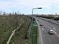
 A12 - geograph.org.uk - 5827291.jpg 1,024 × 681; 113 KB
-
 A12 dual-carriageway at Leytonstone - geograph.org.uk - 2507951.jpg 640 × 480; 60 KB
-
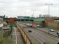
 A12 going through Olympic Park - geograph.org.uk - 4389921.jpg 1,600 × 1,200; 525 KB
-
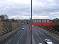
 A12 Leytonstone - geograph.org.uk - 2432199.jpg 4,320 × 3,240; 4.25 MB
-
 A12 to Leyton and Hackney - geograph.org.uk - 3400909.jpg 4,288 × 3,216; 5.08 MB
-
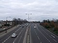
 A12 towards central London - geograph.org.uk - 5984892.jpg 1,024 × 768; 260 KB
-
 A12 towards Wanstead - geograph.org.uk - 3400906.jpg 4,288 × 3,216; 5.16 MB
-
 A12, Leytonstone - geograph.org.uk - 3242540.jpg 640 × 480; 91 KB
-
 A406 North Circular Road - geograph.org.uk - 6206942.jpg 800 × 600; 94 KB
-
 A406, North Circular Road - geograph.org.uk - 5924434.jpg 1,024 × 681; 162 KB
-
 A503 - A112 crossroads - geograph.org.uk - 5939302.jpg 1,024 × 681; 154 KB
-
 A503, Forest Road - geograph.org.uk - 5601043.jpg 1,600 × 1,067; 282 KB
-
 A604 North Circular Road - geograph.org.uk - 5438834.jpg 424 × 640; 47 KB
-

-
 Addison Road Medical Practise - geograph.org.uk - 3375896.jpg 4,288 × 3,216; 5.71 MB
-
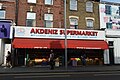 Akdeniz Supermarket - geograph.org.uk - 5939543.jpg 1,024 × 681; 162 KB
-
 Aldi, Lea Bridge Rd - geograph.org.uk - 5809165.jpg 1,024 × 681; 179 KB
-
 Alexandra Rd, A106 - geograph.org.uk - 5827273.jpg 1,024 × 681; 200 KB
-

-
 Alley from Raglan Road to Shernhall Street - geograph.org.uk - 5984726.jpg 1,024 × 768; 327 KB
-
 Allied Bakeries, E17.jpg 2,133 × 1,600; 472 KB
-
 Alongside Ranger's Road - geograph.org.uk - 4475746.jpg 4,000 × 3,000; 3.96 MB
-
 Alpacas at Brooks Farm - geograph.org.uk - 4305202.jpg 4,000 × 3,000; 4.3 MB
-

-
 Amesbury Drive southbound bus stop - geograph.org.uk - 3189613.jpg 640 × 480; 113 KB
-
 An ivied churchyard - geograph.org.uk - 5985899.jpg 1,024 × 768; 475 KB
-
 Anchor ^ Hope public house, River Lea, Clapton - geograph.org.uk - 1918801.jpg 3,264 × 2,448; 2.95 MB
-
 Antique Centre, Wood St - geograph.org.uk - 5928240.jpg 1,024 × 681; 177 KB
-
 Apple Blossom - geograph.org.uk - 4936845.jpg 424 × 640; 75 KB
-
 Apple Blossom ^ Forest Ride - geograph.org.uk - 4936815.jpg 640 × 424; 89 KB
-
 Aqueduct, Lee Valley - geograph.org.uk - 3187322.jpg 640 × 480; 99 KB
-
 Arches under Clapton Junction - geograph.org.uk - 2638800.jpg 1,600 × 1,176; 426 KB
-
 Arches, Leyton Midland Road Station - geograph.org.uk - 5822747.jpg 1,024 × 681; 182 KB
-
 Asda supermarket, Leyton Mills - geograph.org.uk - 2258721.jpg 640 × 480; 73 KB
-
 Aspray House - geograph.org.uk - 5812909.jpg 1,024 × 990; 197 KB
-
 Athletics and a circus - geograph.org.uk - 3186872.jpg 640 × 480; 107 KB
-
 Autumn, Maida Avenue - geograph.org.uk - 3189642.jpg 640 × 480; 128 KB
-
 B146, A1009 junction - geograph.org.uk - 5919636.jpg 1,024 × 681; 165 KB
-
 B146, Friday Hill - geograph.org.uk - 5919634.jpg 1,024 × 681; 172 KB
-
 B160 - geograph.org.uk - 5933092.jpg 1,024 × 681; 157 KB
-
 B161, Cathall Rd - geograph.org.uk - 5830592.jpg 1,024 × 681; 135 KB
-
 Back garden fence, Normanshire Drive, Chingford - geograph.org.uk - 4793514.jpg 1,024 × 768; 126 KB
-
-
 Bailey Close, E4 - geograph.org.uk - 2110502.jpg 1,600 × 1,200; 582 KB
-
 Baker's Arms - geograph.org.uk - 2173681.jpg 640 × 384; 62 KB
-
 Bakers Almshouses Lea Bridge Road Leyton - geograph.org.uk - 2665017.jpg 1,600 × 1,200; 543 KB
-
 Bakers Arms Leyton - geograph.org.uk - 2635943.jpg 1,600 × 1,200; 454 KB
-
 Bakers' Almshouses - geograph.org.uk - 5812957.jpg 1,024 × 681; 304 KB
-
 Bakers' Almshouses - geograph.org.uk - 5818651.jpg 1,024 × 681; 280 KB
-
 Bakers' Almshouses - geograph.org.uk - 5818653.jpg 1,024 × 681; 317 KB
-
 Bakers' Almshouses gardens - geograph.org.uk - 5818652.jpg 1,024 × 681; 279 KB
-
 Banbury Road - geograph.org.uk - 3182189.jpg 640 × 480; 61 KB
-
 Bank by the River Lea, Enfield - geograph.org.uk - 5688710.jpg 2,304 × 1,728; 845 KB
-
 Bank on Lea Bridge Road (A104) - geograph.org.uk - 5489875.jpg 640 × 480; 65 KB
-
 Baptist Sunday School, Leyton - geograph.org.uk - 3402115.jpg 4,288 × 3,216; 4.31 MB
-
 Bar of Peter May Sports Centre, with sports drinks - geograph.org.uk - 3680273.jpg 2,736 × 2,050; 2.15 MB
-
 Barber Shop, Wanstead.jpg 4,588 × 3,824; 12.79 MB
-
 Beacon, Waltham Forest - geograph.org.uk - 5939290.jpg 681 × 1,024; 165 KB
-
 Beech House, South Chingford - geograph.org.uk - 4814532.jpg 1,205 × 761; 1.01 MB
-
 Beech Tree Glade - geograph.org.uk - 5916984.jpg 1,024 × 681; 202 KB
-
 Beetle Food on Leyton Flats - geograph.org.uk - 5438257.jpg 424 × 640; 104 KB
-
 Beresford Road at the junction of Forest Avenue - geograph.org.uk - 5660289.jpg 2,304 × 1,728; 843 KB
-
 Berneliu Uzeiga - geograph.org.uk - 5830716.jpg 1,024 × 681; 153 KB
-
 Beydag Food Centre - geograph.org.uk - 5809156.jpg 1,024 × 681; 132 KB
-
 Billet Works - geograph.org.uk - 3187293.jpg 640 × 428; 78 KB
-
 Birch Grove - geograph.org.uk - 5830584.jpg 1,024 × 681; 141 KB
-
 Bistern Avenue - geograph.org.uk - 5928161.jpg 1,024 × 681; 193 KB
-
 Blackhorse Lane - geograph.org.uk - 6206835.jpg 800 × 600; 99 KB
-
 Blackhorse Lane at the corner of Sutton Road - geograph.org.uk - 3846770.jpg 2,492 × 1,826; 1.46 MB
-
 Blackhorse Lane, E17 - geograph.org.uk - 5309027.jpg 640 × 480; 83 KB
-
 Blackhorse Lane, Walthamstow - geograph.org.uk - 3846983.jpg 2,560 × 1,920; 1.41 MB
-
 Blackhorse Road Baptist Church - geograph.org.uk - 6206334.jpg 800 × 590; 94 KB
-
 Blackhorse Road Baptist Church, Walthamstow - geograph.org.uk - 5438250.jpg 1,600 × 1,303; 594 KB
-
 Block of flats at Whipps Cross Roundabout - geograph.org.uk - 4681257.jpg 4,608 × 3,456; 3.59 MB
-
-
 Bluebells alongside a path in Larks Wood - geograph.org.uk - 5339275.jpg 4,000 × 3,000; 4.96 MB
-
 Bluebells in Larks Wood - geograph.org.uk - 5339279.jpg 4,000 × 3,000; 4.84 MB
-
 Bluebells in Larks Wood - geograph.org.uk - 5339283.jpg 4,000 × 3,000; 5.01 MB
-
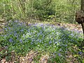 Bluebells in Larks Wood - geograph.org.uk - 5339286.jpg 4,000 × 3,000; 5.01 MB
-
 Boardwalk at Waterworks Nature Reserve - geograph.org.uk - 5764629.jpg 4,896 × 3,672; 5.9 MB
-

-
 Borough of Leyton Electricity Department substation - geograph.org.uk - 4946275.jpg 6,000 × 4,000; 4.58 MB
-
 Boundary Road Leyton-Walthamstow - geograph.org.uk - 2670158.jpg 1,024 × 768; 291 KB
-
 Box junction, A112 - geograph.org.uk - 5827244.jpg 1,024 × 681; 138 KB
-
 Boys Entrance, Woodside Primary School - geograph.org.uk - 5933402.jpg 1,024 × 681; 198 KB
-
 Brandon Rd - geograph.org.uk - 5928231.jpg 1,024 × 681; 189 KB
-
 Bridge on Chigwell branch - geograph.org.uk - 5986222.jpg 1,024 × 684; 263 KB
-
 Bridge over the River Ching - geograph.org.uk - 2684190.jpg 1,600 × 1,200; 748 KB
-
 Bridge over the River Lea - geograph.org.uk - 3272923.jpg 640 × 430; 102 KB
-
 Bridge over the River Lea, London N18 - geograph.org.uk - 4421261.jpg 1,167 × 875; 1.53 MB
-
 Bridge under the A12 - geograph.org.uk - 4312642.jpg 4,000 × 3,000; 4.11 MB
-
 Bridge upon bridge - geograph.org.uk - 2233198.jpg 640 × 480; 134 KB
-
 Bridge, Walthamstow - geograph.org.uk - 6266002.jpg 3,264 × 2,448; 1.8 MB
-
 Brisbane Road, Leyton Orient F.C. - geograph.org.uk - 3977361.jpg 2,848 × 2,136; 3.16 MB
-
 Brockway Close - geograph.org.uk - 5830838.jpg 1,024 × 681; 175 KB
-
 Brookscroft - geograph.org.uk - 5933484.jpg 1,024 × 681; 263 KB
-
 Brydges Road from Chobham Road, Stratford - geograph.org.uk - 5598885.jpg 2,048 × 1,536; 1.5 MB
-
 Builders' Merchants, Blackhorse Road - geograph.org.uk - 3582119.jpg 1,600 × 1,200; 349 KB
-
 Building by the Lea Bridge Weir - geograph.org.uk - 3297025.jpg 640 × 430; 68 KB
-
 Building site off Forest Side - geograph.org.uk - 5916992.jpg 1,024 × 681; 269 KB
-
-
 Building site, E10 - geograph.org.uk - 5985646.jpg 1,024 × 768; 300 KB
-
 Building site^ Chadwick Road - geograph.org.uk - 3861696.jpg 640 × 480; 83 KB
-
 Buildings along Church Hill, Walthamstow - geograph.org.uk - 3846790.jpg 2,518 × 1,862; 1.16 MB
-
 Buildings by the Green Man Roundabout, Leytonstone - geograph.org.uk - 3846702.jpg 2,560 × 1,920; 1.38 MB
-
 Bungalows, Mount Echo Drive, Chingford - geograph.org.uk - 4792592.jpg 1,024 × 768; 162 KB
-
 Burwell Road Factory, E10.jpg 1,600 × 2,133; 507 KB
-
 Bury Road at the junction of Rangers Road - geograph.org.uk - 5660425.jpg 2,206 × 1,588; 855 KB
-
 Bus stop and shelter on Blackhorse Lane, Walthamstow - geograph.org.uk - 6215072.jpg 5,184 × 3,888; 4.39 MB
-

-
 Bus stop on Winchester Road, Highams Park - geograph.org.uk - 6215045.jpg 5,184 × 3,888; 4.79 MB
-
 Bus terminus at Chingford Station - geograph.org.uk - 6080947.jpg 1,920 × 1,280; 1.92 MB
-
 Butler's Retreat - geograph.org.uk - 3709371.jpg 1,600 × 1,064; 537 KB
-
 Butlers Retreat - geograph.org.uk - 5916963.jpg 1,024 × 681; 180 KB
-
 Buxton Road looking towards The Drive - geograph.org.uk - 5660409.jpg 2,304 × 1,728; 863 KB
-
 By Reservoir No.4, Walthamstow Wetlands - geograph.org.uk - 6070109.jpg 4,804 × 3,592; 3.94 MB
-
 By Warwick Reservoir East - geograph.org.uk - 6070102.jpg 3,641 × 4,827; 2.76 MB
-
 By Warwick Reservoir East - geograph.org.uk - 6070107.jpg 4,700 × 2,684; 3.35 MB
-
 B^M, High Rd Leytonstone - geograph.org.uk - 5830717.jpg 1,024 × 681; 157 KB
-
 Cairo Rd - geograph.org.uk - 5939495.jpg 1,024 × 681; 172 KB
-
 Cann Hall Park - geograph.org.uk - 4312376.jpg 4,000 × 3,000; 4.34 MB
-
 Capital Ring - geograph.org.uk - 3294168.jpg 640 × 430; 48 KB
-
 Capital Ring - geograph.org.uk - 5357871.jpg 640 × 426; 45 KB
-
 Capital Ring by Lea Navigation - geograph.org.uk - 5354732.jpg 640 × 426; 61 KB
-
 Capital Ring by the River Lea - geograph.org.uk - 3290119.jpg 640 × 430; 55 KB
-
 Capital Ring, Walthamstow Marshes - geograph.org.uk - 3290096.jpg 640 × 430; 46 KB
-
 Car park near Whipps Cross - geograph.org.uk - 6240750.jpg 1,024 × 768; 202 KB
-
 Car park on Coppermill Lane, Walthamstow - geograph.org.uk - 5598606.jpg 2,048 × 1,536; 1.51 MB
-
 Car wash on Hoe Street, Walthamstow - geograph.org.uk - 3846978.jpg 2,560 × 1,920; 1.28 MB
-
-
 Cash and carry warehouse, Rigg Approach, London E10 - geograph.org.uk - 2774099.jpg 4,320 × 3,240; 3.72 MB
-
 Cash Converters, High Rd - geograph.org.uk - 5818671.jpg 1,024 × 681; 161 KB
-
 Cathall Rd, B161 - geograph.org.uk - 5830591.jpg 1,024 × 681; 181 KB
-
 Cattle grazing the marshes - geograph.org.uk - 3294176.jpg 640 × 430; 61 KB
-
 Centenary Walk - geograph.org.uk - 5919646.jpg 1,024 × 681; 300 KB
-
 Centenary Walk - geograph.org.uk - 5924373.jpg 1,024 × 681; 286 KB
-
 Centenary Walk - geograph.org.uk - 5924378.jpg 1,024 × 681; 300 KB
-
 Centenary Walk - geograph.org.uk - 5924387.jpg 1,024 × 681; 254 KB
-
 Centenary Walk - geograph.org.uk - 5924395.jpg 1,024 × 681; 196 KB
-
 Centenary Walk - geograph.org.uk - 5924413.jpg 1,024 × 681; 273 KB
-
 Centenary Walk - geograph.org.uk - 5924417.jpg 1,024 × 681; 276 KB
-
 Centenary Walk - geograph.org.uk - 5924421.jpg 1,024 × 681; 279 KB
-
 Centenary Walk - geograph.org.uk - 5924424.jpg 1,024 × 681; 267 KB
-
 Centenary Walk - geograph.org.uk - 5924426.jpg 1,024 × 681; 301 KB
-
 Centenary Walk alongside Highams Park lake - geograph.org.uk - 4415075.jpg 4,000 × 3,000; 4.32 MB
-
 Centenary Walk goes right - geograph.org.uk - 5924390.jpg 1,024 × 681; 305 KB
-
 Centenary Walk looking towards Oak Hill - geograph.org.uk - 2704313.jpg 3,648 × 2,255; 2.59 MB
-
 Centenary Walk, Hatch Forest - geograph.org.uk - 5919612.jpg 1,024 × 681; 273 KB
-
 Centenary Walk, Highams Park - geograph.org.uk - 5919645.jpg 1,024 × 681; 218 KB
-
 Centenary Walk, Highams Park - geograph.org.uk - 5919647.jpg 1,024 × 681; 278 KB
-
 Centenary Walk, Highams Park - geograph.org.uk - 5919648.jpg 1,024 × 681; 281 KB
-
 Centenary Walk, Highams Park - geograph.org.uk - 5919650.jpg 1,024 × 681; 309 KB
-
 Centenary Walk, Highams Park - geograph.org.uk - 5919652.jpg 1,024 × 681; 285 KB
-
 Centenary Walk, Highams Park - geograph.org.uk - 5924340.jpg 1,024 × 681; 200 KB
-
 Centenary Walk, Highams Park - geograph.org.uk - 5924354.jpg 1,024 × 681; 301 KB
-
 Centenary Walk, The Warren - geograph.org.uk - 5916974.jpg 1,024 × 681; 284 KB
-
 Centenary Walk, The Warren - geograph.org.uk - 5916976.jpg 1,024 × 681; 251 KB
-
 Centre Court, Eton Manor, Olympic Park - geograph.org.uk - 3118792.jpg 4,288 × 3,216; 4.01 MB
-
 Charter Rd - geograph.org.uk - 5924366.jpg 1,024 × 681; 231 KB
-
 Charter Rd - geograph.org.uk - 5924368.jpg 1,024 × 681; 227 KB


_sign_for_The_(former)_Chequers,_High_Street_-_Storey_Road,_E17_-_geograph.org.uk_-_5287397.jpg)


_-_geograph.org.uk_-_5489875.jpg)


_-_geograph.org.uk_-_5489794.jpg)


_-_geograph.org.uk_-_5489901.jpg)


