Category:Warburton, Greater Manchester
Jump to navigation
Jump to search
village in Greater Manchester, UK  L'église Sainte-Werburh de Walburton | |||||
| Upload media | |||||
| Instance of | |||||
|---|---|---|---|---|---|
| Location | Trafford, Greater Manchester, North West England, England | ||||
 | |||||
Subcategories
This category has the following 7 subcategories, out of 7 total.
C
- Carrgreen Lane, Warburton (4 F)
D
- Dunham Road, Warburton (1 F)
M
S
W
- Warburton War Memorial (1 F)
Media in category "Warburton, Greater Manchester"
The following 147 files are in this category, out of 147 total.
-
 A bus approaches on Dunham Road - geograph.org.uk - 3431386.jpg 4,592 × 3,056; 7.93 MB
-
 A Rural Road Junction - geograph.org.uk - 2793036.jpg 640 × 480; 440 KB
-
 An imposing entrance on Dunham Road - geograph.org.uk - 3431339.jpg 4,507 × 2,423; 5.45 MB
-
 Approaching Warburton Toll Bridge - geograph.org.uk - 1625691.jpg 640 × 480; 50 KB
-
 B5160 - geograph.org.uk - 27234.jpg 640 × 480; 101 KB
-
 Barns Lane, Dunham Woodhouses - geograph.org.uk - 3116984.jpg 1,920 × 1,080; 850 KB
-
 Barns Lane, Dunham Woodhouses - geograph.org.uk - 3116986.jpg 1,920 × 1,080; 903 KB
-
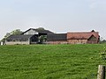 Bent Farm, Warburton.jpg 1,280 × 960; 591 KB
-
 Birch Farm - geograph.org.uk - 2793002.jpg 640 × 480; 499 KB
-
 Bollin Point, Manchester Ship Canal, Lymm - geograph.org.uk - 3226543.jpg 3,762 × 2,821; 3.93 MB
-
 Bouquet of Barbed Wire - geograph.org.uk - 4573004.jpg 5,774 × 3,850; 6.28 MB
-
 Bridge, Trans Pennine Trail, near Carr Green - geograph.org.uk - 3116948.jpg 1,920 × 1,080; 938 KB
-
 Caldwell Brook - geograph.org.uk - 2793034.jpg 640 × 480; 596 KB
-
 Cattle grazing at Warburton Park - geograph.org.uk - 3430505.jpg 4,592 × 2,627; 7.8 MB
-
 Corn Field and Coroners Woods - geograph.org.uk - 35748.jpg 640 × 480; 83 KB
-
 Drainage channel - geograph.org.uk - 4572555.jpg 5,722 × 3,814; 6.1 MB
-
 Dunham Road (B5160) - geograph.org.uk - 2792632.jpg 640 × 480; 553 KB
-
 Dunham Road (B5160) - geograph.org.uk - 3364061.jpg 640 × 480; 71 KB
-
 Dunham Road - geograph.org.uk - 2456347.jpg 2,424 × 2,832; 2.32 MB
-
 Dunham Road - geograph.org.uk - 3431300.jpg 3,992 × 2,661; 7.06 MB
-
 Dunham Road - geograph.org.uk - 3431368.jpg 4,468 × 2,639; 7.75 MB
-
 Dunham Road - geograph.org.uk - 3431751.jpg 4,361 × 2,670; 7.63 MB
-
 Dunham Road At Mossbrow - geograph.org.uk - 1337708.jpg 640 × 480; 177 KB
-
 Farm, Carr Green-Dunham Woodhouses - geograph.org.uk - 3116966.jpg 1,920 × 1,080; 976 KB
-
 Farmland near Warburton - geograph.org.uk - 3354479.jpg 640 × 543; 87 KB
-
 Farmland off Dunham Road - geograph.org.uk - 3364059.jpg 640 × 480; 53 KB
-
 Farmland off Townfield Lane (B5159) - geograph.org.uk - 3354462.jpg 640 × 480; 79 KB
-
 Farmland, Heathlands Farm - geograph.org.uk - 3364064.jpg 640 × 480; 60 KB
-
 Fields Off Carr Green Lane - geograph.org.uk - 1337720.jpg 480 × 640; 215 KB
-
 Fields, Carr Green-Dunham Woodhouses - geograph.org.uk - 3116958.jpg 1,920 × 1,080; 1.04 MB
-
 Fields, Carr Green-Dunham Woodhouses - geograph.org.uk - 3116970.jpg 1,920 × 1,080; 1.02 MB
-
 Gorsey Lane - geograph.org.uk - 2793027.jpg 640 × 480; 553 KB
-

-
 Heathlands Farm - geograph.org.uk - 2792896.jpg 640 × 480; 402 KB
-
 Higher Carr Green farm - geograph.org.uk - 2792617.jpg 640 × 480; 402 KB
-
 Higher Carr Green Farm - geograph.org.uk - 2792618.jpg 640 × 480; 400 KB
-
 Lymm, Manchester Ship Canal - geograph.org.uk - 2613499.jpg 1,024 × 768; 78 KB
-
 Manchester Ship Canal - geograph.org.uk - 2325868.jpg 640 × 480; 232 KB
-
 Manchester Ship Canal - geograph.org.uk - 2325873.jpg 640 × 480; 135 KB
-
 Manchester Ship Canal - geograph.org.uk - 4071733.jpg 640 × 427; 71 KB
-
 Manchester Ship Canal - geograph.org.uk - 4071780.jpg 640 × 427; 56 KB
-
 Manchester Ship Canal - geograph.org.uk - 4071832.jpg 640 × 427; 66 KB
-
 Manchester Ship Canal near Warburton - geograph.org.uk - 4788574.jpg 1,600 × 1,064; 228 KB
-
 Manchester Ship Canal near Warburton - geograph.org.uk - 4952642.jpg 640 × 481; 290 KB
-
 Manchester Ship Canal near Warburton - geograph.org.uk - 4952678.jpg 640 × 481; 279 KB
-

-
-
 Meteorogical sensor at Warburton Lane - geograph.org.uk - 3896110.jpg 1,024 × 795; 150 KB
-
 Midlands Farm, Moss Lane - geograph.org.uk - 2793006.jpg 640 × 480; 464 KB
-
 Moss Lane - geograph.org.uk - 2792944.jpg 640 × 480; 567 KB
-
 Moss Lane - geograph.org.uk - 2792950.jpg 640 × 480; 553 KB
-
 Moss Lane - geograph.org.uk - 3364065.jpg 640 × 480; 84 KB
-
 Moss Lane - geograph.org.uk - 3430613.jpg 4,535 × 2,977; 5.52 MB
-
 Moss Lane by Mosslane Farm - geograph.org.uk - 3430642.jpg 4,522 × 3,009; 6.57 MB
-
 Muddy walk at Warburton - geograph.org.uk - 4573008.jpg 6,000 × 4,000; 7.31 MB
-
 Old St. Werburgh's, Warburton - geograph.org.uk - 4378523.jpg 1,024 × 736; 769 KB
-

-
 On Warburton Bridge - geograph.org.uk - 3354484.jpg 1,200 × 900; 291 KB
-
 Ordnance Survey Cut Mark - geograph.org.uk - 3198418.jpg 3,264 × 2,448; 1.72 MB
-
 Overhead Power Lines, Carr Green-Dunham Woodhouses - geograph.org.uk - 3116975.jpg 1,920 × 1,080; 493 KB
-
 Overhead Power Lines, Little Heatley - geograph.org.uk - 3116954.jpg 1,920 × 1,080; 471 KB
-
 Overhead Power Lines, Little Heatley - geograph.org.uk - 3116961.jpg 1,920 × 1,080; 641 KB
-
 Paddock Lane - geograph.org.uk - 2370905.jpg 1,280 × 960; 709 KB
-
 Paddock Off Dunham Road - geograph.org.uk - 1337713.jpg 640 × 480; 175 KB
-
 Parish Rooms, Warburton.jpg 1,024 × 768; 764 KB
-
 Park Road, Warburton - geograph.org.uk - 3430414.jpg 4,592 × 2,881; 7.72 MB
-
 Quernstones found in Warburton.JPG 2,848 × 2,136; 3.03 MB
-
 Red Brook - geograph.org.uk - 2792900.jpg 640 × 480; 569 KB
-
 Red Brook - geograph.org.uk - 2792921.jpg 640 × 480; 536 KB
-
 Red Brook, Partington - geograph.org.uk - 2792911.jpg 640 × 480; 550 KB
-
 Red Brook, Partington - geograph.org.uk - 3364067.jpg 640 × 480; 115 KB
-
 River Bollin - geograph.org.uk - 2370827.jpg 1,280 × 960; 1.03 MB
-
 Rixton, Manchester Ship Canal - geograph.org.uk - 2613489.jpg 1,024 × 768; 74 KB
-
 Saracens Head - geograph.org.uk - 4201010.jpg 3,526 × 1,983; 1.83 MB
-
 Sawpit Street - geograph.org.uk - 1337740.jpg 640 × 480; 179 KB
-
 Ship Canal - geograph.org.uk - 4572557.jpg 6,000 × 4,000; 5.31 MB
-
 Signpost, Bollin Valley Way - geograph.org.uk - 2792615.jpg 640 × 480; 428 KB
-
 Sinderland Lane - geograph.org.uk - 2793028.jpg 640 × 480; 516 KB
-
 Sinderland Lane - geograph.org.uk - 2793033.jpg 640 × 480; 405 KB
-
 South-East Manchester from the Air - geograph.org.uk - 4621738.jpg 2,784 × 1,568; 2 MB
-
 St Werburgh's Church - geograph.org.uk - 2792627.jpg 640 × 480; 579 KB
-
 St Werburgh's Church - geograph.org.uk - 3364056.jpg 640 × 480; 96 KB
-
 St Werburgh's Church - geograph.org.uk - 4572993.jpg 5,459 × 3,640; 5.82 MB
-
 St Werburgh's Church, Warburton - geograph.org.uk - 2370896.jpg 1,280 × 960; 1.13 MB
-
 St Werburgh's Church, Warburton - geograph.org.uk - 2792626.jpg 640 × 480; 567 KB
-
 St. Werburg's Church and Graveyard - geograph.org.uk - 2263067.jpg 1,200 × 779; 334 KB
-
 St. Werburgh, Warburton - geograph.org.uk - 4378513.jpg 1,024 × 768; 800 KB
-
 Thatched Cottage at Warburton - geograph.org.uk - 2456362.jpg 2,454 × 2,580; 2.15 MB
-
 Thatched House at Warburton - geograph.org.uk - 2263145.jpg 1,200 × 803; 242 KB
-
 The Bollin Valley Way - geograph.org.uk - 3430535.jpg 4,295 × 2,700; 6.37 MB
-
 The Manchester Ship Canal - geograph.org.uk - 3354487.jpg 640 × 480; 51 KB
-
 The old church of St. Werburg - geograph.org.uk - 2263069.jpg 584 × 867; 153 KB
-
 The Old School House - geograph.org.uk - 2260615.jpg 1,200 × 843; 1.16 MB
-
 The Saracen's Head - geograph.org.uk - 2260603.jpg 1,200 × 803; 778 KB
-
 The Saracen's Head - geograph.org.uk - 2260607.jpg 1,200 × 828; 783 KB
-
 The Saracen's Head - geograph.org.uk - 2260611.jpg 600 × 727; 384 KB
-
 The Saracen's Head - geograph.org.uk - 2370901.jpg 1,280 × 960; 869 KB
-
 The Saracen's Head - geograph.org.uk - 2456355.jpg 1,697 × 2,345; 1.35 MB
-
 The Saracen's Head - geograph.org.uk - 3430938.jpg 4,335 × 2,415; 6.8 MB
-
 The toll gate for Warburton Bridge doing roaring business - geograph.org.uk - 3430362.jpg 4,592 × 3,056; 7.47 MB
-
 There's A Ship Canal Out There Somewhere - geograph.org.uk - 1337523.jpg 640 × 480; 178 KB
-
 Toll booth, Warburton - geograph.org.uk - 3354478.jpg 868 × 664; 180 KB
-
 Toll Gate - geograph.org.uk - 4572987.jpg 6,000 × 4,000; 6.28 MB
-
 Towards the Ship Canal - geograph.org.uk - 4572543.jpg 6,000 × 4,000; 7.36 MB
-
 Townfield Lane (closed) at Warburton - geograph.org.uk - 3354474.jpg 640 × 480; 72 KB
-
 Townfield Lane - geograph.org.uk - 2370839.jpg 1,280 × 960; 632 KB
-
 Townfield Lane - geograph.org.uk - 2677199.jpg 640 × 480; 48 KB
-
 Townfield Lane - geograph.org.uk - 3354468.jpg 640 × 480; 60 KB
-
 Trans Pennine Trail - geograph.org.uk - 2792620.jpg 640 × 480; 455 KB
-
 Trans Pennine Trail east of Heatley - geograph.org.uk - 3320469.jpg 1,800 × 1,201; 2.33 MB
-
 Trans Pennine Trail, Warburton Bridge - geograph.org.uk - 2792612.jpg 640 × 480; 636 KB
-
 Trans-Pennine Trail - Carr Green - geograph.org.uk - 1887638.jpg 4,224 × 3,168; 2.2 MB
-
 Transco Gas Plant - geograph.org.uk - 4572978.jpg 5,097 × 3,822; 6.58 MB
-
 Victorian Engineering - geograph.org.uk - 4572566.jpg 5,603 × 3,736; 4.1 MB
-
 Warburton - Paddock Lane - geograph.org.uk - 1337699.jpg 640 × 480; 152 KB
-
 Warburton - Paddock Lane - geograph.org.uk - 1337702.jpg 640 × 480; 175 KB
-
 Warburton - Prefabricated Houses - geograph.org.uk - 1337706.jpg 640 × 480; 165 KB
-

-
 Warburton Bridge Road - geograph.org.uk - 2325876.jpg 640 × 480; 171 KB
-
 Warburton Bridge, looking north-west - geograph.org.uk - 5841438.jpg 1,024 × 768; 396 KB
-
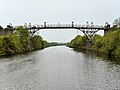
 Warburton High Level Bridge - geograph.org.uk - 2325883.jpg 640 × 480; 167 KB
-
 Warburton High Level Bridge - geograph.org.uk - 2456366.jpg 4,000 × 3,000; 2.82 MB
-
 Warburton High Level Bridge - geograph.org.uk - 2613378.jpg 1,024 × 768; 89 KB
-
 Warburton High Level Bridge - geograph.org.uk - 4572561.jpg 5,615 × 3,743; 6.08 MB
-
 Warburton Lane - Dunham Road Junction - geograph.org.uk - 2792630.jpg 640 × 480; 473 KB
-
 Warburton Lane - geograph.org.uk - 2677165.jpg 640 × 479; 66 KB
-
 Warburton Lane - geograph.org.uk - 2677185.jpg 640 × 481; 40 KB
-
 Warburton Lane-Moss Lane Junction - geograph.org.uk - 2792899.jpg 640 × 480; 336 KB
-
 Warburton Parish Church - geograph.org.uk - 2260600.jpg 1,200 × 861; 1.11 MB
-
 Warburton Parish Church - geograph.org.uk - 2260601.jpg 1,200 × 803; 969 KB
-
 Warburton Parish Hall - geograph.org.uk - 2260593.jpg 1,200 × 815; 945 KB
-
 Warburton Park - geograph.org.uk - 3430472.jpg 4,589 × 2,643; 5.85 MB
-
 Warburton Park - geograph.org.uk - 4201008.jpg 3,887 × 1,760; 1.45 MB
-
 Warburton Toll Bridge - geograph.org.uk - 2260575.jpg 1,200 × 803; 855 KB
-
 Warburton Toll Bridge - geograph.org.uk - 3671301.jpg 640 × 480; 308 KB
-
 Warburton Toll Bridge - geograph.org.uk - 4378528.jpg 1,024 × 767; 452 KB
-
 Warburton Toll Bridge - geograph.org.uk - 4751626.jpg 1,024 × 654; 225 KB
-
 Warburton Toll Bridge - geograph.org.uk - 4788572.jpg 1,600 × 1,210; 218 KB
-
 Warburton toll bridge from the Bollin Valley Way - geograph.org.uk - 3430555.jpg 3,849 × 2,182; 6.21 MB
-
 Warburton Toll Gate - geograph.org.uk - 2368676.jpg 640 × 480; 227 KB
-
 Warburton War Memorial - geograph.org.uk - 2370893.jpg 877 × 1,169; 625 KB
-
 Warburton War Memorial and St Werburgh's Church - geograph.org.uk - 2370889.jpg 1,280 × 960; 942 KB
-
 Warburton, Manchester Ship Canal - geograph.org.uk - 2613470.jpg 1,024 × 768; 82 KB
-
 Welcome to Greater Manchester, Welcome to Trafford - geograph.org.uk - 3923178.jpg 3,072 × 1,728; 2.97 MB
-
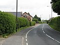
 Welcome To Warburton - geograph.org.uk - 1337693.jpg 640 × 480; 167 KB
-
 Wigsey lane in Warburton - geograph.org.uk - 3896103.jpg 1,600 × 1,200; 395 KB
-
 Saracens Head - geograph.org.uk - 27238.jpg 640 × 480; 122 KB


_-_geograph.org.uk_-_2792632.jpg)
_-_geograph.org.uk_-_3364061.jpg)


_-_geograph.org.uk_-_3354462.jpg)


_-_geograph.org.uk_-_5841436.jpg)
_Bridge_-_geograph.org.uk_-_4952661.jpg)


_at_Warburton_-_geograph.org.uk_-_3354474.jpg)


