Category:Warmington, Northamptonshire
Jump to navigation
Jump to search
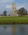
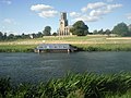
English: Warmington is a village and civil parish in East Northamptonshire, England with a population of 874.
village and civil parish in East Northamptonshire, England  | |||||
| Upload media | |||||
| Instance of | |||||
|---|---|---|---|---|---|
| Location | North Northamptonshire, Northamptonshire, East Midlands, England | ||||
| official website | |||||
 | |||||
Subcategories
This category has the following 2 subcategories, out of 2 total.
M
Media in category "Warmington, Northamptonshire"
The following 174 files are in this category, out of 174 total.
-
 A sign of the times, unfortunately - geograph.org.uk - 2869770.jpg 480 × 640; 84 KB
-
 A605 Services, Warmington - geograph.org.uk - 1334702.jpg 640 × 480; 104 KB
-
 Access bridge - geograph.org.uk - 1252599.jpg 640 × 480; 88 KB
-
 Agricultural transportation near Warmington - geograph.org.uk - 4613732.jpg 4,320 × 3,240; 5.76 MB
-
 Alongside entrance to Davey's Lodge - geograph.org.uk - 5281078.jpg 640 × 480; 72 KB
-
 America Farm Cottages - geograph.org.uk - 2956353.jpg 4,000 × 3,000; 4.35 MB
-
 Approaching the junction to Warmington - geograph.org.uk - 2780263.jpg 4,320 × 3,240; 4.1 MB
-
 Approaching Warmington - geograph.org.uk - 2956439.jpg 4,000 × 3,000; 4.19 MB
-
 Beside Long Spinney - geograph.org.uk - 5281076.jpg 640 × 480; 55 KB
-
 Beside Long Spinney - geograph.org.uk - 5281082.jpg 480 × 640; 49 KB
-
 Bridge over the Nene at Fotheringhay - geograph.org.uk - 4553631.jpg 640 × 480; 70 KB
-
 Bridleway - geograph.org.uk - 1127603.jpg 480 × 640; 83 KB
-
 Bridleway heading towards the Warmington road - geograph.org.uk - 2743622.jpg 3,648 × 2,736; 2.13 MB
-
 Bridleway to Elton - geograph.org.uk - 718636.jpg 640 × 425; 115 KB
-
 Broadgate Way, Warmington - geograph.org.uk - 4610942.jpg 4,320 × 3,240; 5.53 MB
-
 Broadgate Way, Warmington - geograph.org.uk - 5281044.jpg 640 × 480; 71 KB
-
 Busy A605 Warmington roundabout - geograph.org.uk - 3701886.jpg 800 × 450; 222 KB
-
 Church of St Mary and All Saints - geograph.org.uk - 4896123.jpg 652 × 800; 100 KB
-
 Cowslips in the road verge - geograph.org.uk - 2956346.jpg 4,000 × 3,000; 3.99 MB
-
 Dead Cafe Off The A605 - geograph.org.uk - 1334699.jpg 640 × 480; 178 KB
-
 Dovecote, Warmington - geograph.org.uk - 447091.jpg 640 × 428; 134 KB
-
 Eaglesthorpe House, Warmington - geograph.org.uk - 4610792.jpg 4,320 × 3,240; 6.14 MB
-

-
 Eaglethorpe House - geograph.org.uk - 2956472.jpg 4,000 × 3,000; 4.13 MB
-
 Eaglethorpe House - geograph.org.uk - 2956925.jpg 4,000 × 3,000; 4.08 MB
-
 Eaglethorpe House in Warmington - geograph.org.uk - 4951226.jpg 800 × 609; 192 KB
-
 Elder Berries - geograph.org.uk - 3701881.jpg 800 × 601; 433 KB
-
 Elton Mill from the River Nene - geograph.org.uk - 4553660.jpg 480 × 640; 60 KB
-
 Farm Bridleway - geograph.org.uk - 5281094.jpg 640 × 480; 84 KB
-
 Farm Bridleway - geograph.org.uk - 5281103.jpg 640 × 480; 69 KB
-
 Farm Bridleway - geograph.org.uk - 5281105.jpg 640 × 480; 99 KB
-
 Farm Bridleway - geograph.org.uk - 5281107.jpg 640 × 480; 101 KB
-
 Farm Bridleway meets the road - geograph.org.uk - 5281110.jpg 640 × 480; 92 KB
-
 Farm track next to the old railway line - geograph.org.uk - 3701864.jpg 800 × 450; 228 KB
-
 Farmland between Warmington and Morborne - geograph.org.uk - 3988924.jpg 4,320 × 3,240; 5.93 MB
-
 Fields behind Big Green, Warmington - geograph.org.uk - 1127576.jpg 480 × 640; 63 KB
-
 Foot bridge and ford near Elton Hall - geograph.org.uk - 5515300.jpg 4,320 × 3,240; 5.05 MB
-
 Footbridge along the Nene Way - geograph.org.uk - 4951062.jpg 800 × 567; 156 KB
-
 Footbridge next to Taylors Lane - geograph.org.uk - 2956455.jpg 4,000 × 3,000; 4.33 MB
-
 Footpath and track off Taylors Green, Warmington - geograph.org.uk - 4610879.jpg 4,320 × 3,240; 5.65 MB
-
 Footpath at sunset from Bullock Road - geograph.org.uk - 2619798.jpg 4,000 × 3,000; 4 MB
-
 Footpath at the side of Long Spinney - geograph.org.uk - 3988938.jpg 4,320 × 3,240; 5.96 MB
-
 Footpath to Ashton Wold - geograph.org.uk - 3963187.jpg 800 × 600; 204 KB
-
 Footpath to Crow Spinney near Elton Hall - geograph.org.uk - 5515314.jpg 4,320 × 3,240; 5.86 MB
-

-
 Fotheringhay village sign - geograph.org.uk - 4959777.jpg 800 × 511; 131 KB
-
 From Draper's Close, Warmington - geograph.org.uk - 5281041.jpg 480 × 640; 44 KB
-
 Grain Store And Bins, Rectory Farm - geograph.org.uk - 798984.jpg 640 × 480; 75 KB
-
 Grassland near Elton Hall - geograph.org.uk - 5515322.jpg 4,320 × 3,240; 5.79 MB
-
 Grassy Triangle - geograph.org.uk - 802335.jpg 640 × 480; 103 KB
-
 Hillside near America Farm - geograph.org.uk - 3988955.jpg 4,320 × 3,240; 5.68 MB
-
 Hilltop Barn - geograph.org.uk - 3077383.jpg 4,320 × 3,240; 6.67 MB
-
 Houses on a corner in Warmington - geograph.org.uk - 4610805.jpg 4,320 × 3,240; 5.58 MB
-
 Houses on Spinney Close, Warmington - geograph.org.uk - 4610809.jpg 4,320 × 3,240; 5.75 MB
-
 Jem's Diner, off the A605 road, near Warmington - geograph.org.uk - 2932275.jpg 1,024 × 669; 242 KB
-

-
 Junction on the way to Warmington - geograph.org.uk - 2956425.jpg 4,000 × 3,000; 4.45 MB
-
 Line of an old railway - geograph.org.uk - 2957166.jpg 4,000 × 3,000; 4.3 MB
-
 Looking towards an old railway track - geograph.org.uk - 2957156.jpg 4,000 × 3,000; 4.13 MB
-
 Looking towards Fotheringhay Castle mound - geograph.org.uk - 2060081.jpg 1,280 × 960; 655 KB
-
 Looking towards old railway line - geograph.org.uk - 2957149.jpg 4,000 × 3,000; 4.35 MB
-
 Magical Grotto off the Nene - geograph.org.uk - 4553671.jpg 640 × 480; 94 KB
-
 Malus by the road to Tansor Wold - geograph.org.uk - 2743611.jpg 3,648 × 2,736; 2.13 MB
-
 Mature Oak tree on the Elton Estate - geograph.org.uk - 2743653.jpg 2,736 × 3,648; 2.22 MB
-
 Mature Oak trees on the Elton Estate - geograph.org.uk - 2743642.jpg 3,648 × 2,736; 2.14 MB
-
 Mature Oak trees on the Elton Estate - geograph.org.uk - 2743649.jpg 3,648 × 2,736; 2.22 MB
-
 Mill sluice and upper mill pond - geograph.org.uk - 1252609.jpg 480 × 640; 115 KB
-
 Minor bridge across the flood meadow - geograph.org.uk - 1252588.jpg 640 × 480; 90 KB
-
 Moored boats near Eaglethorpe - geograph.org.uk - 1252666.jpg 640 × 480; 108 KB
-
 Nene Way at Warmington Lock - geograph.org.uk - 4950815.jpg 800 × 597; 141 KB
-
 Nene Way towards Elton - geograph.org.uk - 3963223.jpg 800 × 600; 176 KB
-
 Old Barn in Spinney Close, Warmington - geograph.org.uk - 264318.jpg 640 × 480; 91 KB
-
 Old road sign - geograph.org.uk - 896441.jpg 480 × 640; 123 KB
-
 Ordnance Survey Cut Mark with Bolt - geograph.org.uk - 4138616.jpg 4,000 × 3,000; 4.34 MB
-
 OS Bench Mark on Warmington mill - geograph.org.uk - 1252575.jpg 640 × 480; 108 KB
-
 Owl Box In Hedgerow - geograph.org.uk - 799000.jpg 640 × 480; 125 KB
-
 Passing by - geograph.org.uk - 4430569.jpg 4,000 × 3,000; 4 MB
-
 Peterborough Road near Warmington - geograph.org.uk - 4610778.jpg 4,320 × 3,240; 5.17 MB
-
 Protected Verge, Taylors Green - geograph.org.uk - 798974.jpg 640 × 480; 134 KB
-
 Quarry access road - geograph.org.uk - 3452461.jpg 3,648 × 2,736; 2.74 MB
-
 Rectory Farm near Warmington - geograph.org.uk - 4616488.jpg 4,320 × 3,240; 5.37 MB
-
 Restaurant to let near Warmington - geograph.org.uk - 4613709.jpg 4,320 × 3,240; 5.83 MB
-
 Restored road sign - geograph.org.uk - 1126391.jpg 480 × 640; 90 KB
-
 Restricted access to the Quarry - geograph.org.uk - 3963211.jpg 800 × 600; 220 KB
-
 Ridge and furrow field - geograph.org.uk - 641741.jpg 640 × 480; 46 KB
-
-
 River Nene by Fotheringhay Castle - geograph.org.uk - 2070436.jpg 1,280 × 960; 647 KB
-
 River Nene from Fotheringhay Castle - geograph.org.uk - 6370260.jpg 800 × 533; 131 KB
-
 River Nene near Eaglethorpe - geograph.org.uk - 4951070.jpg 800 × 600; 160 KB
-

-
 Road heading towards Fotheringhay - geograph.org.uk - 4959774.jpg 800 × 600; 148 KB
-
 Road junction - geograph.org.uk - 896439.jpg 640 × 480; 90 KB
-

-

-
 Road junction near Warmington - geograph.org.uk - 2956415.jpg 4,000 × 3,000; 4.13 MB
-

-

-

-

-
 Road junction with grass triangle - geograph.org.uk - 2869569.jpg 640 × 480; 88 KB
-
 Road near Warmington - geograph.org.uk - 2956434.jpg 4,000 × 3,000; 4.04 MB
-
 Road to Morborne - geograph.org.uk - 3077369.jpg 4,320 × 3,240; 6.77 MB
-
 Road to Tansor - geograph.org.uk - 5281119.jpg 480 × 640; 85 KB
-
 Rose hips - geograph.org.uk - 3701869.jpg 800 × 800; 325 KB
-
 Sand and Gravel quarry, Warmington - geograph.org.uk - 3452456.jpg 3,648 × 2,736; 2.66 MB
-
 Small footbridge along the Nene Way - geograph.org.uk - 4951079.jpg 800 × 598; 151 KB
-
 Small ford along the Nene Way - geograph.org.uk - 4951536.jpg 800 × 543; 165 KB
-
 Stock Hill - geograph.org.uk - 2743631.jpg 3,648 × 2,736; 2.14 MB
-
 Stock Hill - geograph.org.uk - 2743632.jpg 3,648 × 2,736; 2.14 MB
-
 Stone barn under construction near Warmington - geograph.org.uk - 4610970.jpg 3,821 × 2,276; 2.74 MB
-
 Stopped up road, Warmington - geograph.org.uk - 2869642.jpg 640 × 480; 119 KB
-
 T-Junction - geograph.org.uk - 802316.jpg 640 × 480; 92 KB
-
 Tansor junction - geograph.org.uk - 5281120.jpg 480 × 640; 77 KB
-
 Taylors Green, Warmington - geograph.org.uk - 2956448.jpg 4,000 × 3,000; 4.15 MB
-

-
 The green at Eaglethorpe - geograph.org.uk - 2956929.jpg 4,000 × 3,000; 4.26 MB
-
 The information board at Eaglethorpe - geograph.org.uk - 2956930.jpg 4,000 × 3,000; 4.05 MB
-
 The lane past America Farm Cottages - geograph.org.uk - 2956358.jpg 4,000 × 3,000; 4.16 MB
-
 The Mill at Eaglethorpe - geograph.org.uk - 3963199.jpg 800 × 600; 287 KB
-
 The Orchard, Eaglethorpe - geograph.org.uk - 825578.jpg 640 × 364; 83 KB
-
 The Red Lion, Warmington - geograph.org.uk - 2869671.jpg 640 × 480; 87 KB
-
 The road to Warmington - geograph.org.uk - 2780259.jpg 4,320 × 3,240; 3.72 MB
-
 The road to Warmington - geograph.org.uk - 2956410.jpg 4,000 × 3,000; 4.02 MB
-
 Towards Bullock Road - geograph.org.uk - 5281084.jpg 640 × 480; 76 KB
-
 Towards Davey's Lodge - geograph.org.uk - 5281074.jpg 640 × 480; 43 KB
-
 Towards Stock Hill across the field - geograph.org.uk - 378255.jpg 640 × 480; 142 KB
-
 Towards Warmington - geograph.org.uk - 5281112.jpg 640 × 480; 103 KB
-
 Towards Warmington - geograph.org.uk - 5281114.jpg 640 × 480; 72 KB
-

-
 Underpass mural near Eaglethorpe - geograph.org.uk - 1252546.jpg 640 × 480; 105 KB
-
 View of the River Nene from a canoe - geograph.org.uk - 4553622.jpg 480 × 640; 56 KB
-
 View of the River Nene from a canoe - geograph.org.uk - 4553657.jpg 480 × 640; 60 KB
-
 View of the River Nene from a canoe - geograph.org.uk - 4553659.jpg 480 × 640; 65 KB
-
 View of the River Nene from a canoe - geograph.org.uk - 4553661.jpg 480 × 640; 91 KB
-
 View of the River Nene from a canoe - geograph.org.uk - 4553663.jpg 480 × 640; 95 KB
-
 View of the River Nene from a canoe - geograph.org.uk - 4553667.jpg 480 × 640; 71 KB
-
 View of the River Nene from a canoe - geograph.org.uk - 4553668.jpg 480 × 640; 63 KB
-
 View of the River Nene from a canoe - geograph.org.uk - 4553670.jpg 640 × 480; 66 KB
-
 Villa Farm near Warmington (c1960) - geograph.org.uk - 4610981.jpg 1,195 × 840; 419 KB
-
 Villa Farm, Warmington - geograph.org.uk - 5281116.jpg 640 × 480; 94 KB
-
 Davey's Lodge - geograph.org.uk - 625222.jpg 640 × 480; 98 KB
-
 Lake near Warmington Lock, River Nene - geograph.org.uk - 265710.jpg 640 × 480; 95 KB
-
 Warmington - Acremead - geograph.org.uk - 1334733.jpg 640 × 480; 175 KB
-
 Warmington - Broadgate Way - geograph.org.uk - 1334752.jpg 640 × 480; 236 KB
-
 Warmington - Drapers Close - geograph.org.uk - 1334743.jpg 640 × 480; 173 KB
-
 Warmington - geograph.org.uk - 1127592.jpg 640 × 284; 35 KB
-

-
 Warmington - Pierce Crescent - geograph.org.uk - 1334747.jpg 640 × 480; 186 KB
-
 Warmington - Spinney Close - geograph.org.uk - 1334738.jpg 480 × 640; 246 KB
-
 Warmington - Stamford Lane - geograph.org.uk - 1334729.jpg 640 × 480; 181 KB
-
 Warmington Churchyard - geograph.org.uk - 2542955.jpg 1,496 × 1,122; 987 KB
-
 Warmington footpath - geograph.org.uk - 5281067.jpg 480 × 640; 111 KB
-
 Warmington footpath - geograph.org.uk - 5281068.jpg 640 × 480; 75 KB
-
 Warmington footpath - geograph.org.uk - 5281070.jpg 480 × 640; 79 KB
-
 Warmington footpath - geograph.org.uk - 5281072.jpg 640 × 480; 54 KB
-
 Warmington Mill - geograph.org.uk - 1252565.jpg 640 × 480; 101 KB
-
 Warmington Mill on the River Nene - geograph.org.uk - 4951085.jpg 800 × 567; 184 KB
-
 Warmington mill.jpg 3,456 × 2,592; 3.26 MB
-
 Warmington Working Men's Club - geograph.org.uk - 2869760.jpg 640 × 480; 65 KB
-
 Wheat field ready to harvest near Warmington - geograph.org.uk - 4616508.jpg 4,320 × 3,240; 5.91 MB
-
 Who's crossing whose path - geograph.org.uk - 3452452.jpg 3,648 × 2,736; 2.81 MB
-

-
 Chapel Street in Warmington - geograph.org.uk - 265721.jpg 640 × 480; 99 KB
-
 Cottages in Little Green, Warmington - geograph.org.uk - 265681.jpg 640 × 480; 77 KB
-
 Field and Copse - geograph.org.uk - 612723.jpg 640 × 425; 94 KB
-
 Hedge and Lodge Farm - geograph.org.uk - 625225.jpg 640 × 480; 109 KB
-
 Long Lane in Warmington - geograph.org.uk - 265687.jpg 640 × 480; 86 KB
-
 Rectory Farm near Warmington - geograph.org.uk - 378282.jpg 640 × 480; 139 KB
-
 Stile, Footbridge and Footpath - geograph.org.uk - 625219.jpg 640 × 480; 100 KB
-
 Stone Farmhouse near Warmington - geograph.org.uk - 378276.jpg 640 × 480; 127 KB
-
 The Nene valley - geograph.org.uk - 378298.jpg 640 × 480; 144 KB
-

-
 Track to Davey's Lodge - geograph.org.uk - 378261.jpg 640 × 480; 131 KB
-
 Warmington Mill on the River Nene - geograph.org.uk - 265716.jpg 640 × 480; 120 KB


_-_geograph.org.uk_-_4610981.jpg)


