Category:Wartenberg (Muttenz)
Jump to navigation
Jump to search
| Object location | | View all coordinates using: OpenStreetMap |
|---|
mountain in Muttenz in the canton of Basel-Landschaft, Switzerland  | |||||
| Upload media | |||||
| Instance of | |||||
|---|---|---|---|---|---|
| Location | Muttenz, Arlesheim District, Basel-Landschaft, Switzerland | ||||
| Elevation above sea level |
| ||||
 | |||||
Subcategories
This category has the following 5 subcategories, out of 5 total.
Media in category "Wartenberg (Muttenz)"
The following 6 files are in this category, out of 6 total.
-
 Bergrutsch Wartenberg 7.4.1952 D2.1860.jpg 1,280 × 847; 1.06 MB
-
 Wartenberg (Muttenz) 2015.jpg 4,608 × 3,456; 3.31 MB
-
 Wartenberg CIMG5263.jpg 2,048 × 3,072; 3.83 MB
-
 Wartenberg CIMG5271.jpg 3,072 × 2,048; 3.86 MB
-
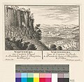 Zentralbibliothek Zürich - Wartenburg im Canton Basel. - 991085178649705501.jpg 2,466 × 2,413; 950 KB
-


_2015.jpg)


