Category:Warwick, Massachusetts
Jump to navigation
Jump to search
| Object location | | View all coordinates using: OpenStreetMap |
|---|
town in Franklin County, Massachusetts, United States   | |||||
| Upload media | |||||
| Instance of | |||||
|---|---|---|---|---|---|
| Part of |
| ||||
| Location | Franklin County, Massachusetts | ||||
| Inception |
| ||||
| Population |
| ||||
| Area |
| ||||
| Elevation above sea level |
| ||||
| Different from | |||||
| official website | |||||
 | |||||
Subcategories
This category has the following 3 subcategories, out of 3 total.
Media in category "Warwick, Massachusetts"
The following 13 files are in this category, out of 13 total.
-
 Fountain, Warwick MA.jpg 5,472 × 3,648; 8.49 MB
-

-
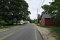
 Hotel Road, Warwick MA.jpg 2,592 × 1,728; 1,007 KB
-
 MA Route 78 northbound, Warwick MA.jpg 5,472 × 3,648; 5.5 MB
-
 Richards Reservoir.jpg 3,000 × 2,400; 2.15 MB
-
 Seal of Warwick, Massachusetts.png 196 × 200; 49 KB
-
 Unitarian Meeting House and Town Clock, Warwick MA.jpg 1,728 × 2,592; 661 KB
-
 View of Mount Monadnock from the Mount Grace fire tower.jpg 300 × 450; 16 KB
-
 Warwick ma highlight.png 788 × 466; 54 KB
-
 Warwick MA Signpost.JPG 1,200 × 1,600; 435 KB
-
 Warwick Town Hall, MA.jpg 2,571 × 1,716; 741 KB
-
 Warwick-State Line.JPG 1,600 × 1,200; 435 KB
-
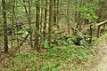 WarwickStateForest MossBrookAtQuarryRoad.jpg 1,024 × 680; 331 KB


