Category:Washington State Route 530
Jump to navigation
Jump to search
State highway in western Washington, US  .png) | |||||
| Upload media | |||||
| Instance of | |||||
|---|---|---|---|---|---|
| Location | Washington, Pacific Northwest, Washington, Pacific States Region | ||||
| Transport network | |||||
| Owned by | |||||
| Maintained by | |||||
| Inception |
| ||||
| Length |
| ||||
| |||||
| « First · 520 · 522 · 523 · 524 · 525 · 526 · 527 · 528 · 529 · 530 · 531 · 532 · 534 · 536 · 538 · 539 · 540 · Last » |
| I-5 · I-82 · I-90 · I-182 · I-205 · I-405 · I-605 · I-705 |
| US-2 · US-10 · US-12 · US-95 · US-97 · US-99 · US-101 · US-195 · US-197 · US-295 · US-395 · US-730 · US-830 |
English: This category should contain files related to Washington State Route 530.
Subcategories
This category has the following 2 subcategories, out of 2 total.
O
- Oso Landslide Memorial (2 F)
S
- Sauk River Bridge (7 F)
Media in category "Washington State Route 530"
The following 40 files are in this category, out of 40 total.
-
 WA-530.svg 600 × 600; 9 KB
-

-
 Darrington, Washington - Hampton Lumber Mills seen from Washington State Route 530 - 01.jpg 6,000 × 4,000; 10.35 MB
-
 Darrington, Washington - Hampton Lumber Mills seen from Washington State Route 530 - 02.jpg 6,000 × 4,000; 11.45 MB
-
 Darrington, Washington Bluegrass Festival 2020 canceled.jpg 6,000 × 4,000; 9.68 MB
-
 Darrington, Washington eastbound on Washington State route 530 - 01.jpg 5,888 × 3,376; 9.96 MB
-
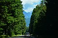
 Looking up Skagit River from Washington SR 530.jpg 4,288 × 2,848; 6.28 MB
-
 Lower Sauk Boat Launch parking lot 01.jpg 4,288 × 2,848; 6.32 MB
-
 Memorial site at Oso, seen from Washington State Route 530 - 01.jpg 6,000 × 4,000; 12.35 MB
-
 Mountainside after the slide at Oso, seen from Washington State Route 530 - 01.jpg 6,000 × 4,000; 11.33 MB
-
 Mountainside after the slide at Oso, seen from Washington State Route 530 - 02.jpg 6,000 × 4,000; 10.98 MB
-
 Northbound out of Darrington, Washington on Washington State Route 530 - 01.jpg 6,000 × 4,000; 8.97 MB
-
 Silvana, WA - former gas station.jpg 4,288 × 2,848; 4.35 MB
-
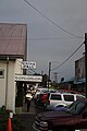
 Silvana, WA 01.jpg 4,288 × 2,848; 4.39 MB
-
 Silvana, WA 02.jpg 2,848 × 4,288; 4.28 MB
-
 Silvana, WA 03.jpg 4,288 × 2,848; 5.44 MB
-
 Skagit River 8776.JPG 4,272 × 2,848; 4.22 MB
-
 Skagit River 8810s.JPG 5,124 × 3,416; 8.17 MB
-
 Skagit River 8811.JPG 4,272 × 2,848; 4.61 MB
-
 Snohomish County boundary on State Route 530.jpg 4,738 × 3,148; 5.24 MB
-
 State Route 530 bicyclist warning sign west of Darrington, WA.jpg 4,584 × 2,892; 3.48 MB
-
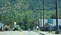
 State Route 530 westbound in downtown Darrington, WA.jpg 4,732 × 3,138; 4.19 MB
-
 Washington SR 530 meets SR 20.jpg 4,288 × 2,848; 6.32 MB
-
 Washington State Route 530 (1983-1991).png 800 × 444; 73 KB
-
 Washington State Route 530 - headed east into the slide area at Oso 01.jpg 6,000 × 4,000; 13.98 MB
-
 Washington State Route 530 - Oso Slide Memorial Highway sign.jpg 3,456 × 2,304; 3.26 MB
-
 Washington State Route 530 bridge over the North Fork Stillaguamish River west of Oso 01.jpg 6,000 × 4,000; 10.46 MB
-
 Washington State Route 530 bridge over the North Fork Stillaguamish River west of Oso 02.jpg 6,000 × 4,000; 9.53 MB
-
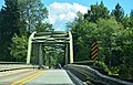
 Washington State Route 530 bridge over the Sauk River north of Darrington 01.jpg 5,992 × 3,400; 9.04 MB
-
 Washington State Route 530 bridge over the Sauk River north of Darrington 02.jpg 5,840 × 3,744; 10.59 MB
-
 Washington State Route 530 bridge over the Sauk River north of Darrington 03.jpg 5,232 × 3,224; 7.72 MB
-
 Washington State Route 530 sign.jpg 6,000 × 4,000; 13.67 MB
-
 Washington State Route 530 temporary bridge over the South Fork Stillaguamish River 01.jpg 6,000 × 3,288; 11.58 MB
-
 Washington State Route 530 temporary bridge over the South Fork Stillaguamish River 02.jpg 6,000 × 3,408; 8.91 MB
-
 Washington State Route 530 west of Oso looking east 01.jpg 6,000 × 4,000; 9 MB
-
 Washington State Route 530.svg 1,152 × 640; 138 KB
-
 Whitehorse Mountain seen from near Oso, WA.jpg 2,272 × 1,704; 835 KB
-
 Whitehorse Mountain seen from near Oso.jpg 2,022 × 1,515; 539 KB
-
 Whitehorse Mountain seen from Washington State Route 530 east of Oso - 01.jpg 6,000 × 4,000; 8.38 MB
-
 Whitehorse Mountain seen from Washington State Route 530 east of Oso - 02.jpg 6,000 × 4,000; 7.74 MB

.jpg)


