Category:Wasserstraßenkreuz Minden
Jump to navigation
Jump to search
| Object location | | View all coordinates using: OpenStreetMap |
|---|
navigable aqueduct   | |||||
| Upload media | |||||
| Instance of | |||||
|---|---|---|---|---|---|
| Location | Minden, Minden-Lübbecke District, Detmold Government Region, North Rhine-Westphalia, Germany | ||||
| Crosses | |||||
| Carries | |||||
| Has part(s) | |||||
| Heritage designation | |||||
| Date of official opening |
| ||||
| Length |
| ||||
 | |||||
Subcategories
This category has the following 13 subcategories, out of 13 total.
H
- Hauptpumpwerk Minden (13 F)
L
- Leo-Sympher-Denkmal (4 F)
M
N
P
S
- Schachtschleuse Minden (69 F)
U
- Untere Schleuse Minden (7 F)
W
- Weserschleuse Minden (57 F)
Media in category "Wasserstraßenkreuz Minden"
The following 9 files are in this category, out of 9 total.
-
 Alpe WSAMinden Minden-Pumpwerk.jpg 1,080 × 810; 276 KB
-
 Alpe WSAMinden MindenPumpwerk-2.jpg 1,080 × 810; 445 KB
-
 Blick ins Mindener Land.jpg 1,280 × 960; 109 KB
-
 Korps PiKdo I.png 400 × 482; 278 KB
-
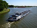 Minden an der Weser-Wasserstraßenkreuz ,Frachtkahn.jpg 3,264 × 2,448; 1.03 MB
-
 Minden4971.JPG 3,264 × 2,448; 314 KB
-
 PiRgt 100.jpg 140 × 180; 14 KB
-
 Schild Rundweg Wasserstraßenkreuz.jpg 440 × 414; 100 KB
-
 StKp PiBrig 100.jpg 102 × 126; 5 KB


