Category:Wasserturm Leer (Ostfriesland)
Jump to navigation
Jump to search
| Object location | | View all coordinates using: OpenStreetMap |
|---|
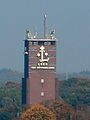
water tower in Leer, Germany  | |||||
| Upload media | |||||
| Instance of | |||||
|---|---|---|---|---|---|
| Location | Leer, Lower Saxony, Germany | ||||
 | |||||
Media in category "Wasserturm Leer (Ostfriesland)"
The following 15 files are in this category, out of 15 total.
-
 2013-05-03 Fotoflug Leer Papenburg DSCF7078.jpg 2,500 × 1,673; 3.18 MB
-
 2013-05-03 Fotoflug Leer Papenburg DSCF7079.jpg 2,500 × 1,673; 3.11 MB
-
 Flug Leer nach Emden 2010 63.JPG 4,172 × 2,728; 8.13 MB
-
 Leer - Großer Oldekamp - Wasserturm 01 ies.jpg 3,744 × 5,616; 23.84 MB
-
 Leer - Großer Oldekamp - Wasserturm 02 ies.jpg 3,744 × 5,616; 23.36 MB
-
 Leer - Großer Oldekamp - Wasserturm 03 ies.jpg 5,616 × 3,747; 17.43 MB
-
 Leer - Großer Oldekamp - Wasserturm 04 ies.jpg 3,744 × 5,616; 20.79 MB
-
 Leer - Großer Oldekamp - Wasserturm 05 ies.jpg 5,616 × 3,744; 22.87 MB
-
 Leer - Großer Oldekamp - Wasserturm 06 ies.jpg 5,616 × 3,744; 20.62 MB
-
 Leer - Großer Oldekamp - Wasserturm 07 ies.jpg 5,616 × 3,744; 22.15 MB
-
 Leer - Großer Oldekamp - Wasserturm 08 ies.jpg 3,744 × 5,616; 21.97 MB
-
 Leer - Großer Oldekamp - Wasserturm 09 ies.jpg 3,744 × 5,616; 20.63 MB
-
 Leer - Großer Oldekamp - Wasserturm 10 ies.jpg 3,744 × 5,616; 25.13 MB
-
 Leer - Großer Oldekamp - Wasserturm 11 ies.jpg 3,744 × 5,616; 20.04 MB
-
 Leer Tor Ostfrieslands Gate 2008.JPG 1,920 × 2,560; 489 KB


