Category:Watton, East Riding of Yorkshire
Jump to navigation
Jump to search
English: Watton is a village and civil parish in the East Riding of Yorkshire, England. The village is situated on the A164 road, about 6 miles (9.7 km) north of Beverley and 6 miles (9.7 km) south of Driffield. According to the 2001 UK census the civil parish of Watton had a population of 238.
village and civil parish in East Riding of Yorkshire, United Kingdom  | |||||
| Upload media | |||||
| Instance of | |||||
|---|---|---|---|---|---|
| Location | East Riding of Yorkshire, Yorkshire and the Humber, England | ||||
 | |||||
Subcategories
This category has the following 10 subcategories, out of 10 total.
B
H
M
- Middleflat Plantation (3 F)
R
- RAF Hutton Cranswick (5 F)
T
- Tophill Low Bridge (4 F)
- Tophill Low Nature Reserve (26 F)
W
- Watton Carr Nature Reserve (6 F)
Media in category "Watton, East Riding of Yorkshire"
The following 200 files are in this category, out of 542 total.
(previous page) (next page)-
 'O' Reservoir and South Marsh hide at Tophill Low - geograph.org.uk - 2413647.jpg 3,648 × 2,736; 2.78 MB
-
 'O' Reservoir viewing screen at Tophill Low - geograph.org.uk - 2413636.jpg 3,648 × 2,736; 2.59 MB
-
 'O' reservoir, Tophill Low - geograph.org.uk - 3499201.jpg 1,600 × 1,036; 339 KB
-
 A glimpse of the reservoir wall - geograph.org.uk - 3499192.jpg 1,600 × 1,200; 863 KB
-

-
 A sea of green (geograph 5436264).jpg 640 × 426; 46 KB
-
 A tight left on this field edge footpath (geograph 5206673).jpg 2,304 × 1,728; 1.01 MB
-
 A walk to Beverley ^58 - geograph.org.uk - 1985036.jpg 800 × 600; 124 KB
-
 A walk to Beverley ^59 - geograph.org.uk - 1985037.jpg 800 × 600; 160 KB
-
 A walk to Beverley ^60 - geograph.org.uk - 1985038.jpg 800 × 600; 238 KB
-
 A walk to Beverley ^61 - geograph.org.uk - 1985040.jpg 800 × 600; 144 KB
-
 A walk to Beverley ^62 - geograph.org.uk - 1985042.jpg 800 × 600; 170 KB
-
 A walk to Beverley ^63 - geograph.org.uk - 1985043.jpg 800 × 600; 125 KB
-
 A walk to Beverley ^64 - geograph.org.uk - 1985046.jpg 800 × 600; 200 KB
-
 A walk to Beverley ^65 - geograph.org.uk - 1985047.jpg 800 × 600; 171 KB
-
 A walk to Beverley ^66 - geograph.org.uk - 1985049.jpg 800 × 600; 220 KB
-
 A walk to Beverley ^67 - geograph.org.uk - 1985051.jpg 800 × 600; 287 KB
-
 A walk to Beverley ^68 - geograph.org.uk - 1985054.jpg 800 × 600; 127 KB
-
 A walk to Beverley ^69 - geograph.org.uk - 1985059.jpg 800 × 600; 122 KB
-
 A walk to Beverley ^70 - geograph.org.uk - 1985064.jpg 800 × 600; 126 KB
-
 A walk to Beverley ^71 - geograph.org.uk - 1985069.jpg 800 × 600; 284 KB
-
 A walk to Beverley ^72 - geograph.org.uk - 1985074.jpg 800 × 600; 122 KB
-
 A walk to Beverley ^73 - geograph.org.uk - 1985078.jpg 800 × 600; 167 KB
-
 A walk to Beverley ^74 - geograph.org.uk - 1985080.jpg 800 × 600; 204 KB
-
 A walk to Beverley ^75 - geograph.org.uk - 1985082.jpg 800 × 600; 255 KB
-
 A walk to Beverley ^76 - geograph.org.uk - 1985086.jpg 800 × 600; 142 KB
-
 A walk to Beverley ^77 - geograph.org.uk - 1985089.jpg 800 × 600; 128 KB
-
 A walk to Beverley ^78 - geograph.org.uk - 1985091.jpg 800 × 600; 159 KB
-
 A walk to Beverley ^79 - geograph.org.uk - 1985094.jpg 800 × 600; 175 KB
-
 A white cottage, Watton Carrs - geograph.org.uk - 1043400.jpg 640 × 427; 386 KB
-
 A164 at Watton (geograph 6292193).jpg 1,024 × 768; 261 KB
-
 A164 towards Cranswick - geograph.org.uk - 1453863.jpg 640 × 480; 94 KB
-
 A164 towards Driffield (geograph 5253578).jpg 640 × 480; 60 KB
-
 A164 towards Driffield (geograph 5253605).jpg 640 × 480; 82 KB
-
 Abbey Farm - geograph.org.uk - 154079.jpg 640 × 480; 102 KB
-
 Abbey Farm, Watton - geograph.org.uk - 1811743.jpg 640 × 469; 226 KB
-
 Access road and footpath to Decoy House - geograph.org.uk - 4088298.jpg 4,608 × 3,456; 3.88 MB
-
-
 Angram Bridge, near Watton (geograph 5090032).jpg 480 × 640; 160 KB
-
 Angram Farm (geograph 6147327).jpg 1,024 × 768; 181 KB
-
 Angram Farm - geograph.org.uk - 3499218.jpg 640 × 415; 107 KB
-
 Angram Farm Watton Carrs (geograph 5268636).jpg 4,608 × 3,456; 5.67 MB
-

-
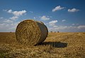 Bales near Bracken, E. Yorks - geograph.org.uk - 4151387.jpg 640 × 441; 177 KB
-
 Barley field - geograph.org.uk - 4511265.jpg 1,024 × 768; 160 KB
-
 Baswick Landing (geograph 5090000).jpg 640 × 425; 88 KB
-

-
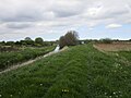
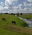
 Beverley and Barmston Drain - geograph.org.uk - 1143092.jpg 426 × 640; 176 KB
-
 Beverley and Barmston Drain - geograph.org.uk - 1410081.jpg 640 × 480; 78 KB
-
 Beverley and Barmston Drain - geograph.org.uk - 1454061.jpg 640 × 480; 64 KB
-
 Beverley and Barmston Drain - geograph.org.uk - 1948743.jpg 2,816 × 2,112; 2.77 MB
-
 Beverley and Barmston Drain - geograph.org.uk - 3499180.jpg 1,600 × 1,200; 628 KB
-
 Beverley and Barmston Drain - geograph.org.uk - 46030.jpg 480 × 640; 86 KB
-
 Beverley and Barmston Drain - geograph.org.uk - 730435.jpg 640 × 480; 86 KB
-
 Beverley and Barmston Drain - geograph.org.uk - 730439.jpg 640 × 480; 104 KB
-
 Beverley and Barmston Drain - geograph.org.uk - 730443.jpg 640 × 480; 86 KB
-
 Beverley and Barmston Drain - geograph.org.uk - 730448.jpg 640 × 480; 96 KB
-
-
 Beverley and Barmston Drain from Top Hill Low bridge (geograph 5268609).jpg 4,606 × 3,454; 7.72 MB
-
 Beverley and Barmston Drain, Wilfholme - geograph.org.uk - 4889861.jpg 575 × 640; 504 KB
-
 Beverley Road (A164) (geograph 5253574).jpg 640 × 480; 57 KB
-
 Beverley Road (A164) (geograph 5254536).jpg 640 × 480; 67 KB
-
 Big sky, big pylon (geograph 5933175).jpg 1,024 × 654; 87 KB
-
 Black Kell (geograph 6292220).jpg 1,024 × 768; 247 KB
-
 Blue Kell (geograph 6292229).jpg 1,024 × 768; 389 KB
-
 Blue Kell, near Watton - geograph.org.uk - 1811397.jpg 640 × 426; 209 KB
-
 Boggy pond (geograph 5449927).jpg 640 × 425; 59 KB
-
 Bracken chickens, E. Yorks - geograph.org.uk - 4151385.jpg 439 × 640; 197 KB
-
 Bracken Cottages near Kilnwick (geograph 5950887).jpg 1,600 × 1,064; 817 KB
-
 Bracken Farm near Kilnwick (geograph 5950875).jpg 1,600 × 1,064; 790 KB
-
 Bracken field, (E Yorks) - geograph.org.uk - 4151479.jpg 640 × 426; 210 KB
-
 Bracken Fold (geograph 6522077).jpg 1,024 × 683; 492 KB
-
 Bracken Lane (2) - geograph.org.uk - 3189728.jpg 1,024 × 768; 172 KB
-
 Bracken Lane - geograph.org.uk - 3189725.jpg 1,024 × 768; 252 KB
-
 Bridge House Farm - geograph.org.uk - 2562132.jpg 800 × 600; 328 KB
-
 Bridge House Farm drive - geograph.org.uk - 3499237.jpg 1,024 × 777; 291 KB
-
 Bridge over Scurf Dyke (geograph 5547677).jpg 1,024 × 768; 219 KB
-
 Bridleway beside Beverley and Barmston Drain - geograph.org.uk - 3499189.jpg 1,600 × 1,200; 804 KB
-
 Bridleway to Angram - geograph.org.uk - 3839990.jpg 1,024 × 768; 178 KB
-
 Bridleway, Tophill Low - geograph.org.uk - 1454059.jpg 640 × 480; 120 KB
-
 Buildings from the former RAF Hutton Cranswick - geograph.org.uk - 5948419.jpg 1,600 × 1,064; 458 KB
-
 Burn Butts - geograph.org.uk - 1453833.jpg 640 × 480; 48 KB
-
 Burn Butts - geograph.org.uk - 90068.jpg 640 × 480; 112 KB
-
 Burnbutts Lane (geograph 4511277).jpg 1,024 × 768; 136 KB
-
 Burnbutts Lane (geograph 6901882).jpg 1,024 × 683; 431 KB
-
 Burnbutts Lane - geograph.org.uk - 1453831.jpg 640 × 480; 81 KB
-
 Burnbutts Lane junction (geograph 5206655).jpg 2,304 × 1,728; 842 KB
-
 Bus stop and shelter, Watton (geograph 5253598).jpg 640 × 480; 63 KB
-
 Car park area, Tophill Low reserve - geograph.org.uk - 3499165.jpg 1,024 × 768; 352 KB
-
 Carr Lane - geograph.org.uk - 1454141.jpg 640 × 480; 104 KB
-
 Carr Lane at Watton Carrs - geograph.org.uk - 2562176.jpg 800 × 600; 291 KB
-
 Cattle grid on Crabtree Lane near Kilnwick (geograph 5951028).jpg 1,600 × 1,064; 902 KB
-
 Cawkeld Field - geograph.org.uk - 1043498.jpg 640 × 427; 412 KB
-
 Cawkeld Field - geograph.org.uk - 1043500.jpg 640 × 427; 372 KB
-
 Cawkeld Field, E Yorkshire - geograph.org.uk - 4151487.jpg 469 × 640; 180 KB
-
 Cawkeld Sinks, Cawkeld (geograph 6494845).jpg 5,456 × 3,632; 3.27 MB
-
 Chicken Shed near Watton (geograph 5933193).jpg 1,024 × 768; 232 KB
-
 Chicken sheds on Carr Lane - geograph.org.uk - 2562146.jpg 800 × 600; 255 KB
-
 Church Lane (geograph 5379019).jpg 640 × 426; 46 KB
-
 Church Lane (geograph 5436273).jpg 640 × 426; 57 KB
-
 Church Lane junction - geograph.org.uk - 3499251.jpg 640 × 447; 163 KB
-
 Church Lane towards Tophill Low - geograph.org.uk - 2563198.jpg 800 × 600; 305 KB
-
 Church Lane, East of Watton - geograph.org.uk - 1454135.jpg 640 × 480; 118 KB
-
 Church Lane, Watton - geograph.org.uk - 2273112.jpg 640 × 480; 80 KB
-
 Close up, Elizabeth II postbox on Carr Lane (geograph 5250169).jpg 900 × 1,733; 291 KB
-
 Colourful Red campion - geograph.org.uk - 3499176.jpg 1,024 × 1,024; 287 KB
-
 Cottage on Church Lane, Watton (geograph 5253593).jpg 640 × 480; 69 KB
-
 Crabtree Lane - geograph.org.uk - 4511023.jpg 1,024 × 768; 159 KB
-
 Crops beside the road to Bracken (geograph 6522035).jpg 1,024 × 683; 567 KB
-
 Crossing the tracks (geograph 6516390).jpg 3,648 × 1,744; 3.07 MB
-
 Crossing the Yorkshire Wolds Prairies - geograph.org.uk - 1043508.jpg 640 × 427; 335 KB
-
 Curved edge of 'D' Reservoir, Tophill Low - geograph.org.uk - 3499168.jpg 1,600 × 1,200; 424 KB
-
 Daffodils at Decoy - geograph.org.uk - 730384.jpg 480 × 640; 123 KB
-
 Damaged willow (geograph 4510806).jpg 1,024 × 768; 240 KB
-
 Decoy House - geograph.org.uk - 257878.jpg 640 × 482; 123 KB
-
 Decoy House and farm buildings - geograph.org.uk - 257883.jpg 640 × 450; 100 KB
-
 Decoy House Farm (geograph 5501797).jpg 1,600 × 1,065; 623 KB
-
 Drain beside Bridleway, Tophill Low - geograph.org.uk - 1454002.jpg 640 × 480; 105 KB
-
 Drain beside Bridleway, Tophill Low - geograph.org.uk - 1454010.jpg 640 × 480; 93 KB
-
 Drain near Wilfholme Landing - geograph.org.uk - 1142041.jpg 640 × 375; 196 KB
-
 Dyke side bush reflected in water (geograph 5276784).jpg 3,456 × 4,608; 5.75 MB
-
 Easingwold Farm Watton Carrs (geograph 5268621).jpg 4,580 × 3,418; 4.92 MB
-
 Easingwold Farm, Watton Carrs (geograph 5502948).jpg 1,600 × 1,044; 900 KB
-
 Electricity pylons on Watton Carrs (geograph 6148340).jpg 1,024 × 768; 131 KB
-
 Elizabeth II postbox on Carr Lane (geograph 5250168).jpg 640 × 456; 83 KB
-
 Elizabeth II postbox on Main Street, Watton (geograph 5249478).jpg 1,169 × 2,204; 527 KB
-
 Embankment of the River Hull - geograph.org.uk - 3499155.jpg 1,024 × 768; 428 KB
-
 End of a footpath near Watton Grange Farm - geograph.org.uk - 4511054.jpg 1,024 × 768; 390 KB
-
 Entering Bracken (geograph 6522071).jpg 1,024 × 683; 433 KB
-
 Entering Hutton Cranswick (geograph 5254538).jpg 640 × 480; 58 KB
-
 Entering Watton on Carr Lane (geograph 5268657).jpg 4,608 × 3,456; 5.93 MB
-
 Entrance to Cawkeld Sinks Plantation (geograph 4510993).jpg 1,024 × 768; 318 KB
-
 Entrance to Easingwold Farm (geograph 6148316).jpg 1,024 × 768; 168 KB
-
 Ex-water authority houses - geograph.org.uk - 664022.jpg 640 × 480; 116 KB
-
 Fallen ash - geograph.org.uk - 4511618.jpg 1,024 × 768; 251 KB
-
 Farm buildings at Decoy House - geograph.org.uk - 257904.jpg 640 × 462; 86 KB
-
 Farm buildings near Kilnwick (geograph 6349452).jpg 1,024 × 686; 137 KB
-
 Farm road near Decoy - geograph.org.uk - 730387.jpg 640 × 480; 90 KB
-
 Farm road to Decoy House (geograph 5501799).jpg 1,600 × 1,065; 723 KB
-
 Farm road to Whinnyforth Farm - geograph.org.uk - 2972103.jpg 4,000 × 3,000; 3.21 MB
-
 Farm track to Watton Abbey Farm (geograph 5436271).jpg 640 × 426; 58 KB
-
 Farm track to Watton Abbey Farm (geograph 5449931).jpg 640 × 425; 58 KB
-
 Farmhouse at Angram Farm - geograph.org.uk - 2416742.jpg 3,648 × 2,736; 1.89 MB
-
 Farmland (geograph 5404054).jpg 640 × 426; 31 KB
-
 Farmland at SE972502 - geograph.org.uk - 110732.jpg 640 × 480; 135 KB
-
 Farmland at SE9859851526 - geograph.org.uk - 90230.jpg 640 × 480; 163 KB
-
 Farmland at TA002513 - geograph.org.uk - 82196.jpg 640 × 480; 138 KB
-
 Farmland at TA0408049059 - geograph.org.uk - 78083.jpg 640 × 480; 123 KB
-
 Farmland near Abbey Farm - geograph.org.uk - 1453933.jpg 640 × 480; 76 KB
-
 Farmland near The Monks Barn - geograph.org.uk - 78077.jpg 640 × 480; 105 KB
-
 Farmland North of Bracken - geograph.org.uk - 90226.jpg 640 × 480; 168 KB
-
 Farmland North of Oldfield Lane - geograph.org.uk - 2237513.jpg 3,648 × 2,736; 3.58 MB
-
 Farmland South of Scurf Dike - geograph.org.uk - 1453962.jpg 640 × 480; 74 KB
-
 Farmland with History - geograph.org.uk - 2347605.jpg 3,264 × 2,448; 1.88 MB
-
 Farmland, Watton Carrs - geograph.org.uk - 1453969.jpg 640 × 480; 105 KB
-
 Farmland, Watton Carrs - geograph.org.uk - 1453975.jpg 640 × 480; 77 KB
-
 Farmland, Watton Carrs - geograph.org.uk - 1453982.jpg 640 × 480; 81 KB
-
 Farmland, Watton Carrs - geograph.org.uk - 1454142.jpg 640 × 480; 88 KB
-
 Fence in the river, near Baswick Steer (geograph 5090004).jpg 640 × 426; 83 KB
-
 Field at Bracken - geograph.org.uk - 3189731.jpg 1,024 × 768; 165 KB
-
 Field Boundary and Hedgerow - geograph.org.uk - 1453847.jpg 640 × 480; 122 KB
-
 Field Edge Footpath - geograph.org.uk - 2347714.jpg 3,264 × 2,448; 2.66 MB
-
 Field edge Footpath to Oldfield Lane - geograph.org.uk - 2104373.jpg 4,000 × 3,000; 3.11 MB
-
 Field Edge Footpath toward Watton. - geograph.org.uk - 2344514.jpg 3,264 × 2,448; 2.33 MB
-
 Field edge, Watton Carrs (geograph 6147323).jpg 1,024 × 768; 202 KB
-
 Field entrance off Little Lane, Watton (geograph 5253601).jpg 640 × 480; 57 KB
-
 Field entrance off the A164 (geograph 5254533).jpg 640 × 433; 52 KB
-
 Field of peas and Middleflat Plantation (geograph 6148350).jpg 1,024 × 768; 211 KB
-
 Field, Watton (geograph 5378981).jpg 640 × 426; 47 KB
-
 Fields near Bracken (geograph 6522074).jpg 1,024 × 683; 504 KB
-
 Fields off Little Lane, Watton (geograph 5253599).jpg 640 × 480; 56 KB
-
 Fields West of Hutton Cranswick - geograph.org.uk - 2347626.jpg 3,264 × 2,448; 1.88 MB
-
 Fieldside Footpath near Watton Grange Farm - geograph.org.uk - 2344496.jpg 3,264 × 2,448; 2.55 MB
-
 Fingerpost north Bracken (geograph 6495088).jpg 3,632 × 5,456; 2.31 MB
-
 Fingerpost north of Bracken (geograph 5950865).jpg 1,600 × 1,064; 717 KB
-
 Fish pond at Cawkeld - geograph.org.uk - 58771.jpg 640 × 480; 139 KB
-
 Flat farmland (geograph 5404060).jpg 640 × 426; 42 KB
-
 Flat farmland (geograph 5436274).jpg 640 × 426; 57 KB
-
 Flat Field (geograph 5378912).jpg 640 × 426; 45 KB
-
 Flat scenery (geograph 5404065).jpg 640 × 426; 39 KB
-
 Flat! (geograph 5404057).jpg 640 × 426; 38 KB
-
 Following the leader... (geograph 6516386).jpg 3,648 × 1,744; 3.33 MB
-
 Foodbridge over Scurf Dike - geograph.org.uk - 1453917.jpg 640 × 480; 142 KB
-
 Footbridge across Scurf Dyke (geograph 6516399).jpg 3,648 × 1,744; 3.45 MB
-
 Footbridge across Scurf Dyke (geograph 6517085).jpg 3,648 × 1,744; 3.24 MB
-
 Footbridge and footpath to Cawkeld (geograph 4511640).jpg 1,024 × 768; 402 KB
-
 Footbridge near Swinekeld Chalk Pit (geograph 5948171).jpg 1,600 × 1,064; 1,013 KB
-
 Footbridge near Watton Grange Farm - geograph.org.uk - 4511624.jpg 1,024 × 768; 301 KB
-
 Footbridge over Barmston Drain (geograph 5501705).jpg 1,600 × 1,065; 947 KB
-
 Footbridge over Decoy Drain (geograph 6148349).jpg 1,024 × 768; 293 KB
-
 Footbridge over Scurf Dike (geograph 6496435).jpg 5,456 × 3,632; 3.21 MB
-
 Footbridge over Scurf Dike - geograph.org.uk - 236739.jpg 640 × 482; 161 KB
-
 Footbridge over Watton Beck (geograph 6494234).jpg 5,456 × 3,632; 3.53 MB
-
 Footpath across Cawkeld Field - geograph.org.uk - 1043505.jpg 640 × 478; 500 KB
-
 Footpath along hedge (geograph 5378555).jpg 640 × 426; 68 KB
-
 Footpath along hedge (geograph 5429901).jpg 640 × 426; 64 KB
-
 Footpath alongside Decoy Drain (geograph 6147316).jpg 1,024 × 768; 160 KB
-
 Footpath alongside Decoy Drain (geograph 6148345).jpg 1,024 × 768; 150 KB
-
 Footpath alongside Decoy Drain (geograph 6148351).jpg 1,024 × 768; 144 KB
-
 Footpath alongside the Scurf Dike (geograph 5924795).jpg 1,024 × 768; 186 KB


.jpg)
.jpg)


.jpg)

.jpg)
.jpg)


.jpg)
.jpg)

.jpg)
.jpg)


.jpg)


.jpg)
.jpg)

_(geograph_5253574).jpg)
_(geograph_5254536).jpg)
.jpg)
.jpg)
.jpg)

.jpg)

.jpg)
.jpg)
_-_geograph.org.uk_-_4151479.jpg)
.jpg)
_-_geograph.org.uk_-_3189728.jpg)


.jpg)


.jpg)
.jpg)

.jpg)
.jpg)


.jpg)


.jpg)
.jpg)

.jpg)
.jpg)


.jpg)

.jpg)

.jpg)
.jpg)


.jpg)


.jpg)


.jpg)
.jpg)
.jpg)
.jpg)
.jpg)
.jpg)


.jpg)
.jpg)
.jpg)
.jpg)
.jpg)


.jpg)

.jpg)

.jpg)
.jpg)

.jpg)


.jpg)


.jpg)
.jpg)
.jpg)
.jpg)
.jpg)
.jpg)
.jpg)


.jpg)
.jpg)

.jpg)
.jpg)
.jpg)
.jpg)
.jpg)
.jpg)

.jpg)
.jpg)
.jpg)
.jpg)

.jpg)
.jpg)
.jpg)

.jpg)

.jpg)
.jpg)
.jpg)
.jpg)
.jpg)
.jpg)