Category:Watton, Norfolk
Jump to navigation
Jump to search
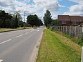
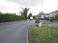
English: Watton is a market town in the district of Breckland within the English county of Norfolk. It is situated on the crossroads of the A1075 Dereham-Thetford road and the B1108 Brandon-Norwich Road, about west of Norwich.
Română: Watton este un oraş în comitatul Norfolk, regiunea East, Anglia. Oraşul se află în districtul Breckland.
market town in the district of Breckland within the English county of Norfolk  | |||||
| Upload media | |||||
| Instance of | |||||
|---|---|---|---|---|---|
| Location | Breckland, Norfolk, East of England, England | ||||
| Population |
| ||||
| Area |
| ||||
| official website | |||||
 | |||||
Subcategories
This category has the following 5 subcategories, out of 5 total.
Media in category "Watton, Norfolk"
The following 198 files are in this category, out of 198 total.
-
 A1075 and B1108 cross roads in Watton - geograph.org.uk - 6130172.jpg 1,024 × 768; 228 KB
-
 Accountants - geograph.org.uk - 6089678.jpg 1,024 × 769; 257 KB
-
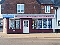
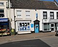
 Accountants former Building Society - geograph.org.uk - 6090580.jpg 1,024 × 778; 223 KB
-
 Adcocks long established electrical retailer - geograph.org.uk - 6090583.jpg 1,024 × 769; 200 KB
-
 All Seasons second hand shop - geograph.org.uk - 6089683.jpg 1,024 × 769; 281 KB
-
 Area of scrubby wood - geograph.org.uk - 6125473.jpg 1,024 × 768; 445 KB
-
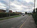
 B1108 to Norwich - geograph.org.uk - 6204006.jpg 1,024 × 768; 245 KB
-
 B1108 towards Watton - geograph.org.uk - 6204001.jpg 1,024 × 768; 251 KB
-
 Barclays Bank last one left - geograph.org.uk - 6089676.jpg 1,024 × 769; 280 KB
-
 Barn Ruche - geograph.org.uk - 6160330.jpg 3,337 × 2,503; 1.82 MB
-
 Bookmaker's shop - geograph.org.uk - 6127900.jpg 1,024 × 768; 309 KB
-
 Bookmakers - geograph.org.uk - 6090591.jpg 769 × 1,024; 184 KB
-
 Brandon Road from roundabout - geograph.org.uk - 6133362.jpg 1,600 × 1,200; 467 KB
-
 Bridge on A1075 - geograph.org.uk - 6053373.jpg 1,024 × 768; 246 KB
-
 Butchers Watton High Street - geograph.org.uk - 6127854.jpg 1,024 × 768; 285 KB
-
 Buyer of gold and much more - geograph.org.uk - 6090582.jpg 823 × 1,024; 257 KB
-
 Cafe on Watton High Street - geograph.org.uk - 6087527.jpg 1,024 × 769; 193 KB
-
 Calls itself an online business - geograph.org.uk - 6130196.jpg 1,024 × 768; 243 KB
-
 Cereal crop with hedge - geograph.org.uk - 6137243.jpg 1,024 × 769; 260 KB
-
 Child care centre - geograph.org.uk - 6090600.jpg 1,024 × 619; 146 KB
-
 Chinese Restaurant and Take Away - geograph.org.uk - 6090567.jpg 1,024 × 765; 259 KB
-
 Church Road, Watton - geograph.org.uk - 6159697.jpg 3,456 × 2,592; 3.87 MB
-
 Dental surgery - geograph.org.uk - 6014529.jpg 4,608 × 3,456; 1.63 MB
-
 Dereham Road A1075 leaving Watton - geograph.org.uk - 5925543.jpg 4,608 × 3,456; 4.04 MB
-
 East on Harvey Street, Watton - geograph.org.uk - 6200280.jpg 1,024 × 768; 191 KB
-
 Electricity sub station - geograph.org.uk - 6026755.jpg 1,024 × 768; 217 KB
-

-
 Entrance to Akrotiri Square - geograph.org.uk - 6204015.jpg 1,024 × 768; 219 KB
-
 Entrance to Beechwood Avenue - geograph.org.uk - 6089691.jpg 1,024 × 769; 236 KB
-
 Entrance to Carpet Store - geograph.org.uk - 6204075.jpg 1,024 × 768; 227 KB
-
 Entrance to Flats - geograph.org.uk - 6130243.jpg 768 × 1,024; 250 KB
-
 Entrance to housing estate from roundabout - geograph.org.uk - 6133356.jpg 1,024 × 768; 179 KB
-
 Entrance to Loch Neaton Sign - geograph.org.uk - 6153036.jpg 1,024 × 768; 259 KB
-
 Entrance to Tesco car park - geograph.org.uk - 6201160.jpg 1,024 × 768; 236 KB
-
 Entrance to Wayland Wood - geograph.org.uk - 6058318.jpg 1,024 × 768; 433 KB
-
 Entrance to Wayland Wood car park - geograph.org.uk - 6058313.jpg 1,024 × 768; 370 KB
-
 Entrance yard to flats - geograph.org.uk - 6089686.jpg 1,024 × 769; 261 KB
-
 Entry to Watton Sports Centre from Dereham Road A1075 - geograph.org.uk - 5925539.jpg 4,608 × 3,456; 3.34 MB
-
 Estate Agents - geograph.org.uk - 6128880.jpg 1,024 × 768; 229 KB
-
 Estate Agents - geograph.org.uk - 6131680.jpg 1,024 × 768; 288 KB
-
 Estate Agents - geograph.org.uk - 6131699.jpg 1,024 × 768; 263 KB
-
 Field behind sub station and next to golf course - geograph.org.uk - 6026764.jpg 1,024 × 768; 239 KB
-
 Field on the outskirts of Watton - geograph.org.uk - 5393257.jpg 640 × 480; 53 KB
-
 Footpath - geograph.org.uk - 2417541.jpg 1,200 × 1,600; 595 KB
-
 Former cafe - geograph.org.uk - 6090574.jpg 1,024 × 769; 245 KB
-
 Former DIY store then charity shop - geograph.org.uk - 6090594.jpg 1,024 × 886; 232 KB
-
 Former Lloyds Bank - geograph.org.uk - 6127888.jpg 1,024 × 768; 280 KB
-
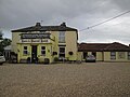
 Former pub now residential - geograph.org.uk - 6128902.jpg 1,024 × 768; 200 KB
-
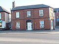
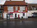 Former Watton Post Office - geograph.org.uk - 6089662.jpg 1,024 × 769; 214 KB
-
 Freshly coppiced area - geograph.org.uk - 6123298.jpg 1,024 × 768; 407 KB
-
 Gas Manager's House Saham Road Watton - geograph.org.uk - 5925533.jpg 4,608 × 3,456; 4 MB
-
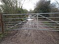 Gate across muddy track - geograph.org.uk - 6053376.jpg 1,024 × 768; 334 KB
-
 Gates at the entrance to Church Walk - geograph.org.uk - 5925560.jpg 4,608 × 3,456; 3.98 MB
-
 Goldfinch Way, Watton - geograph.org.uk - 6159691.jpg 3,456 × 2,592; 3.87 MB
-
 Grand old Willow tree at edge of car park - geograph.org.uk - 6090612.jpg 807 × 1,024; 319 KB
-
 Grassy woodland track - geograph.org.uk - 6123311.jpg 1,024 × 768; 400 KB
-
 Hair salon - geograph.org.uk - 6128994.jpg 1,024 × 768; 266 KB
-
 Hairdressers - geograph.org.uk - 6131705.jpg 768 × 1,024; 315 KB
-
 Hare ^ Barrel Hotel Brandon Road Watton - geograph.org.uk - 5925518.jpg 4,608 × 3,456; 3.85 MB
-
 Harvey Street Watton - geograph.org.uk - 6200284.jpg 1,024 × 768; 210 KB
-
 Hazel that has been coppiced - geograph.org.uk - 6125457.jpg 1,024 × 768; 457 KB
-
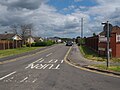
 Heading into Watton from roundabout - geograph.org.uk - 6133351.jpg 1,024 × 768; 172 KB
-
 Hedgerow and field, Watton - geograph.org.uk - 5393254.jpg 640 × 480; 76 KB
-
 Hedgerow, Watton - geograph.org.uk - 5393289.jpg 640 × 480; 74 KB
-
 High or low path^ - geograph.org.uk - 6153120.jpg 1,024 × 768; 394 KB
-
 Hospice charity shop - geograph.org.uk - 6087517.jpg 769 × 1,024; 206 KB
-
 Independent Opticians - geograph.org.uk - 6127912.jpg 1,024 × 768; 238 KB
-
 International food shop and Off Licence - geograph.org.uk - 6089667.jpg 1,024 × 769; 246 KB
-
 Jewellery shop - geograph.org.uk - 6087524.jpg 1,024 × 769; 216 KB
-
 Junction of Town Green Road and Redhill Lane - geograph.org.uk - 5925547.jpg 4,608 × 3,456; 4.27 MB
-
 Just inside Loch Neaton - geograph.org.uk - 6153056.jpg 1,024 × 768; 360 KB
-
 Kebab takeaway - geograph.org.uk - 6128894.jpg 1,024 × 768; 268 KB
-
 Keep off the pipe - geograph.org.uk - 6026419.jpg 1,024 × 768; 335 KB
-
 Kitchen Bedroom shop - geograph.org.uk - 6087531.jpg 1,024 × 769; 219 KB
-
 Letting agents' shop - geograph.org.uk - 6130184.jpg 1,024 × 768; 201 KB
-
 Lochside fishing - geograph.org.uk - 6153117.jpg 1,024 × 768; 369 KB
-
 Long Bridle Road southerly direction - geograph.org.uk - 6137209.jpg 1,024 × 769; 441 KB
-
 Long Bridle Road southerly direction - geograph.org.uk - 6137223.jpg 1,024 × 769; 439 KB
-
 Looking across B1108 into Portal Avenue - geograph.org.uk - 6203997.jpg 1,024 × 768; 241 KB
-
 Looking along A1075 leaving Watton - geograph.org.uk - 6014954.jpg 3,448 × 4,592; 1.35 MB
-
 Looking along stream alongside golf course - geograph.org.uk - 6026710.jpg 1,024 × 768; 295 KB
-
-
 Looking down passage way to Chaston Place Watton - geograph.org.uk - 6090451.jpg 769 × 1,024; 219 KB
-
 Looking East on minor road - geograph.org.uk - 6164860.jpg 1,024 × 768; 258 KB
-
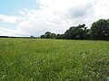
 Looking North across arable field - geograph.org.uk - 6091425.jpg 1,024 × 769; 150 KB
-
 Looking North down Mallard Way - geograph.org.uk - 6183259.jpg 1,024 × 768; 280 KB
-
 Looking North on Long Bridle Road - geograph.org.uk - 6137204.jpg 1,024 × 769; 443 KB
-
 Looking North on woodland track - geograph.org.uk - 6123291.jpg 1,024 × 768; 427 KB
-
 Looking North over Loch Neaton - geograph.org.uk - 6153125.jpg 1,024 × 768; 347 KB
-
 Looking South on forest track - geograph.org.uk - 6125462.jpg 1,024 × 768; 445 KB
-
 Looking towards picnic area - geograph.org.uk - 6153062.jpg 1,024 × 768; 330 KB
-
 Looking towards roundabout from Swaffham road - geograph.org.uk - 6133368.jpg 1,024 × 768; 184 KB
-
 Looking towards roundabout on B1108 - geograph.org.uk - 6183269.jpg 1,024 × 768; 247 KB
-
 Looking towards Saham Toney - geograph.org.uk - 6026737.jpg 1,024 × 536; 209 KB
-
 Looking towards Watton - geograph.org.uk - 6026740.jpg 1,024 × 768; 271 KB
-
 Looking towards Watton from Saham Road - geograph.org.uk - 6091421.jpg 1,024 × 769; 153 KB
-

-
 Looking up Town Green Road - geograph.org.uk - 6164854.jpg 1,024 × 768; 177 KB
-
 Memorial seat - geograph.org.uk - 6058327.jpg 1,024 × 768; 436 KB
-
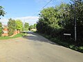
 Minor road out of Watton - geograph.org.uk - 6164848.jpg 1,024 × 768; 245 KB
-
 New houses on former meadow - geograph.org.uk - 6091417.jpg 1,024 × 769; 194 KB
-
 New housing estate off Thetford Road, Watton - geograph.org.uk - 6160363.jpg 3,456 × 2,592; 3.75 MB
-
 North towards traffic lights on A1075 - geograph.org.uk - 6201145.jpg 1,024 × 768; 231 KB
-
 Northern end of Loch Neaton - geograph.org.uk - 6153090.jpg 1,024 × 768; 407 KB
-
 Odds and ends store - geograph.org.uk - 6127874.jpg 1,024 × 768; 316 KB
-
 Ordnance Survey Flush Bracket S0264 - geograph.org.uk - 4284814.jpg 4,000 × 3,000; 3.16 MB
-
 OS Flush Bracket S 0264 Watton - geograph.org.uk - 1921840.jpg 1,024 × 819; 334 KB
-
 Over fields to Redhill Farm - geograph.org.uk - 5925545.jpg 4,608 × 3,456; 4.36 MB
-
 Overgrown footpath to B1108 - geograph.org.uk - 6183297.jpg 768 × 1,024; 455 KB
-
 Overgrown workshop - geograph.org.uk - 6183282.jpg 1,024 × 768; 267 KB
-
 PACT charity shop - geograph.org.uk - 6014036.jpg 4,608 × 3,456; 1,009 KB
-
 Path around Loch Neaton - geograph.org.uk - 6153114.jpg 768 × 1,024; 438 KB
-
 Path division - geograph.org.uk - 6153137.jpg 1,024 × 768; 417 KB
-
 Path to A1075 Watton to Dereham road - geograph.org.uk - 6153133.jpg 1,024 × 768; 431 KB
-
 Plaque in front of the Gas Manager's House Saham Road - geograph.org.uk - 5925527.jpg 4,608 × 3,456; 3.64 MB
-
 Public House - geograph.org.uk - 6128883.jpg 1,024 × 768; 227 KB
-
 Pump over a well in Watton cemetery - geograph.org.uk - 6159708.jpg 3,456 × 2,592; 3.85 MB
-
 Queens Jubilee Rose Garden - geograph.org.uk - 6201129.jpg 1,024 × 768; 314 KB
-
 Rear of houses backing on to Long Bridle Road - geograph.org.uk - 6137228.jpg 1,024 × 769; 233 KB
-
 Rear of Original Factory Shop - geograph.org.uk - 6090439.jpg 1,024 × 769; 213 KB
-
 Rear of pet and garden shop - geograph.org.uk - 6017490.jpg 4,608 × 2,853; 757 KB
-
 Recruitment shop - geograph.org.uk - 6014064.jpg 4,300 × 3,225; 1.07 MB
-
 Recycling area Tesco - geograph.org.uk - 6201168.jpg 1,024 × 670; 162 KB
-
 Residential property - geograph.org.uk - 6128989.jpg 1,024 × 768; 217 KB
-
 Roundabout at West end of Watton - geograph.org.uk - 6132694.jpg 1,024 × 768; 208 KB
-
 Roundabout on Brandon Road Watton - geograph.org.uk - 5925519.jpg 4,608 × 3,456; 3.44 MB
-
 Scrub area behind houses - geograph.org.uk - 6137216.jpg 1,024 × 769; 387 KB
-
 Sharman Avenue junction - geograph.org.uk - 6200278.jpg 1,024 × 768; 198 KB
-
 Shop closed down - geograph.org.uk - 6130222.jpg 768 × 1,024; 301 KB
-
 Shop selling bits of everything - geograph.org.uk - 6090460.jpg 1,024 × 769; 248 KB
-
 Shops on Watton High Street - geograph.org.uk - 6087520.jpg 1,024 × 769; 221 KB
-
 Short stay car park Watton - geograph.org.uk - 6090614.jpg 1,024 × 769; 164 KB
-
 Side entrance to chemists - geograph.org.uk - 6090467.jpg 1,024 × 719; 215 KB
-
 Solicitors - geograph.org.uk - 6090577.jpg 1,024 × 831; 219 KB
-
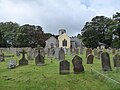
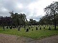
 Some of the War Graves in Watton St. Mary's churchyard - geograph.org.uk - 6159706.jpg 3,456 × 2,592; 3.88 MB
-
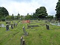
 Some of the War Graves in Watton St. Mary's churchyard - geograph.org.uk - 6160080.jpg 3,456 × 2,592; 3.92 MB
-
 South on A1075 out of Watton - geograph.org.uk - 6201140.jpg 1,024 × 768; 213 KB
-
 Southeast view over grassland - geograph.org.uk - 6183236.jpg 1,024 × 768; 228 KB
-
 Southerly over grassland on edge of Watton - geograph.org.uk - 6183239.jpg 1,024 × 768; 257 KB
-
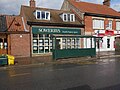 Sowerbys Estate Agents - geograph.org.uk - 6089671.jpg 1,024 × 769; 246 KB
-
 St Mary's Parish Church Watton (1) - geograph.org.uk - 5925553.jpg 4,608 × 3,456; 3.72 MB
-
 St Mary's Parish Church Watton (2) - geograph.org.uk - 5925554.jpg 4,608 × 3,456; 4.36 MB
-
 St Mary's Parish Church Watton (3) - geograph.org.uk - 5925557.jpg 4,608 × 3,456; 4.69 MB
-
 St Mary, Watton, churchyard (a) - geograph.org.uk - 5541478.jpg 640 × 480; 77 KB
-
 St Mary, Watton, churchyard (b) - geograph.org.uk - 5550822.jpg 640 × 480; 83 KB
-
 St Mary, Watton, churchyard (c) - geograph.org.uk - 5550844.jpg 640 × 480; 82 KB
-
 St Mary, Watton, churchyard (d) - geograph.org.uk - 5550845.jpg 640 × 480; 85 KB
-
 St Mary, Watton, churchyard (e) - geograph.org.uk - 5550846.jpg 640 × 480; 78 KB
-
 St Mary, Watton, churchyard (e) - geograph.org.uk - 5550847.jpg 480 × 640; 81 KB
-
 St Mary, Watton, churchyard (f) - geograph.org.uk - 5550848.jpg 640 × 480; 132 KB
-
 St Mary, Watton, churchyard (g) - geograph.org.uk - 5550849.jpg 480 × 640; 79 KB
-
 St Mary, Watton, churchyard (h) - geograph.org.uk - 5550852.jpg 640 × 480; 71 KB
-

-
 Stream along edge of field - geograph.org.uk - 6053355.jpg 1,024 × 622; 246 KB
-
 Stream beside Watton Golf Club - geograph.org.uk - 6026640.jpg 1,024 × 768; 319 KB
-
 Stream between Watton and Saham Toney - geograph.org.uk - 5992896.jpg 3,168 × 4,608; 1.66 MB
-
 Takeaway and cafe - geograph.org.uk - 6090462.jpg 1,024 × 769; 278 KB
-
 Tattoo parlour - geograph.org.uk - 6131713.jpg 768 × 1,024; 311 KB
-
 Taxi firm - geograph.org.uk - 6014539.jpg 4,608 × 3,456; 1.51 MB
-
 Tesco exit junction with A1075 - geograph.org.uk - 6201152.jpg 1,024 × 768; 192 KB
-
 The end of the road, for the time being - geograph.org.uk - 6159685.jpg 3,456 × 2,592; 3.82 MB
-
 The end of the road, for the time being - geograph.org.uk - 6159688.jpg 3,380 × 2,535; 1.82 MB
-
 Threxton Road Industrial Estate - geograph.org.uk - 1361600.jpg 640 × 480; 75 KB
-
 Town Green Road passing Redhill Park - geograph.org.uk - 5925549.jpg 4,608 × 3,456; 4.37 MB
-
 Track junction - geograph.org.uk - 6123306.jpg 1,024 × 768; 395 KB
-
 Track junction Wayland Wood - geograph.org.uk - 6058319.jpg 1,024 × 768; 416 KB
-
 Turkish Barbers - geograph.org.uk - 6014564.jpg 4,608 × 3,456; 1.11 MB
-
 UK Watton.jpg 774 × 1,551; 141 KB
-
 Unnamed overgrown stream - geograph.org.uk - 5992892.jpg 3,456 × 4,608; 2.46 MB
-
 View along A1075 towards Watton - geograph.org.uk - 6014962.jpg 4,592 × 3,448; 1,000 KB
-
 View from bridge on A1075 - geograph.org.uk - 6053351.jpg 1,024 × 640; 298 KB
-
 View from picnic area - geograph.org.uk - 6153100.jpg 1,024 × 768; 373 KB
-
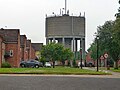 Water tower, Watton - geograph.org.uk - 5305056.jpg 640 × 480; 152 KB
-
 Watton Christian Community Centre - geograph.org.uk - 6014509.jpg 3,374 × 4,499; 1.09 MB
-
 Watton Community Care office - geograph.org.uk - 6014517.jpg 4,608 × 3,456; 1.42 MB
-
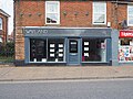
 Watton Edwards News now includes Post Office - geograph.org.uk - 6089665.jpg 1,024 × 769; 234 KB
-
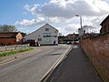
 Watton Fire Station - geograph.org.uk - 6201136.jpg 1,024 × 768; 180 KB
-
 Watton Goldsmith Ltd - geograph.org.uk - 6089673.jpg 1,024 × 769; 278 KB
-
 Watton Golf Course - geograph.org.uk - 6026716.jpg 1,024 × 627; 196 KB
-
 Watton Library - geograph.org.uk - 6017485.jpg 4,608 × 3,456; 1.15 MB
-
 Watton Police Station High Street - geograph.org.uk - 5925536.jpg 4,608 × 3,456; 3.45 MB
-
 Watton Public Toilets - geograph.org.uk - 6090608.jpg 1,024 × 715; 221 KB
-
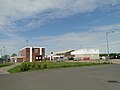 Watton Sports Centre and playing fields - geograph.org.uk - 6159696.jpg 3,456 × 2,592; 3.48 MB
-
 Watton Town clock - geograph.org.uk - 6090587.jpg 635 × 1,024; 161 KB
-
 Watton Town Sign.JPG 2,048 × 1,536; 632 KB
-
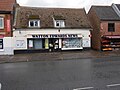
 Watton Vets - geograph.org.uk - 6087535.jpg 1,024 × 769; 185 KB
-
 Wayland House - geograph.org.uk - 6014054.jpg 4,397 × 3,298; 1.02 MB
-
 Wayland Wood Track - geograph.org.uk - 6058322.jpg 1,024 × 768; 451 KB
-
 Wayland Wood Track - geograph.org.uk - 6058324.jpg 1,024 × 768; 360 KB
-
 Wayland Wood Track - geograph.org.uk - 6058325.jpg 1,024 × 768; 424 KB
-
 Wayland Wood Track - geograph.org.uk - 6123287.jpg 1,024 × 768; 424 KB
-
 Wayland Wood, a woodland nature walk at Watton - geograph.org.uk - 6160332.jpg 3,456 × 2,592; 3.9 MB
-
 Willow House restaurant - geograph.org.uk - 6128973.jpg 1,024 × 768; 269 KB
-
 Woodland track in Spring - geograph.org.uk - 6123324.jpg 1,024 × 768; 382 KB
-
 Woodland track with coppiced area on left - geograph.org.uk - 6123319.jpg 1,024 × 768; 375 KB
-
 Wool and craft shop - geograph.org.uk - 6090455.jpg 1,024 × 769; 252 KB
-
 World War One Memorial in Watton St. Mary's church - geograph.org.uk - 6159705.jpg 2,592 × 3,456; 3.08 MB
-
 Through A Six-barred Gate - geograph.org.uk - 293212.jpg 639 × 475; 104 KB


_-_geograph.org.uk_-_5925553.jpg)
_-_geograph.org.uk_-_5925554.jpg)
_-_geograph.org.uk_-_5925557.jpg)
_-_geograph.org.uk_-_5541478.jpg)
_-_geograph.org.uk_-_5550822.jpg)
_-_geograph.org.uk_-_5550844.jpg)
_-_geograph.org.uk_-_5550845.jpg)
_-_geograph.org.uk_-_5550846.jpg)
_-_geograph.org.uk_-_5550847.jpg)
_-_geograph.org.uk_-_5550848.jpg)
_-_geograph.org.uk_-_5550849.jpg)
_-_geograph.org.uk_-_5550852.jpg)


