Category:Weaverham
Aller à la navigation
Aller à la recherche
English: Weaverham is a village and civil parish in the unitary authority of Cheshire West and Chester and the ceremonial county of Cheshire, England. Just off the A49, it is just to the west of Northwich and south of the River Weaver with a population of about 6,500. [1]
village britannique  | |||||
| Téléverser des médias | |||||
| Nature de l’élément | |||||
|---|---|---|---|---|---|
| Lieu | Cheshire West and Chester, Cheshire, Angleterre du Nord-Ouest, Angleterre | ||||
 | |||||
Sous-catégories
Cette catégorie comprend 2 sous-catégories, dont les 2 ci-dessous.
H
- Hefferston Grange (2 F)
M
- St Mary's Church, Weaverham (3 F)
Média dans la catégorie « Weaverham »
Cette catégorie comprend 86 fichiers, dont les 86 ci-dessous.
-
 'Sunpower', Line of pylons at dusk north of Weaverham - geograph.org.uk - 2183994.jpg 1 024 × 768 ; 116 kio
-
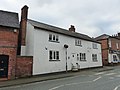
 12 High Street, Weaverham.jpg 1 800 × 1 350 ; 658 kio
-
 13 High Street, Weaverham.jpg 1 800 × 1 350 ; 350 kio
-
 14 and 16 High Street, Weaverham.jpg 1 800 × 1 350 ; 386 kio
-
 24 West Road, Weaverham.jpg 1 800 × 1 350 ; 492 kio
-
 3 and 5 High Street, Weaverham.jpg 800 × 600 ; 106 kio
-
 3 Church Lane, Weaverham.jpg 1 800 × 1 350 ; 411 kio
-
 6 and 8 Church Street, Weaverham.jpg 1 800 × 1 350 ; 480 kio
-
 A49 approaching Millington Lane - geograph.org.uk - 2778253.jpg 640 × 480 ; 55 kio
-
 A49 approaching Weaverham Roundabout - geograph.org.uk - 5016075.jpg 640 × 480 ; 345 kio
-
 A49 at Grange Lane - geograph.org.uk - 2778260.jpg 640 × 480 ; 56 kio
-
 A49 at Weaverham roundabout - geograph.org.uk - 2778265.jpg 640 × 480 ; 58 kio
-
 A49 crossing the West Coast Main Line - geograph.org.uk - 2778262.jpg 640 × 480 ; 49 kio
-
 A49 roundabout at Weaverham - geograph.org.uk - 2810545.jpg 640 × 465 ; 46 kio
-
 A49 Weaverham bypass - geograph.org.uk - 2778270.jpg 640 × 480 ; 60 kio
-
 A49(T) taken from a bridge on B5153 - geograph.org.uk - 17766.jpg 640 × 480 ; 96 kio
-
 A49, Weaverham Roundabout - geograph.org.uk - 5016080.jpg 640 × 427 ; 308 kio
-
 B5412, Weaverham - geograph.org.uk - 5569896.jpg 1 024 × 683 ; 305 kio
-
 Bradleymeadow Wood, from the River Weaver - geograph.org.uk - 5150796.jpg 1 024 × 768 ; 143 kio
-
 Bridges over the A49 near Weaverham - geograph.org.uk - 5016073.jpg 640 × 480 ; 326 kio
-
 Brook Farm - geograph.org.uk - 6246647.jpg 5 605 × 2 555 ; 2,04 Mio
-
 Brook Farmhouse - geograph.org.uk - 1773423.jpg 3 072 × 2 304 ; 801 kio
-
 Bungalows on the south bank of the River Weaver - geograph.org.uk - 5151770.jpg 1 024 × 615 ; 92 kio
-
 Chapel's Wine Bar, High Street, Weaverham - geograph.org.uk - 5935265.jpg 1 024 × 683 ; 145 kio
-
 Combine, Weaverham - geograph.org.uk - 5866049.jpg 1 024 × 768 ; 187 kio
-
 Councilhousing04.jpg 640 × 480 ; 82 kio
-
 Esther’s Lane, Weaverham - geograph.org.uk - 5866584.jpg 1 024 × 768 ; 152 kio
-
 Farm buildings at Brook Farm - geograph.org.uk - 1773418.jpg 3 072 × 2 304 ; 1 001 kio
-
 Farm road - geograph.org.uk - 5223432.jpg 1 024 × 683 ; 515 kio
-
 Farmland near Hefferston Grange - geograph.org.uk - 4955151.jpg 640 × 426 ; 52 kio
-
 Gorstage Oaklands Hotel 1728886 0077a3db.jpg 640 × 387 ; 149 kio
-
 Grammar School, Weaverham.jpg 800 × 600 ; 126 kio
-
 Hartford Golf Club - geograph.org.uk - 5866038.jpg 1 024 × 768 ; 181 kio
-
 Hefferston Grange - geograph.org.uk - 167519.jpg 640 × 638 ; 121 kio
-
 Hefferston Rise - geograph.org.uk - 5568740.jpg 640 × 427 ; 68 kio
-
 High Street, Weaverham - geograph.org.uk - 5569893.jpg 1 024 × 683 ; 453 kio
-
 Hodge Lane looking west - geograph.org.uk - 2808404.jpg 640 × 468 ; 72 kio
-
 It is the logo of Weaverham High School- 2013-12-18 23-21.jpg 219 × 244 ; 23 kio
-
 Ivy House, Weaverham.jpg 1 800 × 1 350 ; 666 kio
-
 Lime Avenue shops, Weaverham - geograph.org.uk - 17728.jpg 640 × 480 ; 87 kio
-
 Marshy ground-the demise of a former brook - geograph.org.uk - 1773435.jpg 3 072 × 2 304 ; 1,69 Mio
-
 Millington Lane - geograph.org.uk - 2808420.jpg 640 × 480 ; 88 kio
-
 Northwich Road, Weaverham - geograph.org.uk - 2808353.jpg 640 × 501 ; 62 kio
-
 Northwich Road-Forster Avenue junction - geograph.org.uk - 2808362.jpg 640 × 480 ; 40 kio
-
 Oaklands Hotel - geograph.org.uk - 1773428.jpg 3 072 × 2 304 ; 727 kio
-
 Off Weaverham Road - geograph.org.uk - 5223431.jpg 1 024 × 683 ; 307 kio
-

-
 Owlet Wood Road, Weaverham - geograph.org.uk - 5866061.jpg 1 024 × 768 ; 180 kio
-
 Owley Wood - geograph.org.uk - 5866076.jpg 1 024 × 768 ; 280 kio
-
 Pastoral scene with pylons - geograph.org.uk - 1773400.jpg 3 072 × 2 304 ; 826 kio
-
 Pond with pylon - geograph.org.uk - 1773432.jpg 3 072 × 2 304 ; 1,18 Mio
-
 Poplar Cottage, Weaverham.jpg 800 × 600 ; 117 kio
-
 Power lines crossing the River Weaver - geograph.org.uk - 5150791.jpg 1 024 × 768 ; 123 kio
-
 Public footpath with stile - geograph.org.uk - 1773413.jpg 2 304 × 3 072 ; 2,22 Mio
-
 Pylon by the West Coast Main Line - geograph.org.uk - 4955142.jpg 640 × 426 ; 45 kio
-
 Raintub Cottage, Weaverham.jpg 800 × 600 ; 137 kio
-
 River Weaver Navigation, north of Weaverham - geograph.org.uk - 5150784.jpg 1 024 × 768 ; 107 kio
-
 Riverside houses off Sandy Lane - geograph.org.uk - 5151759.jpg 1 024 × 614 ; 99 kio
-
 Rough grazing with bog - geograph.org.uk - 1773459.jpg 3 072 × 2 304 ; 968 kio
-
 Sandy Lane junction with the A49 - geograph.org.uk - 1827005.jpg 640 × 480 ; 48 kio
-
 Sandy Lane, Weaverham - geograph.org.uk - 5568744.jpg 1 024 × 683 ; 282 kio
-
 School Bank Cottage, Weaverham - geograph.org.uk - 17721.jpg 640 × 480 ; 86 kio
-
 Small stream forming field boundary - geograph.org.uk - 1773527.jpg 2 304 × 3 072 ; 3,95 Mio
-
 Tall windswept trees, north bank, River Weaver - geograph.org.uk - 5150804.jpg 1 024 × 768 ; 181 kio
-
 Thatched black and white cottage, Weaverham - geograph.org.uk - 17942.jpg 640 × 480 ; 51 kio
-
 The eponymous brook, of the adjacent farmhouse - geograph.org.uk - 1773424.jpg 3 072 × 2 304 ; 1,77 Mio
-
 The Hanging Gate public house - geograph.org.uk - 1773466.jpg 3 072 × 2 304 ; 849 kio
-
 The Hanging Gate, Weaverham - geograph.org.uk - 5569892.jpg 1 024 × 683 ; 259 kio
-
 The River Weaver, north-west of Weaverham - geograph.org.uk - 5151764.jpg 1 024 × 614 ; 86 kio
-
 The Weaver Navigation at dusk north of Weaverham - geograph.org.uk - 2183993.jpg 1 024 × 768 ; 161 kio
-
 Theo's Fish and Chips, Northwich Road, Weaverham - geograph.org.uk - 5935258.jpg 1 024 × 683 ; 176 kio
-
 View of Weaverham High School - geograph.org.uk - 17780.jpg 640 × 480 ; 69 kio
-
 Vr weaverham.png 591 × 443 ; 63 kio
-
 Wallerscote Road - geograph.org.uk - 5866045.jpg 1 024 × 768 ; 155 kio
-
 Wallerscote Road at Weaverham boundary - geograph.org.uk - 5593573.jpg 640 × 481 ; 48 kio
-
 Weaverham By-pass - geograph.org.uk - 3868324.jpg 3 851 × 3 427 ; 6,31 Mio
-
 Weaverham from the air - geograph.org.uk - 3946658.jpg 640 × 487 ; 148 kio
-
 Weaverham from the air - geograph.org.uk - 4509858.jpg 3 264 × 2 448 ; 4,04 Mio
-
 Weaverham Methodist Church.jpg 800 × 600 ; 177 kio
-
 Wheatsheaf, Weaverham.jpg 800 × 600 ; 132 kio
-
 Woodbine Cottage Caravan Park - geograph.org.uk - 5151774.jpg 1 024 × 768 ; 108 kio
-
 Woodland by the West Coast Main Line - geograph.org.uk - 4955153.jpg 640 × 426 ; 101 kio
-
 Potato field close to Owley Wood - geograph.org.uk - 17924.jpg 640 × 480 ; 96 kio
-
 Ski yogurt factory - geograph.org.uk - 17719.jpg 640 × 480 ; 74 kio
-
 Terraced Cottages, Hartford Junction - geograph.org.uk - 182562.jpg 640 × 420 ; 132 kio
-
 The Lodge, Hodge Lane - geograph.org.uk - 192625.jpg 640 × 476 ; 109 kio


_taken_from_a_bridge_on_B5153_-_geograph.org.uk_-_17766.jpg)


