Category:Wegekreuz Züllighovener Weg (Werthhoven)
Jump to navigation
Jump to search
| Object location | | View all coordinates using: OpenStreetMap |
|---|
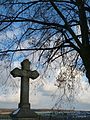
| This category shows a heritage building in Germany, located in the North Rhine-Westphalian municipality Wachtberg (no. A 169). |
Media in category "Wegekreuz Züllighovener Weg (Werthhoven)"
The following 3 files are in this category, out of 3 total.
-
 Wachtberg Denkmal 169 Wegekreuz Züllighovener Weg.jpg 1,920 × 2,560; 2.28 MB
-
 Werthhoven, Weißes Kreuz – Sockel.jpg 1,907 × 1,801; 405 KB
-
 Werthhoven, Weißes Kreuz.jpg 2,595 × 1,734; 3.02 MB


