Category:Wellerondom 5, Brielle
Jump to navigation
Jump to search
| Object location | | View all coordinates using: OpenStreetMap |
|---|
building in Brielle, Netherlands  | |||||
| Upload media | |||||
| Instance of | |||||
|---|---|---|---|---|---|
| Location | Brielle, Voorne aan Zee, South Holland, Netherlands | ||||
| Street address |
| ||||
| Located on street | |||||
| Heritage designation |
| ||||
 | |||||
|
This is a category about rijksmonument number 10989
|
| Address |
|
Media in category "Wellerondom 5, Brielle"
The following 10 files are in this category, out of 10 total.
-
 Achtergevel? - Brielle - 20043448 - RCE.jpg 1,191 × 1,200; 368 KB
-
 Brielle - rijksmonument 10989 - Wellerondom 5 20111112.jpg 403 × 800; 187 KB
-
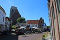 Brielle 06.jpg 5,472 × 3,648; 14.21 MB
-
 Brielle, pand op het Wellerondom foto1 2011-06-26 14.10.JPG 3,312 × 4,416; 6.48 MB
-
 Exterieur RECHTER ZIJGEVEL - Brielle - 20300081 - RCE.jpg 1,192 × 1,200; 333 KB
-
 Exterieur RECHTER ZIJGEVEL, ACHTERGEVEL - Brielle - 20300082 - RCE.jpg 1,200 × 1,200; 318 KB
-
 Exterieur VOORGEVEL - Brielle - 20300080 - RCE.jpg 1,200 × 1,199; 348 KB
-
 Overzicht - Brielle - 20043445 - RCE.jpg 1,200 × 804; 177 KB
-
 Rechter zijgevel - Brielle - 20043447 - RCE.jpg 1,183 × 1,200; 330 KB
-
 Voorgevel - Brielle - 20043446 - RCE.jpg 1,179 × 1,200; 330 KB


