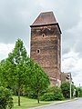
Category:Wendenturm (Gruna)
Jump to navigation
Jump to search
| Object location | | View all coordinates using: OpenStreetMap |
|---|
 | |||||
| Upload media | |||||
| Instance of | |||||
|---|---|---|---|---|---|
| Part of | |||||
| Location | Gruna, Laußig, Nordsachsen, Saxony, Germany | ||||
| Street address |
| ||||
| Heritage designation | |||||
| Inception |
| ||||
 | |||||
Media in category "Wendenturm (Gruna)"
The following 16 files are in this category, out of 16 total.
-
 Der Wendenturm in Gruna.JPG 480 × 640; 146 KB
-
 Gruna Herrenhaus.jpg 4,752 × 3,168; 1.02 MB
-
 Gruna Wendenturm-01.jpg 3,674 × 4,898; 6.51 MB
-
 Gruna Wendenturm-02.jpg 3,896 × 5,195; 9.6 MB
-
 Gruna Wendenturm.jpg 3,168 × 4,752; 1,009 KB
-
 GrunaBrunnen.JPG 2,864 × 2,144; 1.14 MB
-
 GrunaHH.jpg 2,509 × 1,810; 498 KB
-
 Laußig Gruna - Dorfstraße + Flutdenkmal + Wendenturm 01 ies.jpg 3,742 × 5,616; 15.81 MB
-
 Laußig Gruna - Dorfstraße + Herrenhaus + Wendenturm 01 ies.jpg 5,616 × 3,745; 17.94 MB
-
 Laußig Gruna - Dorfstraße + Herrenhaus + Wendenturm 02 ies.jpg 3,743 × 5,616; 14.93 MB
-
 Laußig Gruna - Dorfstraße - Wendenturm 01 ies.jpg 5,616 × 3,744; 23.64 MB
-
 Laußig Gruna - Dorfstraße - Wendenturm 02 ies.jpg 3,745 × 5,616; 24.77 MB
-
 Laußig Gruna - Fährhäuser + Wendenturm 01 ies.jpg 5,616 × 3,744; 19.04 MB
-
 Laußig Gruna - Fährhäuser + Wendenturm 02 ies.jpg 5,616 × 3,744; 18.88 MB
-
 Turm gruna.JPG 2,448 × 3,264; 1.65 MB
-
 Wendenturm-Flut.jpg 1,469 × 1,118; 623 KB


