Category:Wendover
Vai alla navigazione
Vai alla ricerca
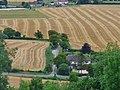
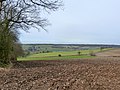
English: Wendover is a market town that sits at the foot of the Chiltern Hills in Buckinghamshire, England. It is also a civil parish within Aylesbury Vale district. The mainly arable parish is 5,832 acres (24 km²) in size and boasts many hamlets that nestle in amongst the lush forest on the surrounding hills.
Nederlands: * Wendover, een plaats in het Engelse graafschap Buckinghamshire
Română: Wendover este un oraş în comitatul Buckinghamshire, regiunea South East England, Anglia. Oraşul se află în districtul Aylesbury Vale.
market town in Buckinghamshire, England  | |||||
| Carica un file multimediale | |||||
| Istanza di | |||||
|---|---|---|---|---|---|
| Luogo | Buckinghamshire, Sud Est dell'Inghilterra, Inghilterra | ||||
| Popolazione |
| ||||
| Superficie |
| ||||
| Considerato essere uguale a | Wendover (pagina Wikimedia duplicata, parrocchia civile dell'Inghilterra) | ||||
| sito web ufficiale | |||||
 | |||||
Sottocategorie
Questa categoria contiene le 21 sottocategorie indicate di seguito, su un totale di 21.
A
B
- Will Burns (24 F)
C
- Community Orchard, Wendover (2 F)
- Coombe Hill Monument (56 F)
D
- Dancers End Pumping Station (2 F)
H
- Hampden Pond, Wendover (6 F)
- Heron Stream, Wendover (6 F)
J
- Jones Hill Wood (1 F)
M
- St Mary's Church, Wendover (50 F)
P
- Pound Street, Wendover (14 F)
S
W
- Wellwick Manor (2 F)
- Wendover Clock Tower (6 F)
- Wendover railway station (8 F)
- Wendover War Memorial (7 F)
- Weston Turville Reservoir (40 F)
- The Witchell, Wendover (3 F)
File nella categoria "Wendover"
Questa categoria contiene 200 file, indicati di seguito, su un totale di 241.
(pagina precedente) (pagina successiva)-
 10 Coldharbour, Tring Road, Wendover, January 2024 02.jpg 4 032 × 3 024; 4,51 MB
-
 10 Coldharbour, Tring Road, Wendover, January 2024.jpg 4 032 × 3 024; 4,86 MB
-
 17 Ton Trucks, possibly not - geograph.org.uk - 6124975.jpg 4 025 × 3 000; 3,8 MB
-
 7 and 9 Tring Road, Wendover, January 2024.jpg 4 032 × 3 024; 3,26 MB
-
 A harrowing experience - geograph.org.uk - 5741916.jpg 2 304 × 1 728; 1,64 MB
-
 A house at The Hale - geograph.org.uk - 160927.jpg 640 × 480; 86 KB
-
 A413 and Wendover Station - geograph.org.uk - 5684571.jpg 5 202 × 3 465; 3,07 MB
-
 A413 at Quilters Way - geograph.org.uk - 2834501.jpg 640 × 481; 49 KB
-
 A413 London Road - geograph.org.uk - 6178623.jpg 1 024 × 684; 307 KB
-
 A413 London Road - geograph.org.uk - 6178630.jpg 1 024 × 684; 291 KB
-
 Access Avenue from Boswell Farm - geograph.org.uk - 577780.jpg 640 × 480; 127 KB
-
 Anne Boleyn Cottages, Wendover - geograph.org.uk - 5458633.jpg 1 280 × 851; 488 KB
-
 Aylesbury Road in Wendover - geograph.org.uk - 3891115.jpg 1 500 × 999; 201 KB
-
 Aylesbury Road in Wendover - geograph.org.uk - 3891121.jpg 1 500 × 999; 167 KB
-
 Aylesbury Road out of Wendover - geograph.org.uk - 3891123.jpg 1 500 × 999; 186 KB
-
 Aylesbury Road, Wendover - geograph.org.uk - 4490203.jpg 1 200 × 809; 1,08 MB
-

-
 Back Street, Wendover - geograph.org.uk - 3045067.jpg 800 × 493; 100 KB
-
 Bacombe Hill conservation area sign - geograph.org.uk - 5684534.jpg 5 202 × 3 465; 5,31 MB
-
 Barn on a Christmas Tree Farm - geograph.org.uk - 6125230.jpg 4 618 × 2 800; 1,62 MB
-
 Bluebells in Barn Wood - geograph.org.uk - 4936649.jpg 3 840 × 2 160; 5,13 MB
-

-
 Boddington Hill from Hale Lane, south-east of Wendover - geograph.org.uk - 2974318.jpg 3 968 × 2 976; 2,73 MB
-
 Bridge on an old road - geograph.org.uk - 6124978.jpg 4 281 × 3 078; 3,88 MB
-
 Bridleway off Chesham Lane - geograph.org.uk - 1054444.jpg 640 × 480; 116 KB
-
 Buckinghamshire Best Kept Town sign, Manor Waste, Wendover, January 2024.jpg 3 024 × 4 032; 5,64 MB
-
 Building on London Road near Wendover - geograph.org.uk - 2632658.jpg 1 600 × 1 200; 654 KB
-
 Celandines by Chesham Lane - geograph.org.uk - 6125246.jpg 3 947 × 2 961; 2,29 MB
-
 Chickweed - geograph.org.uk - 2403481.jpg 2 865 × 2 150; 4,63 MB
-
 Chiltern House, Aylesbury Road - geograph.org.uk - 2721678.jpg 640 × 427; 121 KB
-
 Chiltern Road, Wendover - geograph.org.uk - 577801.jpg 640 × 480; 92 KB
-
 Chiltern View Garden Centre - geograph.org.uk - 3954166.jpg 1 500 × 993; 168 KB
-
 Christmas Cottage, 7 Coldharbour, Tring Road, Wendover, January 2024.jpg 4 032 × 3 024; 4,94 MB
-
 Cockshoots Wood across the valley - geograph.org.uk - 4947663.jpg 4 608 × 3 456; 3,09 MB
-
 Come back for the Bluebells in April - geograph.org.uk - 1192420.jpg 640 × 464; 171 KB
-
 Copses on the hillside - geograph.org.uk - 6128786.jpg 640 × 480; 62 KB
-
 Crossing a large meadow near Wendover - geograph.org.uk - 1235777.jpg 640 × 480; 145 KB
-
 Crossroads at Hale Wood - geograph.org.uk - 2974283.jpg 3 968 × 2 976; 2,79 MB
-
 Defibrillator Box, Wendover - geograph.org.uk - 5458824.jpg 851 × 1 280; 513 KB
-
 Detail of Buckinghamshire Best Kept Town sign, Manor Waste, Wendover, January 2024.jpg 4 032 × 3 024; 2,49 MB
-
 Downtown Wendover - geograph.org.uk - 577796.jpg 640 × 480; 82 KB
-
-
 Electricity Pylon - geograph.org.uk - 1055286.jpg 640 × 480; 50 KB
-
 Ellesborough Road bridge over the Wendover bypass - geograph.org.uk - 2632449.jpg 1 600 × 1 200; 552 KB
-
 Ellesborough Road to Wendover - geograph.org.uk - 3891111.jpg 1 500 × 999; 178 KB
-
 End of the Disused Railway Line - geograph.org.uk - 1230852.jpg 640 × 480; 296 KB
-
 Equestrian cross country course - geograph.org.uk - 2403498.jpg 3 648 × 2 736; 4,18 MB
-
 Farmland and track, Wendover - geograph.org.uk - 2813909.jpg 640 × 480; 138 KB
-
 Farmland near Wendover - geograph.org.uk - 6124980.jpg 5 472 × 3 648; 2,69 MB
-
 Farmland, Wendover - geograph.org.uk - 2813813.jpg 640 × 480; 168 KB
-
 Farmland, Wendover - geograph.org.uk - 2813870.jpg 640 × 480; 154 KB
-
 Farmland, Wendover - geograph.org.uk - 2813887.jpg 640 × 480; 181 KB
-
 Farmland, Wendover - geograph.org.uk - 2813890.jpg 640 × 480; 140 KB
-
 Farmland, Wendover - geograph.org.uk - 2813896.jpg 640 × 480; 137 KB
-
 Farmyard, Cobblershill Farm - geograph.org.uk - 4705869.jpg 640 × 428; 111 KB
-
 Field above Icknield Way - geograph.org.uk - 4176511.jpg 640 × 480; 107 KB
-
 Field access off Bowood Lane - geograph.org.uk - 4705787.jpg 640 × 480; 127 KB
-

-
 Field by Ellesborough Road - geograph.org.uk - 1055402.jpg 640 × 480; 93 KB
-
 Field by Road Barn farm, Wendover - geograph.org.uk - 2632678.jpg 1 600 × 1 200; 553 KB
-
 Field corner with cow parsley and hawthorn - geograph.org.uk - 2403489.jpg 3 648 × 2 736; 4,44 MB
-
 Field edge by old railway line - geograph.org.uk - 4176424.jpg 640 × 480; 112 KB
-
 Field entrance in Dunsmore - geograph.org.uk - 5761637.jpg 2 048 × 1 536; 1,51 MB
-
 Field entrance on Dunsmore Lane - geograph.org.uk - 5761636.jpg 2 048 × 1 536; 1,51 MB
-
 Field south of Dunsmore Lane - geograph.org.uk - 6383628.jpg 1 024 × 768; 315 KB
-
 Fields at Grove Farm, Wendover - geograph.org.uk - 2026889.jpg 1 600 × 1 071; 295 KB
-
 Fields on the edge of the Chiltern hills near Wendover - geograph.org.uk - 2632664.jpg 1 600 × 1 200; 540 KB
-
 Fog in the Valley (50822646436).jpg 4 032 × 1 788; 4,01 MB
-
-
 Footpath heading into Baldwin's Wood - geograph.org.uk - 1566249.jpg 640 × 480; 110 KB
-
 Footpath leading into Great Widmoor Wood - geograph.org.uk - 2427536.jpg 3 072 × 2 304; 1,83 MB
-
 Footpath signs for the Ridgeway at Wendover - geograph.org.uk - 2741753.jpg 3 968 × 2 976; 3,2 MB
-
 Forestry Cottages on Hale Lane - geograph.org.uk - 5761612.jpg 2 254 × 1 658; 2 MB
-
 Garden by London Road, Wendover Dean - geograph.org.uk - 2632476.jpg 1 600 × 1 200; 587 KB
-
 Georgian house in South Street, Wendover - geograph.org.uk - 3412521.jpg 926 × 1 024; 235 KB
-

-
 Grass bank by Hale Road, Wendover - geograph.org.uk - 5741910.jpg 2 218 × 1 606; 1,86 MB
-
 Hale Lane - geograph.org.uk - 4730212.jpg 640 × 480; 96 KB
-
 Hale Lane east of Wendover - geograph.org.uk - 5761613.jpg 2 304 × 1 728; 2,09 MB
-
 Hale Lane in Hale Wood - geograph.org.uk - 4176527.jpg 640 × 480; 191 KB
-
 Hale Lane, The Hale - geograph.org.uk - 5761611.jpg 2 258 × 1 666; 2,74 MB
-
 Hale Road, Wendover - geograph.org.uk - 2973467.jpg 1 024 × 635; 229 KB
-
 Hale Road, Wendover - geograph.org.uk - 5457485.jpg 1 280 × 851; 544 KB
-

-
 Hale Wood - geograph.org.uk - 1566226.jpg 640 × 480; 128 KB
-

-
-

-

-

-
 Heading away from Wendover - geograph.org.uk - 1055352.jpg 640 × 480; 91 KB
-
 House near Wendover.jpg 2 319 × 1 462; 713 KB
-
 Houses in The Hale - geograph.org.uk - 5741923.jpg 2 238 × 1 636; 1,99 MB
-
 HS2 construction site looking northwest (April 2024), Wendover, Buckinghamshire 01.jpg 2 587 × 1 940; 1,49 MB
-
 HS2 construction site looking northwest (April 2024), Wendover, Buckinghamshire 02.jpg 2 587 × 1 940; 1,57 MB
-

-
 K6 telephone kiosk by Clock Tower, Wendover, January 2024.jpg 3 024 × 4 032; 5,82 MB
-
 Lane junction near St. Leonards - geograph.org.uk - 4176539.jpg 640 × 480; 146 KB
-
 Lane to Little London - geograph.org.uk - 1055275.jpg 640 × 480; 118 KB
-
 Line heading to Great Missenden - geograph.org.uk - 1054421.jpg 640 × 480; 113 KB
-
 Little Hampton Close, Wendover - geograph.org.uk - 5761620.jpg 2 238 × 1 636; 1,74 MB
-
 London Road at The Firecrest - geograph.org.uk - 2834421.jpg 640 × 481; 46 KB
-
 London Road looking north - geograph.org.uk - 2834399.jpg 640 × 481; 37 KB
-
 London Road looking west - geograph.org.uk - 2834456.jpg 640 × 481; 73 KB
-
 London Road south of Wendover - geograph.org.uk - 2632642.jpg 1 600 × 1 200; 619 KB
-
 London Road south of Wendover - geograph.org.uk - 2632650.jpg 1 600 × 1 200; 589 KB
-
 London Road, Wendover - geograph.org.uk - 5761635.jpg 1 990 × 1 454; 1,25 MB
-
 London Road, Wendover Dean - geograph.org.uk - 2632472.jpg 1 600 × 1 200; 570 KB
-
 London Road, Wendover Dean - geograph.org.uk - 2632551.jpg 1 600 × 1 200; 559 KB
-
 London Road, Wendover Dean - geograph.org.uk - 2632558.jpg 1 600 × 1 200; 475 KB
-
 London Road, Wendover Dean - geograph.org.uk - 2632563.jpg 1 600 × 1 200; 572 KB
-
 London Road, Wendover Dean - geograph.org.uk - 2633167.jpg 1 600 × 1 200; 198 KB
-
 London Road, Wendover Dean - geograph.org.uk - 2834413.jpg 640 × 480; 74 KB
-

-
 Main road passing through Wendover - geograph.org.uk - 2741747.jpg 3 968 × 2 976; 3,2 MB
-
 Medieval harness pendant (FindID 455742).jpg 3 346 × 2 034; 1,11 MB
-
 Nash Lee Lane - geograph.org.uk - 1223884.jpg 640 × 480; 80 KB
-
 Nash Lee Lane - geograph.org.uk - 4710841.jpg 4 000 × 2 664; 2,88 MB
-
 Nash Lee Road at Wendover Station - geograph.org.uk - 2834472.jpg 640 × 481; 43 KB
-
 Nash Lee Road roundabout - geograph.org.uk - 2834482.jpg 640 × 480; 37 KB
-
 Northeast view from Bacombe Hill - geograph.org.uk - 5684538.jpg 5 202 × 3 465; 3,18 MB
-
 Not the Icknield Way - geograph.org.uk - 6124985.jpg 5 472 × 3 648; 3,65 MB
-
 Old chalkpit by the Ridgeway near Wendover - geograph.org.uk - 5684557.jpg 5 202 × 3 465; 5,46 MB
-
 Old House, Aylesbury Road - geograph.org.uk - 2721673.jpg 640 × 427; 122 KB
-
 Old property in Wendover - geograph.org.uk - 6128740.jpg 640 × 480; 83 KB
-
 Oliver's Bridge, Wendover Arm - geograph.org.uk - 5457500.jpg 1 280 × 851; 718 KB
-
 Pair of cottages at Wendover, Buckinghamshire by Robert F. Johnston.png 984 × 704; 1,01 MB
-
 Parking area on the A413 near Wendover - geograph.org.uk - 2632402.jpg 1 600 × 1 200; 498 KB
-
 Parking area on the A413 Wendover bypass - geograph.org.uk - 2632905.jpg 1 600 × 1 200; 534 KB
-
 Parking area on the A413 Wendover bypass - geograph.org.uk - 2632938.jpg 1 600 × 1 200; 536 KB
-
 Part of the A413 road near Wendover - geograph.org.uk - 6128753.jpg 640 × 480; 80 KB
-
 Pasture, Wendover - geograph.org.uk - 2813882.jpg 640 × 480; 146 KB
-
 Path around Boddington Hillfort ramparts - geograph.org.uk - 5652290.jpg 640 × 480; 133 KB
-

-
 Path between Coombe Hill and Wendover - geograph.org.uk - 6128944.jpg 640 × 480; 116 KB
-
 Path from the fields by London Road - geograph.org.uk - 2632690.jpg 1 600 × 1 200; 604 KB
-
 Path heading into Wendover Woods - geograph.org.uk - 6029083.jpg 640 × 480; 135 KB
-
 Path in Wendover - geograph.org.uk - 5880848.jpg 4 032 × 1 960; 4,75 MB
-
 Path through fields - geograph.org.uk - 6128782.jpg 640 × 480; 61 KB
-
 Path up Bacombe Hill - geograph.org.uk - 2741759.jpg 3 968 × 2 976; 3,24 MB
-
 Path up Bacombe Hill, looking westwards - geograph.org.uk - 5684551.jpg 5 202 × 3 465; 3,07 MB
-

-
 Plants in the Garden Centre - geograph.org.uk - 3954173.jpg 1 500 × 999; 241 KB
-
 Pound Street, Wendover - geograph.org.uk - 5458833.jpg 1 280 × 851; 407 KB
-
 Pound Street, Wendover - geograph.org.uk - 5458840.jpg 1 280 × 851; 467 KB
-
 Pylon across the field - geograph.org.uk - 1054435.jpg 640 × 480; 49 KB
-
 Pylon by the A413 near Wendover - geograph.org.uk - 2632411.jpg 1 600 × 1 200; 477 KB
-
 Railway bridge over A413 - geograph.org.uk - 6178813.jpg 1 024 × 684; 305 KB
-

-
 Ridgeway at Ellesborough Road - geograph.org.uk - 5684560.jpg 5 202 × 3 465; 5,02 MB
-
 Ridgeway path looking eastwards - geograph.org.uk - 5684527.jpg 5 202 × 3 465; 4,98 MB
-
 Riley 4-72 on London Road, Wendover - geograph.org.uk - 5761634.jpg 2 048 × 1 536; 1,71 MB
-
 Rocky Lane descends to meet the A413 - geograph.org.uk - 4402882.jpg 640 × 480; 105 KB
-
 Rossini Restaurant Wendover.jpg 1 024 × 768; 114 KB
-

-
 Roundabout on the Wendover bypass - geograph.org.uk - 2633145.jpg 1 594 × 1 063; 415 KB
-
 Row of cottages in Wendover, Bucks - geograph.org.uk - 5652354.jpg 640 × 480; 60 KB
-
 Row of Cottages, South Street, Wedover - geograph.org.uk - 4230157.jpg 4 320 × 3 240; 5,9 MB
-
 South Bucks Way - geograph.org.uk - 718530.jpg 640 × 425; 85 KB
-
 Station Approach, Wendover - geograph.org.uk - 5457520.jpg 851 × 1 280; 580 KB
-
 Stile and Field Path at Halton - geograph.org.uk - 1230965.jpg 480 × 640; 249 KB
-
 The A413 north of Wendover - geograph.org.uk - 2632400.jpg 1 600 × 1 200; 599 KB
-
 The Blasted Oak - geograph.org.uk - 3098307.jpg 4 000 × 3 000; 2,31 MB
-
 The Canal north of Wendover - geograph.org.uk - 4688395.jpg 1 600 × 1 066; 608 KB
-

-
 The Chiltern Way - geograph.org.uk - 1054417.jpg 640 × 480; 98 KB
-
 The Church of the Resurrection, Dunsmore - geograph.org.uk - 3799600.jpg 4 608 × 3 456; 5,11 MB
-
 The Clock Tower, Wendover, Bucks - geograph.org.uk - 6128724.jpg 640 × 480; 64 KB
-

-
 The edge of the Chiltern Hills near Wendover - geograph.org.uk - 2632680.jpg 1 600 × 1 200; 561 KB
-
 The end of the Wendover Arm - geograph.org.uk - 5458747.jpg 1 280 × 851; 666 KB
-
 The Footpath beyond the Railway Crossing - geograph.org.uk - 1235762.jpg 640 × 480; 201 KB
-
 The Paddocks, Wendover - geograph.org.uk - 5458715.jpg 1 280 × 851; 534 KB
-

-
 The Wendover Arm - geograph.org.uk - 5458806.jpg 1 280 × 851; 571 KB
-
 The Wendover Arm - geograph.org.uk - 5458809.jpg 1 280 × 851; 533 KB
-
 The Wendover Arm - geograph.org.uk - 5458870.jpg 1 280 × 851; 594 KB
-
 The Wendover Arm - towpath and sign - geograph.org.uk - 5458768.jpg 1 280 × 851; 582 KB
-
 The Wendover Arm, Wendover - geograph.org.uk - 5458798.jpg 1 280 × 851; 613 KB
-
 The Wendover Memorial Woodland - geograph.org.uk - 4033923.jpg 3 072 × 2 304; 1,76 MB
-
 The Wendover Memorial Woodland - geograph.org.uk - 6128762.jpg 640 × 480; 69 KB
-
 This way for Bacombe Hill - geograph.org.uk - 2741756.jpg 3 968 × 2 976; 3,14 MB
-
 Towards Boddington Hill - geograph.org.uk - 2973479.jpg 800 × 488; 98 KB
-
 Town Houses on Aylesbury Road, Wendover - geograph.org.uk - 4490186.jpg 1 200 × 806; 1,23 MB
-
 Track and pasture, Wendover - geograph.org.uk - 2813867.jpg 640 × 480; 162 KB
-
 Track to Milesfield, The Hale - geograph.org.uk - 5746602.jpg 2 178 × 1 546; 2,21 MB
-
 Tree-lined avenue to the west of Boswells Farm - geograph.org.uk - 2974275.jpg 3 968 × 2 976; 2,71 MB
-
 Under cover in the Garden Centre - geograph.org.uk - 3954171.jpg 1 500 × 999; 236 KB
-
 Vale of Aylesbury (geograph 5274454).jpg 2 560 × 1 920; 2,47 MB
-
 Vale of Aylesbury from Bacombe Hill - geograph.org.uk - 2741763.jpg 3 968 × 2 976; 3,24 MB
-
 View back down Bacombe Hill - geograph.org.uk - 2741761.jpg 3 968 × 2 976; 2,43 MB
-
 View east from Bacombe Hill - geograph.org.uk - 5684544.jpg 5 202 × 3 465; 4,64 MB
-
 View of Clock Tower From Aylesbury Rd-1.jpg 800 × 640; 125 KB
-

-
 View towards Haddington Hill from Wendover - geograph.org.uk - 2741750.jpg 3 968 × 2 976; 2,61 MB
-
 View west from Kings Lane - geograph.org.uk - 4402870.jpg 640 × 480; 142 KB
-
 Village pond, Dunsmore - geograph.org.uk - 3799607.jpg 4 608 × 3 456; 5,22 MB
-

-
 Wendover (England) Wikivoyage Banner.jpg 3 136 × 450; 352 KB
-
 Wendover , animals in thatch - geograph.org.uk - 6296718.jpg 1 024 × 579; 682 KB


.jpg)


,_Wendover,_Buckinghamshire_01.jpg)
,_Wendover,_Buckinghamshire_02.jpg)


.jpg)


.jpg)


_Wikivoyage_Banner.jpg)