Category:Wensley, North Yorkshire
Jump to navigation
Jump to search
village in North Yorkshire, UK  Low Lane, une rue de Wensley. | |||||
| Upload media | |||||
| Instance of | |||||
|---|---|---|---|---|---|
| Location | Richmondshire, North Yorkshire, Yorkshire and the Humber, England | ||||
| Population |
| ||||
| Area |
| ||||
| Different from | |||||
 | |||||
Subcategories
This category has the following 4 subcategories, out of 4 total.
Media in category "Wensley, North Yorkshire"
The following 200 files are in this category, out of 291 total.
(previous page) (next page)-
 'Oakdene' beside A684 - geograph.org.uk - 2771720.jpg 1,024 × 683; 151 KB
-
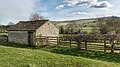 A Barn - geograph.org.uk - 4413791.jpg 640 × 360; 95 KB
-
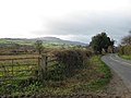
 A bend in the road - geograph.org.uk - 5928782.jpg 2,000 × 1,574; 2.1 MB
-
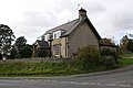
 A house in Wensley - geograph.org.uk - 5928779.jpg 2,000 × 1,317; 2.19 MB
-
 A Line of Molehills leading up to Warren Wood - geograph.org.uk - 4854697.jpg 1,600 × 1,067; 670 KB
-
 A Road called Hollins - geograph.org.uk - 4475533.jpg 5,184 × 3,456; 6.39 MB
-
 A View Towards Penhill - geograph.org.uk - 283643.jpg 640 × 480; 96 KB
-
 A684 crossing Wensley Bridge - geograph.org.uk - 6226643.jpg 2,000 × 1,344; 2.23 MB
-
 A684 crossing Wensley Ings - geograph.org.uk - 2960768.jpg 640 × 439; 72 KB
-
 A684 towards Leyburn - geograph.org.uk - 5414207.jpg 640 × 480; 73 KB
-
 A684 towards Leyburn - geograph.org.uk - 5414220.jpg 640 × 480; 73 KB
-
 A684, Wensley Bridge - geograph.org.uk - 5414235.jpg 640 × 480; 71 KB
-
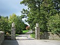
 Access road to Bolton Hall - geograph.org.uk - 1812624.jpg 2,048 × 1,536; 1.47 MB
-
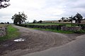 Access road to Gale Bank Farm from Gale Bank - geograph.org.uk - 2772113.jpg 1,024 × 683; 161 KB
-
 Across the green at Wensley - geograph.org.uk - 5242711.jpg 4,320 × 2,362; 2.08 MB
-
 Ascending to the Western End of Leyburn Shawl - geograph.org.uk - 4854269.jpg 1,600 × 1,067; 524 KB
-
 Barn on east side of Gale Bank - geograph.org.uk - 2772054.jpg 1,024 × 683; 209 KB
-
 Barns near Tullis Cote - geograph.org.uk - 448329.jpg 640 × 480; 135 KB
-
 Bench Mark, Wensley Bridge - geograph.org.uk - 2150656.jpg 480 × 640; 83 KB
-
 Bench Mark, Wensley Low Bridge - geograph.org.uk - 2135808.jpg 640 × 480; 114 KB
-
 Benchmark at entrance to Gale Bank Farm - geograph.org.uk - 2772073.jpg 683 × 1,024; 249 KB
-
 Benchmark on 'Oakdene' - geograph.org.uk - 2771684.jpg 1,024 × 683; 233 KB
-
 Benchmark on bridge over Wensley Brook, Low Lane - geograph.org.uk - 3539703.jpg 1,024 × 683; 296 KB
-
 Benchmark on gatepost beside A684 - geograph.org.uk - 2771742.jpg 683 × 1,024; 264 KB
-
 Benchmark on gatepost beside road to Redmire - geograph.org.uk - 3539268.jpg 683 × 1,024; 267 KB
-
 Benchmark on Holy Trinity Church buttress - geograph.org.uk - 2771658.jpg 683 × 1,024; 350 KB
-

-
 Benchmark on wall bounding Wensley Park - geograph.org.uk - 3539221.jpg 683 × 1,024; 255 KB
-
 Benchmark on wall of lane passing Rectory Garth - geograph.org.uk - 5279701.jpg 665 × 1,024; 299 KB
-
 Benchmark on Wrang Beck bridge - geograph.org.uk - 2771918.jpg 1,024 × 683; 295 KB
-
 Benchmarked stile beside A684 at Wensley Ings - geograph.org.uk - 2771518.jpg 683 × 1,024; 299 KB
-
 Beside The Ure - geograph.org.uk - 283637.jpg 640 × 480; 97 KB
-
 Bolton Hall - geograph.org.uk - 4851736.jpg 1,600 × 1,067; 506 KB
-
 Bolton Pew, Holy Trinity Church, Wensley - geograph.org.uk - 4593028.jpg 3,008 × 2,000; 2.67 MB
-
 Brick Garth Plantation - geograph.org.uk - 1840179.jpg 1,024 × 768; 211 KB
-
 Brick Garth Plantation - geograph.org.uk - 891220.jpg 640 × 480; 90 KB
-
 Bridge over Wensley Brook on Low Lane - geograph.org.uk - 3539716.jpg 1,024 × 683; 239 KB
-
 Carriage Drive, Wensley Park - geograph.org.uk - 5242696.jpg 4,320 × 3,240; 4.79 MB
-
 Closed path - geograph.org.uk - 6161445.jpg 2,048 × 1,536; 1,021 KB
-

-
 Cottages in Wensley - geograph.org.uk - 3517049.jpg 1,024 × 680; 179 KB
-
 Cottages in Wensley - geograph.org.uk - 3517051.jpg 1,024 × 680; 217 KB
-
 Cottages, Wensley - geograph.org.uk - 5414238.jpg 640 × 480; 61 KB
-
 Cottages, Wensley - geograph.org.uk - 5414257.jpg 640 × 480; 63 KB
-
 Crop field, Scaw Bottom - geograph.org.uk - 5413930.jpg 640 × 480; 72 KB
-
 Derelict hut north of Millers Gill Plantation - geograph.org.uk - 2610973.jpg 3,648 × 2,736; 2.72 MB
-
 Descending off Leyburn Shawl - geograph.org.uk - 4854690.jpg 1,600 × 1,067; 624 KB
-
 Descending to Tullis Cote - geograph.org.uk - 4413752.jpg 640 × 360; 86 KB
-
 Disused telephone exchange - geograph.org.uk - 3539379.jpg 1,024 × 683; 309 KB
-
 Dwelling in Wensley - geograph.org.uk - 4476115.jpg 5,184 × 3,456; 6.83 MB
-
 East lodge to Wensley House - geograph.org.uk - 4602923.jpg 1,828 × 1,829; 2 MB
-
 East parapet of bridge over Wrang Beck - geograph.org.uk - 2771571.jpg 683 × 1,024; 152 KB
-
 Elizabeth II postbox, Wensley - geograph.org.uk - 5415704.jpg 1,212 × 2,453; 637 KB
-
 Entrance drive to Spigot Lodge, Coverham - geograph.org.uk - 2609872.jpg 3,648 × 2,736; 4.12 MB
-
 Entrance to Bolton Hall - geograph.org.uk - 1961523.jpg 640 × 480; 107 KB
-
 Fallen tree at the eastern edge of Wensley - geograph.org.uk - 5137995.jpg 1,024 × 768; 225 KB
-
 Farm track and barn, Wensley - geograph.org.uk - 5414215.jpg 640 × 480; 53 KB
-
 Farmland at Ellershaw, Wensley - geograph.org.uk - 5137980.jpg 1,024 × 768; 245 KB
-

-

-
 Field - geograph.org.uk - 210482.jpg 640 × 480; 95 KB
-
 Field Path through Wensley Park - geograph.org.uk - 3601913.jpg 4,000 × 3,000; 3.96 MB
-
 Fields south of railway line - geograph.org.uk - 1840182.jpg 1,024 × 768; 121 KB
-
 Footpath heading towards Top Barn - geograph.org.uk - 4476341.jpg 5,184 × 3,456; 6.98 MB
-
 Footpath into the woods near Bolton Hall - geograph.org.uk - 3539198.jpg 1,024 × 683; 313 KB
-
 Footpath through Wensley Park - geograph.org.uk - 5279363.jpg 1,024 × 683; 168 KB
-
 Footpath through West Wood - geograph.org.uk - 1812647.jpg 2,048 × 1,536; 2.24 MB
-
 Footpath, Wensley Bridge - geograph.org.uk - 2150792.jpg 480 × 640; 73 KB
-
 Footpath, Wensley Bridge - geograph.org.uk - 2150805.jpg 640 × 480; 88 KB
-
 Former gateway into field from Hollins - geograph.org.uk - 5280035.jpg 1,024 × 683; 195 KB
-
 Gale Bank as it descends towards Wensley - geograph.org.uk - 6226637.jpg 2,000 × 1,200; 2.7 MB
-
 Gilroy Mill, Wensley, North of Plevna, Ontario 1940 (14128917483).jpg 1,808 × 1,084; 454 KB
-
 Grassland towards Wensley Brook - geograph.org.uk - 5533506.jpg 640 × 427; 59 KB
-
 Grazing - geograph.org.uk - 4561273.jpg 800 × 531; 100 KB
-
 Grazing and woodland, Wensley - geograph.org.uk - 5414217.jpg 640 × 480; 88 KB
-
 Grazing near Westfield Farm - geograph.org.uk - 5533504.jpg 640 × 408; 79 KB
-
 Grazing, Wesley - geograph.org.uk - 5414211.jpg 640 × 480; 65 KB
-
 Havana House - geograph.org.uk - 6226608.jpg 2,000 × 1,227; 1.65 MB
-
 Hedge beside A684 at Wensley Ings - geograph.org.uk - 5280006.jpg 683 × 1,024; 233 KB
-
 Hellgill Bridge - geograph.org.uk - 4413735.jpg 640 × 360; 125 KB
-
 Hellgill Bridge - geograph.org.uk - 5242687.jpg 4,320 × 3,240; 4.37 MB
-
 Hollins - geograph.org.uk - 6226602.jpg 2,000 × 1,134; 1.6 MB
-
 Holy Trinity Church - geograph.org.uk - 5279636.jpg 1,024 × 683; 142 KB
-
 Holy Trinity church in Wensley - geograph.org.uk - 4623549.jpg 1,024 × 763; 664 KB
-
 Holy Trinity Church, Wensley - geograph.org.uk - 4475539.jpg 5,184 × 3,456; 5.73 MB
-
 Holy Trinity Church, Wensley - geograph.org.uk - 4602901.jpg 3,008 × 2,000; 2.53 MB
-
 Holy Trinity church, Wensley - geograph.org.uk - 4758779.jpg 2,377 × 1,782; 2.23 MB
-
 Holy Trinity Church, Wensley - geograph.org.uk - 5414241.jpg 2,848 × 2,136; 1.46 MB
-
 Holy Trinity Church, Wensley - geograph.org.uk - 6226646.jpg 2,000 × 1,478; 2.72 MB
-
 Holy Trinity Churchyard, Wensley - geograph.org.uk - 6226656.jpg 2,000 × 1,322; 2.51 MB
-
 House in Wensley - geograph.org.uk - 4623555.jpg 1,024 × 803; 709 KB
-
 House in Wensley - geograph.org.uk - 4623562.jpg 3,266 × 2,445; 5.92 MB
-
 Houses in Wensley - geograph.org.uk - 5415710.jpg 2,848 × 2,136; 1.49 MB
-
 Houses on the north side of Low Lane, Wensley - geograph.org.uk - 5137987.jpg 1,024 × 768; 275 KB
-
 Lane at entrance to Rectory Garth - geograph.org.uk - 5279714.jpg 1,024 × 683; 273 KB
-
 Lane running parallel to Wensley Beck - geograph.org.uk - 806518.jpg 640 × 480; 141 KB
-
 Leaning larch on the skyline - geograph.org.uk - 5242719.jpg 3,240 × 2,601; 2.03 MB
-
 Leyburn Old Glebe in Spring 2018.jpg 4,032 × 3,024; 3.29 MB
-
 Leyburn Shawl - geograph.org.uk - 4413819.jpg 640 × 480; 150 KB
-
 Leyburn Shawl approaching Warren Wood - geograph.org.uk - 4854683.jpg 1,600 × 1,067; 753 KB
-
 Limestone cottages, Wensley - geograph.org.uk - 4758769.jpg 2,490 × 1,870; 2.45 MB
-
 Limestone edge, Leyburn Shawl - geograph.org.uk - 891211.jpg 640 × 480; 113 KB
-
 Limestone Walls near Leyburn - geograph.org.uk - 94335.jpg 640 × 431; 65 KB
-
 Little-used green lane, south-west of Canaan - geograph.org.uk - 5138027.jpg 1,024 × 768; 223 KB
-
 Lodge House, Wensley Park - geograph.org.uk - 2658841.jpg 1,944 × 1,458; 1.56 MB
-
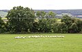
 Longwool sheep, Westfield Farm - geograph.org.uk - 2135602.jpg 640 × 481; 95 KB
-

-
 Looking Towards Penhill - geograph.org.uk - 286787.jpg 640 × 481; 97 KB
-
 Looking towards The Wisings - geograph.org.uk - 4479123.jpg 5,184 × 3,456; 6.17 MB
-
 Looking west from the Shawl - geograph.org.uk - 5242438.jpg 3,240 × 4,320; 3.39 MB
-
 Low Lane entering Wensley - geograph.org.uk - 3085698.jpg 640 × 432; 64 KB
-
 Low Lane, Wensley - geograph.org.uk - 6226649.jpg 2,000 × 1,500; 2.44 MB
-
 Low Lane, Wensley - geograph.org.uk - 806512.jpg 640 × 480; 88 KB
-
 Low water on the Ure - geograph.org.uk - 408759.jpg 640 × 480; 90 KB
-
 Medieval carving II, Holy Trinity Church, Wensley - geograph.org.uk - 4593090.jpg 1,974 × 2,883; 2.56 MB
-
 Medieval carving, Holy Trinity Church, Wensley - geograph.org.uk - 4593060.jpg 3,008 × 2,000; 2.57 MB
-
 Memorial in Wensley - geograph.org.uk - 1812615.jpg 2,048 × 1,536; 2.08 MB
-
 Mount Park farm road - geograph.org.uk - 1390891.jpg 640 × 476; 130 KB
-

-
 Near Ice Pond - geograph.org.uk - 6161457.jpg 2,048 × 1,536; 1,007 KB
-
 Near Wensley Bridge - geograph.org.uk - 6161449.jpg 2,048 × 1,536; 799 KB
-
 North porch, Holy Trinity Church, Wensley - geograph.org.uk - 4593002.jpg 2,000 × 2,412; 2.45 MB
-

-
 Old Post Office, Wensley - geograph.org.uk - 4602938.jpg 2,534 × 1,902; 2.09 MB
-
 Old village pump on green at Wensley - geograph.org.uk - 1961534.jpg 640 × 480; 105 KB
-
 Open field gate, west of Canaan - geograph.org.uk - 5138021.jpg 1,024 × 768; 285 KB
-
 Ordnance Survey Cut Mark with Bolt - geograph.org.uk - 3603901.jpg 4,000 × 3,000; 4.92 MB
-
 Ordnance Survey Cut Mark with Bolt - geograph.org.uk - 3622151.jpg 4,000 × 3,000; 4.9 MB
-
 Ordnance Survey Flush Bracket S0614 - geograph.org.uk - 3603907.jpg 4,000 × 3,000; 4.73 MB
-
 Parapet, Wensley Low Bridge - geograph.org.uk - 2135804.jpg 640 × 480; 83 KB
-
 Pasture near Wensley - geograph.org.uk - 4476203.jpg 5,184 × 3,153; 7.58 MB
-
 Path along River Ure between Wensley Bridge and Leyburn Road - geograph.org.uk - 6226665.jpg 2,000 × 1,228; 2.51 MB
-
 Path in Warren Wood - geograph.org.uk - 4854259.jpg 1,600 × 1,067; 805 KB
-
 Path to Preston under Scar - geograph.org.uk - 891326.jpg 480 × 640; 76 KB
-
 Path to Tullis Cote - geograph.org.uk - 891273.jpg 480 × 640; 144 KB
-
 Polly Peachams Tower - geograph.org.uk - 1525637.jpg 640 × 446; 56 KB
-
 Poster on the Wensleydale Railway - geograph.org.uk - 4555847.jpg 1,024 × 539; 75 KB
-
-
 Remains of Flue, Gillfield Wood - geograph.org.uk - 2657123.jpg 1,500 × 2,000; 2.22 MB
-
 Restoration font, Holy Trinity Church, Wensley - geograph.org.uk - 4593020.jpg 1,591 × 2,030; 1.52 MB
-
 River Ure East of Wensley - geograph.org.uk - 4479131.jpg 5,184 × 3,456; 7.48 MB
-
 River Ure from Lords Bridge - geograph.org.uk - 3613966.jpg 4,000 × 3,000; 3.6 MB
-
 River Ure from Wensley Bridge - geograph.org.uk - 1892583.jpg 1,024 × 686; 216 KB
-
 River Ure from Wensley Bridge - geograph.org.uk - 3613969.jpg 4,000 × 3,000; 2.7 MB
-
 River Ure from Wensley bridge, looking downstream - geograph.org.uk - 2194469.jpg 1,600 × 1,200; 439 KB
-
 River Ure near Wensley - geograph.org.uk - 2135818.jpg 640 × 481; 85 KB
-
 River Ure near Wensley - geograph.org.uk - 2150647.jpg 640 × 480; 68 KB
-
 River Ure near Wensley - geograph.org.uk - 2150697.jpg 640 × 480; 76 KB
-
 River Ure near Wensley - geograph.org.uk - 4257898.jpg 495 × 640; 200 KB
-
 River Ure seen from Wensley Bridge - geograph.org.uk - 6226641.jpg 2,000 × 1,500; 2.38 MB
-
 River Ure seen from Wensley Bridge - geograph.org.uk - 6226662.jpg 2,000 × 1,500; 2.36 MB
-
 River Ure West of Wensley - geograph.org.uk - 4476119.jpg 5,177 × 3,187; 6.96 MB
-
 Road heading towards Wensley at Thowker Corner - geograph.org.uk - 3539208.jpg 1,024 × 683; 192 KB
-
 Road junction by church - geograph.org.uk - 1961531.jpg 640 × 480; 84 KB
-
 Road Junction, Wensley - geograph.org.uk - 3441679.jpg 3,648 × 2,736; 6.88 MB
-
 Road to Coverdale from A694 - geograph.org.uk - 2960769.jpg 640 × 439; 51 KB
-
 Road to Preston Under Scar - geograph.org.uk - 1412302.jpg 640 × 371; 28 KB
-
 Roads at Middleham Low Moor near Spigot Lodge - geograph.org.uk - 2772170.jpg 1,024 × 683; 150 KB
-
 Rock outcrop in Thowker Wood - geograph.org.uk - 5855254.jpg 1,024 × 768; 411 KB
-
 Room to turn at the entrance to Spigot Lodge - geograph.org.uk - 5138038.jpg 1,024 × 768; 224 KB
-
 Sheep grazing near Westfield - geograph.org.uk - 5533575.jpg 640 × 427; 92 KB
-
 Sheep may safely graze, Wensley - geograph.org.uk - 2135560.jpg 640 × 481; 74 KB
-
 Sheep near Wensley - geograph.org.uk - 2134722.jpg 640 × 480; 63 KB
-
 Sheep near Westfield Farm - geograph.org.uk - 2135579.jpg 640 × 481; 75 KB
-
 Shelterbelt at the Wisings - geograph.org.uk - 5137963.jpg 1,024 × 614; 121 KB
-

-
 Speed limit, Low Lane, Wensley - geograph.org.uk - 5137976.jpg 1,024 × 768; 242 KB
-
 Squeeze Stile near Leyburn Shawl - geograph.org.uk - 94407.jpg 640 × 417; 62 KB
-

-
 Stone barn beside Gale Bank - geograph.org.uk - 5414229.jpg 640 × 425; 57 KB
-
 The A684 passing through Wensley - geograph.org.uk - 6226651.jpg 2,000 × 1,476; 2.39 MB
-
 The end of the Shawl - geograph.org.uk - 6161484.jpg 2,048 × 1,536; 721 KB
-
 The end of the Shawl - geograph.org.uk - 891318.jpg 640 × 480; 91 KB
-
 The Green Wensley - geograph.org.uk - 1390809.jpg 640 × 480; 116 KB
-
 The line to Leyburn - geograph.org.uk - 886008.jpg 640 × 480; 113 KB
-
 The path to Tullis Cote - geograph.org.uk - 5242440.jpg 3,239 × 3,442; 2.3 MB
-
 The River Ure - geograph.org.uk - 266344.jpg 640 × 480; 111 KB
-
 The River Ure - geograph.org.uk - 266348.jpg 640 × 480; 99 KB
-
 The River Ure, Wensley - geograph.org.uk - 5414234.jpg 640 × 480; 59 KB
-
 The road into Wensley opposite Westfield - geograph.org.uk - 3539243.jpg 1,024 × 683; 183 KB
-
 The road to Gale Bank and Agglethorpe - geograph.org.uk - 5138011.jpg 1,024 × 768; 145 KB
-
 The road to Redmire from Wensley - geograph.org.uk - 3539378.jpg 1,024 × 683; 196 KB
-
 The Three Horseshoes Inn, Wensley - geograph.org.uk - 4593098.jpg 2,076 × 1,557; 1.41 MB
-
 The Three Horseshoes, Wensley - geograph.org.uk - 5414267.jpg 640 × 480; 76 KB
-
 The Three Horseshoes, Wensley - geograph.org.uk - 6226652.jpg 2,000 × 1,603; 2.36 MB
-
 The Ure below Leyburn - geograph.org.uk - 408770.jpg 480 × 640; 72 KB
-
 Three Horseshoes Inn Wensley - geograph.org.uk - 1961526.jpg 640 × 480; 63 KB
-
 Top Barn - geograph.org.uk - 3613952.jpg 4,000 × 3,000; 3.52 MB
-
 Top Barn - geograph.org.uk - 4476851.jpg 5,184 × 3,456; 7.55 MB
-
 Track beside Spigot Lodge Plantation - geograph.org.uk - 4476846.jpg 5,184 × 3,456; 5.91 MB
-

-
 Travellers on the A684, Wensley - geograph.org.uk - 5414250.jpg 640 × 480; 100 KB
-
 Trees in a field - geograph.org.uk - 1840175.jpg 1,024 × 768; 96 KB
-
 Unnamed watercourse in Millers Gill Plantation - geograph.org.uk - 2610964.jpg 3,648 × 2,736; 3.67 MB
-
 View across A684 through gateway of Myer's Farm - geograph.org.uk - 2771755.jpg 1,024 × 683; 136 KB
-
 View across the fields to Penhill - geograph.org.uk - 5855253.jpg 1,024 × 768; 156 KB
-
-

-
 Village Hall, Wensley - geograph.org.uk - 4593108.jpg 1,957 × 1,661; 1.34 MB
-
 Walking the Shawl - geograph.org.uk - 5242435.jpg 4,320 × 2,671; 2.84 MB


.jpg)


