Category:West Mountain (Utah County, Utah)
Jump to navigation
Jump to search
mountain in Utah County, Utah, United States  | |||||
| Upload media | |||||
| Instance of | |||||
|---|---|---|---|---|---|
| Location | Utah County, Utah | ||||
| Mountain range | |||||
| Topographic prominence |
| ||||
| Elevation above sea level |
| ||||
 | |||||
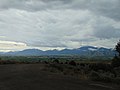
English: Media related to West Mountain (Utah County, Utah), a mountain on the southeastern edge of Utah Lake in southwestern Utah County, Utah, United States, that is on the southern segment of the Wasatch Range, though it is not connected to the main range.
Subcategories
This category has the following 2 subcategories, out of 2 total.
W
- West Mountain Observatory (3 F)
Media in category "West Mountain (Utah County, Utah)"
The following 37 files are in this category, out of 37 total.
-

-
 Benjamin Cemetery entrance, Benjamin, Utah, Jun 16.jpg 2,592 × 1,944; 2.31 MB
-
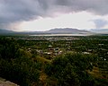
 Looking down on central Springville, Jun 04.jpg 1,280 × 960; 305 KB
-
 Looking down on north Springville, Jun 04.jpg 1,280 × 960; 306 KB
-
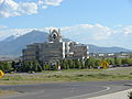 Neways' building in Springville, Utah.JPG 2,816 × 2,112; 2.41 MB
-
 North at West Mountain from Genola, Utah, May 16.jpg 2,592 × 1,944; 2.33 MB
-
 Northeast across Goshen Valley from Big Canyon, Utah, May 16.jpg 2,592 × 1,944; 2.34 MB
-
 Northeast across Utah Valley from West Mountain, Utah, Jun 16.jpg 2,592 × 1,944; 2.23 MB
-
 Northeast at West Mountain, Goshen, Utah, May 16.jpg 2,592 × 1,944; 2.34 MB
-
 Northwest across US-6 & S State Rd intersection west of Genola, Utah, May 16.jpg 2,592 × 1,944; 2.35 MB
-
 NRCSUT97006 - Utah (6487)(NRCS Photo Gallery).jpg 2,100 × 1,500; 4.12 MB
-
 NRCSUT97006 - Utah (6487)(NRCS Photo Gallery).tif 2,100 × 1,500; 7.75 MB
-
 Provo 025.jpg 1,280 × 1,024; 261 KB
-
 Provo Bay, Provo, UT 84601, USA - panoramio (6).jpg 2,994 × 1,978; 1.59 MB
-
 Provo, UT, USA - panoramio.jpg 3,002 × 1,992; 1.81 MB
-
 South Provo from the Y, May 2008.JPG 2,816 × 2,112; 2.55 MB
-
 Southern Utah Valley, Feb 08 - panoramio.jpg 2,500 × 1,277; 743 KB
-
 Southwest at future southbound bus stop on E University Pkwy in Provo, Mar 15.jpg 2,816 × 2,112; 2.78 MB
-
 Southwest at West Mountain from SR-77 in Palmyra, Utah, May 16.jpg 2,592 × 1,944; 2.32 MB
-
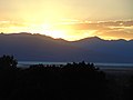 Sunset over Utah Lake, from Maple Canyon, Jul 16.jpg 2,592 × 1,944; 2.14 MB
-
 Tower cluster on West Mountain, Jun 17.jpg 1,944 × 2,592; 1.62 MB
-
 UTA bus shelter at UDOT Park & Ride lot, southwest Payson, Utah, Jun 16.jpg 2,592 × 1,944; 2.42 MB
-
 Utah County, UT, USA - panoramio.jpg 2,980 × 1,956; 1.55 MB
-
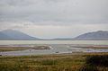
 Utah Lake satellite view.JPG 639 × 423; 168 KB
-
 Utah Lake State Park, Provo, United States (Unsplash).jpg 3,071 × 1,629; 2.1 MB
-
 View From Grove Creek Trail in September - panoramio.jpg 2,800 × 2,128; 1.76 MB
-
 West along Dry Creek from SR-51, Mar 17.jpg 2,592 × 1,944; 2.1 MB
-
 West along SR-178, Feb 16.jpg 2,816 × 2,112; 2.55 MB
-
 West at S 4400 W & S 3200 W intersection, Lake Shore, Utah, May 16.jpg 2,592 × 1,944; 2.42 MB
-
 West at SR-198 & SR-115 junction, Payson, Utah, May 16.jpg 2,592 × 1,944; 2.35 MB
-
 West at West Mountain from Spanish Fork Main St, May 16.jpg 2,592 × 1,944; 2.32 MB
-
 West on Dry Creek from N 350 West, Spanish Fork, UT, Mar 17.jpg 2,592 × 1,944; 2.41 MB
-
 West on SR-77 at N 2600 W & S 400 W in Springville, Utah, May 16.jpg 2,592 × 1,944; 2.35 MB
-
 West toward junction of SR-178 & SR-198, Feb 16.jpg 2,816 × 2,112; 2.42 MB
-
 West toward junction of SR-77 and SR-147, Apr 16.jpg 2,592 × 1,944; 2.23 MB
-
 West toward western end of SR-178, Feb 16.jpg 2,816 × 2,112; 2.5 MB
-
 Westmountainsummit.jpg 1,281 × 994; 233 KB


(NRCS_Photo_Gallery).jpg)

.jpg)


.jpg)


