Category:West Huntspill
Aller à la navigation
Aller à la recherche
English: West Huntspill is a village and civil parish in the Sedgemoor district, in the county of Somerset, England. The parish includes the village of Huntspill and the hamlet of Alstone.
village au Royaume-Uni  | |||||
| Téléverser des médias | |||||
| Nature de l’élément | |||||
|---|---|---|---|---|---|
| Lieu | Sedgemoor, Somerset, Angleterre du Sud-Ouest, Angleterre | ||||
 | |||||
Sous-catégories
Cette catégorie comprend 2 sous-catégories, dont les 2 ci-dessous.
H
P
Média dans la catégorie « West Huntspill »
Cette catégorie comprend 183 fichiers, dont les 183 ci-dessous.
-
 5N20 Exeter Riverside to Bristol East Junc ECS headed by 37 601 "Class 37 - Fifty".jpg 4 441 × 3 277 ; 1,97 Mio
-
 A very conspicuous pillbox by the River Brue - geograph.org.uk - 2388958.jpg 640 × 480 ; 309 kio
-
 Alstone , Alstone Lane - geograph.org.uk - 5691542.jpg 6 000 × 4 000 ; 6,2 Mio
-
 Alstone , Grassy Footpath - geograph.org.uk - 5691543.jpg 4 000 × 6 000 ; 7,5 Mio
-
 Alstone , Grassy Footpath - geograph.org.uk - 5691544.jpg 6 000 × 4 000 ; 7,35 Mio
-
 Alstone , Huntspill Road A38 - geograph.org.uk - 5697007.jpg 6 000 × 4 000 ; 5,09 Mio
-
 Alstone Gardens, Alstone - geograph.org.uk - 6027654.jpg 1 024 × 768 ; 323 kio
-
 Apple Tree Boarding Cattery, West Huntspill - geograph.org.uk - 3904627.jpg 1 024 × 789 ; 163 kio
-
 Approaching Huntspill - geograph.org.uk - 4251671.jpg 640 × 480 ; 88 kio
-
 Barn, Sunrise Farm - geograph.org.uk - 4986740.jpg 640 × 329 ; 39 kio
-
 Below New Clyce Bridge - geograph.org.uk - 1320576.jpg 640 × 327 ; 53 kio
-
 Burnham on Sea - The mouth of the River Bure - geograph.org.uk - 4630848.jpg 1 024 × 768 ; 121 kio
-
 Burnham on Sea - The muddy estuary of the River Brue - geograph.org.uk - 4630845.jpg 1 024 × 768 ; 164 kio
-
 Cadwell's Lane - geograph.org.uk - 3904855.jpg 1 024 × 768 ; 171 kio
-
 Church Road, Huntspill - geograph.org.uk - 3904800.jpg 1 024 × 768 ; 192 kio
-
 Corrugated shed - geograph.org.uk - 5229093.jpg 640 × 330 ; 50 kio
-
 Corrugated sheds - geograph.org.uk - 4986767.jpg 640 × 426 ; 61 kio
-
 Cottages, at the end of Church Road - geograph.org.uk - 3905069.jpg 1 024 × 768 ; 147 kio
-
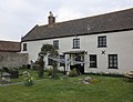
 Crossways Inn, West Huntspill - geograph.org.uk - 2307872.jpg 1 024 × 768 ; 122 kio
-
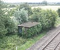 Derelict platelayer's hut, below Batts Bow Bridge - geograph.org.uk - 4549721.jpg 1 024 × 849 ; 302 kio
-
 Drainage ditch, alongside Puriton Road - geograph.org.uk - 3903970.jpg 1 024 × 768 ; 180 kio
-
 Farm machinery on a track near Huntspill - geograph.org.uk - 2388971.jpg 640 × 480 ; 321 kio
-
 Farmland in Brue Valley - geograph.org.uk - 5991902.jpg 1 024 × 681 ; 88 kio
-
 Farmland, Glebe Acre - geograph.org.uk - 4361201.jpg 640 × 403 ; 47 kio
-
 Farmland, Huntspill Level - geograph.org.uk - 5313318.jpg 640 × 426 ; 34 kio
-
 Flood defence wall, River Parrett - geograph.org.uk - 2388961.jpg 640 × 480 ; 315 kio
-
 Flood defence wall, River Parrett - geograph.org.uk - 2388962.jpg 640 × 480 ; 307 kio
-
 Footbridge over a rhyne near Huntspill - geograph.org.uk - 2388965.jpg 640 × 480 ; 346 kio
-
 Footbridge over a rhyne near Huntspill - geograph.org.uk - 2388973.jpg 640 × 480 ; 316 kio
-
 Footbridge, Huntspill - geograph.org.uk - 3904836.jpg 1 024 × 768 ; 223 kio
-
 Former schoolhouse, Huntspill - geograph.org.uk - 3904810.jpg 1 024 × 768 ; 184 kio
-
 Global Service Station, Alstone - geograph.org.uk - 3448176.jpg 1 024 × 768 ; 138 kio
-
 Grazing south of Highbridge - geograph.org.uk - 4361200.jpg 640 × 427 ; 37 kio
-
 Hedge - geograph.org.uk - 5545782.jpg 640 × 426 ; 62 kio
-
 Hedgerow - geograph.org.uk - 4986757.jpg 640 × 426 ; 50 kio
-
 Huntspill , Cadwell's Rhyne - geograph.org.uk - 5692562.jpg 6 000 × 4 000 ; 5,6 Mio
-
 Huntspill , Church Road - geograph.org.uk - 5691562.jpg 6 000 × 4 000 ; 6,22 Mio
-
 Huntspill , Church Road - geograph.org.uk - 5692581.jpg 6 000 × 4 000 ; 4,93 Mio
-
 Huntspill , Footpath - geograph.org.uk - 5691563.jpg 6 000 × 4 000 ; 7,49 Mio
-
 Huntspill , Footpath - geograph.org.uk - 5692568.jpg 6 000 × 4 000 ; 6,3 Mio
-
 Huntspill , Footpath - geograph.org.uk - 5692569.jpg 6 000 × 4 000 ; 5,91 Mio
-
 Huntspill , Footpath - geograph.org.uk - 5692570.jpg 4 000 × 6 000 ; 6,24 Mio
-
 Huntspill , Footpath - geograph.org.uk - 5692571.jpg 6 000 × 4 000 ; 6,83 Mio
-
 Huntspill , Footpath - geograph.org.uk - 5692573.jpg 4 000 × 6 000 ; 6,96 Mio
-
 Huntspill , Footpath - geograph.org.uk - 5692574.jpg 6 000 × 4 000 ; 6,57 Mio
-
 Huntspill , Footpath - geograph.org.uk - 5692576.jpg 4 000 × 6 000 ; 7,43 Mio
-
 Huntspill , Grange Road - geograph.org.uk - 5691564.jpg 6 000 × 4 000 ; 5,42 Mio
-
 Huntspill , Grassy Field - geograph.org.uk - 5691561.jpg 6 000 × 4 000 ; 6,65 Mio
-
 Huntspill , Grassy Field - geograph.org.uk - 5692563.jpg 6 000 × 4 000 ; 7,67 Mio
-
 Huntspill , Grassy Field - geograph.org.uk - 5692564.jpg 6 000 × 4 000 ; 7,6 Mio
-
 Huntspill , Grassy Field ^ Gate - geograph.org.uk - 5692567.jpg 6 000 × 4 000 ; 7,15 Mio
-
 Huntspill , Plymor Road - geograph.org.uk - 5692578.jpg 6 000 × 4 000 ; 6,6 Mio
-
 Huntspill , Silver Street - geograph.org.uk - 5692577.jpg 6 000 × 4 000 ; 7,57 Mio
-
 Huntspill , Silver Street - geograph.org.uk - 5692580.jpg 6 000 × 4 000 ; 6,68 Mio
-
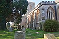
 Huntspill , St Peter's Church - geograph.org.uk - 5692583.jpg 4 000 × 6 000 ; 6,91 Mio
-
 Huntspill , St Peter's Church - geograph.org.uk - 5692584.jpg 5 508 × 3 672 ; 7,8 Mio
-
 Huntspill , St Peter's Church Churchyard - geograph.org.uk - 5692586.jpg 6 000 × 4 000 ; 6,65 Mio
-
 Huntspill , St Peter's Church Churchyard - geograph.org.uk - 5692588.jpg 6 000 × 4 000 ; 5,99 Mio
-
 Huntspill , St Peter's Church Churchyard - geograph.org.uk - 5692589.jpg 6 000 × 4 000 ; 6,66 Mio
-
 Huntspill Level - geograph.org.uk - 4986753.jpg 640 × 426 ; 44 kio
-
 Huntspill Level - geograph.org.uk - 5229090.jpg 640 × 281 ; 30 kio
-
 Huntspill Level - geograph.org.uk - 5229091.jpg 640 × 369 ; 35 kio
-
 Huntspill Level - geograph.org.uk - 5229092.jpg 640 × 245 ; 28 kio
-
 Huntspill Level - geograph.org.uk - 5313323.jpg 640 × 426 ; 34 kio
-
 Huntspill Level - geograph.org.uk - 5624219.jpg 640 × 426 ; 54 kio
-
 Huntspill Level - geograph.org.uk - 5624220.jpg 640 × 426 ; 50 kio
-
 Huntspill Methodist Church - geograph.org.uk - 3455756.jpg 640 × 480 ; 67 kio
-
 Huntspill River - geograph.org.uk - 3903980.jpg 1 024 × 768 ; 198 kio
-
 Huntspill River - geograph.org.uk - 3904785.jpg 1 024 × 768 ; 92 kio
-
 Huntspill River - geograph.org.uk - 4495857.jpg 1 024 × 685 ; 764 kio
-
 Huntspill River - geograph.org.uk - 4986728.jpg 640 × 426 ; 29 kio
-
 Huntspill River - geograph.org.uk - 4986730.jpg 640 × 460 ; 52 kio
-
 Huntspill River - geograph.org.uk - 5229087.jpg 640 × 373 ; 41 kio
-
 Huntspill River - geograph.org.uk - 5313309.jpg 640 × 426 ; 38 kio
-
 Huntspill River - geograph.org.uk - 5545779.jpg 640 × 426 ; 54 kio
-
 Huntspill River - geograph.org.uk - 5991896.jpg 1 024 × 681 ; 92 kio
-
 Huntspill River at the sluice by R Parrett - geograph.org.uk - 5607205.jpg 5 184 × 2 920 ; 1,7 Mio
-
 Local train approaches Black Ditch Bridge - geograph.org.uk - 3903938.jpg 1 024 × 706 ; 208 kio
-
 Looking north from Batts Bow Bridge - geograph.org.uk - 4549697.jpg 1 024 × 768 ; 225 kio
-
 M5 bridge over Huntspill River - geograph.org.uk - 5229086.jpg 640 × 270 ; 28 kio
-
 Marina on the River Brue looking downstream at low tide - geograph.org.uk - 2799608.jpg 3 072 × 2 304 ; 3,19 Mio
-
 Mill Farm - geograph.org.uk - 4986769.jpg 640 × 426 ; 57 kio
-
 Mill Farm - geograph.org.uk - 5545783.jpg 640 × 426 ; 66 kio
-
 North of Huntspill River - geograph.org.uk - 5541933.jpg 640 × 426 ; 44 kio
-
 North Rhyne Drain - geograph.org.uk - 3455761.jpg 640 × 480 ; 110 kio
-
 Outbuildings, Alstone Wildlife Park - geograph.org.uk - 3905037.jpg 1 024 × 768 ; 168 kio
-
 Outfall warning sign, Parrett estuary - geograph.org.uk - 3904891.jpg 1 024 × 768 ; 113 kio
-
 Passenger Train passing Mill Farm - geograph.org.uk - 3831737.jpg 1 200 × 803 ; 1,21 Mio
-
 Pasture land - geograph.org.uk - 4986748.jpg 640 × 337 ; 40 kio
-
 Pasture land - geograph.org.uk - 5991897.jpg 1 024 × 681 ; 116 kio
-
 Pasture, Mill Farm - geograph.org.uk - 5545786.jpg 640 × 426 ; 70 kio
-
 Pastureland - geograph.org.uk - 5313320.jpg 640 × 426 ; 36 kio
-
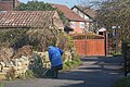
 Path through Alstone - geograph.org.uk - 2388984.jpg 640 × 480 ; 270 kio
-
 Path through Alstone - geograph.org.uk - 2388986.jpg 640 × 480 ; 286 kio
-
 Phone box at Alstone - geograph.org.uk - 2388975.jpg 640 × 480 ; 286 kio
-
 Plymor Hill Farm - geograph.org.uk - 3905075.jpg 1 024 × 783 ; 162 kio
-
 Pond in field - geograph.org.uk - 5545789.jpg 640 × 426 ; 49 kio
-
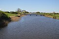
 Puriton Road Bridge - geograph.org.uk - 5624208.jpg 640 × 372 ; 51 kio
-
 Puriton Road Bridge, Huntspill River - geograph.org.uk - 5541932.jpg 640 × 426 ; 53 kio
-
 Rough grassland - geograph.org.uk - 4986723.jpg 640 × 426 ; 52 kio
-
 Rough grassland - geograph.org.uk - 5229088.jpg 640 × 426 ; 68 kio
-
 Route of public footpath, through Maundril's Farm - geograph.org.uk - 3905051.jpg 1 024 × 768 ; 190 kio
-
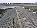
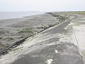 Sea defences, Parrett Estuary - geograph.org.uk - 3904905.jpg 1 024 × 768 ; 166 kio
-
 Sea defences, Parrett Estuary - geograph.org.uk - 3905017.jpg 1 024 × 768 ; 183 kio
-
 Sedgemoor , England Coast Path - geograph.org.uk - 5695876.jpg 6 000 × 4 000 ; 6,79 Mio
-
 Sedgemoor , England Coast Path - geograph.org.uk - 5695877.jpg 6 000 × 4 000 ; 5,51 Mio
-
 Sedgemoor , England Coast Path - geograph.org.uk - 5695880.jpg 6 000 × 4 000 ; 6,07 Mio
-
 Sedgemoor , England Coast Path - geograph.org.uk - 5696960.jpg 5 943 × 3 962 ; 6,22 Mio
-
 Sedgemoor , England Coast Path - geograph.org.uk - 5696965.jpg 5 932 × 3 955 ; 5,96 Mio
-
 Sedgemoor , England Coast Path - geograph.org.uk - 5696970.jpg 5 814 × 3 876 ; 6,27 Mio
-
 Sedgemoor , England Coast Path - geograph.org.uk - 5696973.jpg 5 946 × 3 964 ; 7,04 Mio
-
 Sedgemoor , England Coast Path - geograph.org.uk - 5696982.jpg 5 719 × 3 813 ; 7,04 Mio
-
 Sedgemoor , England Coast Path - geograph.org.uk - 5696984.jpg 5 590 × 3 726 ; 6,33 Mio
-
 Sedgemoor , Farm Track - geograph.org.uk - 5691556.jpg 6 000 × 4 000 ; 6,67 Mio
-
 Sedgemoor , Footpath Stile - geograph.org.uk - 5691548.jpg 4 000 × 6 000 ; 7,83 Mio
-
 Sedgemoor , Footpath Stile - geograph.org.uk - 5691549.jpg 6 000 × 4 000 ; 7,87 Mio
-
 Sedgemoor , Grassy Field - geograph.org.uk - 5691545.jpg 6 000 × 4 000 ; 6,14 Mio
-
 Sedgemoor , Grassy Field - geograph.org.uk - 5691558.jpg 6 000 × 4 000 ; 6,85 Mio
-
 Sedgemoor , Grassy Field - geograph.org.uk - 5691559.jpg 5 771 × 3 847 ; 7,87 Mio
-
 Sedgemoor , Grassy Field - geograph.org.uk - 5692592.jpg 6 000 × 4 000 ; 6,09 Mio
-
 Sedgemoor , Grassy Field - geograph.org.uk - 5692594.jpg 6 000 × 4 000 ; 6,76 Mio
-
 Sedgemoor , Grassy Field - geograph.org.uk - 5696976.jpg 4 315 × 2 876 ; 5,2 Mio
-
 Sedgemoor , Grassy Field - geograph.org.uk - 5696981.jpg 6 000 × 4 000 ; 7,7 Mio
-
 Sedgemoor , Grassy Field - geograph.org.uk - 5696985.jpg 6 000 × 4 000 ; 6,87 Mio
-
 Sedgemoor , Grassy Field ^ Horses - geograph.org.uk - 5692595.jpg 5 710 × 3 807 ; 7,2 Mio
-
 Sedgemoor , Grassy Field ^ Path - geograph.org.uk - 5691547.jpg 6 000 × 4 000 ; 7,34 Mio
-
 Sedgemoor , Huntspill River - geograph.org.uk - 5692601.jpg 6 000 × 4 000 ; 5,93 Mio
-
 Sedgemoor , Huntspill River - geograph.org.uk - 5692602.jpg 6 000 × 4 000 ; 6,5 Mio
-
 Sedgemoor , Huntspill River - geograph.org.uk - 5692603.jpg 5 986 × 3 990 ; 5,69 Mio
-
 Sedgemoor , Huntspill Sluice - geograph.org.uk - 5696969.jpg 6 000 × 4 000 ; 5,33 Mio
-
 Sedgemoor , Laburnum House - geograph.org.uk - 5692599.jpg 6 000 × 4 000 ; 5,41 Mio
-
 Sedgemoor , Laburnum House - geograph.org.uk - 5692600.jpg 6 000 × 4 000 ; 5,27 Mio
-
 Sedgemoor , Marshland - geograph.org.uk - 5695881.jpg 5 986 × 3 990 ; 6,36 Mio
-
 Sedgemoor , Marshland - geograph.org.uk - 5695883.jpg 5 807 × 3 871 ; 5,41 Mio
-
 Sedgemoor , Marshland - geograph.org.uk - 5696958.jpg 5 884 × 3 923 ; 6,7 Mio
-
 Sedgemoor , Marshland - geograph.org.uk - 5696963.jpg 6 000 × 4 000 ; 6,71 Mio
-
 Sedgemoor , Maundril's Farm - geograph.org.uk - 5691550.jpg 6 000 × 4 000 ; 5,4 Mio
-
 Sedgemoor , Maundril's Farm - geograph.org.uk - 5691551.jpg 6 000 × 4 000 ; 7,06 Mio
-
 Sedgemoor , Maundril's Farm - geograph.org.uk - 5691552.jpg 6 000 × 4 000 ; 6,62 Mio
-
 Sedgemoor , Maundril's Farm - geograph.org.uk - 5691553.jpg 6 000 × 4 000 ; 6,37 Mio
-
 Sedgemoor , Maundril's Farm - geograph.org.uk - 5691554.jpg 6 000 × 4 000 ; 7,72 Mio
-
 Sedgemoor , Maundril's Farm - geograph.org.uk - 5691555.jpg 6 000 × 4 000 ; 6,72 Mio
-
 Sedgemoor , Maundril's Farm - geograph.org.uk - 5691557.jpg 6 000 × 4 000 ; 7,13 Mio
-
 Sedgemoor , North Rhyne - geograph.org.uk - 5691546.jpg 6 000 × 4 000 ; 7,67 Mio
-
 Sedgemoor , River Parrett - geograph.org.uk - 5695878.jpg 6 000 × 4 000 ; 5,89 Mio
-
 Sedgemoor , River Parrett - geograph.org.uk - 5695879.jpg 5 934 × 3 955 ; 6,55 Mio
-
 Sedgemoor , River Parrett - geograph.org.uk - 5696966.jpg 6 000 × 4 000 ; 6,81 Mio
-
 Sedgemoor , River Parrett - geograph.org.uk - 5696967.jpg 5 950 × 3 967 ; 6,3 Mio
-
 Sedgemoor , River Parrett - geograph.org.uk - 5696968.jpg 6 000 × 4 000 ; 6,11 Mio
-
 Sedgemoor , River Parrett - geograph.org.uk - 5696972.jpg 5 972 × 3 981 ; 5,93 Mio
-
 Sedgemoor , River Parrett - geograph.org.uk - 5696974.jpg 5 978 × 3 986 ; 5,95 Mio
-
 Sedgemoor , River Parrett - geograph.org.uk - 5696977.jpg 5 780 × 3 853 ; 6,81 Mio
-
 Sedgemoor , River Parrett - geograph.org.uk - 5696978.jpg 5 492 × 3 661 ; 7,29 Mio
-
 Sedgemoor , River Parrett - geograph.org.uk - 5696980.jpg 6 000 × 4 000 ; 7,39 Mio
-
 Sedgemoor , River Parrett Estuary - geograph.org.uk - 3048773.jpg 4 288 × 2 848 ; 4,88 Mio
-
 Sedgemoor , Shepherd's Lane - geograph.org.uk - 5691560.jpg 4 000 × 6 000 ; 6,96 Mio
-
 Sedgemoor , Sloway Lane - geograph.org.uk - 5692596.jpg 6 000 × 4 000 ; 6,78 Mio
-
 Sedgemoor , Sloway Lane - geograph.org.uk - 5692598.jpg 6 000 × 4 000 ; 6,84 Mio
-
 Sedgemoor , Sloway Lane - geograph.org.uk - 5692604.jpg 6 000 × 4 000 ; 6,73 Mio
-
 Sedgemoor , Sloway Lane - geograph.org.uk - 5692605.jpg 6 000 × 4 000 ; 5,97 Mio
-
 Sedgemoor , Small Pond - geograph.org.uk - 5696983.jpg 5 993 × 3 995 ; 6,49 Mio
-
 Sheep between railway and motorway - geograph.org.uk - 4986744.jpg 640 × 426 ; 48 kio
-
 Sheep grazing - geograph.org.uk - 5545787.jpg 640 × 426 ; 68 kio
-
 Somerset levels at Alstone - geograph.org.uk - 3242120.jpg 640 × 280 ; 31 kio
-
 Somerset pasture - geograph.org.uk - 5541931.jpg 640 × 426 ; 58 kio
-
 Terraced houses on Alstone Road - geograph.org.uk - 3905047.jpg 1 024 × 768 ; 163 kio
-
 The Crossways Inn, Huntspill - geograph.org.uk - 3455751.jpg 640 × 480 ; 61 kio
-
 The Huntspill Arms - geograph.org.uk - 3447906.jpg 1 024 × 768 ; 145 kio
-
 The Huntspill River joins the River Parrett - geograph.org.uk - 3904871.jpg 1 024 × 768 ; 125 kio
-
 The Langlands, Huntspill - geograph.org.uk - 3905071.jpg 1 024 × 802 ; 265 kio
-
 The Orchard Inn, Huntspill - geograph.org.uk - 3447911.jpg 1 024 × 768 ; 132 kio
-
 The Orchard, pub on the A38 - geograph.org.uk - 6027645.jpg 1 024 × 768 ; 343 kio
-
 The Parrett estuary - geograph.org.uk - 2388960.jpg 640 × 480 ; 315 kio
-
 The Sundowner Hotel - geograph.org.uk - 3455759.jpg 640 × 480 ; 110 kio
-
 The Sundowner Hotel and Restaurant, Huntspill - geograph.org.uk - 3448158.jpg 1 024 × 786 ; 169 kio
-
 The White Cottage Restaurant, Huntspill - geograph.org.uk - 3447891.jpg 1 024 × 734 ; 139 kio
-
 The White Cottage Restaurant, Huntspill - geograph.org.uk - 3455748.jpg 640 × 480 ; 73 kio
-
 Track by the Great Western Line - geograph.org.uk - 4986724.jpg 640 × 532 ; 70 kio
-
 Track to Maundril's Farm - geograph.org.uk - 3905063.jpg 1 024 × 768 ; 214 kio
-
 Traffic on the A38, looking south, at Huntspill - geograph.org.uk - 6027649.jpg 1 024 × 768 ; 375 kio
-
 View north from Withy Bridge - geograph.org.uk - 4549630.jpg 1 024 × 768 ; 257 kio
-
 View towards Stert Island - geograph.org.uk - 3905020.jpg 1 024 × 768 ; 157 kio
-
 Walrow Industrial Estate - geograph.org.uk - 4986765.jpg 640 × 426 ; 38 kio


