Category:West Kingsdown
Aller à la navigation
Aller à la recherche
English: West Kingsdown is a village and civil parish in the Sevenoaks District of Kent, England. The parish is located on the North Downs, north of Sevenoaks town, within the London Commuter Belt. Both the A20 and the M20 motorway cross the parish.
Nederlands: West Kingsdown is een plaats en civil parish in het bestuurlijke gebied Sevenoaks, in het Engelse graafschap Kent.
localité britannique du comté anglais du Kent  | |||||
| Téléverser des médias | |||||
| Nature de l’élément | |||||
|---|---|---|---|---|---|
| Lieu | Sevenoaks, Kent, Angleterre du Sud-Est, Angleterre | ||||
 | |||||
Sous-catégories
Cette catégorie comprend 7 sous-catégories, dont les 7 ci-dessous.
Média dans la catégorie « West Kingsdown »
Cette catégorie comprend 198 fichiers, dont les 198 ci-dessous.
-
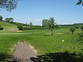 10th Tee in Austin Lodge Golf Course - geograph.org.uk - 1331320.jpg 640 × 480 ; 74 kio
-
 11th Tee in Austin Lodge Golf Course - geograph.org.uk - 1331319.jpg 640 × 480 ; 66 kio
-
 16th Tee in Woodland Manor Golf Course - geograph.org.uk - 1256342.jpg 640 × 480 ; 56 kio
-
 A20, West Kingsdown - geograph.org.uk - 323264.jpg 640 × 428 ; 74 kio
-
 Bali Hai Farm - geograph.org.uk - 2174073.jpg 640 × 430 ; 133 kio
-
 Barngate Farmhouse - geograph.org.uk - 1256368.jpg 640 × 480 ; 113 kio
-
 Botsom Lane at the junction of Knatts Valley Road - geograph.org.uk - 4426337.jpg 2 560 × 1 920 ; 2 Mio
-
 Brands Hatch - geograph.org.uk - 5607915.jpg 4 000 × 3 000 ; 3,01 Mio
-
 Brands Hatch, Brabham Straight - geograph.org.uk - 5607917.jpg 4 000 × 3 000 ; 2,11 Mio
-
 Brands Hatch, Clark Curve - geograph.org.uk - 5607918.jpg 5 184 × 3 456 ; 1,32 Mio
-
 Brands Hatch, Clark Curve - geograph.org.uk - 5607919.jpg 5 184 × 3 456 ; 4,17 Mio
-
 Brands Hatch, pedestrian Tunnel under Brabham Straight - geograph.org.uk - 5607920.jpg 3 000 × 4 000 ; 1,82 Mio
-
 Bridleway in High Castle Wood - geograph.org.uk - 1315019.jpg 480 × 640 ; 109 kio
-
 Bridleway in Hog Wood - geograph.org.uk - 1315014.jpg 640 × 480 ; 131 kio
-
 Bridleway junction in Stacklands Wood - geograph.org.uk - 1256353.jpg 640 × 480 ; 139 kio
-
 Bridleway near Maplebank Farm - geograph.org.uk - 1314989.jpg 640 × 480 ; 136 kio
-
 Bridleway to Drane Farm - geograph.org.uk - 1254182.jpg 640 × 480 ; 135 kio
-
 Bridleway to Maplescombe Lane - geograph.org.uk - 1315001.jpg 640 × 480 ; 138 kio
-
 Bridleway to Stacklands Wood - geograph.org.uk - 1256349.jpg 640 × 480 ; 111 kio
-
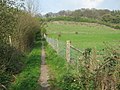
 Bridleway, Knatts Valley - geograph.org.uk - 1955555.jpg 480 × 640 ; 98 kio
-
 BT Telephone Exchange and Mobile Phone Masts - geograph.org.uk - 1178405.jpg 640 × 481 ; 55 kio
-
 Buildings at Woodlands Manor Golf Club - geograph.org.uk - 1267396.jpg 640 × 480 ; 79 kio
-
 Byway off Cotmans Ash Lane - geograph.org.uk - 2174043.jpg 640 × 430 ; 199 kio
-
 Byway towards Woodlands - geograph.org.uk - 1256318.jpg 640 × 480 ; 152 kio
-
 Catholic Church, West Kingsdown. - geograph.org.uk - 323395.jpg 640 × 428 ; 85 kio
-
 Cherry Tree Green, East Hill - geograph.org.uk - 1315024.jpg 640 × 480 ; 109 kio
-
 Clarkes Green Rd, west - geograph.org.uk - 2174135.jpg 640 × 430 ; 162 kio
-
 Close up of the village sign at West Kingsdown - geograph.org.uk - 3321166.jpg 3 000 × 4 000 ; 3,94 Mio
-
 Coppiced tree, Birches Wood - geograph.org.uk - 2171733.jpg 640 × 430 ; 176 kio
-
 Coppiced trees, Birches Wood - geograph.org.uk - 2171729.jpg 640 × 430 ; 159 kio
-
 Coppiced trees, Birches Wood - geograph.org.uk - 2171738.jpg 640 × 430 ; 176 kio
-
 Coppiced trees, Birches Wood - geograph.org.uk - 2171740.jpg 640 × 430 ; 186 kio
-
 Cotman's Ash Lane - geograph.org.uk - 2174101.jpg 640 × 430 ; 153 kio
-
 Country Lane running through Knatts Valley - geograph.org.uk - 2207127.jpg 1 143 × 770 ; 322 kio
-
 Courtfield Shaw - geograph.org.uk - 1314991.jpg 640 × 480 ; 99 kio
-
 Cow parsley in Knatts Valley - geograph.org.uk - 6180498.jpg 4 000 × 3 000 ; 4,51 Mio
-
 Cow parsley in Knatts Valley - geograph.org.uk - 6180501.jpg 4 000 × 3 000 ; 4,81 Mio
-
 Crowhurst Lane crossing M20 - geograph.org.uk - 6316489.jpg 1 024 × 576 ; 88 kio
-
 Crowhurst Lane goes over the M20 - geograph.org.uk - 4067783.jpg 1 600 × 1 200 ; 1,13 Mio
-
 Dried up pond by the North Downs Way - geograph.org.uk - 2171743.jpg 640 × 430 ; 156 kio
-
 East Hill Farmhouse - geograph.org.uk - 1315031.jpg 640 × 480 ; 110 kio
-
 Elaborate entrance to house on Knatts Lane - geograph.org.uk - 4427509.jpg 2 560 × 1 920 ; 2,14 Mio
-
 Fallen Policeman Memorial - geograph.org.uk - 1178411.jpg 640 × 481 ; 131 kio
-
 Farmhouse, Goodbury Farm - geograph.org.uk - 2187955.jpg 640 × 430 ; 123 kio
-
 Fawkham Road bridge over M20 Motorway - geograph.org.uk - 1178430.jpg 640 × 481 ; 68 kio
-
 Field by Cotmans Ash Lane - geograph.org.uk - 2174045.jpg 640 × 430 ; 100 kio
-
 Field next to M20 - geograph.org.uk - 2433334.jpg 640 × 480 ; 57 kio
-
 Field off Knatts Valley Road - geograph.org.uk - 4059748.jpg 4 000 × 3 000 ; 3,98 Mio
-
 Field outside West Kingsdown - geograph.org.uk - 4175476.jpg 640 × 430 ; 73 kio
-
 Fields next to M20 - geograph.org.uk - 2433349.jpg 640 × 480 ; 62 kio
-
 Flint Building on Cotman's Ash Lane - geograph.org.uk - 1267404.jpg 640 × 480 ; 78 kio
-
 Footpath at Woodlands - geograph.org.uk - 5085512.jpg 4 608 × 3 456 ; 3,33 Mio
-
 Footpath near Woodlands - geograph.org.uk - 5085515.jpg 4 608 × 3 456 ; 3,3 Mio
-
 Footpath off Cotman's Ash Lane - geograph.org.uk - 2174103.jpg 640 × 430 ; 153 kio
-
 Fox Farm, Cotmans Ash Lane - geograph.org.uk - 2174131.jpg 640 × 430 ; 186 kio
-
 French riders, Scratchers Lane - geograph.org.uk - 3132538.jpg 640 × 427 ; 98 kio
-
 Gate, Teias Farm - geograph.org.uk - 2174059.jpg 640 × 430 ; 161 kio
-
 Golf course sign - geograph.org.uk - 1104653.jpg 640 × 480 ; 95 kio
-
 Goodbury Farm - geograph.org.uk - 2187952.jpg 640 × 430 ; 114 kio
-
 Goodbury Rd - geograph.org.uk - 2174138.jpg 640 × 430 ; 192 kio
-
 Goodbury Rd - geograph.org.uk - 2187951.jpg 640 × 430 ; 169 kio
-
 Goodbury Rd - geograph.org.uk - 2187954.jpg 640 × 430 ; 145 kio
-
 Goodbury Road at the junction of Hills Lane - geograph.org.uk - 4426262.jpg 2 560 × 1 920 ; 1,92 Mio
-
 Gorse Hill - geograph.org.uk - 3127599.jpg 640 × 427 ; 75 kio
-
 Gorse Hill Main Road - geograph.org.uk - 6126805.jpg 1 024 × 768 ; 168 kio
-
 Graham Hill Bend, Brands Hatch - geograph.org.uk - 5076251.jpg 3 264 × 2 448 ; 1,76 Mio
-
 Green lane off the North Downs Way - geograph.org.uk - 2171748.jpg 640 × 430 ; 170 kio
-
 Hedges, Cotmans Ash Lane - geograph.org.uk - 2174071.jpg 640 × 430 ; 122 kio
-
 Horse and Groom public house, West Kingsdown - geograph.org.uk - 1638694.jpg 640 × 480 ; 59 kio
-
 House entrances on Knatts Valley Road - geograph.org.uk - 4427500.jpg 2 560 × 1 920 ; 2,16 Mio
-
 Inside St Mary's Church at Woodlands - geograph.org.uk - 5776176.jpg 4 000 × 3 000 ; 4,93 Mio
-

-
 Junction of Goodbury Rd and Hills Lane - geograph.org.uk - 2187957.jpg 640 × 430 ; 149 kio
-
 Knatts Lane at the junction of Knatts Road - geograph.org.uk - 4426297.jpg 2 560 × 1 920 ; 2,07 Mio
-
 Knatts Lane junction, Knatts Valley - geograph.org.uk - 1955569.jpg 640 × 480 ; 98 kio
-
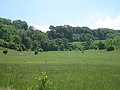
 Knatts Valley - geograph.org.uk - 1957897.jpg 640 × 467 ; 100 kio
-
 Knatts Valley from Maplescombe Church - geograph.org.uk - 3182860.jpg 4 000 × 3 000 ; 3,94 Mio
-
 Knatts Valley hill - geograph.org.uk - 1956575.jpg 640 × 480 ; 99 kio
-
 Knatts Valley Road - geograph.org.uk - 1706201.jpg 2 048 × 1 536 ; 1,17 Mio
-
 Knatts Valley Road - geograph.org.uk - 4059092.jpg 4 000 × 3 000 ; 4,34 Mio
-
 Knatts Valley Road - geograph.org.uk - 4059094.jpg 4 000 × 3 000 ; 4,01 Mio
-
 Knatts Valley Road - geograph.org.uk - 4059100.jpg 4 000 × 3 000 ; 4,06 Mio
-
 Knatts Valley Road - geograph.org.uk - 4426271.jpg 2 560 × 1 920 ; 1,95 Mio
-
 Knatts Valley Road - geograph.org.uk - 4426773.jpg 2 560 × 1 920 ; 2 Mio
-
 Knatts Valley Road, junction with Botsom Lane - geograph.org.uk - 1706193.jpg 2 048 × 1 536 ; 1,06 Mio
-
 Lodge to the London Golf Club - geograph.org.uk - 1092129.jpg 640 × 480 ; 127 kio
-
 Looking along Knatts Valley Road - geograph.org.uk - 4059726.jpg 4 000 × 3 000 ; 4,24 Mio
-
 Looking down Tinker Pot Lane - geograph.org.uk - 4060188.jpg 4 000 × 3 000 ; 4,35 Mio
-
 Looking south from the top of Scratchers Lane - geograph.org.uk - 3204647.jpg 2 560 × 1 920 ; 2,2 Mio
-
 Looking up the side of Knatts Valley - geograph.org.uk - 3183101.jpg 4 000 × 3 000 ; 4,04 Mio
-
 Looking up Tinker Pot Lane - geograph.org.uk - 4060185.jpg 4 000 × 3 000 ; 4,23 Mio
-
 Looking west down Scratcher's lane from the top of the hill - geograph.org.uk - 3204642.jpg 2 560 × 1 920 ; 2,61 Mio
-
 Lower Park Wood - geograph.org.uk - 1314962.jpg 640 × 480 ; 84 kio
-
 M20 bridge over Brands Hatch Road - geograph.org.uk - 3182929.jpg 4 000 × 3 000 ; 4,15 Mio
-
 M20 crossing Brands Hatch Road - geograph.org.uk - 3182495.jpg 4 000 × 3 000 ; 4,29 Mio
-
 Main Road Gorse Hill - geograph.org.uk - 3182896.jpg 4 000 × 3 000 ; 3,96 Mio
-
 Manure, Teias Farm - geograph.org.uk - 2174061.jpg 640 × 396 ; 99 kio
-
 Maplebank Farm - geograph.org.uk - 1267385.jpg 640 × 427 ; 84 kio
-
 Memorial in St Mary's Church, Woodlands - geograph.org.uk - 5085538.jpg 4 608 × 3 456 ; 3,45 Mio
-
 Memorial to Detective Constable John Fordham, West Kingsdown - geograph.org.uk - 3321174.jpg 3 000 × 4 000 ; 3,95 Mio
-
 Men's Paralympic Cycling - geograph.org.uk - 3128549.jpg 4 000 × 3 000 ; 2,84 Mio
-

-
 Motorbikes on Brands Hatch Circuit - geograph.org.uk - 1314870.jpg 640 × 480 ; 96 kio
-

-
 North Downs Way in Birches Wood - geograph.org.uk - 2171728.jpg 640 × 430 ; 187 kio
-
 North Downs Way in Birches Wood - geograph.org.uk - 2171731.jpg 640 × 430 ; 159 kio
-
 North Downs Way in Birches Wood - geograph.org.uk - 2171732.jpg 640 × 430 ; 135 kio
-
 North Downs Way leaves Birches Wood - geograph.org.uk - 2171734.jpg 640 × 430 ; 142 kio
-
 Paralympic Cycling - geograph.org.uk - 3126811.jpg 4 000 × 3 000 ; 2,39 Mio
-
 Paralympic Cycling - geograph.org.uk - 3126830.jpg 4 000 × 3 000 ; 2,26 Mio
-
 ParalympicGB, Scratchers Lane - geograph.org.uk - 3130306.jpg 640 × 427 ; 103 kio
-
 ParalympicGB, Scratchers Lane - geograph.org.uk - 3130307.jpg 640 × 427 ; 100 kio
-
 ParalympicGB, Scratchers Lane - geograph.org.uk - 3130308.jpg 640 × 427 ; 133 kio
-
 Pasadena Park - geograph.org.uk - 1315027.jpg 640 × 480 ; 82 kio
-
 Path above Knatts Valley - geograph.org.uk - 3926005.jpg 4 000 × 3 000 ; 4,23 Mio
-
 Path above Knatts Valley - geograph.org.uk - 3926010.jpg 4 000 × 3 000 ; 3,98 Mio
-
 Path down North Downs - geograph.org.uk - 6126813.jpg 768 × 1 024 ; 438 kio
-
 Path in High Castle Wood - geograph.org.uk - 3926017.jpg 4 000 × 3 000 ; 4,33 Mio
-
 Path through High Castle Wood - geograph.org.uk - 3921678.jpg 4 000 × 3 000 ; 4,39 Mio
-
 Path through High Castle Wood - geograph.org.uk - 3926021.jpg 4 000 × 3 000 ; 4,34 Mio
-
 Pells Lane - geograph.org.uk - 3321211.jpg 4 000 × 3 000 ; 4,33 Mio
-
 Pells Lane looking towards West Kingsdown - geograph.org.uk - 3321241.jpg 3 000 × 4 000 ; 4,39 Mio
-
 Post stile - geograph.org.uk - 1331302.jpg 640 × 480 ; 136 kio
-
 Remains of Maplescombe Church - geograph.org.uk - 3182839.jpg 4 000 × 3 000 ; 4,06 Mio
-
 Richardson's Farm - geograph.org.uk - 1092140.jpg 640 × 480 ; 82 kio
-
 Rising Sun, Cotmans Ash - geograph.org.uk - 2174060.jpg 640 × 401 ; 103 kio
-
 Road race support vehicles, Gorse Hill - geograph.org.uk - 3127597.jpg 640 × 427 ; 114 kio
-
 Roughly half way^ - geograph.org.uk - 2171745.jpg 640 × 430 ; 153 kio
-
 School Lane - geograph.org.uk - 3921694.jpg 4 000 × 3 000 ; 4,34 Mio
-
 School Lane, West Kingsdown - geograph.org.uk - 3926032.jpg 4 000 × 3 000 ; 4,44 Mio
-
 Scratchers Lane - geograph.org.uk - 3126868.jpg 4 000 × 3 000 ; 2,39 Mio
-
 Seventh Tee in Woodlands Manor Golf Course - geograph.org.uk - 1256336.jpg 640 × 480 ; 87 kio
-
 Signpost, Cotman's Ash Lane - geograph.org.uk - 2174137.jpg 640 × 430 ; 181 kio
-
 Site of Maplescombe Church - geograph.org.uk - 3182484.jpg 4 000 × 3 000 ; 4,04 Mio
-
 Site of Maplescombe Church - geograph.org.uk - 3182841.jpg 4 000 × 3 000 ; 4,19 Mio
-
 Small valley crosses Cotmans Ash Lane - geograph.org.uk - 2174067.jpg 640 × 430 ; 152 kio
-
 Southbound M20 near Stansted - geograph.org.uk - 3708862.jpg 640 × 480 ; 213 kio
-
 Southbound M20 Nearing Junction 2 - geograph.org.uk - 3708876.jpg 640 × 480 ; 243 kio
-
 St Mary's Church, Woodlands - geograph.org.uk - 5085949.jpg 4 435 × 3 325 ; 3,07 Mio
-
 Stacklands Retreat Church - geograph.org.uk - 1256362.jpg 640 × 480 ; 88 kio
-
 Steps at the end of Hever Road, West Kingsdown - geograph.org.uk - 3321123.jpg 3 000 × 4 000 ; 4,27 Mio
-
 Steps on Bridleway - geograph.org.uk - 1315121.jpg 480 × 640 ; 119 kio
-
 Subway under the M20 at Crowhurst - geograph.org.uk - 1092155.jpg 640 × 480 ; 212 kio
-
 Terry's Lodge Farm near West Kingsdown - geograph.org.uk - 3156998.jpg 2 048 × 1 536 ; 1,58 Mio
-
 The end of Hever Road, West Kingsdown - geograph.org.uk - 3321121.jpg 4 000 × 3 000 ; 4,25 Mio
-
 The entrance to Woodlawn on Knatts Valley Road - geograph.org.uk - 4426723.jpg 2 560 × 1 920 ; 1,95 Mio
-
 The Grove, West Kingsdown - geograph.org.uk - 2375396.jpg 4 320 × 3 240 ; 4,83 Mio
-
 The M20 towards the M25 and London - geograph.org.uk - 4067349.jpg 1 600 × 1 194 ; 1,22 Mio
-
 The M20 towards the M25 and London - geograph.org.uk - 4067769.jpg 1 600 × 1 200 ; 1,13 Mio
-
 The M20 towards the M25 and London - geograph.org.uk - 4067812.jpg 1 600 × 1 200 ; 1,22 Mio
-
 The M20 towards the M25 and London - geograph.org.uk - 4067827.jpg 1 600 × 1 200 ; 1,22 Mio
-
 The Portobello Inn, West Kingsdown - geograph.org.uk - 1178398.jpg 640 × 481 ; 65 kio
-
 The Rising Sun, Cotman's Ash - geograph.org.uk - 6256877.jpg 3 691 × 2 769 ; 2,4 Mio
-
 The setting of St Mary's, Woodlands - geograph.org.uk - 4057426.jpg 4 000 × 3 000 ; 3,84 Mio
-

-
 The start of Knatts Valley - geograph.org.uk - 3183110.jpg 4 000 × 3 000 ; 4,2 Mio
-
 The west end of St Mary's Church, Woodlands - geograph.org.uk - 5085952.jpg 4 608 × 3 456 ; 3,33 Mio
-
 Three Gates Road bridge over M20 Motorway - geograph.org.uk - 1314886.jpg 640 × 480 ; 90 kio
-
 Tinker Pot Lane - geograph.org.uk - 4060195.jpg 4 000 × 3 000 ; 4,39 Mio
-
 Tinkerpot Lane - geograph.org.uk - 2174136.jpg 640 × 430 ; 172 kio
-
 Toothworts beside footpath - geograph.org.uk - 1264046.jpg 640 × 480 ; 143 kio
-
 Top of the hill, Goodbury Rd - geograph.org.uk - 2187949.jpg 640 × 430 ; 182 kio
-
 Track leading to Stacklands Retreat - geograph.org.uk - 3926026.jpg 4 000 × 3 000 ; 4,44 Mio
-
 Track to Knatts Farm - geograph.org.uk - 4059733.jpg 4 000 × 3 000 ; 3,86 Mio
-
 Track to Maplescombe Lane - geograph.org.uk - 3925992.jpg 4 000 × 3 000 ; 4,38 Mio
-
 Track to Maplescombe Lane - geograph.org.uk - 3925996.jpg 4 000 × 3 000 ; 4,01 Mio
-
 Tunnel under the M20 - geograph.org.uk - 4175500.jpg 640 × 430 ; 17 kio
-
 View across the M20 - geograph.org.uk - 3182504.jpg 4 000 × 3 000 ; 4,02 Mio
-
 View by Knatts Valley Road - geograph.org.uk - 4426774.jpg 2 560 × 1 920 ; 1,98 Mio
-
 View from High Castle Wood - geograph.org.uk - 3926015.jpg 4 000 × 3 000 ; 4,04 Mio
-
 View from Hog Wood - geograph.org.uk - 1315010.jpg 640 × 360 ; 60 kio
-
 View from Main Road Gorse Hill - geograph.org.uk - 3182906.jpg 4 000 × 3 000 ; 4 Mio
-
 View to Canary Wharf from High Castle Wood - geograph.org.uk - 3921670.jpg 4 000 × 3 000 ; 4,04 Mio
-
 Village sign on the green at West Kingsdown - geograph.org.uk - 3321161.jpg 3 000 × 4 000 ; 4,43 Mio
-
 Wennlands Farm - geograph.org.uk - 2174074.jpg 640 × 430 ; 148 kio
-
 West Kingsdown Baptist Church - geograph.org.uk - 1178418.jpg 640 × 481 ; 70 kio
-
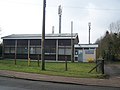
 West Kingsdown Pavilion and Library - geograph.org.uk - 1314859.jpg 640 × 480 ; 52 kio
-
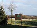
 West Kingsdown Village Sign - geograph.org.uk - 1178408.jpg 481 × 640 ; 59 kio
-
 West Kingsdown Village Sign - geograph.org.uk - 1314867.jpg 640 × 480 ; 78 kio
-
 Woman's Paralympic Cycling - geograph.org.uk - 3126845.jpg 4 000 × 3 000 ; 2,47 Mio
-
 Women road race, Scratchers Lane - geograph.org.uk - 3127608.jpg 640 × 427 ; 117 kio
-
 Women road race, Scratchers Lane - geograph.org.uk - 3127609.jpg 640 × 427 ; 115 kio
-
 Women's Individual B Road Race, Scratchers Lane - geograph.org.uk - 3130313.jpg 640 × 427 ; 130 kio
-
 Women's Individual B Road Race, Scratchers Lane - geograph.org.uk - 3130314.jpg 640 × 427 ; 132 kio
-

-
-
 Women's Individual B Road Race, Scratchers Lane - geograph.org.uk - 3132543.jpg 640 × 384 ; 116 kio
-
 Women's individual race, Colin Chapman Way - geograph.org.uk - 3120373.jpg 640 × 427 ; 119 kio
-
 Women's road racing, Colin Chapman Way - geograph.org.uk - 3127593.jpg 640 × 427 ; 103 kio
-
 Woodlands Manor Golf Club - geograph.org.uk - 1256319.jpg 640 × 480 ; 104 kio
-
 A bend on the M20 - geograph.org.uk - 1092134.jpg 640 × 480 ; 108 kio
-
 A Chalk Valley Lane Junction - geograph.org.uk - 323253.jpg 640 × 428 ; 89 kio
-
 Pells Farm on Pells Lane - geograph.org.uk - 323411.jpg 640 × 428 ; 139 kio
-
 School Lane, West Kingsdown - geograph.org.uk - 323123.jpg 640 × 428 ; 96 kio
-
 Slated Cottages, West Kingsdown - geograph.org.uk - 323363.jpg 640 × 429 ; 103 kio
-
 Springham's Cottages, West Kingsdown - geograph.org.uk - 323372.jpg 640 × 428 ; 132 kio
-
 St Clere Hill Road, West End - geograph.org.uk - 323144.jpg 640 × 429 ; 109 kio
-
 The Gamecock, West Kingsdown - geograph.org.uk - 323273.jpg 640 × 428 ; 86 kio


