Category:Westbere
Vai alla navigazione
Vai alla ricerca
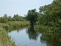
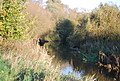
English: Westbere is a small village in Kent between Canterbury and the Isle of Thanet. The village is a preservation area that overlooks Westbere lakes (created by gravel extraction) that teem with birds, and are used by The King's School for Rowing and Sailing.
village and civil parish in Kent, United Kingdom  | |||||
| Carica un file multimediale | |||||
| Istanza di | |||||
|---|---|---|---|---|---|
| Luogo | City of Canterbury, Kent, Sud Est dell'Inghilterra, Inghilterra | ||||
| Popolazione |
| ||||
| Superficie |
| ||||
 | |||||
Sottocategorie
Questa categoria contiene le 5 sottocategorie indicate di seguito, su un totale di 5.
A
- All Saints' church, Westbere (11 F)
- Ashby Cottage, Westbere (2 F)
C
- Westbere Cottage (3 F)
H
- Westbere House (3 F)
Y
- Ye Olde Yew Tree, Westbere (5 F)
File nella categoria "Westbere"
Questa categoria contiene 179 file, indicati di seguito, su un totale di 179.
-
 26 & 28 Westbere Lane (geograph 2802082).jpg 640 × 430; 78 KB
-
-
 A28, Westbere - geograph.org.uk - 3360577.jpg 640 × 430; 42 KB
-
 Ashford to Ramsgate Line - geograph.org.uk - 2805786.jpg 640 × 430; 101 KB
-
 Autumnal colour - geograph.org.uk - 2805803.jpg 640 × 430; 121 KB
-
 Bend, Westbere Lane - geograph.org.uk - 2802135.jpg 640 × 430; 97 KB
-
 Buildings at Rushbourne Manor - geograph.org.uk - 385875.jpg 640 × 480; 54 KB
-
 Bushey Hill Rd - geograph.org.uk - 2797822.jpg 640 × 430; 108 KB
-
 Cecil Cottages (geograph 2802114).jpg 640 × 430; 72 KB
-
 Church Lane (geograph 2802109).jpg 640 × 430; 114 KB
-
 Church Lane - geograph.org.uk - 2802124.jpg 640 × 430; 102 KB
-
 Crossing Cottage, Walnut Tree Lane - geograph.org.uk - 2797747.jpg 640 × 430; 75 KB
-
 Danger deep water, Westbere Marshes - geograph.org.uk - 2794842.jpg 640 × 430; 84 KB
-
 Ditch, Westbere Marshes - geograph.org.uk - 2792119.jpg 640 × 430; 74 KB
-
 Ditch, Westbere Marshes - geograph.org.uk - 2794826.jpg 640 × 430; 76 KB
-
 Ditch, Westbere Marshes - geograph.org.uk - 2794906.jpg 640 × 430; 86 KB
-
 Drainage ditch by the footpath - geograph.org.uk - 2792020.jpg 640 × 430; 75 KB
-
 Footpath along the Great Stour - geograph.org.uk - 2789226.jpg 640 × 430; 109 KB
-
 Footpath beside the River Great Stour - geograph.org.uk - 2059504.jpg 3 072 × 2 304; 2,33 MB
-
 Footpath by the Great Stour - geograph.org.uk - 2789262.jpg 640 × 430; 146 KB
-
 Footpath by the railway - geograph.org.uk - 2797729.jpg 640 × 430; 50 KB
-
 Footpath by the railway line - geograph.org.uk - 2805792.jpg 640 × 430; 70 KB
-

-
 Footpath by Westbere Lake - geograph.org.uk - 2792104.jpg 640 × 430; 81 KB
-
 Footpath by Westbere Lake - geograph.org.uk - 2797712.jpg 640 × 430; 136 KB
-
 Footpath by Westbere Lake - geograph.org.uk - 2797724.jpg 640 × 430; 149 KB
-
 Footpath from Westbere Marshes - geograph.org.uk - 2424340.jpg 3 072 × 2 304; 2,11 MB
-

-
 Footpath in the Stour Valley - geograph.org.uk - 2789245.jpg 640 × 430; 87 KB
-
 Footpath in the woods - geograph.org.uk - 2810707.jpg 640 × 430; 119 KB
-
 Footpath in Westbere Marshes - geograph.org.uk - 2424349.jpg 3 072 × 2 304; 1,96 MB
-
 Footpath into Westbere Marshes - geograph.org.uk - 2797734.jpg 640 × 430; 124 KB
-
 Footpath junction beside the River Stour - geograph.org.uk - 2424343.jpg 3 072 × 2 304; 2,34 MB
-

-
 Footpath to Sturry - geograph.org.uk - 2805747.jpg 640 × 430; 126 KB
-
 Footpath to Sturry - geograph.org.uk - 2805764.jpg 640 × 430; 126 KB
-
 Footpath to Sturry - geograph.org.uk - 2806233.jpg 640 × 430; 70 KB
-
 Footpath to the Westbere Marshes - geograph.org.uk - 2789258.jpg 640 × 430; 103 KB
-
 Footpath, north bank of the Great Stour - geograph.org.uk - 2789232.jpg 640 × 430; 117 KB
-
 Footpath, Westbere Marshes - geograph.org.uk - 2792114.jpg 640 × 430; 84 KB
-
 Footpath, Westbere Marshes - geograph.org.uk - 2794837.jpg 640 × 430; 77 KB
-
 Footpath, Westbere Marshes - geograph.org.uk - 2794845.jpg 640 × 430; 98 KB
-
 Former foot crossing near Westbere - geograph.org.uk - 5029258.jpg 4 608 × 3 456; 3,45 MB
-
 Former foot crossing near Westbere - geograph.org.uk - 5029259.jpg 4 608 × 3 456; 3,4 MB
-
 Gauging Station, Great Stour - geograph.org.uk - 2789222.jpg 640 × 430; 74 KB
-
 Great Stour - geograph.org.uk - 2789234.jpg 640 × 430; 91 KB
-
 Great Stour - geograph.org.uk - 2789241.jpg 640 × 430; 90 KB
-
 Great Stour - geograph.org.uk - 2789260.jpg 640 × 430; 120 KB
-
 Great Stour - geograph.org.uk - 2792074.jpg 640 × 430; 103 KB
-
 Great Stour Valley - geograph.org.uk - 2792069.jpg 640 × 430; 62 KB
-
 Grey heron perching near Fordwich - geograph.org.uk - 2872212.jpg 640 × 450; 115 KB
-
 High Speed train - geograph.org.uk - 2806238.jpg 640 × 430; 100 KB
-
 House in Westbere (geograph 2802145).jpg 640 × 415; 73 KB
-
 House on Westbere Lane - geograph.org.uk - 2802131.jpg 640 × 430; 52 KB
-
 House, Westbere Lane - geograph.org.uk - 2805738.jpg 640 × 430; 127 KB
-
 House, Westbere Lane - geograph.org.uk - 2805743.jpg 640 × 430; 108 KB
-
 Houses on Staines Hill, Westbere - geograph.org.uk - 5155846.jpg 2 048 × 1 536; 999 KB
-
 Houses on Staines Hill, Westbere - geograph.org.uk - 5157273.jpg 2 048 × 1 536; 1,49 MB
-
 In the Great Stour Valley - geograph.org.uk - 2792030.jpg 640 × 430; 77 KB
-
 K6 Telephone Kiosk, Westbere - geograph.org.uk - 2797815.jpg 640 × 430; 129 KB
-
 Kemphall Farmhouse - geograph.org.uk - 2802085.jpg 640 × 405; 84 KB
-
 Kemphall Farmhouse - geograph.org.uk - 2802086.jpg 640 × 430; 74 KB
-
 Kissing Gate on the Great Stour footpath - geograph.org.uk - 2059492.jpg 3 072 × 2 304; 2,7 MB
-

-
 Laurel Cottage (geograph 2802118).jpg 640 × 430; 144 KB
-
 Level crossing, Walnut Tree Lane - geograph.org.uk - 2797769.jpg 640 × 430; 89 KB
-
 Looking across the River Great Stour - geograph.org.uk - 5029240.jpg 4 608 × 3 456; 3,57 MB
-
 Looking across the River Great Stour - geograph.org.uk - 5072838.jpg 4 608 × 3 456; 3,62 MB
-
-
 Marsh Drain in Westbere Marshes - geograph.org.uk - 2424345.jpg 3 072 × 2 304; 2,03 MB
-
 Marsh vegetation - geograph.org.uk - 2805769.jpg 640 × 430; 81 KB
-
 Marshland vegetation - geograph.org.uk - 2805774.jpg 640 × 430; 120 KB
-
 Model railway track, Sturry - geograph.org.uk - 2810682.jpg 640 × 430; 92 KB
-
 Mute swans on Westbere Marshes - geograph.org.uk - 2872197.jpg 640 × 479; 62 KB
-
 North Cottages (geograph 2802078).jpg 640 × 430; 82 KB
-
 Old level crossing gatehouse^ - geograph.org.uk - 371024.jpg 640 × 480; 61 KB
-
 Path along the Great Stour - geograph.org.uk - 2789240.jpg 640 × 430; 128 KB
-
 Path along the Great Stour - geograph.org.uk - 2792015.jpg 640 × 430; 97 KB
-
 Path along the Great Stour - geograph.org.uk - 2792048.jpg 640 × 430; 124 KB
-
 Path on Westbere Marshes - geograph.org.uk - 5072828.jpg 4 608 × 3 456; 3,38 MB
-
 Pond, Westbere Marshes - geograph.org.uk - 2797716.jpg 640 × 430; 123 KB
-

-
 Railway line to Canterbury - geograph.org.uk - 2797750.jpg 640 × 430; 68 KB
-
 Railway line to Ramsgate - geograph.org.uk - 2797768.jpg 640 × 430; 57 KB
-
 Reedbeds, Westbere Marshes - geograph.org.uk - 2794852.jpg 640 × 430; 88 KB
-
 Reedbeds, Westbere Marshes - geograph.org.uk - 2794921.jpg 640 × 430; 67 KB
-
 Reeds, Westbere Marshes - geograph.org.uk - 2794844.jpg 640 × 430; 68 KB
-
 Reeds, Westbere Marshes - geograph.org.uk - 2794898.jpg 640 × 430; 81 KB
-
 River Great Stour - geograph.org.uk - 2059496.jpg 3 072 × 2 304; 2,16 MB
-
 River Great Stour - geograph.org.uk - 2059499.jpg 3 072 × 2 304; 1,55 MB
-
 River Great Stour flowing to Fordwich - geograph.org.uk - 2059519.jpg 3 072 × 2 304; 1,76 MB
-
 Sand and gravel works - geograph.org.uk - 2806236.jpg 640 × 430; 99 KB
-
 Shades of autumn - geograph.org.uk - 2806235.jpg 640 × 430; 92 KB
-
 Stable Court (geograph 2802090).jpg 640 × 430; 78 KB
-
 Stagecoach Bus on Staines Hill - geograph.org.uk - 3724590.jpg 640 × 480; 264 KB
-
 Staines Hill (A28) - geograph.org.uk - 3724609.jpg 640 × 480; 334 KB
-

-

-
 The Causeway alongside Westbere Lake - geograph.org.uk - 5029229.jpg 4 608 × 3 456; 3,36 MB
-
 The Causeway alongside Westbere Lake - geograph.org.uk - 5029236.jpg 4 608 × 3 456; 3,37 MB
-
 The Great Stour - geograph.org.uk - 2789229.jpg 640 × 430; 115 KB
-
 The Great Stour - geograph.org.uk - 2792018.jpg 640 × 430; 110 KB
-
 The river Stour - geograph.org.uk - 371246.jpg 640 × 480; 99 KB
-
 The river Stour - geograph.org.uk - 371260.jpg 640 × 480; 74 KB
-

-
 Track to Westbere Marshes - geograph.org.uk - 2424337.jpg 3 072 × 2 304; 3,24 MB
-
 Tree lined path - geograph.org.uk - 2789238.jpg 640 × 430; 134 KB
-
 Trees by the Great Stour - geograph.org.uk - 2794910.jpg 640 × 430; 92 KB
-
 Trees by the path , Westbere Marshes - geograph.org.uk - 2794913.jpg 640 × 430; 67 KB
-
 Trenleypark Wood - geograph.org.uk - 2792027.jpg 640 × 430; 66 KB
-
 Vauxhall garage on Staines Hill, Westbere - geograph.org.uk - 5058001.jpg 1 979 × 1 398; 751 KB
-
 View of Westbere Lake - geograph.org.uk - 2059515.jpg 3 072 × 2 304; 2 MB
-
 View up the line from the foot crossing near Westbere - geograph.org.uk - 5029216.jpg 4 608 × 3 456; 3,4 MB
-
 Walnut Tree Barn - geograph.org.uk - 2424336.jpg 3 072 × 2 304; 1,66 MB
-
 Walnut Tree Barn - geograph.org.uk - 2797806.jpg 640 × 430; 74 KB
-
 Walnut Tree Farmhouse - geograph.org.uk - 2797797.jpg 640 × 430; 108 KB
-
 Walnut Tree Lane - geograph.org.uk - 2797785.jpg 640 × 430; 45 KB
-
 Westbere graveyard - geograph.org.uk - 371003.jpg 640 × 480; 83 KB
-
 Westbere Lake - geograph.org.uk - 2789255.jpg 640 × 430; 88 KB
-
 Westbere Lake - geograph.org.uk - 2792051.jpg 640 × 430; 88 KB
-
 Westbere Lake - geograph.org.uk - 2792054.jpg 640 × 430; 99 KB
-
 Westbere Lake - geograph.org.uk - 2792080.jpg 640 × 430; 98 KB
-
 Westbere Lake - geograph.org.uk - 2792098.jpg 640 × 430; 70 KB
-
 Westbere Lake - geograph.org.uk - 2794916.jpg 640 × 430; 40 KB
-
 Westbere Lake - geograph.org.uk - 2794918.jpg 640 × 430; 50 KB
-
 Westbere Lake - geograph.org.uk - 2797721.jpg 640 × 430; 65 KB
-
 Westbere Lake - geograph.org.uk - 5029227.jpg 4 608 × 3 456; 3,37 MB
-
 Westbere Lake - geograph.org.uk - 5029232.jpg 4 608 × 3 456; 3,43 MB
-
 Westbere Lake - geograph.org.uk - 5029234.jpg 4 515 × 3 385; 2,32 MB
-
 Westbere Lane - geograph.org.uk - 2802139.jpg 640 × 430; 87 KB
-
 Westbere Lane - geograph.org.uk - 2802142.jpg 640 × 430; 83 KB
-
 Westbere Lane - geograph.org.uk - 5057976.jpg 2 048 × 1 536; 1,5 MB
-
 Westbere Lane, Westbere - geograph.org.uk - 3076569.jpg 3 872 × 2 592; 5,54 MB
-
 Westbere Marshes - geograph.org.uk - 2792093.jpg 640 × 430; 73 KB
-
 Westbere Marshes - geograph.org.uk - 2792108.jpg 640 × 430; 81 KB
-
 Westbere Marshes - geograph.org.uk - 2792112.jpg 640 × 430; 78 KB
-
 Westbere Marshes - geograph.org.uk - 2794820.jpg 640 × 430; 66 KB
-
 Westbere Marshes - geograph.org.uk - 2794831.jpg 640 × 430; 75 KB
-
 Westbere Marshes - geograph.org.uk - 2794859.jpg 640 × 430; 96 KB
-
 Westbere Marshes - geograph.org.uk - 2794902.jpg 640 × 430; 65 KB
-
 Westbere Marshes - geograph.org.uk - 2797711.jpg 640 × 430; 98 KB
-
 Westbere Marshes - geograph.org.uk - 5072823.jpg 4 608 × 3 456; 3,39 MB
-
 Westbere Village Green (geograph 1959984).jpg 3 072 × 2 304; 1,92 MB
-
 Westbere village green - geograph.org.uk - 370998.jpg 640 × 480; 59 KB
-
 Westbere Village Hall (geograph 1959967).jpg 3 072 × 2 304; 1,83 MB
-
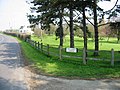
 Westbere Village Sign (geograph 1960004).jpg 2 304 × 3 072; 1,59 MB
-
 Westbere Village sign - geograph.org.uk - 2802120.jpg 640 × 430; 87 KB
-
 Westbere village sign and village green - geograph.org.uk - 3076562.jpg 3 872 × 2 592; 5,84 MB
-
 White Cottage (geograph 2797849).jpg 640 × 430; 73 KB
-
 White Cottage - geograph.org.uk - 2797830.jpg 640 × 430; 81 KB
-
 White Cottage in Westbere Lane (geograph 2872188).jpg 640 × 475; 106 KB
-
 Woodland north of the Great Stour - geograph.org.uk - 2789237.jpg 640 × 430; 102 KB
-

-
 Buckwell Farm - geograph.org.uk - 385901.jpg 640 × 480; 35 KB
-

-
 Cottages near Tile Lodge Farm - geograph.org.uk - 385918.jpg 640 × 480; 55 KB
-
 Field margin parallel to Hoath Road - geograph.org.uk - 488153.jpg 640 × 480; 74 KB
-
 Footpath heading W along the Stour - geograph.org.uk - 371269.jpg 640 × 480; 97 KB
-
 Hoath Road at Rushbourne Manor - geograph.org.uk - 385866.jpg 640 × 480; 45 KB
-

-

-

-
 Looking NE along Hoath Road - geograph.org.uk - 385890.jpg 640 × 480; 51 KB
-
 Looking NE along Island Road, Sturry - geograph.org.uk - 370979.jpg 640 × 480; 53 KB
-
 Looking NE up Babs Oak Hill - geograph.org.uk - 370983.jpg 640 × 480; 71 KB
-
 Looking SW along Babs Oak Hill - geograph.org.uk - 369370.jpg 640 × 480; 78 KB
-
 Paddocks on Hersden Hill - geograph.org.uk - 371281.jpg 640 × 480; 72 KB
-

-
 Tile Lodge Farm and Woodfield - geograph.org.uk - 385916.jpg 640 × 480; 59 KB
-
 Tile Lodge Farm on Hoath Road - geograph.org.uk - 382563.jpg 640 × 480; 58 KB
-
 Track across Westbere Marshes - geograph.org.uk - 369375.jpg 640 × 480; 91 KB
-

-
 View across farmland to Clangate Wood - geograph.org.uk - 385904.jpg 640 × 480; 60 KB
-
 View across Westebere Lakes - geograph.org.uk - 371239.jpg 640 × 480; 75 KB
-
 View along Westbere Lane - geograph.org.uk - 371017.jpg 640 × 480; 184 KB
-
 View SW along Hoath Road - geograph.org.uk - 385896.jpg 640 × 480; 49 KB
-
 Westbere from Island Road - geograph.org.uk - 370993.jpg 640 × 480; 53 KB
-

-
 Westbere Lakes from Westbere - geograph.org.uk - 370995.jpg 640 × 480; 98 KB
.jpg)


.jpg)
.jpg)


.jpg)


.jpg)


.jpg)


.jpg)

_-_geograph.org.uk_-_3724609.jpg)


.jpg)

.jpg)
.jpg)


.jpg)

.jpg)


