Category:Westhorpe, Suffolk
Jump to navigation
Jump to search
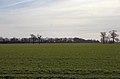
English: Westhorpe is a linear village and civil parish in the Suffolk countryside, thirteen miles from Bury St. Edmunds, eight miles from Stowmarket and a mile from the villages of Wyverstone and Finningham.
village and civil parish in Mid Suffolk, Suffolk, England .jpg) | |||||
| Upload media | |||||
| Instance of | |||||
|---|---|---|---|---|---|
| Location | Mid Suffolk, Suffolk, East of England, England | ||||
 | |||||
Subcategories
This category has the following 2 subcategories, out of 2 total.
M
W
Media in category "Westhorpe, Suffolk"
The following 69 files are in this category, out of 69 total.
-
 Barn - geograph.org.uk - 2544894.jpg 1,024 × 768; 312 KB
-
 Bridleway diverted^ - geograph.org.uk - 5441933.jpg 3,304 × 2,203; 2.53 MB
-
 Byway near Botany Farm - geograph.org.uk - 4676765.jpg 640 × 480; 162 KB
-
 Church Road Westhorpe - geograph.org.uk - 2060041.jpg 1,600 × 1,200; 709 KB
-
 Church Road, Westhorpe - geograph.org.uk - 4463569.jpg 640 × 480; 92 KB
-
 Church Road, Westhorpe - geograph.org.uk - 4676780.jpg 640 × 480; 88 KB
-
 Corrugated Barn - geograph.org.uk - 2544893.jpg 768 × 1,024; 274 KB
-
 Cottage near The Green, Westhorpe - geograph.org.uk - 4676775.jpg 640 × 480; 89 KB
-
 Country Road - geograph.org.uk - 2060053.jpg 1,600 × 1,200; 611 KB
-
 Dried Up Ford - geograph.org.uk - 2059934.jpg 1,600 × 1,200; 570 KB
-
 Entrance to Peartree Farm - geograph.org.uk - 4676769.jpg 640 × 480; 120 KB
-
 Farmland near Westhorpe - geograph.org.uk - 4677145.jpg 640 × 480; 76 KB
-
 Field and woodland, Westhorpe - geograph.org.uk - 4676778.jpg 640 × 480; 115 KB
-
 Field near Botany Farm - geograph.org.uk - 4792134.jpg 640 × 480; 93 KB
-
 Finningham Ford - geograph.org.uk - 3217035.jpg 3,872 × 2,592; 2.43 MB
-
 Flat farmland near Westhorpe - geograph.org.uk - 4676781.jpg 640 × 480; 103 KB
-
 Fleurael Cottage, Westhorpe (geograph 7553096).jpg 1,600 × 900; 700 KB
-
 Footpath And Trees - geograph.org.uk - 2066173.jpg 1,200 × 1,600; 767 KB
-
 Footpath junction - geograph.org.uk - 5442335.jpg 3,318 × 2,212; 2.42 MB
-
 Footpath junction - geograph.org.uk - 5442352.jpg 3,318 × 2,212; 3.01 MB
-
 Footpath Signpost - geograph.org.uk - 2544872.jpg 1,024 × 768; 291 KB
-
 Footpath To Westthorpe Lodge Farm - geograph.org.uk - 2544882.jpg 1,024 × 768; 248 KB
-
 Footpath to Wyverstone - geograph.org.uk - 5442393.jpg 3,038 × 2,025; 1.43 MB
-
 Heading south east from Westhorpe - geograph.org.uk - 4676784.jpg 640 × 480; 72 KB
-
 House on Shorter's End - geograph.org.uk - 4676787.jpg 640 × 456; 71 KB
-
 Lavender Cottage, Westhorpe (geograph 7553121).jpg 1,600 × 900; 586 KB
-
 Leaving Westhorpe - geograph.org.uk - 5442379.jpg 2,212 × 3,318; 1.66 MB
-
 Minor road near West Farm - geograph.org.uk - 4792133.jpg 640 × 480; 68 KB
-
 Minor road towards Finningham - geograph.org.uk - 4792135.jpg 640 × 480; 62 KB
-
 Minor road towards Westhorpe - geograph.org.uk - 4676767.jpg 640 × 480; 77 KB
-
 Minor road towards Westhorpe - geograph.org.uk - 4676771.jpg 640 × 480; 77 KB
-
 Minor road towards Westhorpe - geograph.org.uk - 4677148.jpg 640 × 480; 73 KB
-
 Old Fuel Pump - geograph.org.uk - 2544890.jpg 768 × 1,024; 314 KB
-
 Part of Crownland Road - geograph.org.uk - 1229678.jpg 640 × 480; 67 KB
-
 Pylon in flat field - geograph.org.uk - 4676762.jpg 640 × 480; 61 KB
-
 Pylons And Power Lines - geograph.org.uk - 2544881.jpg 1,024 × 768; 162 KB
-
 Red Telephone Box - geograph.org.uk - 2066533.jpg 1,200 × 1,600; 711 KB
-
 Road Junction - geograph.org.uk - 2544899.jpg 1,024 × 768; 311 KB
-
 Shorter's End - geograph.org.uk - 4792138.jpg 640 × 480; 102 KB
-
 Signs - geograph.org.uk - 2066177.jpg 1,600 × 1,200; 480 KB
-
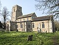
 St Margaret's Church, Westhorpe - geograph.org.uk - 4676773.jpg 640 × 480; 108 KB
-
 St Margaret, Westhorpe - East end - geograph.org.uk - 6136895.jpg 1,000 × 750; 681 KB
-
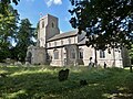
 St Margaret, Westhorpe - geograph.org.uk - 6136887.jpg 1,000 × 753; 703 KB
-
 St Margaret, Westhorpe - geograph.org.uk - 6136889.jpg 1,000 × 764; 962 KB
-
 St Margaret, Westhorpe - Monument - geograph.org.uk - 6136922.jpg 772 × 1,000; 601 KB
-
 St Margaret, Westhorpe - Monument - geograph.org.uk - 6136926.jpg 698 × 1,000; 591 KB
-
 St Margaret, Westhorpe - Royal Arms - geograph.org.uk - 6136924.jpg 808 × 1,000; 776 KB
-
 St Margaret, Westhorpe - South aisle - geograph.org.uk - 6136897.jpg 1,000 × 750; 682 KB
-
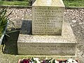
 St Margaret, Westhorpe - War Memorial - geograph.org.uk - 6136891.jpg 750 × 1,000; 1.11 MB
-
 St Margaret, Westhorpe - War Memorial details - geograph.org.uk - 6136893.jpg 1,000 × 750; 1.02 MB
-
 St. Margaret's church, Westhorpe, Suffolk - geograph.org.uk - 5100313.jpg 4,000 × 3,000; 5.75 MB
-
 Street Farmhouse (geograph 7553117).jpg 1,600 × 900; 622 KB
-
 Stubble field near West Farm - geograph.org.uk - 4676760.jpg 640 × 480; 92 KB
-
 The Green, Westhorpe - geograph.org.uk - 4463570.jpg 1,024 × 768; 372 KB
-
 The Old Crown, Westhorpe (geograph 7553135).jpg 1,600 × 900; 491 KB
-
 Tudor Cottage, Westhorpe (geograph 7553110).jpg 1,600 × 900; 619 KB
-
 UK Westhorpe (Suffolk) (cropped).jpg 397 × 528; 42 KB
-
 UK Westhorpe (Suffolk).jpg 566 × 1,699; 222 KB
-
 Westhorpe Farm - geograph.org.uk - 2544886.jpg 1,024 × 768; 210 KB
-
 Westhorpe Lodge sign - geograph.org.uk - 5096540.jpg 2,243 × 2,991; 5.04 MB
-
 Westhorpe Road near Saracen's Hill - geograph.org.uk - 4463581.jpg 640 × 480; 117 KB
-
 Westhorpe Road, Westhorpe - geograph.org.uk - 4463563.jpg 640 × 480; 82 KB
-
 Westhorpe village sign - geograph.org.uk - 4295691.jpg 480 × 640; 117 KB
-
 Westthorpe Lodge Farm - geograph.org.uk - 2543616.jpg 1,024 × 768; 276 KB
-
 Flat Suffolk field - geograph.org.uk - 339648.jpg 640 × 420; 64 KB
-
 Footpath to Westhorpe Lodge Farm - geograph.org.uk - 339645.jpg 640 × 427; 87 KB
-
 Moat of Westhorpe Hall - geograph.org.uk - 339633.jpg 640 × 427; 110 KB
-

-
 Track to Hartshall Farm - geograph.org.uk - 339657.jpg 427 × 640; 90 KB


.jpg)


.jpg)


.jpg)


.jpg)
.jpg)
_(cropped).jpg)


